
Where Flight Simulation Enthusiasts Gather from Around the World!
AVSIM Library - Search Results

| Category: Flight Simulator X - Scenery | |
| X2DA - RAF Down Ampney - Gloucestershire, England |

|
File Description:
RAF Down Ampney (ICAO X2DA) was a Royal Air Force station located 1.8 miles (2.9 km) north east of Cricklade, Wiltshire and 3 miles (4.8 km) south west of RAF Fairford, Gloucestershire.
The airfield operated during World War II from February 1944 until February 1947.
Down Ampney was part of a group of 3 airfields with RAF Broadwell and RAF Blakehill Farm dedicated to air transportation.
No. 48 Squadron RAF and No. 271 Squadron RAF flew Douglas Dakotas on major missions. On D-Day they dropped the main elements of the 3rd Parachute Brigade in Normandy as well as towing Airspeed Horsa gliders across the English Channel.
They were also active in Operation Market Garden (Arnhem) and the Rhine crossing.
Source: Wikipedia.
| Filename: | X2DA__RAF_Down_Ampney__Gloucestershire_England.zip |
| License: | Freeware |
| Added: | 16th April 2016, 11:37:35 |
| Downloads: | 148 |
| Author: | Terry Boissel |
| Size: | 1.94 MB |
| Category: Flight Simulator X - Scenery | |
| KCGS - College Park Airport - Maryland, USA |
|
Images related to this file:
File Description:
FSX Scenery - College Park Airport (IATA: CGS, ICAO: KCGS, FAA LID: CGS) is a public airport located in the City of College Park, in Prince George's County, Maryland, USA. It is the world's oldest continuously operated airport. College Park Airport was established in August 1909 by the United States Army Signal Corps to serve as a training location for Wilbur Wright to instruct two military officers to fly in the government's first airplane. For your flying pleasure by John B. Loney, Jr.
| Filename: | KCGS__College_Park_Airport__Maryland_USA.zip |
| License: | Freeware, limited distribution |
| Added: | 16th April 2016, 11:44:54 |
| Downloads: | 270 |
| Author: | John B. Loney, Jr. |
| Size: | 25.9 MB |
| Category: Flight Simulator X - Scenery | |
| Alf's UK airfields Volume 34 - Sleap EGCV |
|
Images related to this file:
File Description:
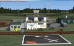
Sleap, near Shrewsbury, is the home of Shropshire Aero Club and in the past it was a satellite of nearby RAF Shawbury and used for training ATC personel.
| Filename: | Alfs_UK_airfields_Volume_34__Sleap_EGCV.zip |
| License: | Freeware |
| Added: | 17th April 2016, 18:59:20 |
| Downloads: | 394 |
| Author: | Alf Denham |
| Size: | 8.59 MB |
| Category: Flight Simulator X - Scenery | |
| RAF Broadwell - Oxfordshire, England |
|
File Description:
RAF Broadwell (ICAO X2BW) is a former Royal Air Force station located 2 miles north of Broadwell and 3 miles southeast of Burford, Oxfordshire, within 2 miles of RAF Brize Norton.
It opened on 15 November 1943 and closed on 31 March 1947, operating under RAF Transport Command. It consisted of 3 concrete runways in triangular configuration.
Broadwell took part in the D-Day assaults with nearby RAF Down Ampney and RAF Blakehill Farm. Broadwell had two such squadrons, No. 512 Squadron RAF and No. 575 Squadron RAF were based here, flying the Douglas Dakota.
In February 1944, No. 512 Squadron was transferred to No. 46 Group at RAF Broadwell, it was a tactical Dakota squadron and started training glider towing and parachute dropping. Its first operation in the new role was a leaflet drop on 5 June 1944 over France, this followed intensive flying in and out of France including dropping parachutists at Arnhem.
On the eve of D-Day No. 575 Squadron dropped 5 Para into the invasion drop zone. On 6 June, it towed 21 Horsa gliders into France. In the next few weeks it started a casualty evacuation service from France back to England. In September 1944, it was involved in operation market garden to Arnhem where it suffered severe casualties.
The airfield continued to be a terminus for long-range transport operations to Europe, the Middle East and India. Source: Wikipedia
| Filename: | RAF_Broadwell__Oxfordshire_England.zip |
| License: | Freeware |
| Added: | 17th April 2016, 19:06:12 |
| Downloads: | 144 |
| Author: | Terry Boissel |
| Size: | 948.66 KB |
| Category: Flight Simulator X - Scenery | |
| X1BK - RAF Blakehill Farm - Wiltshire, England |
|
File Description:
RAF Blakehill Farm (ICAO X1BK) was an RAF airfield situated in Wiltshire, England. The station was originally allocated to the United States Army Air Forces Ninth Air Force but not used.
It opened in 1944 and was home for transport aircraft of No. 46 Group Transport Command. In 1948 the airfield was a satellite of RAF South Cerney and used by training aircraft before the airfield closed in 1952 and was returned to agricultural use.
After WWII, GCHQ set up an "experimental radio station", a top secret research facility, on the site of the RAF's wartime airfield at Blakehill Farm. It consisted of huge communications masts arranged in mysterious strategic patterns in the middle of the old airfield. The site was still active in some capacity until the mid 1990s and traces of the former antenna bases can still be seen on satellite photographs.
The site is now a Wiltshire Wildlife Trust nature reserve.
| Filename: | X1BK__RAF_Blakehill_Farm__Wiltshire_England.zip |
| License: | Freeware |
| Added: | 18th April 2016, 09:23:07 |
| Downloads: | 162 |
| Author: | Terry Boissel |
| Size: | 2.25 MB |
| Category: Flight Simulator X - Scenery | |
| LI40 - Montagnana Airfield - Padova, Italy |
|
Images related to this file:
File Description:
Scenery for the Airfield of Montagnana (LI40) in the northern of Italy. Enjoy!
| Filename: | LI40__Montagnana_Airfield__Padova_Italy.zip |
| License: | Freeware |
| Added: | 22nd April 2016, 10:46:00 |
| Downloads: | 233 |
| Author: | Carlo Boninsegna |
| Size: | 29.77 MB |
| Category: Flight Simulator X - Scenery | |
| RAF Tarrant Rushton (1944) - Dorset, England |
|
File Description:
RAF Tarrant Rushton was a Royal Air Force station near the village of Tarrant Rushton east of Blandford Forum in Dorset, England from 1943 to 1947. It was used for glider operations during World War II and later revived for civilian operations. It is currently disused, though some buildings survive.
Horsa gliders from Tarrant Rushton left for France on the eve of D-Day, to begin Operation Tonga with an action that would later become known as Pegasus Bridge. Among the glider pilots was Jim Wallwork, on a Horsa nicknamed Lady Irene. The Tarrant Rushton gliders landed in occupied France shortly after midnight. Wallwork's aircraft was the first to touch down, but it landed heavily: the force of the impact catapulted both Wallwork and his co-pilot John Ainsworth through the front of the cockpit. Although stunned, this made them the first Allied troops to touch French soil on D-Day.
Other gliders were later flown from the airfield to Arnhem to take part in Operation Market Garden. During the closing stages of WWII, aircraft were used for SOE operations.
| Filename: | RAF_Tarrant_Rushton_1944__Dorset_England.zip |
| License: | Freeware |
| Added: | 22nd April 2016, 22:27:09 |
| Downloads: | 174 |
| Author: | Terry Boissel |
| Size: | 1.18 MB |
| Category: Flight Simulator X - Scenery | |
| RAF Manston 1944 |
|
File Description:
RAF Manston (ICAO EGMH)was an RAF station in the north-east of Kent, on the Isle of Thanet from 1916 until 1996. The site is now split between a commercial airport Kent International Airport (KIA) and a continuing military use by the Defence Fire Training and Development Centre (DFTDC), following on from a long-standing training facility for RAF firefighters at the Manston base.
Source: Wikipedia
I have represented it here in 1944 leading up to its part in Operation Market garden and D Day. It was one of the few airfields installed with the Fog Investigation Dispersal Organisation (FIDO) system designed to remove fog from airfields by burning it off with petrol and I have represented this with the 8 fuel tanks at the 29 end of the mail runway. I have laid the station out roughly according to an old map made in the mid 40s but I make no claims to the accuracy of building I have used.
| Filename: | RAF_Manston_1944.zip |
| License: | Freeware |
| Added: | 26th April 2016, 00:15:35 |
| Downloads: | 160 |
| Author: | Terry Boissel |
| Size: | 1.71 MB |
| Category: Flight Simulator X - Scenery | |
| EDOR Stoelln/Rhinow and "Lady Agnes" |
|
File Description:
The airflield EDOR Stoelln/Rhinow in Northwest of Berlin.
"Lady Agnes" is an aircraft of the type IL-62 with the code DDR-SEG of the former
Eastgerman airline Interflug. It landed in 1989 on the grass airstrip and is used
today as a museum.
Model by Edgar Guinart, repaint by Enrique R. Moure Garcia.
| Filename: | EDOR_StoellnRhinow_and_Lady_Agnes.zip |
| License: | Freeware |
| Added: | 26th April 2016, 00:19:32 |
| Downloads: | 205 |
| Author: | Juergen Wolf |
| Size: | 1.27 MB |
| Category: Flight Simulator X - Scenery | |
| Dupont airfield New Jersey |
|
Images related to this file:
File Description:
Presenting Dupont Airport in Delaware for FSX.
This scenery was done by request of Anthony Necastro, a good friend of ours on our Skype 'family' of friends,who often flew out of this airfield.
This airfield closed circa 1958. Lindberg landed here once. There are a number of planes needed for the traffic files. These are in a separate zip called Dupont-traffic-planes.zip.
If you install those also, you will see a good number of planes taking off around 12 noon. One or two go around and land again. Others go to New Castle a short distance away, and return soon.
My e-mail is in this download for hlep or comments. Bob Lacy
| Filename: | Dupont_airfield_New_Jersey.zip |
| License: | Freeware |
| Added: | 26th April 2016, 00:31:23 |
| Downloads: | 158 |
| Author: | Robert Lacy |
| Size: | 19.05 MB |


© 2001-2026 AVSIM Online
All Rights Reserved
Privacy Policy |