
Where Flight Simulation Enthusiasts Gather from Around the World!
AVSIM Library - Search Results

| Category: Flight Simulator X - Scenery | |
| Doel PowerPlant Antwerp |

|
File Description:
Doel PowerStation (Nuclear power plant) Belgium.
EB00 (zero-zero)
The Power plant of Doel NW of Antwerp is one of the major landmarks for the southwest of the Netherlands and the northwest of Belgium.
The Powerplant is so huge that it’s plainly visible from EHLE (Lelystad) at 1500ft, about 150 -200 kilometers north in reality.
This scenery not only places the power plant correct in FSX corrected for Ultimate terrain X Europe, but it also adds several ships on the Schelde river and in port.
Have fun and happy landings.
| Filename: | Doel_PowerPlant_Antwerp.zip |
| License: | Freeware, limited distribution |
| Added: | 13th January 2009, 14:28:30 |
| Downloads: | 3,050 |
| Author: | Joost Visser / ADE |
| Size: | 284.79 KB |
| Category: Flight Simulator X - Scenery | |
| TNCA - Queen Beatrix Intl. Airport (Aruba) |
|
File Description:
Queen Beatrix International Airport (IATA: AUA, ICAO: TNCA), in Oranjestad, Aruba, is a fairly large aviation facility that has
flight services to the United States, most countries in the Caribbean, the northern coastal countries of South America and some parts
of Europe, notably the Netherlands. It was named after Queen Beatrix of the Netherlands, the head of state of Aruba.
This airport used to serve as the hub for bankrupt airline Air Aruba, which was for many years an international airline.
Before Aruba's separation from the Netherlands Antilles in 1986 it was also one of three hubs for Air ALM. The airport has
a new airline, Tiara Air and Aruba Airlines.
| Filename: | TNCA__Queen_Beatrix_Intl_Airport__Aruba.zip |
| License: | Freeware |
| Added: | 22nd April 2009, 07:15:26 |
| Downloads: | 2,311 |
| Author: | Daniel Louvet |
| Size: | 1.8 MB |
| Category: Flight Simulator X - Scenery | |
| St KILDA upgrade for ORBX SCOTLAND |
|
File Description:
ST KILDA is an archipelago situated 41miles West of the Outer Hebrides.It is a world heritage site.
Its islands with their exceptional cliffs and sea stacks form the most important seabird breeding station in north-west Europe. The evacuation of its native population in 1930 brought to a close an extraordinary story of survival.
This scenery upgrades the ORBX scenery with the addition of -BORERAY Island and its two stacks (highest in the UK), Levenish, many birds, scenery added to HIRTA(the main island) and boat traffic.
Sadly no airfield but as Hirta has a military prescence there is a helicopter pad. This is an ideal place to explore with a floatplane!
| Filename: | St_KILDA_upgrade_for_ORBX_SCOTLAND.zip |
| License: | Freeware |
| Added: | 9th July 2017, 19:11:50 |
| Downloads: | 284 |
| Author: | john watts |
| Size: | 5.41 MB |
| Category: Flight Simulator X - Scenery | |
| Sicogon Airport with AirSwift Winter 2018/2019 FlightPlan and AI OSP ATR 72-600 AirSwift repaint textures |
|
Images related to this file:
File Description:

Sicogon Airport ICAO: RPIC with Photoreal Scenery. Comes with my own AirSwift Winter 2018/2019 Flightplan for OSP ATR 42-500 and OSP ATR 72-500/600 and AirSwift textures for OSP ATR 72-500. REQUIRES THE OSP AI MODELS of ATR 42-500 and ATR 72-500 for traffic.
| Filename: | Sicogon_Airport_with_AirSwift_Winter_20182019_Flig.zip |
| License: | Freeware, limited distribution |
| Added: | 3rd March 2019, 22:51:22 |
| Downloads: | 277 |
| Author: | Aeron M. Tumanut |
| Size: | 10.08 MB |
| Category: Flight Simulator X - Scenery | |
| channel ships |
|
File Description:
Ships, loads of ships in the English Channel (excusee: Pas de Calais)
About 60 ships (apart from ai ships)
When flying over the Channel, pilots say that an emergency landing here would certainly mean a crash into a ship; there are that many ships about.
You'll see Cargo ships, containerships, super tankers. Cruisliners are symbolic for the ferries sailing to and from Calais / Dover and Dunkirk.
Corrected for use with Ultimate terrain Europe
To be able to see this scenery I had to make a fake airport and named it LF00 (read: LF zero-zero)
There's a tower position as well, midways the channel with a height of 100 mtr. I haven’t tested it, it's not visible either.LF00 is visible in your GPS. Have fun.
| Filename: | channel_ships.zip |
| License: | Freeware, limited distribution |
| Added: | 12th January 2009, 13:00:36 |
| Downloads: | 3,775 |
| Author: | Joost Visser / ade1.37 |
| Size: | 134.43 KB |
| Category: Flight Simulator X - Scenery | |
| Gustavo Rojas Pinilla International Airport (SKPS) 2011 |
|
File Description:
Gustavo Rojas Pinilla International Airport (IATA: ADZ, ICAO: SKSP) is the leading airport in the archipelago of San Andres, Providencia and Santa Catalina, which has enough capacity to receive large aircraft, due to a number of
charter flights and seasonal in different parts of America and Europe.
This file has the right coordinates, with the apron and characteristics of the airport. The runways were reoriented to the correct direction, runway were re-sized the gates placed on correct location and number, FAC was placed
(Colombian Air force and Colombian National Army) all the airport charts required to navigate in and out of this airport can be found at www.aerocivil.gov.co/ under Informacion Aeronautica click AIP; on AIP
click Aerodromos then click at SKSP.
| Filename: | Gustavo_Rojas_Pinilla_International_Airport_SKPS_2.zip |
| License: | Freeware |
| Added: | 23rd August 2011, 02:26:49 |
| Downloads: | 1,678 |
| Author: | Anwar Gonzalez |
| Size: | 10.03 KB |
| Category: Flight Simulator X - Scenery | |
| RAF Upper Heyford "1940s" - Oxfordshire, England |
|
File Description:
RAF Upper Heyford was a Royal Air Force station located 5 miles (8 km) north-west of Bicester near the village of Upper Heyford, Oxfordshire, England.
| Filename: | RAF_Upper_Heyford_1940s__Oxfordshire_England.zip |
| License: | Freeware |
| Added: | 21st May 2016, 20:33:23 |
| Downloads: | 156 |
| Author: | Terry Boissel |
| Size: | 1.27 MB |
| Category: Flight Simulator X - Scenery | |
| Global Classic AI Ship Traffic V1 for P3D and FSX |
|
Images related to this file:
File Description:
This package for FSX/P3D contains around 250 classic ship models and AI ship routes representing shipping as it looked in the early sixties. From the last steam freight ships to elegant ocean liners, from upgraded WWII destroyers to the then latest types of frigates, and much more. The AI routes cover Western Europe from Norway to the Mediterranean, the US East Coast, South East Asia, and the South East Coast of South America. Cities covered includes Narvik, Bergen, Stavanger, Edinburgh, London, Southampton, Liverpool, Belfast, Gothenburg, Copenhagen, Aarhus, Kiel, Hamburg, Amsterdam, Le Havre, Brest, Lisbon, Gibraltar, Nice, Naples, Palermo, Suez, Quebec, New York, Miami, Havana, Singapore, Bangkok, Ho Chi Minh, Danang, Hong Kong, and many more. Contributors to this package are Erwin Welker, Jean-Pierre Fillion, Dave Garwood, SkippyBing, Knud Kristoffersen, and Henrik Nielsen.
| Filename: | Global_Classic_AI_Ship_Traffic_V1_for_P3D_and_FSX.zip |
| License: | Freeware |
| Added: | 31st January 2021, 19:25:27 |
| Downloads: | 1,513 |
| Author: | Henrik Nielsen |
| Size: | 287.58 MB |
| Category: Flight Simulator X - Scenery | |
| Puck (EPCK) vintage floatplane base |
|
Images related to this file:
File Description:
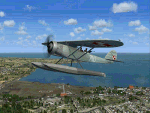
This is a re-upload of the scenery available previously on Avsim. Puck was the second floatplane base in Europe, constructed between 1911-12. Because of the calm waves of Puck Bay, the Germans organised there a test base where different types of floatplanes and seaplanes were tested. After the end of the First World War, the aerodrome was taken by the Poles and served as a home base of Morski Dywizjon Lotniczy (Naval Squadron) until the outbreak of Second World War. The aerodrome was also in use after the 1945 and remained active until the early 50's.
The scenery consists of custom gmax objects, detailed photoscenery and a few city landmarks. All the objects were compiled using FSX-SDK. We recommend you to fly there using Lublin R.XIII package by Michael Puto and Jastarnia aerodrome scenery. Happy landings!
| Filename: | Puck_EPCK_vintage_floatplane_base.zip |
| License: | Freeware, limited distribution |
| Added: | 26th January 2011, 23:59:02 |
| Downloads: | 1,206 |
| Author: | Marek M. Misiewicz, Lukasz Kubacki |
| Size: | 42.45 MB |
| Category: Flight Simulator X - Scenery | |
| TNCC |
|
File Description:
Hato International Airport or Curacao International Airport (originally named Dr. Albert Plesman International Airport) (IATA: CUR, ICAO: TNCC) is the airport of Willemstad, Curacao. It has services to the Caribbean region, South America, North America and Europe. Hato Airport is a fairly large facility, with the third longest commercial runway in the Caribbean region (after Rafael Hern�¡ndez Airport and Pointe-a-Pitre International Airport). The airport was the hub of Air ALM and its successor Dutch Caribbean Airlines, the flag carriers of the former Netherlands Antilles until the latter ceased operations in 2004. The airport is now the home base of Dutch Antilles Express and Insel Air.
This file has the right coordinates, with the apron and characteristics of the airport, working jetways. The runways and runways were resized the gates placed on correct location.
| Filename: | TNCC.zip |
| License: | Freeware |
| Added: | 9th April 2011, 23:52:03 |
| Downloads: | 2,419 |
| Author: | Anwar Gonzalez |
| Size: | 22.3 KB |


© 2001-2026 AVSIM Online
All Rights Reserved
Privacy Policy |