
Where Flight Simulation Enthusiasts Gather from Around the World!
AVSIM Library - Search Results

| Category: Flight Simulator X - Scenery | |
| LFLJ - Courchevel, France |

|
File Description:
This FSX scenery package contains the LFLJ Courchevel airport in the French Alps. The airport has a very short, upslope runway of only 525 m (1,722 ft). The airport is considered one of the seven most dangerous in the world. It has a difficult approach, a 300 foot upslope runway and is adjacent to the Courchevel ski runs. The Courchevel airport altitude is the highest in Europe, with a mean elevation of 6,520 feet. This airport is intended to be used with FSX and the free addon - TileProxy. TileProxy provides real-time photorealistic satellite imagery in place of the stock auto generated FSX scenery or any other scenery package. The Courchevel airport was originally released as part of an FSX airport scenery package containing 15 airports, located in the French Alps. The link to the original 15 French Alps Airport package is shown below. This file is not required, but allows you to download 15 related French Alps airports. The LFLJ, Courchevel airport in the original 15 airport package was missing a required scenery file which corrects the airport altitude (from 6420 ft. to 6520 ft.) due to the mis-location of the stock FSX airport. This download provides all three of the required .bgl scenery files.
related download:
http://library.avsim.net/search.php?SearchTerm=french+alps+airports&CatID=root&Go=Search
| Filename: | LFLJ__Courchevel_France.zip |
| License: | Freeware |
| Added: | 30th November 2013, 20:20:07 |
| Downloads: | 6,045 |
| Author: | John Greenwood |
| Size: | 655.63 KB |
| Category: Flight Simulator X - Scenery | |
| EDST - Hahnweide Kirchheim - Germany *v1.2* |
|
Images related to this file:
File Description:
The airfield EDST-Hahnweide is located approximately 17 nautical miles southeast of EDDS- Stuttgart. Former it was just a gliderfield but now ist is available also for small motor-aircrafts.
Each two years there are happens the greatest meeting of oldtimer-aircrafts in Europe.
This scenery is designed very much in detail. All important objects have been created by me and Joachim Herwig using actual original photos of the airfield and its surrounding. A retouched photo background, covering all four seasons, completes the scenery.
EDST Hahnweide does not exist in the standard scenery of the FSX. So this scenery is an addon-scenery, which hopefully will fill one of the plenty “white spots†in the World of FSX.
Because this field is some like a “bumpi†medow, the airfield ground is exactly designed like this. Therefore you will not find a plane runway.
Libraries: Many smaller Objects, like people, cars or static airplanes in this scenery were taken from three popular freeware libraries for whose use I got the friendly permission of the authors. If these libraries are not installed , many objects are not visible !
The following libraries are used:
1. FS-Piloten_Objektlibrary -
http://www.fs-piloten.de/thread.php?threadid=1063
2. FSX_FlightPortLib -
http://www.flightport.de/libraries/flightport-library/
3. 3d People Library -
http://library.avsim.net/download.php?DLID=192454
| Filename: | EDST__Hahnweide_Kirchheim___Germany_v12.zip |
| License: | Freeware, limited distribution |
| Added: | 25th October 2016, 21:01:37 |
| Downloads: | 1,483 |
| Author: | Wolfgang Allers, Joachim Herwig |
| Size: | 369.26 MB |
| Category: Flight Simulator X - Scenery | |
| EGKK - Gatwick Intl Airport - London, UK *Texture Fix* |
|
File Description:
For those having problems with missing Jetway extensions you will need these textures,
you will need my airport file "fsx_egkk_rs.zip" to use these textures, for those using my version of EKCH or KMKE will already have these textures
| Filename: | EGKK__Gatwick_Intl_Airport__London_UK__Texture_Fix.zip |
| License: | Freeware, limited distribution |
| Added: | 15th November 2017, 00:36:46 |
| Downloads: | 2,610 |
| Author: | Ray Smith |
| Size: | 103.68 KB |
| Category: Flight Simulator X - Scenery | |
| Ground Texture Upgrade |
|
File Description:
These new textures for FSX enhance your defualt ground airport textures. This package contains all new high detailed taxiway textures, ground textures, and all new taxiway line textures. The new ground textures give a more realistic illusion of rocks, grass, etc. Autogen as well as taxiways, will now look more realistice and "in place"since they are no longer over a low resolution detail 1.bmp file. The new taxiway line textures ( or taxilines as I call them) make your defualt taxilines look even more realistic. Now you will see enviromental weathering effects such as cracks and holes on the taxiline paint. And finally, the new taxiway textures upgrade the defualt FSX ones. Every detail, crack, and pebble was carefully analyzed and created with the aid of hi-res sources.
| Filename: | Ground_Texture_Upgrade.zip |
| License: | Freeware |
| Added: | 18th November 2006, 06:06:46 |
| Downloads: | 25,420 |
| Author: | Gamalier Padilla |
| Size: | 1.76 MB |
| Category: Flight Simulator X - Scenery | |
| Photoreal Autogen Palm Trees |
|
Images related to this file:
File Description:
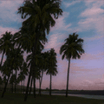
This file will replace the default autogen coconut and fan palms with photoreal textures to give them a much more realistic appearance. These textures are derived from high-quality photographs, instead of the fake CG textures of the defaults. Download and enjoy!
| Filename: | Photoreal_Autogen_Palm_Trees.zip |
| License: | Freeware |
| Added: | 5th December 2010, 05:07:22 |
| Downloads: | 2,745 |
| Author: | Scott Armstrong |
| Size: | 403.9 KB |
| Category: Flight Simulator X - Scenery | |
| Santa Cruz de la Sierra - Bolivia |
|
File Description:
Scenery Photoreal: Santa Cruz de la Sierra, Bolivia
Santa Cruz de la Sierra: (English: Holy Cross of the Mountain Range), commonly known as Santa Cruz, is the
capital of the Santa Cruz department in eastern Bolivia (17 45', South, 63 14', West)at 416 m above sea level.
The city of Santa Cruz is located not far from the easternmost extent of the Andes Mountains and they are
visible from some parts of the city its Situated too on the Pirai River.
The city of Santa Cruz and its metropolitan area are home to over 70% of the population of the department and
it is one of the fastest-growing cities in the world.
Airports: (NOT included in this package, just Scenery Photoreal of the city)
Viru Viru International Airport (IATA: VVI, ICAO: SLVR) in Santa Cruz de la Sierra, Bolivia is Bolivia's largest
international airport. Viru Viru handles domestic, regional, and international flights from Bolivia to
North America, South America and Europe and is the hub for Bolivia's biggest airline Boliviana de Aviacion (BoA).
The airport is able to handle the largest commercial jets.
El Trompillo Airport (IATA: SRZ, ICAO: SLET) is located in the south part of Santa Cruz, Bolivia, about 2 km
(1.25 miles) away from the central plaza. Airport type:(Public / Military).
Compatible with both FSX and P3D.
| Filename: | Santa_Cruz_de_la_Sierra__Bolivia.zip |
| License: | Freeware |
| Added: | 23rd June 2015, 17:09:33 |
| Downloads: | 1,724 |
| Author: | Marcos A. Rivas Torrez |
| Size: | 69.85 MB |
| Category: Flight Simulator X - Scenery | |
| RAF Broadwell - Oxfordshire, England |
|
File Description:
RAF Broadwell (ICAO X2BW) is a former Royal Air Force station located 2 miles north of Broadwell and 3 miles southeast of Burford, Oxfordshire, within 2 miles of RAF Brize Norton.
It opened on 15 November 1943 and closed on 31 March 1947, operating under RAF Transport Command. It consisted of 3 concrete runways in triangular configuration.
Broadwell took part in the D-Day assaults with nearby RAF Down Ampney and RAF Blakehill Farm. Broadwell had two such squadrons, No. 512 Squadron RAF and No. 575 Squadron RAF were based here, flying the Douglas Dakota.
In February 1944, No. 512 Squadron was transferred to No. 46 Group at RAF Broadwell, it was a tactical Dakota squadron and started training glider towing and parachute dropping. Its first operation in the new role was a leaflet drop on 5 June 1944 over France, this followed intensive flying in and out of France including dropping parachutists at Arnhem.
On the eve of D-Day No. 575 Squadron dropped 5 Para into the invasion drop zone. On 6 June, it towed 21 Horsa gliders into France. In the next few weeks it started a casualty evacuation service from France back to England. In September 1944, it was involved in operation market garden to Arnhem where it suffered severe casualties.
The airfield continued to be a terminus for long-range transport operations to Europe, the Middle East and India. Source: Wikipedia
| Filename: | RAF_Broadwell__Oxfordshire_England.zip |
| License: | Freeware |
| Added: | 17th April 2016, 19:06:12 |
| Downloads: | 144 |
| Author: | Terry Boissel |
| Size: | 948.66 KB |
| Category: Flight Simulator X - Scenery | |
| 130 AI Ships and AI Ship Traffic |
|
Images related to this file:
File Description:
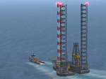
This package contains 130 new AI ships and AI ship traffic routes for the North Sea, the Norwegian coast and the sea around the Arabian Peninsula and a few routes for the Mediterranean Sea.
The new ship models include 40 ferries, 4 cruise ships, different types of fishing vessels, Platform Supply Vessels (PSV), Offshore Subsea Construction Vessels (OSCV), and shuttle tankers from off shore oil industry, a pirate mother ship, pirate attack boats, a Greenpeace ship, a heavy lift ship, a couple of frigates, a coast guard ship, container ships, bulk carriers, a number of small coasters, and much more. Around 40 ships have landable helicopter platforms - all marked with an H. Most ships will have simple animations and custom wake, smoke and light effects.
Ships visits among other places Le Havre, Plymouth, Jersey, Hull, Aberdeen, Oslo, Kristiansand, Stavanger, Bergen, Trondheim, Bodo, Narvik, Tromso, Hammerfest, Murmansk, Mallorca, Rome, Neaples, Heraklion, Port Said, Suez, Jeddah, Djibouti, Salalah, Muscat, Dubai, Abu Dhabi, Doha, Ras Tanura, Kuwait, Basra, Bandar Imam, Mogadishu, Karachi, and Mumbai.
In order to get full benefit of this package you must first download and install 63 AI Ships and AI Ship Traffic for Europe and South America, 75 AI Ships and AI Ship Traffic, and the corresponding patch. With that installed you will have a total of 268 ships on shipping routes across the globe.
Full credits to the many people who have contributed in this project can be found in the PDF manual.
| Filename: | 130_AI_Ships_and_AI_Ship_Traffic.zip |
| License: | Freeware |
| Added: | 2nd March 2014, 12:37:04 |
| Downloads: | 11,546 |
| Author: | Henrik Nielsen |
| Size: | 56.11 MB |
| Category: Flight Simulator X - Scenery | |
| Photorealistic Chile S41W70 Pack6 |
|
File Description:
Photorealistic Chile Sector s41w70 this scenery use 8pack textures and elevation
this zip file contain 2 type file ,elevantion and textures you don't need install aditional elevation from chile
| Filename: | Photorealistic_Chile_S41W70_Pack6.zip |
| License: | Freeware |
| Added: | 19th October 2007, 05:34:58 |
| Downloads: | 424 |
| Author: | David Ventura Chamudes |
| Size: | 60.87 MB |
| Category: Flight Simulator X - Scenery | |
| Photorealistic Chile S41W69 Pack1 |
|
File Description:
Photorealistic Chile Sector s41w69 this scenery use 8pack textures and elevation this zip file contain 2 type file ,elevantion and textures you don't need install aditional elevation from chile
| Filename: | Photorealistic_Chile_S41W69_Pack1.zip |
| License: | Freeware |
| Added: | 22nd October 2007, 02:01:18 |
| Downloads: | 559 |
| Author: | David Ventura Chamudes |
| Size: | 59.04 MB |


© 2001-2026 AVSIM Online
All Rights Reserved
Privacy Policy |