
Where Flight Simulation Enthusiasts Gather from Around the World!
AVSIM Library - Search Results

| Category: Flight Simulator X - Scenery | |
| YKEB Kellerberrin, Western Australia |

|
File Description:
YKEB Kellerberrin was modelled at the request of Councillor Cole. In this updated version, the silos have been added and the landclass for the town south of the highway has been masked giving a more realistic impression from the air. Kellerberrin is a town in the Wheatbelt region of Western Australia, 205 kilometres east of Perth on the Great Eastern Highway. The railway line from Northam to Southern Cross was constructed through here in 1893-94, and this section opened for traffic in 1895. Kellerberrin was one of the original stations when the line opened. By 1898 there was a demand for small blocks of land in the area, and the government surveyed a number of 20-acre lots the same year. The area was gazetted as Kellerberrin townsite in 1901, and the government soon made more land available for settlers. Early settlers from 1890 to 1910 from Ireland settled in the area of Kellerberrin and Wittem. Their family name
was English. A road was named after this family. The name Kellerberrin is Aboriginal, and is derived from the name of a nearby hill. The hill was first recorded as "Killaburing Hill" by an explorer in 1861, but in 1864 the explorer Charles Hunt recorded it as Kellerberrin Hill. One source claims that Kellerberrin is the name for the fierce ants that are found in the area, while another gives it as meaning "camping place near where rainbow birds are found" - kalla means camping place or place of, and berrin berrin is the rainbow bird. (repeating the name makes it plural) It also serves as a stop on the Prospector and Avonlink rural train services. REQUIRES Blencowe_LibraryKit.zip
REQUIRES blencowe_librarykit_309494.zip (Available HERE)
| Filename: | YKEB_Kellerberrin_Western_Australia.zip |
| License: | Freeware |
| Added: | 28th February 2013, 13:52:02 |
| Downloads: | 246 |
| Author: | Alan Blencowe |
| Size: | 2.69 MB |
| Category: Flight Simulator X - Scenery | |
| LFMQ - Le Castellet |
|
File Description:
Welcome to Le Castellet Airfield -
This airfield is situated few Nm east of Marseille Provence - LFML, in the south of France. On the 1,000 hectares of plateau he acquired between Marseille and Toulon, Paul Ricard, forever motivated by innovation and development, constructed in 1962 the largest
private airfield in the Provence-Alpes-Côte d’Azur region.
The landing strip at Le Castellet covered a distance of 1,000 metres and allowed for VFR (Visual Flight Rules) operation. Situated on a plateau at the time free of all economic development, it was above all a private airfield. In 1970, the construction
of the Paul Ricard Circuit nearby created an economic dynamic for the first time on Le Castellet plateau. In 1972, Paul Ricard invested in improvements to the runway, lengthening it from 1,000 to 1,750 metres, thus rendering it capable of
receiving business and private airplanes of up to 38 tonnes.
Over twenty years, Le Castellet Airport saw intense periods of activity due to business and private aviation, notably with the arrival of the first F1 French Grand Prix on the Paul Ricard Circuit in 1971, and more recently, with the creation of the Entreprise Zone at Signes, situated only a few kilometres from the airfield. Stop by for an amazing visit at the medieval village as well, situatued on top of a hill.
Nevertheless, from 1972 to 1999, no investment was made at the airfield. In May 1999, the company Excelis S.A. purchased the site (airfield and circuit) and refurbished and modernised the installations.
A truly amazing place to fly to - I have enhanced the entire apron as it is today, all marking correctly set, acces to runway and the Heli area for the "Eggbeater" fan :)
includes the hangar, building and other things around. Hope you'll enjoy your stay at "Le castellet"!
| Filename: | LFMQ__Le_Castellet.zip |
| License: | Freeware |
| Added: | 24th April 2009, 16:28:59 |
| Downloads: | 2,350 |
| Author: | Daniel Louvet |
| Size: | 986.65 KB |
| Category: Flight Simulator X - Scenery | |
| YNUL Nullagine, Western Australia |
|
File Description:
YNUL Nullagine - Shire of East Pilbara with added ORBX textures. Nullagine is serviced by a gravel airstrip. This facility provides a vital air link. RFDS, Police, and local charter operators all rely on this airstrip for the provision of vital services to the communities. Nullagine is an old goldrush town in Western Australia's Pilbara region. It is located on the Nullagine River 296 km south-east of Port Hedland and 1,364 km north-north-east of Perth on the old Great Northern Highway. The town originated from gold being discovered in the area in 1886 by a prospector, N.W. Cooke. The population increased sharply as a result and by the mid 1890s the community wanted to have a town declared. Lots were surveyed and released in 1897 and the state government gazetted the town in 1899. Nullagine comes from the Aboriginal name of a nearby river, the Ngullagine river; the meaning of the word is unknown. Besides gold other minerals were mined in the area including diamonds and other gemstones. Between 1895 and 1914 the town boomed and contained a number of general stores, three hotels, eight stamp mills and a population of over 3,000. Its population was 1,500 prior to World War II. Now, with the decline of gold mining, only about 200 remain. However the town still attracts fossickers and prospectors who visit the surrounding area, which is particularly rich in minerals such as agate, asbestos, antimony, beryl, chalcedony, copper, jade, jasper, manganese, tiger eye and wolfram. The town is also the place of the Yirrangadji Aboriginal Community. The Martu people make up the bulk of this population. REQUIRES Blencowe_LibraryKit.zip
REQUIRES blencowe_librarykit_309494.zip (Available HERE)
| Filename: | YNUL_Nullagine_Western_Australia.zip |
| License: | Freeware |
| Added: | 28th February 2013, 14:00:15 |
| Downloads: | 293 |
| Author: | Alan Blencowe |
| Size: | 5.72 MB |
| Category: Flight Simulator X - Scenery | |
| LJLJ Ljubljana Joze Pucnik Airport |
|
File Description:
Ljubljana Joze Pucnik Airport (IATA: LJU, ICAO: LJLJ) also known by its previous name Brnik Airport, is the international airport of Ljubljana, Slovenia. The airport is located near the village of Brnik, 19 km (12 mi) north of Ljubljana
and 11 km (6.8 mi) south of Kranj on the road between Kranj and Menges. It has a 3,300 m �� 45 m (10,827 ft �� 148 ft) paved runway. Letalisce Brnik was opened on December 24, 1963.
In 2007, the central-right government controversially renamed the airport to Ljubljana Joze Pucnik airport. Joze Pucnik was a Slovene public intellectual, dissident, and politician, leader of the Democratic Opposition of Slovenia (Demos)
between 1989 and 1992.
The airport is home to Adria Airways, the Slovenian flag carrier. There are currently two low-cost carriers serving the airport, EasyJet and Wizz Air. A few other airlines also serve the airport.
On December 8, 2004, the airport received its first annual millionth passenger. Overall, the airport handled 1,369,485 passengers in 2011, down from 1,673,050 passengers in 2008. It is the only airport in Slovenia with scheduled air
traffic.
The airport is served by a motorway exit off the A2 motorway and by bus service connecting it with Ljubljana and Kranj. A rail line to both cities is planned as well.
Airport is equipped with ILS Cat IIIb on runway 30. NDB and VOR approach are also available.
The runway of the Ljubljana Joze Pucnik Airport was closed to air traffic in April 2010. During that time, the entire width of the asphalt surface of the runway was renovated, as well as the asphalt surface on some parts of taxiways.
This file has the right coordenates, apron and characteristics of the airport, airport vehicules and buildings, Airport charts included.
| Filename: | LJLJ_Ljubljana_Joze_Pucnik_Airport.zip |
| License: | Freeware |
| Added: | 22nd November 2012, 16:29:14 |
| Downloads: | 1,511 |
| Author: | Anwar Gonzalez |
| Size: | 1.84 MB |
| Category: Flight Simulator X - Scenery | |
| VOHS-VOBL package for FSX and FSX-SE |
|
Images related to this file:
File Description: Rajiv Gandhi International Airport (IATA: HYD, ICAO: VOHS) is an international airport that serves Hyderabad,
the largest city in the Indian state of Telangana. It is located in Shamshabad, about 24 kilometres (15 mi) south of Hyderabad.
The airport is operated by GMR Hyderabad International Airport Ltd, a public–private venture.
It was opened in March 2008 to replace Begumpet Airport as the primary commercial airport for Hyderabad.
It is named after Rajiv Gandhi, former Prime Minister of India. _______________________________________________________________________________________ Kempegowda International Airport (IATA: BLR, ICAO: VOBL) is an international airport serving Bangalore, the capital of the Indian state of Karnataka.
Spread over 4,000 acres (1,600 ha), it is located about 40 kilometres (25 mi) north of the city near the village of Devanahalli.
It is owned and operated by Bangalore International Airport Limited (BIAL), a public–private consortium.
The airport opened in May 2008 as an alternative to increased congestion at HAL Airport,
the original primary commercial airport serving the city. It is named after Kempe Gowda I, the founder of Bangalore.
Kempegowda International Airport became Karnataka's first fully solar powered airport developed by CleanMax Solar.[2][3] As of 2016, Kempegowda Airport is the third-busiest airport by passenger traffic in the country,
behind the airports in Delhi, Mumbai and is the 35th-busiest airport in Asia. It handled over 22.2 million passengers in 2016 with little less than 500 aircraft movements a day.
The airport also handled about 314,060 tonnes (346,190 short tons) of cargo. By 2020, it is expected to handle at least 40 million passengers per year,
with 45 international airlines and more than 1000 aircraft movements per day.
| Filename: | VOHSVOBL_package_for_FSX_and_FSXSE.zip |
| License: | Freeware |
| Added: | 28th January 2018, 17:03:17 |
| Downloads: | 4,479 |
| Author: | morten thomas van der linden |
| Size: | 171.62 MB |
| Category: Flight Simulator X - Scenery | |
| Ireland VFR Small Airports Part 3 |
|
Images related to this file:
File Description:
Ireland VFR Small Airports Part 3. This scenery consists of 1. EIKY Kerry International Airport, 2. EIBN Bantry Airfield, 3. EIBR Birr Airfield, and 4. Clonbullogue Airfield.
Kerry is situated in the South West of Ireland and serves as a gateway to the world famous Lakes of Killarney, The Ring of Kerry and the Dingle Peninsula. Bantry is ideal for visiting the rugged beauty of West Cork. Clonbullogue is home to the Irish Parachute Club and is situated approximately 30 miles southwest of EIDW Dublin. Birr is almost in the centre of Ireland and is home to a very active group of GA aviators.
The scenery has been created almost entirely from real photographs and all objects have been placed accurately using ordinance survey data and satellite imagery. It also includes animated marshallers, aircrew and passengers together with animated animals and vehicles. Appropriate sound effects have been added to each file together with smoke and strobe lighting. Full night lighting is included, with flood and wash lighting of the aprons and carparks. Each airport has been sub-divided into seperate elements, which can be switched on or off according to the users preference and hardware setup. It caters for GA enthuasiasts and for those who prefer to fly the heavies.
This scenery has not been designed as a standalone, it calls on many objects from my Ireland VFR Small Airports parts 1 and 2. It has also been designed to complement photographic scenery but will also work with the default terrain and I have inlcuded a set of landclass and photoreal textures. It also includes an extended set of photoscenery treescapes. Full installation instructions, settings, credits and tips can be found in the README file.
Please enjoy and I hope you like my airports as much as I enjoyed making them.
| Filename: | Ireland_VFR_Small_Airports_Part_3.zip |
| License: | Freeware, limited distribution |
| Added: | 8th April 2012, 22:40:52 |
| Downloads: | 3,758 |
| Author: | George Keogh |
| Size: | 81.33 MB |
| Category: Flight Simulator X - Scenery | |
| YPNW Pannawonica, Western Australia town and strip |
|
File Description:
YPNW Pannawonica with FSX default and ORBX tints condensed into one zipfile. The town of Pannawonica is an iron-ore mining town located in the Pilbara region of Western Australia, near the Robe River, about 200��� km south-west from Karratha. In 2006, it reportedly had the highest median weekly income of any town in Australia, due to the high income of its mine workers. Pannawonica was built in 1970 by Cleveland-Cliffs Robe River Iron (predecessor of the present Robe River Iron Associates) and was gazetted as a townsite in 1972. The township�¢����s name was derived from nearby Pannawonica Hill, named by a surveyor in 1885 after the corresponding Aboriginal placename which is said to mean "the hill that came from the sea". The traditional legend is that two local Aboriginal tribes were arguing over the ownership of the hill which was located by the sea. The sea spirit decided to resolve the dispute by moving the hill inland. As the hill was dragged over the land it left a deep indentation which became the Robe River. Pannawonica is one of a number of remote-area iron-ore-mining towns built throughout the Pilbara to house workers operating open-cut mines and the loading of ore trains. It is a 'closed town', having limited facilities for visitors, the company's accommodation being reserved for its staff and visiting contractors. Some visitor accommodation is available at the Pannawonica Tavern. Pannawonica is home to more than 800 people, comprising Robe and Pilbara Iron employee families, staff on fly-in fly-out (�¢����fifo�¢����) roster from Perth, and those involved in support services. It is accessible by road, rail and light aircraft. REQUIRES Blencowe_LibraryKit.zip
REQUIRES blencowe_librarykit_309494.zip (Available HERE)
| Filename: | YPNW_Pannawonica_Western_Australia_town_and_strip.zip |
| License: | Freeware |
| Added: | 28th February 2013, 14:00:44 |
| Downloads: | 287 |
| Author: | Alan Blencowe |
| Size: | 3.38 MB |
| Category: Flight Simulator X - Scenery | |
| EPGO Goraszka 2010 - The Airshow Challenge |
|
Images related to this file:
File Description:
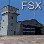
EPGO Goraszka 2010 - The Airshow Challenge is a freeware, extremely detailed scenery of a general aviation airport located 12nm (20km) south-east of Warsaw downtown and Warsaw Frederic Chopin International Airport, Poland. EPGO Goraszka airfield was built in 1994 and currently belongs to General Aviation company, which offers aero-taxi flights, air transport and special flights (air photo, patrol) and airport services. The airport has a 800m-long runway and a lightened helipad, which can be used by helicopters up to 5700kg weight. General Aviation's fleet includes Antonov AN-2, PZL-104 Wilga 80, Bell 407 and 427. Since 1996 the International Air Picnic Goraszka is organized every year by "Polish Eagles" Foundation created on initiative of Zbigniew Niemczycki.
The scenery is equipped with an automatic installer. Currently we support a safe, manual way of adding new sceneries to Scenery Library in Flight Simulator. This is just one thing users need to do for themselves. Detailed instructions will be given during the installation process.
Scenery features:
-Compatible with FSX only
-Highest level of accuracy in geographic positioning, modelling and texturing
-Incredibly high quality photoreal textures of all airport buildings. Textures are based on over 300 real world -photographs made for this project.
-Hundrieds of 3D objects like tents, exhibitions, airport buildings and surrounding buildings
-Life in the airport: people and cars will enchance your feelings
-AI traffic, animations and effects, designed specifically for FSX
-Some buildings include interior (control tower)
-High quality aerial photos of the airport surrondings (5 seasons + night) with autogen and water mask
-Ultra high quality aerial photos of the airport (with seasons)
-Plain airport scenery with no airshow objects available too (details in the manual)
-Product includes manual and airport charts in PDF format
EPGO Goraszka 2010 - The Airshow Challenge scenery is compatible with almost every payware add-on, including Ultimate Terrain Eastern Europe and Warsaw Photo Scenery by Simdesign. Scenery by Drzewiecki Design - www.drzewiecki-design.net .
| Filename: | EPGO_Goraszka_2010__The_Airshow_Challenge.zip |
| License: | Freeware |
| Added: | 16th July 2010, 12:31:42 |
| Downloads: | 4,716 |
| Author: | Drzewiecki Design - Stanislaw Drzewiecki, Jakub Paczek |
| Size: | 237.18 MB |
| Category: Flight Simulator X - Scenery | |
| LYPG Podgorica Airport, Montenegro |
|
File Description:
Podgorica Airport (IATA: TGD, ICAO: LYPG) is an international airport located 11 km (6.8 mi) south of Podgorica, Montenegro. It is the main hub for Montenegro Airlines.
It is one of two public airports in Montenegro, the other being Tivat Airport. Both are operated by the state-owned company Airports of Montenegro. The airport is sometimes called Golubovci Airport by the locals, as the town of
Golubovci is in close proximity. Airports Council International awarded Podgorica the best airport under 1 million passengers in 2007.
The IATA code of the airport is still TGD because Podgorica was named Titograd (after Josip Broz Tito) from 1946 to 1992, during which time the airport opened.
The airport handles domestic flights within Montenegro as well as international flights. As Montenegro's two main airports are merely 80 km apart, there are no regular passenger domestic flights. Domestic flights have been reduced to
charter flights and general aviation, and all scheduled traffic is international.
There are daily scheduled flights to various European destinations. During the summer season, there are many charter flights and air connections to various major cities in the world. The flight to Belgrade airport has traditionally
accounted for majority of the traffic at the airport, but the percentage is decreasing.
VIP and taxi airlines Vektra Aviation, Di Air and OKI Air are based at the airport. Serbian VIP airlines Air Pink and Prince Aviation also use the airport.
Podgorica Airport served 538,477 passengers in 2008. However, due to global economic downturn, passenger numbers declined to 450,504 in 2009. In 2010, strong growth was recorded, so numbers passed the 600,000 mark.
Thanks to Serbia And Montenegro Virtual Area Control Center for the airport charts.
This file has the right coordinates, with the apron and characteristics of the airport, airport vehicles and buildings, also it is set to the correct altitude of 126 feet or 38 meters.
| Filename: | LYPG_Podgorica_Airport_Montenegro.zip |
| License: | Freeware |
| Added: | 29th October 2012, 21:41:37 |
| Downloads: | 4,667 |
| Author: | Anwar Gonzalez |
| Size: | 10.52 MB |
| Category: Flight Simulator X - Scenery | |
| Pagasa Island, Philippines |
|
Images related to this file:
File Description:
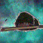
Pagasa Island is a jewel in the South China Sea. It is the one pictured - an emerald splash in an azure sea slashed by a coral runway - whenever new collisions or confrontations are reported in the news for the region. Occupied continuously by the Philippines since 1971, historical use dates back to the Han dynasty, which many believe forms the basis of the Chinese claim to the island. Each country has it's own interpretation of international law and the Filipinos are clearly banking on the precedence of continuous occupation, at no small expense, as Rancudo Field is the farthest airport from Manila within the Philippine sphere of control.
Surprisingly, the geography of the island serves to capture and retain rainwater, although the aquifer is stagnant and the water must be treated for consumption. Sea life remains abundant, poachers take coral heads and sea turtles. There is a solar farm and recently installed solar street lights, fuel for the generators is a precious commodity this far from the mainland.
Sadly, nature may solve the struggle for possession by withdrawing the island from the arena. It is believed that the construction of the runway may have compromised the islands basic integrity, allowing it to crumble into the sea. Whatever the cause, the evidence is clear. Bunkers built during the Japanese occupation in WWII are already slipping beneath the waves and the rate of salt water encroachment has been recorded at close to 6" per day.
There are some things to explore, the grounded BRP Laneo Del Norte to the west; over to the north near the resort grounds are a dugout fishing canoe and some authentic Philippine bangka boats; you may want to load up and head east to do some low warning passes over the Chinese fishing fleet. Standing at the east end of the field, you can just barely spot the China Coast Guard cutter's smoke on the horizon.
The tower is marked by a bright strobe that fires once every five seconds and at night it is bright enough to guide you back to the island from the distance of the fleet. There are no published procedures and the tower is not staffed. Airport ICAO is RPPN.
| Filename: | Pagasa_Island_Philippines.zip |
| License: | Freeware, limited distribution |
| Added: | 10th May 2014, 12:21:19 |
| Downloads: | 1,858 |
| Author: | Rick Keller |
| Size: | 16.17 MB |


© 2001-2026 AVSIM Online
All Rights Reserved
Privacy Policy |