
Where Flight Simulation Enthusiasts Gather from Around the World!
AVSIM Library - Search Results

| Category: Flight Simulator X - Scenery | |
| RAF Folkingham |

|
File Description:
Royal Air Force Station Folkingham or RAF Folkingham is a former Royal Air Force station located south west of Folkingham, Lincolnshire and about 29 miles (47 km) due south of county town Lincoln and 112 miles (180 km) north of London, England.
Opened in 1940, it was used by both the Royal Air Force and United States Army Air Forces. During the war it was used primarily as a troop carrier airfield for airborne units and as a subsidiary training depot of the newly formed Royal Air Force Regiment. After the war it was placed on care and maintenance during 1947 when the RAF Regiment relocated to RAF Catterick.
You will need some additional scenery files by Ted Andrews and Ian Pearson which can be found at http://www.ianpsdarkcorner.co.uk, otherwise on the runway and peri track show. Ted Andrew - small buildings and Ians FSX Object Libraries.
| Filename: | RAF_Folkingham.zip |
| License: | Freeware |
| Added: | 8th October 2015, 17:55:15 |
| Downloads: | 298 |
| Author: | Terry Boissel |
| Size: | 9.59 KB |
| Category: Flight Simulator X - Scenery | |
| LOWL Linz Airport (also known as Blue Danube Airport), Austria |
|
Images related to this file:
File Description:
The airport Linz-Hoersching (blue danube airport linz) is located 10 km outside the city centre Linz direction south west direct from the town Hoersching. Therefore the epithet Hoersching.
This airport is in possession of the Austrian Army, but there is a civil right of use. The aerodrome Vogler is place south, the civil part is locate in north direction of the runway.
--------------------
Der Flugplatz Linz-Hoersching (blue danube airport linz) befindet sich 10 km ausserhalb des Stadtzentrums Linz in suedwestlicher Richtung direkt bei Hoersching. Darum auch der Beiname Hoersching. Der Flughafen gehoert dem oesterreichischen Bundesheer, es gibt aber ein ziviles Nutzungsrecht. Der Fliegerhorst Vogler ist suedlich, der zivile Teil noerdlich der Landebahn angesiedelt.
--------------------
Features: ground texture with 25cm / px., autogen, hand placed objects, correct road marking, correct taxiway signs, new middle lights, automatic switching of the seasons, night illumination.
| Filename: | LOWL_Linz_Airport_also_known_as_Blue_Danube_Airpor.zip |
| License: | Freeware |
| Added: | 21st July 2013, 13:47:13 |
| Downloads: | 11,012 |
| Author: | Oliver Brandl |
| Size: | 222.14 MB |
| Category: Flight Simulator X - Scenery | |
| Botswana Airports - Update 2 |
|
File Description:
This pack contains updates, a few new airports and improvements for my previous airports package covering the whole of Botswana (botswana_airports.zip and botswana_airports_update_1.zip). It also contains other details, such as the handful of Radio Botswana and and the single Voice of America broadcast transmitters receivable by aircraft ADF radio, meaning that you can use them as NDBs, and more radio/TV/cell masts (now 170+ over Namibia and Botswana). You'll also find corrected CTAF frequencies for every uncontrolled airfield. Everything made with ADE X v1.5, and tested in FSX SP2. There is also a set of landclass updates, which provide some local tweaks to Aeroworx's excellent Southern Africa landclass.
| Filename: | Botswana_Airports__Update_2.zip |
| License: | Freeware |
| Added: | 16th February 2013, 00:39:55 |
| Downloads: | 1,359 |
| Author: | David Atkinson |
| Size: | 322.55 KB |
| Category: Flight Simulator X - Scenery | |
| FHSH - St. Helena Island Custom Terminal, Tower, and Signs - St. Helena, South Atlantic |
|
Images related to this file:
File Description:
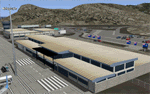
Frits Beyer has created a wonderful custom terminal, tower, and signs for the "FSX_St_Helena_Ascension_Tristan-da-Cunha.zip" scenery. I have made some small edits to some of my original files to fit Frits Beyer's scenery, and as a small addition, I have added the green space near the Napoleon house where the 9-hole golf course resides.
This update requires "FSX_St_Helena_Ascension_Tristan-da-Cunha.zip".
| Filename: | FHSH__St_Helena_Island_Custom_Terminal_Tower_and_S.zip |
| License: | Freeware |
| Added: | 5th May 2016, 07:49:12 |
| Downloads: | 2,449 |
| Author: | Carlyle Sharpe / Frits Beyer |
| Size: | 1.5 MB |
| Category: Flight Simulator X - Scenery | |
| 63 AI Ships and AI Ship Traffic for South America and Europe V1 |
|
Images related to this file:
File Description:

Plenty of good designers have created beautiful navy ships and aircraft carriers for FSX, but only few have created container ships, tankers, off-shore supply ships, tugs, or bulk carriers and put them to sail around the globe in FSX. With this package I intend to fill a part of this gap and to bring more life to the mostly empty oceans in FSX by providing AI ships and AI traffic files with a fleet of modern merchant ships travelling through some of the most heavily trafficked sea routes in the world. The pack contains 63 AI ships based on more than 35 different GMAX models. Around one third are equipped with landable helicopter decks. Most ships have simple animations like rotating radars and most have custom light, smoke and wake effects. The pack also contains traffic files for the east coast of South America and the coasts of North West Europe: In South America ships visit Belem, Sao Louis, Natal, Recife, Salvador, Macae, Rio de Janeiro, Santos, Florianopolis, Pelotas, Porto Alegre, Montevideo, Buenos Aires and Puerto Madryn. In Europe ships visit Gibraltar, Algeciras, Lissabon, Bordeaux, La Rochelle, Saint Nazaire, Brest, Le Havre, Antwerp, Rotterdam, Amsterdam, Thamesport, Felixstowe, Bremerhaven, Hamburg, Esbjerg, Oslo, Aarhus, Copenhagen and St.Petersburg. For map of coverage, routes and ship details see the PDF manual.
| Filename: | 63_AI_Ships_and_AI_Ship_Traffic_for_South_America_.zip |
| License: | Freeware |
| Added: | 3rd March 2013, 16:37:41 |
| Downloads: | 23,956 |
| Author: | Henrik Nielsen |
| Size: | 17.24 MB |
| Category: Flight Simulator X - Scenery | |
| Santa Cruz de la Sierra - Bolivia |
|
File Description:
Scenery Photoreal: Santa Cruz de la Sierra, Bolivia
Santa Cruz de la Sierra: (English: Holy Cross of the Mountain Range), commonly known as Santa Cruz, is the
capital of the Santa Cruz department in eastern Bolivia (17 45', South, 63 14', West)at 416 m above sea level.
The city of Santa Cruz is located not far from the easternmost extent of the Andes Mountains and they are
visible from some parts of the city its Situated too on the Pirai River.
The city of Santa Cruz and its metropolitan area are home to over 70% of the population of the department and
it is one of the fastest-growing cities in the world.
Airports: (NOT included in this package, just Scenery Photoreal of the city)
Viru Viru International Airport (IATA: VVI, ICAO: SLVR) in Santa Cruz de la Sierra, Bolivia is Bolivia's largest
international airport. Viru Viru handles domestic, regional, and international flights from Bolivia to
North America, South America and Europe and is the hub for Bolivia's biggest airline Boliviana de Aviacion (BoA).
The airport is able to handle the largest commercial jets.
El Trompillo Airport (IATA: SRZ, ICAO: SLET) is located in the south part of Santa Cruz, Bolivia, about 2 km
(1.25 miles) away from the central plaza. Airport type:(Public / Military).
Compatible with both FSX and P3D.
| Filename: | Santa_Cruz_de_la_Sierra__Bolivia.zip |
| License: | Freeware |
| Added: | 23rd June 2015, 17:09:33 |
| Downloads: | 1,722 |
| Author: | Marcos A. Rivas Torrez |
| Size: | 69.85 MB |
| Category: Flight Simulator X - Scenery | |
| Larisa-Volos |
|
Images related to this file:
File Description:
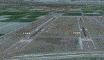
AS REAL AS IT GETS.
This is a detailed photorealistic scenery of Larisa, Volos and the area from Anatolikos Olympos in the North to Almyros in the South.
Default FSX airports of Larisa (LGLR) Stefanovikio (LGSV) and Almyros (LGBL) were completely redone, positioned to their exact location, buildings and objects were added in the airport compounds.
New runways, taxiways, aprons with parking spots, and a small aircraft traffic file.
| Filename: | LarisaVolos.zip |
| License: | Freeware |
| Added: | 5th August 2011, 14:43:51 |
| Downloads: | 1,977 |
| Author: | Angelo Tassoglou |
| Size: | 238.02 MB |
| Category: Flight Simulator X - Scenery | |
| LOWG - Graz airport - Graz, Austria |
|
Images related to this file:
File Description:
Graz Airport, known as Flughafen Graz-Thalerhof in AUSTRIA, is a minor international airport in Graz, the second-largest city in Austria. It is located in the south of the Alps. The airport serves flights to European leisure and some metropolitan destinations. In this version all buildings are landable. New ILS-lights - the tower is new - the area behind the terminal is new - the Heli-Base Christopherus is new and landable.
| Filename: | LOWG__Graz_airport__Graz_Austria.zip |
| License: | Freeware |
| Added: | 20th June 2015, 02:04:46 |
| Downloads: | 1,732 |
| Author: | Manfred Marbler |
| Size: | 257.96 MB |
| Category: Flight Simulator X - Scenery | |
| KMDT - Harrisburg International Airport - Pennsylvania, USA |
|
Images related to this file:
File Description:
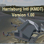
Harrisburg International Airport (KMDT), PA. Located in suburban Middletown, Pennsylvania (USA), the Harrisburg International Airport (KMDT) serves south-central Pennsylvania and is the third-busiest airport in the PA. MDT is presently served by five airlines and is home to the 193rd Special Operations Wing of the Pennsylvania Air National Guard. Modeled in version 1.00 is an updated AFCAD airport layout, custom-made terminal building, ATC tower, and several hangar facilities.
| Filename: | KMDT__Harrisburg_International_Airport__Pennsylvan.zip |
| License: | Freeware |
| Added: | 28th October 2015, 15:02:07 |
| Downloads: | 826 |
| Author: | Matthew Derr |
| Size: | 70.16 MB |
| Category: Flight Simulator X - Scenery | |
| Icabaru (SVIC) & Wonken (SVUQ) - Venezuela |
|
Images related to this file:
File Description:
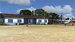
Two small airports located south of Venezuela, especially for VFR flights:
- Icabaru is one of the oldest mining towns in the region located near the border with Brazil.
- Wonken is located in the Canaima National Park, only 15 minutes by plane from Santa Elena de Uairen.
Photo-terrain area improved with Autogen files. Not compatible with versions prior to FSX. Also includes a friendly Auto-Install.
| Filename: | Icabaru_SVIC__Wonken_SVUQ__Venezuela.zip |
| License: | Freeware |
| Added: | 18th January 2014, 16:29:41 |
| Downloads: | 978 |
| Author: | David Maldonado |
| Size: | 83.37 MB |


© 2001-2026 AVSIM Online
All Rights Reserved
Privacy Policy |