
Where Flight Simulation Enthusiasts Gather from Around the World!
AVSIM Library - Search Results

| Category: Flight Simulator X - Scenery | |
| Ruacana Airport in Namibia on the African continent. |

|
File Description:
This is Ruacana Airport in Namibia. This airport is near the border with Angola and was used by the South African Defence force for operations into Angola before Namibia became independant. Now it is a popular tourist destination and ideal for traveling to Ruacana Falls. It is made from default FSX scenery librarys. Not the real thing but pretty close.
| Filename: | Ruacana_Airport_in_Namibia_on_the_African_continen.zip |
| License: | Freeware |
| Added: | 26th January 2009, 14:23:43 |
| Downloads: | 798 |
| Author: | Jacques Botha |
| Size: | 10.38 KB |
| Category: Flight Simulator X - Scenery | |
| Marine 1 White House and Camp David |
|
Images related to this file:
File Description:
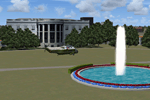
This scenery/ AI package shuttles the
presidential helicopter "Marine 1" among
a customized South Lawn of the White
House, a custom built Camp David, and
Andrews AFB. EZ scenery, Runway12,and
Dan French Core LibrariesVol2_FSX or higher
required. AI Sikorsky SH-3D Sea King helicopter
by Rob Nieuwenhoven, Chris Jones and Mal Lloyd
(freeware) required for AI. By Dan French.
| Filename: | Marine_1_White_House_and_Camp_David.zip |
| License: | Freeware, limited distribution |
| Added: | 18th August 2012, 13:31:25 |
| Downloads: | 581 |
| Author: | Dan French |
| Size: | 2.06 MB |
| Category: Flight Simulator X - Scenery | |
| LOWG - Graz Airport - Graz, Austria |
|
Images related to this file:
File Description:
Graz Airport, known as Flughafen Graz-Thalerhof in AUSTRIA, is a minor international airport in Graz, the second-largest city in Austria.
It is located in the south of the alps the airport serves flights to European leisure and some metropolitan destinations.
in this version you have animated people, no flakering, new animated vehicle, new animated tower.
Manfred Marbler:
[email protected]
| Filename: | LOWG__Graz_Airport__Graz_Austria.zip |
| License: | Freeware |
| Added: | 25th August 2015, 01:57:58 |
| Downloads: | 2,597 |
| Author: | manfred marbler |
| Size: | 264.55 MB |
| Category: Flight Simulator X - Scenery | |
| The new St. George Regional KSGU, St. George, Utah |
|
Images related to this file:
File Description:
The KSGU depicted in the stock FSX scenery was closed in 2011 and operations moved to the new KSGU built approx. 6 miles to the south east. This is the new version, the old one has been removed. As per charts here is no ILS approach for R1, and the localizer for R19 is offset by 7 degrees. See Skyvector.com for charts.
| Filename: | The_new_St_George_Regional_KSGU_St_George_Utah.zip |
| License: | Freeware |
| Added: | 24th September 2018, 16:46:04 |
| Downloads: | 632 |
| Author: | Sidney Schwartz |
| Size: | 7.61 MB |
| Category: Flight Simulator X - Scenery | |
| PASY - Erickson AS, Shemya Island, AK (USA) |
|
File Description:
PASY is located in the Western Aleutian Islands approximately 1,500 miles southwest of Anchorage, AK. It is located just South of R220, one of the primary routes between Anchorage and Asia.
This scenery was designed to be used with the default FSX scenery. It was created using the latest freeware verison of Airport Design Editor from ScruffyDuck Software using only stock library objects.
| Filename: | PASY__Erickson_AS_Shemya_Island_AK_USA.zip |
| License: | Freeware |
| Added: | 17th April 2013, 18:05:56 |
| Downloads: | 1,138 |
| Author: | Bill Bridges |
| Size: | 6.45 KB |
| Category: Flight Simulator X - Scenery | |
| Santa Elena de Uairen, Venezuela (SVSE) |
|
Images related to this file:
File Description:
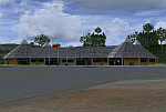
Located to south of Venezuela, to few kilometers from the border with Brazil.
The airport design, reflects the Pemon indigenous culture.
With photo-terrain scenery from satellite imagery of Google Earth.
Not compatible with versions prior to FSX.
This scenery requires SP1, SP2, or the Acceleration
expansion pack in order to be displayed correctly.
Also includes a friendly Auto-Install.
| Filename: | Santa_Elena_de_Uairen_Venezuela_SVSE.zip |
| License: | Freeware |
| Added: | 3rd August 2013, 17:34:22 |
| Downloads: | 1,422 |
| Author: | David Maldonado |
| Size: | 76.57 MB |
| Category: Flight Simulator X - Scenery | |
| LRTZ(Tuzla Airfield) |
|
Images related to this file:
File Description:
LRTZ(Tuzla Airfield) is located near the Black Sea, South-West of Tuzla village. It has 2 grass runways and 6 parking spots for GA aircraft. It also has 4 Helipads where you can start the flight from. In real life the airfield is used for offshore flying to the Black Sea for different costumers and it also has a flight school.
| Filename: | LRTZTuzla_Airfield.zip |
| License: | Freeware |
| Added: | 26th August 2021, 00:19:20 |
| Downloads: | 73 |
| Author: | Liviu |
| Size: | 5.96 KB |
| Category: Flight Simulator X - Scenery | |
| EKAE - Aero Island - Denmark ** Ver.1** |
|
Images related to this file:
File Description:
Aero is a small island situatet in the area south of Funen among many other small islands. This Area is only a short flight away from Northern Germany and called "The Danish South Funen Archepelago".
The strip has a 590x30m grass Runway, and is approved for VMC day and VFR night operations.
I tried to emulate the character of Aero as well as possible using existing standard objects in combination with some new build objects like the main building.
The scenery includes a photo background covering alls four seasons and some night textures.
However, many smaller Objects, like people were taken from a popular freeware library for whose use I got the friendly permission of the autor.
If these library are not installed, some objects are not visible!
The following library is used:
FS-Piloten_Objektlibrary:
http://www.fs-piloten.de/thread.php?threadid=1063
| Filename: | EKAE__Aero_Island__Denmark___Ver1.zip |
| License: | Freeware |
| Added: | 19th July 2016, 17:46:54 |
| Downloads: | 894 |
| Author: | Wolfgang Allers |
| Size: | 131.57 MB |
| Category: Flight Simulator X - Scenery | |
| AI Ship Traffic for North West Europe |
|
Images related to this file:
File Description:

This package contains AI ship traffic files to be used with my packages 63 AI Ships and AI Ship Traffic for Europe and South America and 75 AI Ships and AI Ship Traffic. This package updates all European routes from 63 AI Ships and AI Ship Traffic for Europe and South America so they benefit from the total of 138 ships included in the two packages. At the same time the routing has been improved and expanded so the coverage is far wider - from Tenerife to Saint Petersburg. The ships visit among other places Gibraltar, Tenerife, Lisboa, Rotterdam, Liverpool, Le Havre, Copenhagen, Amsterdam, Oslo, Gdansk, Felixstowe, Portsmouth, Bordeaux, Brest, Cherbourg, Antwerp and many more.
A great thanks to Jean-Pierre Fillion, Didier Lagaffe Puentes and Robystar for letting me use some of their models in the project and to all the beta testers.
| Filename: | AI_Ship_Traffic_for_North_West_Europe.zip |
| License: | Freeware |
| Added: | 16th August 2013, 22:36:07 |
| Downloads: | 11,017 |
| Author: | Henrik Nielsen |
| Size: | 865.22 KB |
| Category: Flight Simulator X - Scenery | |
| YCDN Corunna Downs Station and Old Corunna Downs RAAF (Closed) |
|
File Description:
Corunna Downs heritage listed RAAF Base was a secret airfield located in scrub and spinifex country, about 16 kms south west of Marble Bar, the hottest part of the "The Pilbara" area of Western Australia. Not a very ideal place to have a tent city. Today there are very few reminders of the once busy airfield. One can see some crumbling foundations and half filled post holes. 73 OBU operated the Corunna Downs airfield which comprised two intersecting bitumen runways, now regressed and graded occasionally. One ran approximately north-south, 5,000 feet in length while the other ran approximately east-west, 7,000 feet in length. Both runways were approximately 150 feet wide. A 50 foot wide taxiway linked the northern end of the north-south runway to the western end of the east-west runway. Approximately 20 camouflaged revetments to disperse aircraft to minimise bomb damage were constructed at Corunna Downs. Permission is required for landing and there may be vegetation on the strip if not graded recently. No cones or windsock so be careful. Corunna Downs Homestead is also heritage listed and consists of graded strips and homestead complex. Start points are at the homestead and the RAAF base is to the west. REQUIRES Blencowe_LibraryKit.zip
REQUIRES blencowe_librarykit_309494.zip (Available HERE)
| Filename: | YCDN_Corunna_Downs_Station_and_Old_Corunna_Downs_R.zip |
| License: | Freeware |
| Added: | 25th February 2013, 08:59:42 |
| Downloads: | 283 |
| Author: | Alan Blencowe |
| Size: | 4.92 MB |


© 2001-2026 AVSIM Online
All Rights Reserved
Privacy Policy |