
Where Flight Simulation Enthusiasts Gather from Around the World!
AVSIM Library - Search Results

| Category: Flight Simulator X - Scenery | |
| CJCR update Piano FSX landclass towns |

|
Images related to this file:
File Description:
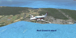
CJCR update
This update adds landclass towns from Rock Sound and south
to the FSX default terrain. Towns
added are:Rock Sound, Greencastle,
Princess Cays Beach, Princess Cays,
Freetown (MYZ2) improvements also
to CJCR with fencing,
GA terminal, lighting and more.
jimmy R martin
| Filename: | CJCR_update_Piano_FSX_landclass_towns.zip |
| License: | Freeware |
| Added: | 17th July 2010, 23:35:09 |
| Downloads: | 1,136 |
| Author: | jimmy R martin |
| Size: | 8.8 MB |
| Category: Flight Simulator X - Scenery | |
| SMJP |
|
File Description:
Johan Adolf Pengel International Airport (IATA: PBM, ICAO: SMJP), also known as Paramaribo-Zanderij International Airport, is an airport located in the town of Zanderij, 45 km south of Paramaribo. It is Suriname's main international gateway operated by Airport Management, Ltd./ NV Luchthavenbeheer.
| Filename: | SMJP.zip |
| License: | Freeware |
| Added: | 17th March 2011, 19:55:44 |
| Downloads: | 2,970 |
| Author: | Anwar Gonzalez |
| Size: | 9.08 KB |
| Category: Flight Simulator X - Scenery | |
| FSX Grand Canyon North Rim Simulation |
|
Images related to this file:
File Description:
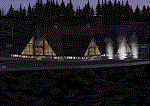
Welcome to the North Rim of the Grand Canyon!
This scenery is a mostly fictitious representation of what the North Rim might look like of it had been developed like the South rim. A new airport (KKPA, Kaibab Plateau Airport) is the centerpiece. It sits at 8,730 ft MSL so density altitude is a real issue. Runway 17/35 is 6,500ft long so biz jets can get in and out safely. A new resort sits atop the ridge to the east [Eagle's Nest]. There is a helipad for access. An NDB makes finding it easier [AZ95 220.9 kHz]. Or you can just follow the traffic on the access road that branches off from highway 67 just south of the airport. To the north I have added a gravel strip to Jacob Lake where 67 joins 89A. Runway 14/32 is 3000 ft long and sits at 7900 ft MSL. An NDB [AZ93 393 kHz] is included. At the south end of Highway 67 sits the North Rim Visitor Center. There is a helipad on the roof for those who like rotary wing challenges. The NDB is AZ94 at 423.4 kHz. The entire length of Highway 67 is represented with traffic going both ways. You will see
air traffic from KGCN at the South Rim and traffic between KKPA and Jacob Lake.
| Filename: | FSX_Grand_Canyon_North_Rim_Simulation.zip |
| License: | Freeware, limited distribution |
| Added: | 19th May 2021, 19:28:12 |
| Downloads: | 102 |
| Author: | Brett Delana |
| Size: | 16.26 MB |
| Category: Flight Simulator X - Scenery | |
| Namibia Airports - Update 2 |
|
File Description:
This pack contains updates, a few new airports and general improvements for my previous airports package covering the whole of Namibia (namibia_airports.zip and namibia_airports_update_1.zip). You'll also find corrected CTAF frequencies for every uncontrolled airfield, and more radio/TV/cell masts (now 170+ over Namibia and Botswana). Everything made with ADE X v1.5, and tested in FSX SP2. There is also a set of landclass updates, which provide some local tweaks to Aeroworx's excellent Southern Africa landclass.
| Filename: | Namibia_Airports__Update_2.zip |
| License: | Freeware |
| Added: | 16th February 2013, 00:42:22 |
| Downloads: | 1,194 |
| Author: | David Atkinson |
| Size: | 577.43 KB |
| Category: Flight Simulator X - Scenery | |
| Namibia Airports Update 1 |
|
Images related to this file:
File Description:
This pack contains updates, a few new airports and improvements for my previous airports package covering Namibia (namibia_airports.zip). It also contains other details, such as various radio masts across the country and representative details at the following mines: Uis, Skorpion, Tsumeb, and Arandis. All were designed with ADE X v1.5, and tested in FSX SP2. There is also a set of landclass updates, which provide some local tweaks to Aeroworx's excellent Southern Africa landclass. See Readme for more details.
| Filename: | Namibia_Airports_Update_1.zip |
| License: | Freeware |
| Added: | 31st August 2012, 13:05:02 |
| Downloads: | 1,514 |
| Author: | David Atkinson |
| Size: | 242.5 KB |
| Category: Flight Simulator X - Scenery | |
| Thessalia North - Greece |
|
Images related to this file:
File Description:
ThessaliaN Dn
AS REAL AS IT GETS.
This is a detailed photorealistic scenery containing the northern part
of Thessalia (Mount Olympos)and south-western part of Macedonia WITH NIGHT TEXTURES.
There are no airports in this photoscenery.
Just a lot of mountains and fields.
| Filename: | Thessalia_North__Greece.zip |
| License: | Freeware |
| Added: | 31st May 2016, 16:49:36 |
| Downloads: | 775 |
| Author: | Angelo Tassoglou |
| Size: | 221.86 MB |
| Category: Flight Simulator X - Scenery | |
| SYCJ |
|
File Description:
Cheddi Jagan International Airport (IATA: GEO, ICAO: SYCJ), formerly Timehri International Airport, is the national airport of Guyana. The airport is located on the right bank of the Demerara River in the city of Timehri, 41 kilometres (25 mi) south of Guyana's capital, Georgetown.
| Filename: | SYCJ.zip |
| License: | Freeware |
| Added: | 17th March 2011, 19:50:12 |
| Downloads: | 1,226 |
| Author: | Anwar Gonzalez |
| Size: | 14.71 KB |
| Category: Flight Simulator X - Scenery | |
| Greece Mesh Terrain, v1 |
|
Images related to this file:
File Description:
Detailed FSX mesh terrain of Greece and surrounding territories (West Turkey, South Bulgaria, FYRoM, Albania) based on SRTM Data (3 arcsec, 90m) and sampled to LOD9 resolution (76m). For more information visit www.avsim.com/greece/scenery.
| Filename: | Greece_Mesh_Terrain_v1.zip |
| License: | Freeware, limited distribution |
| Added: | 9th June 2010, 14:46:18 |
| Downloads: | 30,488 |
| Author: | Hellas Scenery Team (HST) |
| Size: | 76.58 MB |
| Category: Flight Simulator X - Scenery | |
| WV29 - Valley Point Airport |
|
Images related to this file:
File Description:
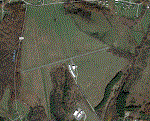
Valley Point (WV29) is a privately owned airport nestled in the hills of Albright, West Virginia. This has been updated from defualt FSX to include the north south grass runway.
Based on local a local flight instructor, the airport should always be approached for landing going north bound towards rising terrain (if the winds are less than 10 knots). This assists with braking. A go around should never be attempted going northbound after the wheels impact the ground.
Takeoffs should always be performed going south bound (if the winds are less than 10 knots) due to steeply rising terrain (300 feet above the airport) to the north.
| Filename: | WV29__Valley_Point_Airport.zip |
| License: | Freeware |
| Added: | 28th June 2021, 04:14:34 |
| Downloads: | 116 |
| Author: | David Abreu |
| Size: | 2.17 KB |
| Category: Flight Simulator X - Scenery | |
| YSEN Serpentine, Western Australia |
|
File Description:
YSEN Serpentine - Sport Aircraft Builder's Club. This airfield is south of the City of Perth and shares CTAF radio frequencies with YMUL Murray Field. REQUIRES Blencowe_LibraryKit.zip
REQUIRES blencowe_librarykit_309494.zip (Available HERE)
| Filename: | YSEN_Serpentine_Western_Australia.zip |
| License: | Freeware |
| Added: | 28th February 2013, 14:01:32 |
| Downloads: | 241 |
| Author: | Alan Blencowe |
| Size: | 2.46 MB |


© 2001-2026 AVSIM Online
All Rights Reserved
Privacy Policy |