
Where Flight Simulation Enthusiasts Gather from Around the World!
AVSIM Library - Search Results

| Category: Flight Simulator X - Scenery | |
| Mesh South America / MeSA E03 |

|
File Description:
FSX Mesh South America Project:
This terrain mesh file is a part of a whole project covering all the Continent
of South America and some islands, divided in tiles identified in a map by its
column (letters) and rows (numbers).
Those files were multi-LOD compiled from 90m SRTM2 source data, reprocessed
with 3DEM to remove voids and spikes, providing a 76.4m (LOD9) horizontal
resolution topography intended for use only in FSX updated with SP1.
Although not well documented, to improve performance, the updated FSX loads DEM
files in threads and only the closer terrain (about 5-10 NM from the point of view)
is rendered in high detail, while at far distances FSX shows up its default low
resolution mesh, when there is not a third part terrain mesh compiled in all
others intermediate level of details (multi-LOD).
THIS FILE:
FSX_MeSA_E03 (Column E x Row 03)
covers the area inside the boundaries:
N = 5º 37,5' N; S = 0º 0' S;
W = 60º 0' W; E = 52º 30' W;
| Filename: | Mesh_South_America__MeSA_E03.zip |
| License: | Freeware |
| Added: | 13th June 2007, 21:41:26 |
| Downloads: | 1,256 |
| Author: | Hely Heck Jr. and José Lôbo |
| Size: | 83.82 MB |
| Category: Flight Simulator X - Scenery | |
| South America Mesh Scenery, MeshX_C5 |
|
File Description:
Mesh terrain scenery for the whole continental South America, based on SRTM 90m
dem geotiff files resampled to 76 meter of horizontal resolution (LOD 9). The new files have
improved the vertical resolution from 16m to 10m, resulting in more details
and accuracy over previous versions. There are 50 files, compatible with FS 9
and FS X, identified in a map by column letter and line number, covering the
contiguous countries and states. Boundaries: N = 11º 15' S; S = 16º 52.5' S;
E = 56º 15' W; W = 63º 45' W.
| Filename: | South_America_Mesh_Scenery_MeshX_C5.zip |
| License: | Freeware |
| Added: | 28th October 2006, 23:27:21 |
| Downloads: | 1,457 |
| Author: | Oséas Dourado and José Lôbo |
| Size: | 35.44 MB |
| Category: Flight Simulator X - Scenery | |
| South America Mesh Scenery, MeshX_C4 |
|
File Description:
Mesh terrain scenery for the whole continental South America, based on SRTM 90m
dem geotiff files resampled to 76 meter of horizontal resolution (LOD 9). The new files have
improved the vertical resolution from 16m to 10m, resulting in more details
and accuracy over previous versions. There are 50 files, compatible with FS 9
and FS X, identified in a map by column letter and line number, covering the
contiguous countries and states. Boundaries: N = 5º 37.5' S; S = 11º 15' S;
E = 56º 15' W; W = 63º 45' W.
| Filename: | South_America_Mesh_Scenery_MeshX_C4.zip |
| License: | Freeware |
| Added: | 28th October 2006, 23:27:57 |
| Downloads: | 1,442 |
| Author: | Oséas Dourado and José Lôbo |
| Size: | 39.66 MB |
| Category: Flight Simulator X - Scenery | |
| Birds for South West England |
|
File Description:
Flocks of Birds - 1000-5000ft within the area --EGGD/EGFF/EGBJ/Bristol Channel/Severn Estuary. Over 100 flocks between 2000 and 5000ft alone
This is a cumulative file of the previous single files of this area.
Includes some static boats for Chew Valley Lake.
| Filename: | Birds_for_South_West_England.zip |
| License: | Freeware |
| Added: | 15th August 2015, 02:30:03 |
| Downloads: | 482 |
| Author: | John Watts |
| Size: | 6.37 KB |
| Category: Flight Simulator X - Scenery | |
| Airfield Chalais LFIH, France |
|
File Description:
Chalais Airfield LFIH
SCENE FOR FSX
The aerodrome is in Charente, south of the Cognac vineyard
| Filename: | Airfield_Chalais_LFIH_France.zip |
| License: | Freeware |
| Added: | 10th March 2018, 00:35:25 |
| Downloads: | 457 |
| Author: | Jean-Pierre Kozerawski |
| Size: | 1.41 MB |
| Category: Flight Simulator X - Scenery | |
| Offshore Trinidad and Tobago 2023 |
|
File Description:
Depicts the offshore rigs of Trinidad and Tobago, populating the south east coast and other areas.
| Filename: | Offshore_Trinidad_and_Tobago_2023.zip |
| License: | Freeware |
| Added: | 29th August 2024, 14:44:57 |
| Downloads: | 60 |
| Author: | Andre Noreiga |
| Size: | 3.25 MB |
| Category: Flight Simulator X - Scenery | |
| FALE King Shaka Airport |
|
File Description:
King Shaka International Airport, named after Shaka, leader of the Zulu nation in the early 19th century, also known as La Mercy Airport (after the area in which it is situated) and abbreviated as KSIA, will be the primary airport serving Durban, South Africa. Located at La Mercy, approximately 35 kilometers (22 mi) north of the city centre, it is expected to open on May 1, 2010 (just over a month before the start of the 2010 FIFA World Cup); replacing the existing Durban International Airport. All flights handled by Durban International Airport will terminate on April 30, 2010 and will move to King Shaka International Airport overnight, with KSIA handling its first flight on May 1, 2010. This updated version caters for AI flight plans and Aircraft. I just added jetways
| Filename: | FALE_King_Shaka_Airport.zip |
| License: | Freeware |
| Added: | 2nd May 2010, 05:36:47 |
| Downloads: | 5,655 |
| Author: | Pierre Cornelissen & Mundus Yssel: Peter Vermeulen added jet ways |
| Size: | 28.58 KB |
| Category: Flight Simulator X - Scenery | |
| Detailed Terrain Features for Southern Africa, Update 9 |
|
Images related to this file:
File Description:

Scenery consist of Updated Terrain Vector data concerning Coastlines, rivers, dams, lakes, streams, roads, traffic, railroads, power lines and extrusion bridges for Southern African countries South of the Equator. A lot of work was done from the East Coast at Dar Es Salaam, west towards the Great Lakes in the Rift Valley like Lake Malawi, Lake Tanganyika, Lake Rukwa, Zambia and the Republic of the Congo and as far down as Lusaka and the Kafue swamps. Some work was also done around Robertson in the Cape and some around Ceres, With this scenery it is important to install the previous release of "fsxWorx01" and updates 1 to 8 before this file.
| Filename: | Detailed_Terrain_Features_for_Southern_Africa_Upda.zip |
| License: | Freeware |
| Added: | 19th March 2014, 22:12:43 |
| Downloads: | 2,244 |
| Author: | Hannes Steyn, Aeroworx |
| Size: | 4.79 MB |
| Category: Flight Simulator X - Scenery | |
| Detailed Terrain Features for Southern Africa, Update 8 |
|
Images related to this file:
File Description:
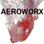
Scenery consist of Updated Terrain Vector data concerning Coastlines, rivers, dams, lakes, streams, roads, traffic, railroads, power lines and extrusion bridges for Southern African countries South of the Equator. A lot of work was done from the East Coast at Dar Es Salaam, west towards the Great Lakes in the Rift Valley like Lake Malawi, Lake Tanganyika, Lake Rukwa, etc. as were the areas across the Luangwa Valley and as far down as Lusaka and the Kafue swamps. With this scenery it is important to install the previous release of "fsxWorx01" and updates 1 to 7 before this file.
| Filename: | Detailed_Terrain_Features_for_Southern_Africa_Upda.zip |
| License: | Freeware |
| Added: | 4th January 2014, 14:57:05 |
| Downloads: | 2,553 |
| Author: | Hannes Steyn, Aeroworx |
| Size: | 4.22 MB |
| Category: Flight Simulator X - Scenery | |
| Non-Airport Scenery for Southern Africa, Update 1 |
|
Images related to this file:
File Description:
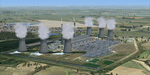
Non Airport Scenery update 1, will add a few more individual scenery enhancements, Arnot Power Station, SA Air Force Memorial designed by Kobus and a few default models Tutuka, Majuba and Lethabo Power Stations to act as reference points when flying VFR and enhance your Southern Africa scenery. Please install fsxWorx04.zip, fsxWorx01.zip, fsxWorx02.zip, and updates before this scenery.
| Filename: | NonAirport_Scenery_for_Southern_Africa_Update_1.zip |
| License: | Freeware |
| Added: | 10th February 2013, 14:30:08 |
| Downloads: | 3,564 |
| Author: | Kobus van Wyk, Hannes Steyn, Aeroworx |
| Size: | 37.12 MB |


© 2001-2026 AVSIM Online
All Rights Reserved
Privacy Policy |