
Where Flight Simulation Enthusiasts Gather from Around the World!
AVSIM Library - Search Results

| Category: Flight Simulator X - Scenery | |
| New Garden (N57) Airshow Scenery |

|
File Description:
New Garden Airport annually holds their Airshow at New Garden Flying Field (N57) and shows off many different aerobatic aviation displays, static displays, and a car show. Usually, this show is held by David Schultz Airshows LLC
(schultzairshows.com). There isn't much at the show for aviation except for hotrods and other kinds of cars that may run fast. This scenery includes Tents, Porta Pots, two Cubs, a glider, and an outstanding crowd! There is also a school bus I added in as well. In the future I will be making different kinds of scenery, including stuff as new airports as well.
| Filename: | New_Garden_N57_Airshow_Scenery.zip |
| License: | Freeware |
| Added: | 13th July 2010, 09:15:45 |
| Downloads: | 229 |
| Author: | Holden Smith |
| Size: | 3.65 KB |
| Category: Flight Simulator X - Scenery | |
| Eagle Island Airport PEIR Version 1.0 |
|
Images related to this file:
File Description:
This is the first version of the fictional Eagle Island airport, located near Nome, Alaska. This airport includes:
1.Eagle Island Airport has a fully functional ATC with specific Approach, Departure, Ground, and ATIS frequencys.
2.Both runways have ILS, and the longest runway 19R/01L (15000ft) has a GPS approach.
3.Two fuel parking spaces
4.Two working fuel trucks for all the GA parking spaces and all the gates east of runway 19R/01L
5.Working jetways on all gates west of runway 19R/01L
6.PAPI glide slope indicators for all runways.
| Filename: | Eagle_Island_Airport_PEIR_Version_10.zip |
| License: | Freeware, limited distribution |
| Added: | 18th July 2011, 19:47:54 |
| Downloads: | 307 |
| Author: | George Smith |
| Size: | 6.8 KB |
| Category: Flight Simulator X - Scenery | |
| Blue Angels Homecoming Air Show |
|
Images related to this file:
File Description:
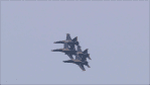
The Blue Angels end there season every year at there homecoming show at Nas Pensacola. Now, it can be done on Fsx. This scenery is to reflect the Blues Homecoming show in November. In this scenery, you can look from different camera angles on the flight line and watch the action. This scenery requires FS Recorder 2.1 Beta and Jim Dhaenen's NAS Pensacola and Chevalier Field Scenery. Air show scenery done by Holden Smith.
| Filename: | Blue_Angels_Homecoming_Air_Show.zip |
| License: | Freeware |
| Added: | 29th July 2011, 16:46:39 |
| Downloads: | 667 |
| Author: | Holden Smith |
| Size: | 1.63 MB |
| Category: Flight Simulator X - Scenery | |
| EVRA - Riga Intl Airport, Latvia |
|
Images related to this file:
File Description:
This airport was designed to update Riga Intl Airport and created only for FSX: runway now at its new length of 3200m, terminals and gates re-designed, airline gate allocation as per their website, frequencies corrected, all approaches, taxiways and taxi signs updated to the latest charts, lighted helipad, fuel trucks and vehicle paths included.
| Filename: | EVRA__Riga_Intl_Airport_Latvia.zip |
| License: | Freeware, limited distribution |
| Added: | 9th June 2017, 07:17:26 |
| Downloads: | 16,842 |
| Author: | Jamie Smith |
| Size: | 753.27 KB |
| Category: Flight Simulator X - Scenery | |
| Free Flight Mode Project - Midwest Flyin |
|
File Description:
This add-on will modify the FSX Mission "Midwest Flyin" so that the mission scenery, animations, and even sound effects will all be visible in free flight mode. Also included are AFCAD modifications for each airport, the smaller, private field is now AI-Ready.
Please note the original scenery in this package was designed by Microsoft, I just modified the file types to accomplish the above.
| Filename: | Free_Flight_Mode_Project__Midwest_Flyin.zip |
| License: | Freeware, limited distribution |
| Added: | 27th October 2008, 07:09:48 |
| Downloads: | 517 |
| Author: | Dakota Smith / Smith Graphics / Microsoft |
| Size: | 12.85 KB |
| Category: Flight Simulator X - Scenery | |
| FFM - San Juan Island Run |
|
File Description:
This add-on will modify the FSX Mission "San Juan Island Run" so that all scenery seen in the mission will be visible in free flight.
Please note the original scenery in this package was designed by Microsoft, I just modified the file types to accomplish the above.
| Filename: | FFM__San_Juan_Island_Run.zip |
| License: | Freeware, limited distribution |
| Added: | 28th October 2008, 13:15:17 |
| Downloads: | 535 |
| Author: | Dakota Smith / Smith Graphics, Microsoft |
| Size: | 1.9 KB |
| Category: Flight Simulator X - Scenery | |
| Long Island Mac Arthur Airport, Islip, New York (KISP) |
|
File Description:
This scenery is built for FSX. This scenery was created with Abacus EZ Scenery. You will need the RWY12 Libraries installed as well as a few EZ scenery libraries. This scenery adds many many things, including a terminal replacement, parking spots, and vehicles, GA Hangars, and more.
| Filename: | Long_Island_Mac_Arthur_Airport_Islip_New_York_KISP.zip |
| License: | Freeware, limited distribution |
| Added: | 15th March 2008, 17:02:28 |
| Downloads: | 1,364 |
| Author: | Brandon DePalo and Ray Lunning / Watsup Sceneries |
| Size: | 3.93 MB |
| Category: Flight Simulator X - Scenery | |
| St. Helena, Ascension, and Tristan da Cunha Islands |
|
Images related to this file:
File Description:
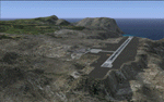
This project was begun to add the new airport (FHSH) to St. Helena Island and eventually was expanded to include a complete remake of Ascension Island (FHAW) and Tristan da Cunha (with an optional airport FHTC) and Gough Island with the actual weather station heliport (FHGH). Tested in both the default FSX/Acceleration and with FTX Global/Vector, accurate coastlines, lakes, road data, and SRTMGL1 (30m) mesh, as well as corrected landclass are provided based on the latest available satellite imagery. Flight plans are provided for the proposed commercial service to St. Helena, and some additional GA and military flights to the island are added as well.
The FSX St. Helena (FHSH) airport was created by aligning master plans for the airport with current satellite data and by studying many of the pictures that have been posted as the airport has taken shape. The official opening of the real airport on May 21, 2016, has been pushed back for more field tests due to challenging crosswinds. The Ascension Island (FHAW) airport was updated after I realized that Ascension could receive commercial service as a result of the new St. Helena airport. The entire airfield is redesigned to allow the volcanic terrain to display properly. The airbase, towns, BBC Atlantic relay station, and numerous satellite dishes, radomes, and wind turbines now appear in their real-world locations. Since I was already in the region, I added the Tristan da Cunha Islands (including Inaccessible, Nightingale and Gough Islands) and the Gough Island weather station maintained by the South African National Antarctic Programme. I also added an optional airport (and flight plans) to Tristan da Cunha (FHTC), which can be easily enabled/disabled. The FHTC airport is placed on the only part of the island that appears to be free of people or farmland, and the area is just long enough to accommodate a pared-down version of the St. Helena airport.
Updates were created or rebuilt in a manner which carefully aligns airport data with current satellite imagery. Scenery was created using Airport Design Editor X v1.67.5684, SBuilderX 3.13, and the FSX Object Placement Tool. Scenery objects were added and modified from stock FSX scenery to resemble as closely as possible the actual airports. The animated flag model is by Dietmar Loleit, the FSX apron lights included are from the set created by Jim Dhaenens, and the animated wind turbines and radomes are from the freeware package by Ray Porter.
| Filename: | St_Helena_Ascension_and_Tristan_da_Cunha_Islands.zip |
| License: | Freeware |
| Added: | 1st May 2016, 11:23:05 |
| Downloads: | 6,092 |
| Author: | Carlyle Sharpe |
| Size: | 10.52 MB |


© 2001-2026 AVSIM Online
All Rights Reserved
Privacy Policy |