
Where Flight Simulation Enthusiasts Gather from Around the World!
AVSIM Library - Search Results

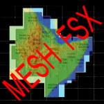
| Category: Flight Simulator X - Scenery | |
| South America Mesh Scenery MeshX_A10 |

|
File Description:
Mesh terrain scenery for the whole continental South America, based on SRTM 90m
dem geotiff files resampled to 76 meter of horizontal resolution (LOD 9). The new files have
improved the vertical resolution from 16m to 10m, resulting in more details
and accuracy over previous versions. There are 50 files, compatible with FS 9
and FS X, identified in a map by column letter and line number, covering the
contiguous countries and states. Boundaries: N = 39º 22.5' S; S = 45º 0' S;
E = 71º 15' W; W = 78º 45' W.
| Filename: | meshx_a10.zip |
| License: | Freeware |
| Added: | 30th October 2006, 00:49:28 |
| Downloads: | 2,801 |
| Author: | Oséas Dourado and José Lôbo |
| Size: | 17.38 MB |
| Category: Flight Simulator X - Scenery | |
| South America Mesh Scenery, MeshX_B11 |
|
File Description:
Mesh terrain scenery for the whole continental South America, based on SRTM 90m
dem geotiff files (at: ftp://ftp.glcf.umiacs.umd.edu/glcf/SRTM/Degree_Tiles/),
resampled to 76 meter of horizontal resolution (LOD 9). The new files have
improved the vertical resolution from 16m to 10m, resulting in more details
and accuracy over previous versions. There are 50 files, compatible with FS 9
and FS X, identified in a map by column letter and line number, covering the
contiguous countries and states. Boundaries: N = 45º 0' S; S = 50º 37.5' S;
E = 63º 45' W; W = 71º 15' W.
| Filename: | meshx_b11.zip |
| License: | Freeware |
| Added: | 30th October 2006, 05:44:41 |
| Downloads: | 1,841 |
| Author: | Oséas Dourado, José Lôbo |
| Size: | 19.15 MB |
| Category: Flight Simulator X - Scenery | |
| South America Mesh Scenery, MeshX_A12 |
|
File Description:
Mesh terrain scenery for the whole continental South America, based on SRTM 90m
dem geotiff files (at: ftp://ftp.glcf.umiacs.umd.edu/glcf/SRTM/Degree_Tiles/),
resampled to 76 meter of horizontal resolution (LOD 9). The new files have
improved the vertical resolution from 16m to 10m, resulting in more details
and accuracy over previous versions. There are 50 files, compatible with FS 9
and FS X, identified in a map by column letter and line number, covering the
contiguous countries and states. Boundaries: N = 50º 37.5' S; S = 56º 15' S;
E = 71º 15' W; W = 78º 45' W.
| Filename: | meshx_a12.zip |
| License: | Freeware |
| Added: | 30th October 2006, 05:45:01 |
| Downloads: | 1,954 |
| Author: | Oséas Dourado and José Lôbo |
| Size: | 13.36 MB |
| Category: Flight Simulator X - Scenery | |
| Faroe Islands mesh and scenery |
|
File Description:
Welcome to the Faroe Islands. Our complete mesh and scenery will let you enjoy these beautiful North Atlantic islands. The only airport of the islands is modelled together with all helipads, towns, ports, road traffic and much more. A FSX-style flight plan for Atlantic Airways (2007, week 36) is included.
Please read the manual for further information.
| Filename: | faroes_fsx.zip |
| License: | Freeware, limited distribution |
| Added: | 28th August 2007, 15:48:07 |
| Downloads: | 7,249 |
| Author: | Ryan Andersen and Peter H. Poulsen |
| Size: | 18.38 MB |
| Category: Flight Simulator X - Scenery | |
| Horn Of Africa Mesh, part 1/3 |
|
Images related to this file:
File Description:

Part 1 of 3: Mesh (lod 1 to 9) of the "Horn Of Africa": Ethiopia, Erythrea, Djibouti and Somalia. (Re-upload)
| Filename: | etherysom1_fsx.zip |
| License: | Freeware, limited distribution |
| Added: | 10th June 2010, 08:57:38 |
| Downloads: | 2,244 |
| Author: | Marcel "Teutonique" Wislet |
| Size: | 82.8 MB |
| Category: Flight Simulator X - Scenery | |
| Horn Of Africa Mesh, part 2/3 |
|
Images related to this file:
File Description:
Part 2 of 3: Mesh (lod 1 to 9) of the "Horn Of Africa": Ethiopia, Erythrea, Djibouti and Somalia. (Re-upload)
| Filename: | etherysom2_fsx.zip |
| License: | Freeware, limited distribution |
| Added: | 10th June 2010, 08:59:50 |
| Downloads: | 2,086 |
| Author: | Marcel "Teutonique" Wislet |
| Size: | 88.81 MB |
| Category: Flight Simulator X - Scenery | |
| Horn Of Africa Mesh, part 3/3 |
|
Images related to this file:
File Description:

Part 3 of 3 : Mesh (lod 1 to 9) of the "Horn Of Africa": Ethiopia, Erythrea, Djibouti and Somalia. (Re-upload)
| Filename: | etherysom3_fsx.zip |
| License: | Freeware, limited distribution |
| Added: | 10th June 2010, 09:01:32 |
| Downloads: | 2,063 |
| Author: | Marcel "Teutonique" Wislet |
| Size: | 68.17 MB |
| Category: Flight Simulator X - Scenery | |
| Hong Kong Photo Scenery |
|
File Description:
This photo scenery add-don covers the entire Hong Kong region and part of Shen Zhen. Terrain mesh is not included.
| Filename: | hk_photoscenery.zip |
| License: | Freeware, limited distribution |
| Added: | 27th August 2011, 19:54:29 |
| Downloads: | 7,480 |
| Author: | Alex Lo |
| Size: | 52.09 MB |
| Category: Flight Simulator X - Scenery | |
| NWT Landscape - Canada |
|
File Description:
Elevation data (mesh-Lod10 - 38m), land cover, water polygons, rivers, stream lines, lanes and shorelines around airports of Northwest Territories, Canada.
| Filename: | nwt_landscape.zip |
| License: | Freeware, limited distribution |
| Added: | 9th February 2011, 17:43:21 |
| Downloads: | 3,331 |
| Author: | Gilles Gauthier |
| Size: | 89.21 MB |
| Category: Flight Simulator X - Scenery | |
| AFX_EDHM |
|
File Description:
Update for my FSX scenery of
a small private landing place
northeasterly of Hamburg.
Corrects AF2, mesh and as
bonus EDHX nearby.
| Filename: | afx_edhm.zip |
| License: | Freeware |
| Added: | 24th January 2008, 00:02:31 |
| Downloads: | 1,431 |
| Author: | Uwe Schweitzer |
| Size: | 284 KB |
© 2001-2025 AVSIM Online
All Rights Reserved