
Where Flight Simulation Enthusiasts Gather from Around the World!
AVSIM Library - Search Results

| Category: Flight Simulator X - Scenery | |
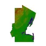
| Mesh for St.Eustatius - Caribbean |

|
Images related to this file:
File Description:
This file "FSX_St-Eustatius_CARIBB_photo_scenery_MESH", partially handmade.
Requires: Photo_scenery of St.Eustatius (Statia) in the Caribbean with the airport F.D. Roosevelt (TNCE).
"FSX__St.Eustatius_CARIBB_photo_scenery.zip".
Optional : "FSX_St-Eustatius_CARIBB_photo_scenery_aditional_tanks2_OBX.zip"
| Filename: | fsx_st-eustatius_caribb_photo_scenery_mesh.zip |
| License: | Freeware |
| Added: | 5th December 2012, 03:12:28 |
| Downloads: | 517 |
| Author: | Harald Sandvik |
| Size: | 172 KB |
| Category: Flight Simulator X - Scenery | |
| Egypt Mesh Scenery SRTM |
|
File Description:
This scenery is based on the collected Datas of the NASA Spaceshuttle mission SRTM
The Shuttle Radar Topographic Mission in the year 2000 made by the Spaceshuttle Endevour.
| Filename: | eg_srtm_fsx.zip |
| License: | Freeware, limited distribution |
| Added: | 2nd January 2012, 16:25:24 |
| Downloads: | 10,960 |
| Author: | Mathias Schindler |
| Size: | 129.51 MB |
| Category: Flight Simulator X - Scenery | |
| Greece Mesh Terrain, v1 |
|
Images related to this file:
File Description:
Detailed FSX mesh terrain of Greece and surrounding territories (West Turkey, South Bulgaria, FYRoM, Albania) based on SRTM Data (3 arcsec, 90m) and sampled to LOD9 resolution (76m). For more information visit www.avsim.com/greece/scenery.
| Filename: | hspfsxmesh1.zip |
| License: | Freeware, limited distribution |
| Added: | 9th June 2010, 14:46:18 |
| Downloads: | 30,418 |
| Author: | Hellas Scenery Team (HST) |
| Size: | 76.59 MB |
| Category: Flight Simulator X - Scenery | |
| Millau Viaduct Bridge Patch |
|
File Description:
Patch for scenery Millau Viaduct Bridge.
In order to obtain a better adaptation of the viaduct with the ground, this archive contains three choices, according to the installed add-ons in your Scenery library:
options-1 Without UTX Europe and with Mesh France of France VFR. Option-2 With UTX Europe without Mesh France of France VFR.
Option-3 Without UTX Europe and Without Mesh France of France VFR.
The scenery " millau_Viaduct_FSX.zip " is needed. Download on AVSIM File Library.
| Filename: | patch_millau-viaduct_fsx.zip |
| License: | Freeware, limited distribution |
| Added: | 31st March 2008, 17:54:03 |
| Downloads: | 4,332 |
| Author: | Jean-Claude Irle |
| Size: | 11 KB |
| Category: Flight Simulator X - Scenery | |
| Northeast New Jersey 5 Meter Mesh Terrain |
|
Images related to this file:
File Description:
High Resolution Northeast New Jersey 5 Meter Mesh Terrain by Wally-Bob represents a significant improvement over FSX default 38 meter mesh terrain. The results are also dramatic compared to 10 meter compressed payware mesh as lossless compression compilation (read no data loss) is used. Lossless compiling produces renderings that have the Crispness of the Real World Terrain. Fly the Hudson River and view the Palisades as they are in real life, see the screen shots enclosed. High Quality 5 meter mesh terrain is a must have for mountainous areas especially where photo scenery is also used to render the virtual world. Manual includes FSX configuration and scenery installation tips. USGS LiDAR 1/9 Arc-Second source data.
| Filename: | nenj_mesh_5m_v1_w-b.zip |
| License: | Freeware, limited distribution |
| Added: | 26th February 2011, 21:35:52 |
| Downloads: | 1,096 |
| Author: | Walter Roberts |
| Size: | 135.89 MB |
| Category: Flight Simulator X - Scenery | |
| FSX British Columbia Airfields 1-3 For Default Scenery |
|
File Description:
60 British Columbia airfields/seaplane bases with surrounding scenery like lakes, landclass etc.. These sceneries are for the FSX default scenery, i.e. a scenery that does not have enhancements like Ultimate Terrain or ORBX which correct or add e.g. lakes, towns etc.
However, I do use additional freeware mesh sceneries, which are the "FSX Canada 19M Terrain Mesh" parts 1 and 2 by Raimundo Taburet (LOD 11) and the North America/Canada mesh from "FreeMesh X Global 1.0" (LOD 10). But in principle my sceneries should work with any mesh.
All files are named by their ICAO ID, so you can easlily remove any airfiled that you don't need or don't like.
| Filename: | misc_bc_airfields_1-3.zip |
| License: | Freeware |
| Added: | 20th November 2020, 05:32:29 |
| Downloads: | 167 |
| Author: | Detlev J. Rohmer |
| Size: | 196 KB |
| Category: Flight Simulator X - Scenery | |
| Quebec Mesh (Lod10), between N56°-N57° and W66°-W77°, Prov. of Quebec (Canada) |
|
File Description:
FSX 38m (Lod10) terrain mesh files of territory included between N56°-N57° and W66°-W77°, province of Quebec, Canada.
| Filename: | qc38mbj1_fsx.zip |
| License: | Freeware, limited distribution |
| Added: | 1st March 2008, 14:37:15 |
| Downloads: | 3,036 |
| Author: | Gilles Gauthier |
| Size: | 21.61 MB |
| Category: Flight Simulator X - Scenery | |
| Nunavut Landscape - Canada |
|
File Description:
Elevation data (mesh-Lod10), land cover, water polygons, rivers, stream lines, lanes and shorelines around airports of Nunavut, Canada
| Filename: | nunavut_landscape.zip |
| License: | Freeware, limited distribution |
| Added: | 20th November 2010, 00:10:27 |
| Downloads: | 2,498 |
| Author: | Gilles Gauthier |
| Size: | 49.5 MB |
| Category: Flight Simulator X - Scenery | |
| ITATIBA P1 - Photo Realistic Scenery |
|
File Description:
ITATIBA P1 - 1/2
This is the complement of Campinas to cover ITATIBA region. This scenery is composed by five parts. Folow instructions on Readme.txt and have a nice visual flight.
Is a good idea install the FSX Mesh South America parts F7 and F8 cordinates in the map to have the essential mesh terrain.
| Filename: | itatibap1_1.zip |
| License: | Freeware |
| Added: | 11th August 2008, 08:27:11 |
| Downloads: | 1,347 |
| Author: | Gilson A. Rocchetti |
| Size: | 47.69 MB |
| Category: Flight Simulator X - Scenery | |
| Mesh for Northern Africa, Base Grid 0603 - Part 1 |
|
Images related to this file:
File Description:
Highly detailed 76m SRTM mesh for Africa using the latest release of STRM Data V2.1. This file covers the Africa Area of base file 0603 (N01 and E00), North of the Equator. You need to download all two parts to restore the mesh bgl file. DO NOT DISABLE THE DEFAULT DEM 603 FILE.
| Filename: | fsxmeshx0603w_part1.zip |
| License: | Freeware |
| Added: | 8th February 2014, 22:03:34 |
| Downloads: | 2,513 |
| Author: | Martin du Preez, Hannes Steyn, Aeroworx |
| Size: | 307.22 MB |
© 2001-2025 AVSIM Online
All Rights Reserved