
Where Flight Simulation Enthusiasts Gather from Around the World!
AVSIM Library - Search Results

| Category: Flight Simulator X - Scenery | |
| Nellis Air Force Base - KLSV |

|
File Description:
This file contains several BGL's which enhance the default
FSX Nellis Air Force Base (KLSV ). I have added some
ramp parking for miltary aircraft. Additionally, I have added several
scenery objects to enhance the visual experience.
The other change I made was to eliminate the "mesa effect" caused by
the stock FSX airport as it sits above/below the surrounding
terrain using "sloped flattens" to blend the airport level
terrain into the surrounding terrain.
I am using the "FSX Usa 10 M terrains Project - West Coast Version 1.1"
mesh but the default FSX mesh should blend O.K.
| Filename: | klsv_nellis_afb.zip |
| License: | Freeware |
| Added: | 21st December 2007, 04:37:40 |
| Downloads: | 3,328 |
| Author: | Paul Strogen |
| Size: | 855 KB |
| Category: Flight Simulator X - Scenery | |
| St Eustatius, Caribbean, PhotoScenery V2 |
|
Images related to this file:
File Description:
St Eustatius, Caribbean, PhotoScenery V2 with added Valladier Tower and Terminal.
Photo scenery of St.Eustatius (Statia) in the Caribbean with the airport F.D. Roosevelt (TNCE) in Oranjestad. JL Valladier's model of terminal, tower and PIR included with permission. This file also includes updates and mesh.
| Filename: | fsx_st-eustatius_photo_scenery-photoreal_tower_and_terminal.zip |
| License: | Freeware |
| Added: | 11th December 2012, 17:33:53 |
| Downloads: | 3,300 |
| Author: | Harald Sandvik |
| Size: | 63.43 MB |
| Category: Flight Simulator X - Scenery | |
| LGIR-v2, Heraklion Int. airport, Crete |
|
Images related to this file:
File Description:
Renewed setup of my LGIR scenery, now with photoreal background. With this I solved some errors and gave it some more realism.
'Nikos Kazantzakis' als the air[port is called, is the second airport of Greece. Visitors are mostly tourists. I used FreeMeshX as mesh.
| Filename: | lgirv2.zip |
| License: | Freeware |
| Added: | 13th November 2018, 06:23:58 |
| Downloads: | 2,065 |
| Author: | Tim van Ringen |
| Size: | 16.83 MB |
| Category: Flight Simulator X - Scenery | |
| Kabel Car Complex - Cape Town South Africa |
|
File Description:
Kabel Car Complex for FSX,not the real thing just that i saw in Google.
For this scenery to work right you got to have a mesh installed,you can use the Aeroworx one from her at avsim or the NMG Trading one both will work.
| Filename: | kabel_car_complex.zip |
| License: | Freeware |
| Added: | 6th October 2008, 20:57:08 |
| Downloads: | 1,347 |
| Author: | Frits Beyer |
| Size: | 380 KB |
| Category: Flight Simulator X - Scenery | |
| Western Sahara VFR - Terrain Mesh SRTM 1 Arc/Sec version 3 |
|
Images related to this file:
File Description:
Enhanced Terrain Mesh from data source NASA SRTM 1 Arc/Sec (30 meters) version 3 at LOD 11 (19mt meters/pixel). Coverage: Lat 28 to Lat 20. Re-design coastline of the Western Sahara and replaced Dakhla Airport (GMMH). Fully compatible also with P3D.
| Filename: | western_sahara_srtm_1arcsec.zip |
| License: | Freeware |
| Added: | 27th April 2015, 12:58:28 |
| Downloads: | 914 |
| Author: | Giovanni Miduri |
| Size: | 373.13 MB |
| Category: Flight Simulator X - Scenery | |
| Updated EGGP Liverpool |
|
File Description:
Updated EGGP - Liverpool Airport for FSX. Blended to fit Horizon GenX Scenery and Mesh, removing cliff and valley effect. This update fixes a problem with aircraft travelling to / from General Parking using section of runway instead of remaining on taxiway 'A' Original file was EGGP Liverpool.zip
| Filename: | eggp1_liverpool.zip |
| License: | Freeware, limited distribution |
| Added: | 20th October 2007, 23:12:42 |
| Downloads: | 3,070 |
| Author: | Tony Meredith |
| Size: | 558 KB |
| Category: Flight Simulator X - Scenery | |
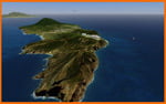
| Whale Island (Hi Resolution Photo and mesh), New Zealand |
|
Images related to this file:
File Description:
Whale Island (Maori Name: Moutohora) is a small island located off the Bay of Plenty coast of New Zealand's North Island. It is located about 12 kilometers north of the town of Whakatane. A whaling station existed on the island during the 19th century. The 1.43 km island is a remnant of a complex volcano which has eroded, leaving two peaks. This is still an area of volcanic activity and there are hot springs on the island in Sulphur Valley, McEwans Bay, and Sulphur Bay.
This Hi Resolution scenery was created from a 0.25m pixel resolution Ortho-rectified Aerial mosaic owned by Environment Bay of Plenty (The Bay of Plenty Regional Council) and flown in 2007. The imagery has been slightly de-sampled for use in Flight Simulator X and utilizes the a custom hi resolution 5m Mesh derived from photogrammetry data off the photos. The textures are intended for summer daylight flying only, although due to the evergreen nature of New Zealand's native bush, the Islands appearance remains relatively constant throughout the year.
The island contains a small helicopter pad which is used for checking the various radio antennas on the Island. There is also a small Department of Conservation hut near the south western tip of the Island. These objects have been added from the FSX library of objects. Make sure to turn up your graphics sliders to make the most of this data! To find the Island fly north from Whakatane airport.
| Filename: | bopislands_whalehires.zip |
| License: | Freeware, limited distribution |
| Added: | 20th January 2010, 10:12:14 |
| Downloads: | 4,642 |
| Author: | Tim Barnes |
| Size: | 9.96 MB |
| Category: Flight Simulator X - Scenery | |
| California Central Coast with Megascenery Earth and FSGenesis Mesh |
|
Images related to this file:
File Description:
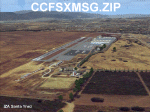
California Central Coast Scenery for FSX with Megascenery Earth and FSGenesis mesh. CCFSXMSG.ZIP covers the California coastal region from N36° 10' (Coalinga) to N34° 25' (Santa Barbara) and from the coast East to W119° 40'. It is a version of my previously created California Central Coast scenery redesigned and expanded to work with FSX MegaScenery Earth and FSGenesis USA Terrain Mesh for FSX V2 by Justin Tyme. Airstrips in the area covered by this scenery have been added for a total of 27 airports and airstrips. 6 imaginary water runways are also added for AI float plane traffic. Several other areas of interest such as the Santa Barbara marina, Morro Bay, etc. are included for a total of 41 points of interest. All airports, airstrips and related structures have been adjusted and realigned to conform to actual positions and dimensions as indicated by the MegaScenery Earth satellite textures. Megascenery Earth California-13, -14 and -15 are required and -12, -28 and -29 are recommended. By Al Wheeler 9/25/09.
| Filename: | ccfsxmsg.zip |
| License: | Freeware |
| Added: | 7th January 2010, 19:54:57 |
| Downloads: | 869 |
| Author: | Al Wheeler |
| Size: | 8.13 MB |
| Category: Flight Simulator X - Scenery | |
| KSPG UPDATE Albert Whitted |
|
Images related to this file:
File Description:

This is an update for KSPG. New
lighting plus docks added N of
airport.
You MUST have "kspg_aw.zip" installed!
A representation of the
construction for the new airport
control tower.
jimmy R martin
BEST IF USED WITH ULTIMATE TERRAIN X
REAL ENVIRONMENT X USED HERE
FS GENESIS TERRAIN MESH
| Filename: | kspg_fsx_ud.zip |
| License: | Freeware |
| Added: | 29th August 2010, 23:52:50 |
| Downloads: | 361 |
| Author: | jimmy R martin |
| Size: | 1.57 MB |
| Category: Flight Simulator X - Scenery | |
| N52 - Lakes, Streams and St.Lawrence River with iced cover. Province of Quebec (Canada) |
|
File Description: This scenery replaces the FSX 'winter' water polygons by an iced cover for
lakes, rivers and St.Lawrence river of Province of Quebec, Canada, under N52.
Only compatible with Gilles Gauthier's Quebec mesh and landscape sceneries
and Jean-Pierre Fillion AI ships routes. (See www.quebecfsx.org).
| Filename: | glacehiverquebec.zip |
| License: | Freeware, limited distribution |
| Added: | 18th September 2013, 13:06:36 |
| Downloads: | 511 |
| Author: | Gilles Gauthier and Jean-Pierre Fillion |
| Size: | 54.15 MB |
© 2001-2025 AVSIM Online
All Rights Reserved