
Where Flight Simulation Enthusiasts Gather from Around the World!
AVSIM Library - Search Results

| Category: Flight Simulator X - Scenery | |
| Manchester Boston Regional Airport (KMHT) |

|
Images related to this file:
File Description:
This airport was made using Airport Design Editor 9x (ADE9x). Manchester Boston Regional Airport is an airport located in Mancherster New Hamshire. I replaced all of the stock building with more accurate ones. I added more gates at the terminal a cargo gates to the southwest. At the cargo area, I added cargo buildings and cargo trucks. At the main terminal I put jetways and more gates. At the general aviation area, I put static aircraft and more parking. I made all this based on Google earth and Bing maps. Please read the readme for instructions on how to install. This is for Flight Simulator X only.
| Filename: | Manchester_Boston_Regional_Airport_KMHT.zip |
| License: | Freeware |
| Added: | 25th December 2011, 10:25:56 |
| Downloads: | 1,736 |
| Author: | Tyler Lawrence |
| Size: | 13.18 MB |
| Category: Flight Simulator X - Scenery | |
| Alaska Airfields Kodiak |
|
Images related to this file:
File Description:
This is a pack of three airfields in Kodiak Alaska that I have modified to look more like the real thing. The scenery is made of stock ready made library buildings and trees, and some freeware custom made aircraft-objects. So, it's not a flashy photo-real scenery or something, but it's a vast improvement over the stock FSX airfields. The three airfields are (KDK) Kodiak Municipal Airfield, (4K5) Ouzinkie Airfield and (ORI) Port Lions Airfield.
PLEASE NOTE: These scenerys are made with FSX Acceleration and Flight 1's Ultimate Alaska X installed. I don't know how they look or work without these add-ons.
| Filename: | Alaska_Airfields_Kodiak.zip |
| License: | Freeware |
| Added: | 17th May 2012, 22:00:23 |
| Downloads: | 2,607 |
| Author: | Torbjorn Kuntze |
| Size: | 6.1 MB |
| Category: Flight Simulator X - Scenery | |
| EKSP - Skrydstrup |
|
Images related to this file:
File Description:
EKSP Skrydstrup scenery, version 1.0, for Microsoft Flight Simulator X. FW Skrydstrup/Vojens Lufthavn (EKSP, SKS) in southern Jutland is the home of the Danish F-16's. This scenery covers the entire air base area, complete with detailed airport layout, a great number of stock and custom 3-D objects, lots of autogen vegetation and an 80cm/pixel ortophoto ground map. Improvements over stock FSX scenery include renumbered runways, realistic taxi and parking layout, updated and added navaids, updated instrument approaches, and the "new" runway 10L ILS. Extensive PDF documentation, including charts, included. An optional update package with a high resolution 40cm/pixel ground map is also available.
| Filename: | EKSP__Skrydstrup.zip |
| License: | Freeware |
| Added: | 1st May 2014, 03:46:05 |
| Downloads: | 2,005 |
| Author: | Jens Peter Pedersen |
| Size: | 35.34 MB |
| Category: Flight Simulator X - Scenery | |
| 6I2 - Lebanon-Springfield Airport - Kentucky, USA |
|
Images related to this file:
File Description:
Lebanon-Springfield Airport (FAA LID: 6I2), a public use airport in Washington County, Kentucky (KY), USA. It is located three nautical miles (6 km) south of Springfield in Washington County) and north of Lebanon (in Marion County). The airport is owned by Marion and Washington Counties. The scenery contains seasonal ground textures for winter, spring, summer, autumn and night; autogen and default scenery objects of FSX plus a modified AFCAD file. Tested with FSX: SE on Windows 10. Version 1.1 contains fixes for the terrain aswell as corrected scenery objects.
** Do not use this version with FreeMesh X - USA; use 6I2_FMX.zip instead **
By Peregrine Simulations
| Filename: | 6I2__LebanonSpringfield_Airport__Kentucky_USA.zip |
| License: | Freeware, limited distribution |
| Added: | 21st February 2018, 23:36:38 |
| Downloads: | 250 |
| Author: | Peregrine Simulations |
| Size: | 104.1 MB |
| Category: Flight Simulator X - Scenery | |
| KVBG Vandenberg AFB v2.0 |
|
File Description:
Vandenberg Air Force Base is headquarters for the 30th Space Wing. The 30th manages Department of Defense space and missile testing, and placing satellites into polar orbit from the West Coast, using expendable boosters. Vandenberg is located on California's "Central Coast". Vandenberg and central California's coastal residents consider their environment mild. The 150 square mile area midway between San Francisco and Los Angeles is surrounded by the Santa Ynez Mountains, the Pacific shore, and ranches of northern Santa Barbara and San Luis Obispo Counties. This file has been designed to work on both FS2004 and FS-X platforms. Requires RWY 12 library textures (available at www.avsim.com) for full enhancement.
| Filename: | KVBG_Vandenberg_AFB_v20.zip |
| License: | Freeware |
| Added: | 12th November 2006, 22:21:11 |
| Downloads: | 2,202 |
| Author: | Brian C. Selb |
| Size: | 86.07 KB |
| Category: Flight Simulator X - Scenery | |
| Port Allen airport Scenery, Hawaii - PAK |
|
File Description:
Aloha! -
This is a fictitious rendition of the actual airport at Port Allen, Hawaii USA - PAK.
Port Allen Airport is approx. one mile southwest of the town on Hanapepe on the south shore of Kauai.
Virtual improvements have finally come to the beautiful garden paradise. Come see for yourself! Stay at the new virtual Hanapepe resort.
I took a boring airport and added some "eye-candy" in order to have something nice to look at in addition to the spectacular ocean front properties.
Designed with the FS X Sdk Scenery function of the Mission builder and the Abacus Scenery shortcut tool.
This scenery is frame rate friendly.
| Filename: | Port_Allen_airport_Scenery_Hawaii__PAK.zip |
| License: | Freeware |
| Added: | 26th January 2007, 18:45:14 |
| Downloads: | 1,881 |
| Author: | Bob Caparoula |
| Size: | 7.74 MB |
| Category: Flight Simulator X - Scenery | |
| SVMD - Merida, Venezuela |
|
Images related to this file:
File Description:
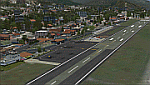
SVMD is an airport located 3 km southwest of downtown Merida, Venezuela, at an elevation of 1,526 m MSL. Its runway is 1,630 m long.
The runway has a gradient slope of +/- 4.05 %, for that reason, this airport is the most difficult and dangerous to land in Venezuela.
It is situated in a valley in the Andean mountains, surrounded by higher terrain in all
quadrants. Night operations are prohibited. Runway 07 is used for landings only and Rwy 25 is used only for take off.
Photo-terrain area improved with Autogen files.
Only compatible with versions to FSX or P3Dv1v2v3.x.
Also includes a friendly Auto-Install.
| Filename: | SVMD__Merida_Venezuela.zip |
| License: | Freeware |
| Added: | 9th December 2015, 09:13:34 |
| Downloads: | 1,072 |
| Author: | David Maldonado |
| Size: | 72.62 MB |
| Category: Flight Simulator X - Scenery | |
| NZOP- Opotiki Aerodrome (VectorLandClass, New Zealand) |
|
Images related to this file:
File Description:
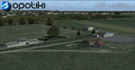
Opotiki aerodrome (ICAO: NZOP) is a small airstrip outside the township of of Opotiki, the gateway to the beautiful East coast of the North Island of New Zealand. Opotiki itself sits at the confluence of the Waioeka and Otara rivers and is surrounded by dairy farmland and Kiwifruit orchards with large areas of native bush to the south and east.
This scenery accompanies Tim Barnes'�� series of other small Bay of Plenty aerodromes (Whakatane,
Galatea, Waihi Beach) for use with VectorLandClass- It features custom modelled and textured buildings, large coverage of beautiful 0.5m aerial photography (fully auto-genned and including seasonal and night variations) and extensive use of high quality objects from the free VLC library. Installation of the library V1.1+ is required for this scenery to work properly and can be downloaded from the VectorLandClass website (www.vectorlandclass.co.nz)
This release, although not requiring it, works best with VectorLandClass topographic mesh and landclass addon covering all 268676 square kilometers of New Zealand. If you'��re not a VLC customer, you'��ll notice when the photoreal coverage runs out!
| Filename: | NZOP_Opotiki_Aerodrome_VectorLandClass_New_Zealand.zip |
| License: | Freeware, limited distribution |
| Added: | 21st February 2013, 13:52:47 |
| Downloads: | 969 |
| Author: | Tim Barnes |
| Size: | 146.68 MB |
| Category: Flight Simulator X - Scenery | |
| FSX_MeSA_G08_Patch |
|
File Description:
This terrain mesh file should substitute the before one we uploaded with the same name, which presents a small area with some voids that were not detected in our tests.
Please, accept our apologies for this mistake.
It was multi-LOD compiled from 90m SRTM2 source data, reprocessed
with 3DEM to remove voids and spikes, providing a 76.4m (LOD9) horizontal
resolution topography intended for use only in FSX updated with SP1.
FSX_MeSA_G08_Patch (Column G x Row 08) covers the area inside the boundaries:
N = 22º 30' S; S = 28º 7.5' S;
W = 45º 0' W; E = 37º 30' W;
Authors:
Hely Heck Junior - Magrao ( [email protected] )
and Jose Lobo ( [email protected] )
TerraBrasilis: www.terra-brasilis.org
| Filename: | FSX_MeSA_G08_Patch.zip |
| License: | Freeware |
| Added: | 24th June 2007, 18:09:48 |
| Downloads: | 633 |
| Author: | Hely Heck Jr. and José Lôbo |
| Size: | 10.39 MB |
| Category: Flight Simulator X - Scenery | |
| Nashua Municipal Airport (Boire Field) - KASH |
|
File Description:
This airport was made using Airport Design Editor 9x. (ADE9x). Nashua Municipal Airport, or Boire Field is a general aviation airport located in Nashua, New Hamshire. I made it based on Google Earth and Bing maps. I have replaced most of the stock buildings and added more accurate ones. The flight simulator made the taxiways 75 feet wide but they are only supposed to be 50 feet wide. That is something else I fixed. I also added static aircraft on the ramp and cars in the parking lot. The scenery complexity can not be set to to very sparse or nothing will not show up. Please read the readme for instructions. This file is for Flight Simulator X only.
| Filename: | Nashua_Municipal_Airport_Boire_Field__KASH.zip |
| License: | Freeware |
| Added: | 11th December 2011, 06:40:36 |
| Downloads: | 345 |
| Author: | Tyler Lawrence |
| Size: | 11.38 KB |


© 2001-2026 AVSIM Online
All Rights Reserved
Privacy Policy |