
Where Flight Simulation Enthusiasts Gather from Around the World!
AVSIM Library - Search Results

| Category: Flight Simulator X - Scenery | |
| FD08 - Antiquers Aerodrome - Delray Beach, Florida |

|
Images related to this file:
File Description:
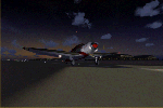
A real airport on the Atlantic Coast in the Miami/Ft. Lauderdale area with a grass airstrip.
-Features: I added a small Tower with comms, tidied up parking, taxiways, and for the 'difficult-to-taxi' tail-draggers, a circular taxiway to the Primary Runway, 9.
-Three freeware airplanes are included, Aeronca Chief, Boeing Stearman, and Beechcraft D18.
-Two Acceleration Pack aircraft, the P51 Racer #2, and the Grumman Goose are written into the Traffic file, so if you have Acceleration installed, they will also appear at the Aerodrome.
| Filename: | fd08_antiquers_aerodrome.zip |
| License: | Freeware |
| Added: | 11th November 2014, 06:22:56 |
| Downloads: | 559 |
| Author: | Jeff Reed |
| Size: | 24.29 MB |
| Category: Flight Simulator X - Scenery | |
| KTEX - Telluride Regional Airport - Colorado, USA |
|
Images related to this file:
File Description:
East Coast Simulations presents scenery for Telluride Regional Airport (KTEX/TEX) for FSX/P3D! Telluride Regional Airport (IATA: TEX, ICAO: KTEX, FAA LID: TEX) is a public airport six miles west of Telluride, in San Miguel County, Colorado. It is owned by the Telluride Regional Airport Authority. At an elevation of 9,078 feet (2767 m) above sea level, it was the highest commercial airport in North America with scheduled passenger flights, until Great Lakes Airlines ended service in 2014. This scenery includes all custom buildings and terminals with a season changing photoreal background.
| Filename: | ecs-ktex.zip |
| License: | Freeware |
| Added: | 30th June 2015, 23:47:41 |
| Downloads: | 1,684 |
| Author: | Wesley Chin and Kyle Kato |
| Size: | 92.68 MB |
| Category: Flight Simulator X - Scenery | |
| Barrage Gouin - Gouin Dam |
|
File Description:
Barrage Gouin (CTP3) - Gouin Dam(CTP3) is a real bush destination in the central portion of the Canadian province of Quebec. It is a popular fishing destination. This accurate scenery contains many of the real buildings, chalets and docks near the dam. Bush pilots on wheels, there's a runway south of the dam near the river. There's also another outfitter (CB31) scenery north-west of the dam with a sand runway.
You can takeoff from Quebec city (CYQB) (see Gilles Boily's scenery) or Trois-Riviere (CYRQ) and fly north to the dam.
See the readme file for more informations.
| Filename: | barragegouin.zip |
| License: | Freeware, limited distribution |
| Added: | 7th April 2008, 09:31:08 |
| Downloads: | 4,185 |
| Author: | Jean St-Cyr |
| Size: | 5.81 MB |
| Category: Flight Simulator X - Scenery | |
| Columbia Regional Airport KCOU FSX |
|
Images related to this file:
File Description:
FSX Scenery - Columbia Regional Airport (IATA: COU, ICAO: KCOU, FAA LID: COU) is a city owned, public use airport located 10 nautical miles (12 mi, 19 km) southeast of the central business district of Columbia, a city in Boone County, Missouri, United States. The airport is served by one commercial airline and also provides general aviation services. This scenery is complete with no additional downloads, however, if you wish to see the one commercial airline serving Cloumbia in the AI flight plans, you must download the file woa_americaneagle_v2.zip by World of AI. Created for your flying pleasure by John B. Loney, Jr.
| Filename: | columbia_regional_kcou_fsx_2016.zip |
| License: | Freeware, limited distribution |
| Added: | 17th November 2016, 05:51:18 |
| Downloads: | 704 |
| Author: | John B. Loney, Jr. |
| Size: | 20.41 MB |
| Category: Flight Simulator X - Scenery | |
| 0VG - Lee County Airport - Virginia, USA |
|
Images related to this file:
File Description:
Lee County Airport (FAA LID: 0VG) is a public use airport in Lee County, Virginia, United States.It is owned by Lee County and located five nautical miles (6 mi, 9 km) southwest of the central business district of Jonesville, Virginia.
Added taxiways and aircraft parking along with custom buildings. Created with Airport Design Editor by ScruffyDuck Software using current FAA documentation and Google Earth measurements, this package offers a replacement for FSX's stock airport. All these enhancements are as close to the real airport as I can get with stock library objects and custom buildings.
| Filename: | 0vgairport.zip |
| License: | Freeware |
| Added: | 21st November 2014, 01:40:00 |
| Downloads: | 315 |
| Author: | Wayne Roberts |
| Size: | 106 KB |
| Category: Flight Simulator X - Scenery | |
| RAF Topcliffe - Yorkshire, England |
|
File Description:
RAF Topcliffe (ICAO: EGXZ) is a Royal Air Force station in North Yorkshire, England. It is a satellite station serving in the role of a Relief Landing Ground for Tucano aircraft of the Central Flying School (CFS) based nearby at RAF Linton-on-Ouse (one of two, the other being Dishforth Airfield). As such, no RAF personnel are based permanently at the airfield and airfield services are provided by personnel assigned to RAF Linton-on-Ouse.
Topcliffe is also used by the Air Training Corps as a motor glider airfield for Gliding induction courses and Gliding scholarships.
| Filename: | raf_topcliffe.zip |
| License: | Freeware |
| Added: | 1st January 2016, 17:50:08 |
| Downloads: | 400 |
| Author: | Terry Boissel |
| Size: | 1.34 MB |
| Category: Flight Simulator X - Scenery | |
| KCVO / OR52 - Corvallis-Venell Airports |
|
Images related to this file:
File Description:
FSX Scenery - Corvallis Municipal Airport (IATA: CVO, ICAO: KCVO, FAA LID: CVO) is a city owned, public use airport located four nautical miles (5 mi, 7 km) southwest of the central business district of Corvallis, a city in Benton County, Oregon, United States. It is included in the National Plan of Integrated Airport Systems for 2011-2015, which categorized it as a general aviation facility. Venell Airport (FAA LID: OR52) is a private airport located at the southern end of Corvallis Municipal Airport in Benton County, Oregon, USA. For your flying pleasure by John B. Loney, Jr.
| Filename: | corvallis_venell_airports_2015_fsx.zip |
| License: | Freeware, limited distribution |
| Added: | 30th August 2015, 17:49:24 |
| Downloads: | 756 |
| Author: | John B. Loney, Jr. |
| Size: | 22.99 MB |
| Category: Flight Simulator X - Scenery | |
| RAF Stenigot |
|
File Description:
RAF Stenigot was a Second World War radar station situated at Stenigot, near Donington on Bain, Lincolnshire.
It was part of the Chain Home radar network, intended to provide long range early warning for raids from Luftflotte V and the northern elements of Luftflotte II along the approaches to Sheffield and Nottingham and the central midlands.
I would like to give credit and to acknowledge the following authors without whose work I could not have made this scenery; all credit for the models contained in it is theirs I merely placed it. Ted Andrews - Ian Pearson - Mike Hudson.
| Filename: | raf_stenigot.zip |
| License: | Freeware |
| Added: | 3rd October 2015, 18:50:05 |
| Downloads: | 307 |
| Author: | Terry Boissel |
| Size: | 130 KB |
| Category: Flight Simulator X - Scenery | |
| Mach Loop Markers: Fast Jets |
|
Images related to this file:
File Description:
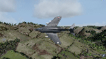
A series of markers around the famous "Mach Loop" in Wales to help sim flyers find and fly the
route.
The Mach Loop is a series of valleys in the United Kingdom in west-central Wales, notable for
their use as low-level training areas for fast aircraft. The system of valleys lies 13 km (8
mi) east of Barmouth between the towns of Dolgellau to the north and Machynlleth to the south,
from the latter of which it takes its name.
It is usually flown in an anti-clockwise direction.
Works in FSX and P3D.
| Filename: | mach_loop_markers_fast_jets.zip |
| License: | Freeware |
| Added: | 10th October 2022, 14:02:20 |
| Downloads: | 76 |
| Author: | Peter J Forster |
| Size: | 2.31 MB |
| Category: Flight Simulator X - Scenery | |
| Tampa, FL - Tampa Executive Airport (KVDF) |
|
Images related to this file:
File Description:
This airport was Vandenberg Airport until renaming in 2009 to avoid confusion with Vandenberg AFB in California. Generic floating buildings have been replaced with custom and library objects. Landclass changes, roads, rework of runways, taxiways and aprons, placement of library objects and a library of new airport buildings are included. Scenery in this package is based on Virtual Earth (Bing) and Google Earth imagery. An ILS glide slope has been added and visual glide slopes are changed to the actual airport angles. An alternate airport file is included with FSX default aircraft used as static objects to populate open aircraft shelters (see the installation instructions).
| Filename: | tampa_exec_fl.zip |
| License: | Freeware |
| Added: | 8th June 2011, 00:54:24 |
| Downloads: | 1,596 |
| Author: | Art Poole |
| Size: | 19.98 MB |
© 2001-2025 AVSIM Online
All Rights Reserved