
Where Flight Simulation Enthusiasts Gather from Around the World!
AVSIM Library - Search Results

| Category: Flight Simulator X - Scenery | |
| 4G7 Fairmont Airport, Fairmont WV UPDATE |

|
Images related to this file:
File Description:
This is a beautiful rendition of Fairmont Airport in Fairmont WV. Any GA or bush pilot can appreciate this beautiful airport hidden in the mountains of West Virginia.It features the AC Express Flight School Hanger bay and adjacent hangers. Airport includes updated RNWY numbers and taxiway placement, pilots observing the airport, birds flying over head, two lighted base ball stadiums, and an abundance of trees placed one by one around the field! Used accurate satellite imagery for buildings, roads and tree placement! Enjoy and Godbless! David Abreu
UPDATED TO FIT Richard L. Hills highly accurate river terrain: wv_fsx.zip
Richards file includes LWM and VTP files for the entire state!
| Filename: | 4G7_Fairmont_Airport_Fairmont_WV_UPDATE.zip |
| License: | Freeware |
| Added: | 4th June 2011, 18:50:19 |
| Downloads: | 880 |
| Author: | David Abreu |
| Size: | 4.49 MB |
| Category: Flight Simulator X - Scenery | |
| White Island Photoreal Scenery (2nd of 4 releases) |
|
File Description:
This is the second of four photoreal scenery releases covering the main offshore islands in the Bay of Plenty, New Zealand.
This scenery was created from a scanned aerial photograph owned by Environment Bay of Plenty (The Bay of Plenty Regional Council). The imagery has been de-sampled for use in Flight Simulator X and utilizes the default terrain mesh. The textures are intended for summer daylight flying only, although due to the sparse nature of White Islands’ vegetation, the Islands appearance remains relatively consistent throughout the year.
It includes Steam, autogen objects (including a library object which vaguely resembles the abandoned Sulphur works) and animated birds.
| Filename: | White_Island_Photoreal_Scenery_2nd_of_4_releases.zip |
| License: | Freeware, limited distribution |
| Added: | 30th April 2007, 23:46:45 |
| Downloads: | 2,930 |
| Author: | Tim Barnes |
| Size: | 4.77 MB |
| Category: Flight Simulator X - Scenery | |
| KPBI - Palm Beach International Airport - Florida, Miami - USA **Beta** |
|
Images related to this file:
File Description:
This scenery is not complete due to missing scenery objects in some GA areas but is issued for testing and performance comments pending it's final completion. The terminal area is complete including assigned airline gate parking with moving jetways. All runways, taxiways, aprons, control tower, etc. have been brought up to date. The scenery includes custom scenery objects, placement of library objects and landclass changes. Scenery is based on Google Earth and Bing Maps Birds Eye, and it is optimized for use with UTX. I find it flyable with low framerates on my computer with scenery complexity set to extremely dense, extensive WOAI airline traffic enabled to activate jetways.
| Filename: | KPBI__Palm_Beach_International_Airport__Florida_Mi.zip |
| License: | Freeware |
| Added: | 27th October 2014, 01:49:24 |
| Downloads: | 808 |
| Author: | Art Poole |
| Size: | 2.46 MB |
| Category: Flight Simulator X - Scenery | |
| St KILDA upgrade for ORBX SCOTLAND |
|
File Description:
ST KILDA is an archipelago situated 41miles West of the Outer Hebrides.It is a world heritage site.
Its islands with their exceptional cliffs and sea stacks form the most important seabird breeding station in north-west Europe. The evacuation of its native population in 1930 brought to a close an extraordinary story of survival.
This scenery upgrades the ORBX scenery with the addition of -BORERAY Island and its two stacks (highest in the UK), Levenish, many birds, scenery added to HIRTA(the main island) and boat traffic.
Sadly no airfield but as Hirta has a military prescence there is a helicopter pad. This is an ideal place to explore with a floatplane!
| Filename: | St_KILDA_upgrade_for_ORBX_SCOTLAND.zip |
| License: | Freeware |
| Added: | 9th July 2017, 19:11:50 |
| Downloads: | 281 |
| Author: | john watts |
| Size: | 5.41 MB |
| Category: Flight Simulator X - Scenery | |
| LFLB |
|
File Description:
Adjusted scenery for FSX
Uploaded to AVSIM only.
1 rearranged gates and parking spots (as seen on pictures)
(Small disadvantage is that FS places a Pushback car at the end, may be changed in an other version)
2 birds SW and NW of the runway and high flying Eagles in the mountains left and right of the airport.
3 an NDB transmitter where the NDB is south of the runway.
4 rearranged buildings at the airport and some privat planes on the parkings
5 An MD83 on the apron.
6 small (if any) impact on frame rates.
Overall: a more lively LFLB, Aix Les Bains in the French Alps
Have fun and have many good flights in 2009!
| Filename: | LFLB.zip |
| License: | Freeware, limited distribution |
| Added: | 5th January 2009, 13:25:03 |
| Downloads: | 1,057 |
| Author: | Joost Visser thanks to ADE |
| Size: | 164.54 KB |
| Category: Flight Simulator X - Scenery | |
| Frieda River Airstrip (FRR) |
|
File Description:
This airfield is managed by Frieda Copper Ltd in Papua New Guinea and is used mostly as remote air freight hub for movement of mining equipment and personnel. There are four exploration sites with landable bamboo helipads within vicinity of airfield which are accessed only by company helicopters. There are animals, birds in flight, sounds, night lighting effects, animation, custom rwy, apron and vegetation, etc.
Read the README carefully as there are separate installation instructions for payware owners and non-owners of "Raw Grit: PNG Bushpilot" and "Extreme Bush Trekker" (or combo pack). This is a stand-alone freeware so it doesn't matter if you don't have the commercial combo pack.
| Filename: | Frieda_River_Airstrip_FRR.zip |
| License: | Freeware, limited distribution |
| Added: | 4th May 2010, 09:35:59 |
| Downloads: | 970 |
| Author: | Graham Michael |
| Size: | 27.18 MB |
| Category: Flight Simulator X - Scenery | |
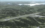
| Duncan Airport (CAM3) - Duncan, British Columbia, Canada V1 |
|
Images related to this file:
File Description:
CAM3 is the local airstrip In the heart of the Cowichan Valley located on the eastern side of Vancouver Island situated near Duncan and North Cowichan communities. A short hop from both Nanaimo (CYCD) and Victoria (CYYJ) this airstrip sits atop a large gravel deposit plateau. Immediately adjacent to this airstrip is an active gravel mining operation. This scenery builds on the default Orbx airstip and adds additional elements to the airstrip and surrounding area. Designed to be compatible only with Orbx PNW scenery. Added are real life elements such as the cafe - burger joint, additional hangers, airport clutter, lighting, custom 3D people, industrial gravel operations, airport fencing, birds and other eye candy.
| Filename: | Duncan_Airport_CAM3__Duncan_British_Columbia_Canad.zip |
| License: | Freeware |
| Added: | 15th January 2012, 08:18:02 |
| Downloads: | 1,543 |
| Author: | Bryan Wallis |
| Size: | 43.44 MB |
| Category: Flight Simulator X - Scenery | |
| LGIKA Ikaria (redbull)air(race)tracks (3) +scenery of the Island (secrets) and Aiport |
|
File Description:
English:
This scenery should not be an accurate representation of the Aiports and the countryside,simply a challenge and discovery tour. There are three (race)tracks,every brings you to an Mystery of the island! There are objects like birds, dolphins, a ballon, a oil-platform, ships, a military aircraftcarrier, elephants, people, cranes, secret places, hotels, helipads, buildings etc..Enjoyit!
Further is written in the 'Readmea-file'!
Deutsch:
Diese Scenery soll nicht eine genaue Darstellung des Aiports und der Landschaft sein,
einfach eine Herausforderung und Entdeckungsreise. Es gibt drei (Renn)Strecken, jede bringt Sie zu einem Geheimnis der Insel! Es sind Objekte vorhanden wie Vögel, Delfine, Ballons, eine Öl-Plattform, Schiffe, ein Flugzeugträger, Elefanten, Menschen, Kräne, geheimen Orten, Hotels, helipads, Gebäude usw.. Genießen Sie es!
Weiteres steht in der 'Liesmich-Datei'
| Filename: | LGIKA_Ikaria_redbullairracetracks_3_scenery_of_the.zip |
| License: | Freeware |
| Added: | 21st March 2008, 20:28:03 |
| Downloads: | 762 |
| Author: | Konrad Ellsässer |
| Size: | 14.7 MB |
| Category: Flight Simulator X - Scenery | |
| Wynoochee Lake WA - (Bob's Fly-in Cabin) |
|
File Description:
Wynoochee Lake WA (Bob's Fishing Cabin) - Airport ID: BOB (FSX). - -
This is a fictitious fly-in lodge that I created for a quiet spot to fly into for weekend trips from the Seattle area. My cabin is located about 40 miles due south of Port Angeles, WA and about 50 miles due west of Seattle. - -
Wynoochee Lake is a real location, but my scenery around the lake is fictitious. - -
You will find my dirt airstrip to be quite challenging, although completely fly-able. My location is even more challenging at dawn or dusk with Weather. There are no approach lights, its just a rugged bush strip. - -
It is extra challenging with crash detection turned on - watch out for those birds, they're everywhere and that old tree just of the side of the dirt strip - don't get too close! - -
This is freeware. I hope you enjoy it. - -
Designed with the FS X Sdk Scenery function of the Mission builder,Abacus Scenery shortcut tool and Lee Swordy's AFCAD. - -
This scenery is frame rate friendly. - - Please read the "readme" - -
by Bob Caparoula
www.flydeervalley.com
| Filename: | Wynoochee_Lake_WA___Bobs_Flyin_Cabin.zip |
| License: | Freeware |
| Added: | 2nd February 2007, 21:10:37 |
| Downloads: | 1,455 |
| Author: | Bob Caparoula |
| Size: | 4.64 KB |
| Category: Flight Simulator X - Scenery | |
| Branson Airport KBBG--New Airport, Scenery, and Flight Plans |
|
Images related to this file:
File Description:
This project adds a new, detailed Branson Airport KBBG (Missouri) to FSX, which opened in May 2009, and is a privately developed commercial airport. The construction of the airport, which involved the flattening of several Ozark Mountains, is claimed to be the largest earthmoving project in Missouri history. As a result, the airport actually sits on a manmade plateau, surrounded by rolling hills. The airport uses the ICAO identifier BBG, however, the airlines use the IATA code BKG. The airport is served by AirTran, Frontier, and ExpressJet (Branson AirExpress), and is located in hilly terrain. Aircraft equipped with a terrain avoidance warning system may experience system activation on final approach. Birds are in the vicinity of the airport. AFCAD with sloping terrain created using Airport Design Editor X v1.47.07, and the hilltops were cleared and flattened and roads were added using SBuilderX 3.13. The terminal, hangar, FBO, and cars were added and modified from stock FSX scenery, using the FSX Object Tool, to resemble as closely as possible the actual airport.
| Filename: | Branson_Airport_KBBGNew_Airport_Scenery_and_Flight.zip |
| License: | Freeware |
| Added: | 5th August 2010, 01:08:33 |
| Downloads: | 2,003 |
| Author: | Carlyle Sharpe |
| Size: | 6.02 MB |
© 2001-2026 AVSIM Online
All Rights Reserved
Privacy Policy |