
Where Flight Simulation Enthusiasts Gather from Around the World!
AVSIM Library - Search Results

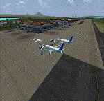
| Category: Flight Simulator X - Scenery | |
| Durham Tees Valley Airport Ultimate Edition |

|
Images related to this file:
File Description:

Durham Tees Valley Airport for FSX. The Airport has been scaled up to the correct proportions, the runway's start location has been switched to the correct end.
The airport now looks and acts like the real thing. AI traffic is fully supported and performs as real airport traffic would in the the actual airport.
| Filename: | dtva_egnv_fsx.zip |
| License: | Freeware |
| Added: | 20th November 2012, 01:51:49 |
| Downloads: | 849 |
| Author: | Soarfly Concepts |
| Size: | 372 KB |
| Category: Flight Simulator X - Scenery | |
| Pyongyang Sunan International Airport (ZKPY) v1.0 with Photoreal Scenery |
|
Images related to this file:
File Description:

Pyongyang Sunan International Airport (ZKPY)v1.0 with Photoreal Scenery for FSX
Pyongyang International Airport (IATA: FNJ, ICAO: ZKPY), also known as the Pyongyang Sunan International Airport, is the main airport serving Pyongyang, capital of North Korea. It is located in the city's Sunan District. As of August 2018, Air China and Air Koryo are servicing Pyongyang International Airport and the two destination countries from Pyongyang International Airport are China and Russia.
| Filename: | Pyongyang_Sunan_International_Airport_ZKPY_v10_with_Photoreal_Scenery.zip |
| License: | Freeware, limited distribution |
| Added: | 2nd February 2019, 17:17:33 |
| Downloads: | 3,113 |
| Author: | Aeron M. Tumanut |
| Size: | 9.47 MB |
| Category: Flight Simulator X - Scenery | |
| China International Airports: ZBSJ - Shijiazhuang/Zhengding |
|
Images related to this file:
File Description:
Uptodate representation of Shijiazhuang Zhengding International Airport (ZBSJ). The layout of the airport corresponds to satellite images and actual airport charts, the buildings are made with GMAX.
| Filename: | zbsj_shijiazhuang.zip |
| License: | Freeware, limited distribution |
| Added: | 29th September 2021, 16:33:30 |
| Downloads: | 366 |
| Author: | Winfried Orthmann |
| Size: | 64.39 MB |
| Category: Flight Simulator X - Scenery | |
| FAMG - Margate Airport - Margate, KwaZulu-Natal - South Africa |
|
Images related to this file:
File Description:
This is Margate Airport in South Africa. The airport is used for general aviation and CemAir fly everyday into the airport. Completely custom designed objects and buildings.
| Filename: | margate.zip |
| License: | Freeware |
| Added: | 27th May 2015, 21:26:46 |
| Downloads: | 1,412 |
| Author: | Frits Beyer |
| Size: | 12.39 MB |
| Category: Flight Simulator X - Scenery | |
| Mattala Intl. Airport (VCRI), Sri Lanka |
|
File Description:
Sri Lankan Virtual Airlines (ALK-VA) has developed Sri Lanka's main airport VCBI-Bandaranaike Intl. airport, Katunayaka and newest airport VCRI-Mattala Intl. airport, Hambantota scenery for FSX.
All data is accurate as per the currently available airport information.
Scenery files will be updated when new information is received. Please check ALK-VA website for the latest revision.
| Filename: | vcbi-vcri_fsx.zip |
| License: | Freeware |
| Added: | 30th October 2013, 17:30:21 |
| Downloads: | 1,541 |
| Author: | Imal Mille |
| Size: | 530 KB |
| Category: Flight Simulator X - Scenery | |
| ATAP - Smith Airport (WA73) |
|
Images related to this file:
File Description:

Toposim Airport Terrain Adjustment Pack (ATAP) for Smith Airport (WA73) in Coleville, Washington.
| Filename: | toposim_atap_wa73.zip |
| License: | Freeware |
| Added: | 15th July 2013, 17:44:24 |
| Downloads: | 261 |
| Author: | Justin Tyme - Toposim |
| Size: | 524 KB |
| Category: Flight Simulator X - Scenery | |
| ATAP - Degali Airport (ENDI) |
|
Images related to this file:
File Description:

Toposim Airport Terrain Adjustment Pack (ATAP) for Degali Airport (ENDI) in Buskerud, Norway.
| Filename: | toposim_atap_endi.zip |
| License: | Freeware |
| Added: | 15th July 2013, 17:45:03 |
| Downloads: | 618 |
| Author: | Justin Tyme - Toposim |
| Size: | 944 KB |
| Category: Flight Simulator X - Scenery | |
| ATAP - Rohnerville Airport (KFOT) |
|
Images related to this file:
File Description:

Toposim Airport Terrain Adjustment Pack (ATAP) for Rohnerville Airport (KFOT) in Fortuna, California.
| Filename: | toposim_atap_kfot.zip |
| License: | Freeware |
| Added: | 15th July 2013, 17:44:47 |
| Downloads: | 304 |
| Author: | Justin Tyme - Toposim |
| Size: | 1.62 MB |
| Category: Flight Simulator X - Scenery | |
| SMJP |
|
File Description:
Johan Adolf Pengel International Airport (IATA: PBM, ICAO: SMJP), also known as Paramaribo-Zanderij International Airport, is an airport located in the town of Zanderij, 45 km south of Paramaribo. It is Suriname's main international gateway operated by Airport Management, Ltd./ NV Luchthavenbeheer.
| Filename: | smjp.zip |
| License: | Freeware |
| Added: | 17th March 2011, 19:55:44 |
| Downloads: | 2,914 |
| Author: | Anwar Gonzalez |
| Size: | 9 KB |
| Category: Flight Simulator X - Scenery | |
| WADD - Denpasar International Airport - Bali, Indonesia |
|
Images related to this file:
File Description:
Bali Ngurah Rai International Airport, also known as Denpasar International Airport, is located in southern Bali, 13 km south of Denpasar.
It is Indonesias third-busiest international airport.
| Filename: | wadd_x.zip |
| License: | Freeware |
| Added: | 31st May 2016, 16:17:59 |
| Downloads: | 12,504 |
| Author: | morten thomas van der linden |
| Size: | 60.91 MB |
© 2001-2025 AVSIM Online
All Rights Reserved