
Where Flight Simulation Enthusiasts Gather from Around the World!
AVSIM Library - Search Results

| Category: Flight Simulator X - Scenery | |
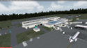
| Ilorin Airport for FSX\P3D |

|
File Description:
Ilorin International Airport (IATA: ILR, ICAO: DNIL) is an airport serving Ilorin, a city in Kwara State of Nigeria.
The Ilorin non-directional beacon (Ident: IL) is located on the field. The Ilorin VOR-DME (Ident: ILR) is located 4.9 nautical miles (9.1 km) southwest of the airport
-------------------
Photoreal Background, Corrected Parkings, Added more buildings, Ramp Lights, Airport chart....
| Filename: | dnil-fsx.zip |
| License: | Freeware |
| Added: | 29th September 2018, 15:28:31 |
| Downloads: | 565 |
| Author: | Raheem Adeleke |
| Size: | 29.69 MB |
| Category: Flight Simulator X - Scenery | |
| KGNV - Gainesville Regional Airport - Florida, USA ** Version 2.2 ** |
|
Images related to this file:
File Description:
KGNV (Gainesville Regional Airport) Add-on Airport designed by LKP Designs. This airport has been designed and tested for use in FSX. All buildings, taxiways and ground textures have been modeled after the real airport. Note that Jetway's are currently stationary but will updated to function in later versions.
*****FSX Issue with buildings not showing up FIXED****
| Filename: | kgnv_lkp_fsx2_2.zip |
| License: | Freeware |
| Added: | 20th July 2016, 09:08:15 |
| Downloads: | 743 |
| Author: | Lane Pulcini |
| Size: | 35.22 MB |
| Category: Flight Simulator X - Scenery | |
| DIAP - Port Bouet Airport - Abidjan, Côte d'Ivoire |
|
File Description:
Port Bouet Airport (IATA: ABJ, ICAO: DIAP), also known as Felix Houphouet-Boigny International Airport, is located 10 miles (16 kilometres) south east of Abidjan, Cote d'Ivoire. It is the largest airport in the country for air traffic. The airport is the main hub of the national airline Air Cote d'Ivoire
This work is dedicated to West Wind Airlines.
| Filename: | diap.zip |
| License: | Freeware |
| Added: | 20th April 2013, 20:15:20 |
| Downloads: | 4,703 |
| Author: | Anwar Gonzalez |
| Size: | 1.06 MB |
| Category: Flight Simulator X - Scenery | |
| New Islamabad International - OPIS |
|
Images related to this file:
File Description:

New Islamabad International Airport (ICAO: OPIS) is an airport situated 20KM West of the Capital of Pakistan, Islamabad. It is bound to replace the existing Benazir Bhutto International Airport. The scenery includes Accurate airport layout, Custom made 3D terminal building and the cargo terminal, Correctly placed Taxi signs, Correct Taxiway designators according to charts, and much more.
| Filename: | new_islamabad_intl-_opis.zip |
| License: | Freeware, limited distribution |
| Added: | 27th June 2017, 00:15:51 |
| Downloads: | 4,998 |
| Author: | Irfan Kaleem |
| Size: | 29.11 MB |
| Category: Flight Simulator X - Scenery | |
| MTCH 2011 |
|
File Description:
Cap-Haitien International Airport (IATA: CAP, ICAO: MTCH) is an airport serving Cap-Haitien, a city in the Nord department in Haiti. It is the second largest airport in Haiti.
This file has the right coordenates, with the apron and characteristics of the airport. The runways were resized the gates placed on correct location and number.
| Filename: | mtch_291681.zip |
| License: | Freeware |
| Added: | 19th August 2011, 00:30:14 |
| Downloads: | 962 |
| Author: | Anwar Gonzalez |
| Size: | 3 KB |
| Category: Flight Simulator X - Scenery | |
| Warsaw Airport 2011 X (part 2) |
|
Images related to this file:
File Description:

Warsaw Chopin Airport (Polish: Lotnisko Chopina w Warszawie) (IATA: WAW, ICAO: EPWA) is an international airport located in the Okecie district of Warsaw, Poland. Formerly Okecie International Airport, it is named after the famous Polish composer and former Warsaw resident, Frederic Chopin. It is Poland's busiest airport, handling just under 50% of the country's air passenger traffic.
| Filename: | mkepwa2011x_part2.zip |
| License: | Freeware, limited distribution |
| Added: | 21st January 2011, 22:18:56 |
| Downloads: | 23,054 |
| Author: | Mateusz Stabryla, MK-Studios |
| Size: | 172.92 MB |
| Category: Flight Simulator X - Scenery | |
| Toncontin International Airport (MHTG) v1 |
|
File Description:
This it an update of the default FSX airport of Toncontin, Tegucigalpa, Honduras. One of the most dangerous approach airport in the world.
2 jetways were added and other buildings as current true airport configuration. Themes with people and vehicles, fire station, etc were added to give some life to an otherwise "boring" FSX default airport.
| Filename: | toncontin_jbj_v1.zip |
| License: | Freeware |
| Added: | 26th January 2011, 14:43:55 |
| Downloads: | 2,757 |
| Author: | Joe Garcia |
| Size: | 242 KB |
| Category: Flight Simulator X - Scenery | |
| FYWH - Hosea Kutako International Airport - Windhoek, Nambia |
|
File Description:
Hosea Kutako International Airport (IATA: WDH, ICAO: FYWH) is the main international airport serving the Namibian capital city of Windhoek. Located 45 km (28 mi) east of the city, it is Namibia's primary airport with international
connections and handled 672,582 passengers in 2007. In 2009, the airport handled around 680,000 passengers, just over 4% down on the previous year when over 710,000 passengers were processed. The airport is named after Namibian hero
Hosea Kutako.
Windhoek Hosea Kutako International Airport underwent a modernizing makeover in 2009. It has one terminal with one departure and one arrival hall.
Airport two runways were corrected also the aprons and buildinds. Airport charts thanks to fly uk virtual airways, www.flyuk.aero/en/index.php?page=airport_opsinfo&id=FYWH.
This work is dedicated to West Wind Airlines.
| Filename: | fywh_312518.zip |
| License: | Freeware |
| Added: | 18th June 2013, 04:58:07 |
| Downloads: | 4,225 |
| Author: | Anwar Gonzalez |
| Size: | 586 KB |
| Category: Flight Simulator X - Scenery | |
| Greater Kankakee KIKK |
|
Images related to this file:
File Description:
FSX Scenery - Greater Kankakee Airport (IATA: IKK, ICAO: KIKK, FAA LID: IKK) is a public airport located three miles (5 km) south of the central business district of Kankakee, in Kankakee County, Illinois, United States. The airport was opened in 1962 and continues to operate as a general aviation facility serving the Kankakee area and South Chicago. It is 60 miles (97 km) south of Chicago and 75 miles (121 km) north of Champaign, Illinois. It is the largest Airport between the Chicago Midway Airport and the Champaign Airport. Greater Kankakee is a general aviation airport, consisting of mostly private aircraft with a mix of corporate and business aircraft usage. Created by John B Loney Jr.
| Filename: | greater_kankakee_kikk_fsx.zip |
| License: | Freeware, limited distribution |
| Added: | 20th March 2012, 01:36:22 |
| Downloads: | 635 |
| Author: | John B. Loney, Jr. |
| Size: | 4.09 MB |
| Category: Flight Simulator X - Scenery | |
| Yuba Co-Oroville Muni |
|
File Description:
FSX Scenery - Yuba County Airport (IATA: MYV, ICAO: KMYV) is a public airport located three miles (4.8 km) southeast of Marysville, serving Yuba County, California, USA. The airport has two runways and is mostly used for general aviation. Oroville Municipal Airport (IATA: OVE, ICAO: KOVE) is a public airport located 3 miles (5 km) southwest of the city of Oroville in Butte County, California, USA. Oroville Municipal Airport covers 920 acres and has two runways. This airport is about 23nm NW of Yuba Co. An 18 hole golf course is located right next to the facility for you "Fly-in Golfers". EZ Scenry libraries require, some are included. By John B. Loney, Jr. and Robert Lacy.
| Filename: | yubafsx1.zip |
| License: | Freeware, limited distribution |
| Added: | 11th May 2010, 21:36:46 |
| Downloads: | 1,301 |
| Author: | John B. Loney, Jr. |
| Size: | 9.77 MB |
© 2001-2025 AVSIM Online
All Rights Reserved