
Where Flight Simulation Enthusiasts Gather from Around the World!
AVSIM Library - Search Results

| Category: Flight Simulator X - Scenery | |
| RAF Barkston Heath - 1944 |

|
File Description:
At the time of its construction, RAF Barkston Heath in common with a number of other airfields in the Grantham area had been planned for the RAF's No. 7 Group. In late 1943, Barkston Heath was made available to the United States Army Air Forces Ninth Air Force and designated as USAAF station 483. It was earmarked for basing troop carrier units scheduled to be transferred from Sicily to participate in the forthcoming cross-Channel invasion, Operation "Overlord"
American 61 TCG aircraft based at Barkston Heath carried British paratroops on the ill-fated operation Market Garden.
The USAAF returned control of the airfield to the Air Ministry in June 1945 when the war in Europe ended. Barkston Heath was used by No 256 Maintenance Unit and No 2 RAF Regiment. Beginning in May 1948.,
RAF Barkston Heath has the Naval and Army Elements of No. 3 Flying Training School (3 FTS) which, for a period between approximately 1995-2010 operated the Slingsby T67M260 Firefly two-seat trainer. The school now operates the Grob Tutor T1. A secondary role of RAF Barkston Heath is as a Relief Landing Ground for the flying training activities at RAF Cranwell.
Source: Wikipedia
| Filename: | RAF_Barkston_Heath__1944.zip |
| License: | Freeware |
| Added: | 10th March 2017, 07:13:15 |
| Downloads: | 150 |
| Author: | Terry Boissel |
| Size: | 1.05 MB |
| Category: Flight Simulator X - Scenery | |
| MIAMI CITY X DEMO |
|
Images related to this file:
File Description:

MIAMI CITY X DEMO features an extremely detailed scenery of Miami City in Florida, United States, fully compatible with FSX/FSX:SE/P3Dv1/P3Dv2/P3Dv3/P3Dv4 and FSW by Dovetail.
This Demo version of the commercial product is a fully functional freeware scenery, perfectly aligned with the full payware version. This ensures no problems with online (VATSIM, IVAO and multiplayer) flying in case some users have the payware scenery and some don't. The demo gives a few downtown buildings and AFCAD files for KMIA, KTMB and KOPF airports.
Miami is a city located on the Atlantic coast in southeastern Florida and the county seat of Miami-Dade County. This product gives you the possibility to fly over a very large area of Miami City, with ground, autogen, hundrieds of custom-made photoreal buildings, including lite sceneries of KMIA, KTMB and KOPF airports.
It's equipped with an automatic installer, which means that the scenery will be automatically added to the Flight Simulator Scenery Library.
Please uninstall all previous versions of this airport you may have installed before. Please make also sure that no duplicated AFCAD files are installed.
Enjoy your virtual flying with Drzewiecki Design!
| Filename: | MIAMI_CITY_X_DEMO.zip |
| License: | Freeware, limited distribution |
| Added: | 23rd August 2017, 01:36:12 |
| Downloads: | 1,664 |
| Author: | Drzewiecki Design |
| Size: | 15.39 MB |
| Category: Flight Simulator X - Scenery | |
| YMDN Merredin, Western Australia, Town and Airfield |
|
File Description:
YMDN Merredin Town and Airfield - includes townsite landclass. Merredin, a town better known for its wheat and sheep exports. But for almost a decade, it's where one of Asia's busiest carriers, China Southern Airlines, has been sending its trainee pilots to learn how to fly. "They come from a country with a population of more than a billion people. Right now they live in Merredin - population, depending on who's visiting, around 2,000. For nine years now, they and hundreds like them have travelled to WA's empty, sprawling Wheatbelt to learn how to fly. The middle of the Wheatbelt is not the first place you'd look for the future of Chinese commercial aviation. But before these fledgling flyers can spread their wings with China's largest airline, they must pass six months of boot camp in Merredin. Most of them are from China's southern provinces. Their backgrounds are varied. For many of them, it's the first time that they've operated some form of machinery, which includes those students that haven't even had an exposure to driving a motor car. It's early days in their careers. The students are putting in the groundwork. First, mastering the art of piloting single-engine two-seater planes. It's all preparation for the Boeings and airbuses they'll eventually be flying on major international routes. The pressure is intense. Every aspect of the student's progress is measured. Failure can have serious implications for their hopes of becoming commercial pilots. It's part theory and part practical. But flying isn't the only thing that these young men have to get used to in Merredin. For one, there's the incredibly slow pace of country life. Merredin Shire sold the defunct airport for $1 - that's cheaper than a bag of lollies. The locals say the monetary sweetener has paid off." (From ABC transcript) REQUIRES Blencowe_LibraryKit.zip
REQUIRES blencowe_librarykit_309494.zip (Available HERE)
| Filename: | YMDN_Merredin_Western_Australia_Town_and_Airfield.zip |
| License: | Freeware |
| Added: | 28th February 2013, 13:56:12 |
| Downloads: | 281 |
| Author: | Alan Blencowe |
| Size: | 4.56 MB |
| Category: Flight Simulator X - Scenery | |
| RAF Bradwell Bay |
|
File Description:
RAF Bradwell Bay is a former Royal Air Force station located 9.5 miles (15.3 km) east of Maldon, Essex, England and 3.1 miles (5.0 km) south west of West Mersea, Essex.
The airfield was first used as grass landing strip for the nearby firing ranges before being turned into a RAF station with concrete runways and hangars.The station is unique as it was the only fighter station where the Fog Investigation and Dispersal Operation (FIDO) was used.
Part of the site is currently being used by the Bradwell nuclear power station. Several of the hangars are still used as storage by the local farmers and the control tower is now a private house. Agricultural buildings, built in the '70s and '80s on runways one and two, are now home to several local businesses.
If you would like a more detailed history follow the following link. http://www.worldwar2heritage.com/en/page/9069/189/Bradwell-Bay-Airfield
| Filename: | RAF_Bradwell_Bay.zip |
| License: | Freeware |
| Added: | 26th January 2017, 20:05:03 |
| Downloads: | 138 |
| Author: | Terry Boissel |
| Size: | 18.06 MB |
| Category: Flight Simulator X - Scenery | |
| RAF Manston 1944 |
|
File Description:
RAF Manston (ICAO EGMH)was an RAF station in the north-east of Kent, on the Isle of Thanet from 1916 until 1996. The site is now split between a commercial airport Kent International Airport (KIA) and a continuing military use by the Defence Fire Training and Development Centre (DFTDC), following on from a long-standing training facility for RAF firefighters at the Manston base.
Source: Wikipedia
I have represented it here in 1944 leading up to its part in Operation Market garden and D Day. It was one of the few airfields installed with the Fog Investigation Dispersal Organisation (FIDO) system designed to remove fog from airfields by burning it off with petrol and I have represented this with the 8 fuel tanks at the 29 end of the mail runway. I have laid the station out roughly according to an old map made in the mid 40s but I make no claims to the accuracy of building I have used.
| Filename: | RAF_Manston_1944.zip |
| License: | Freeware |
| Added: | 26th April 2016, 00:15:35 |
| Downloads: | 160 |
| Author: | Terry Boissel |
| Size: | 1.71 MB |
| Category: Flight Simulator X - Scenery | |
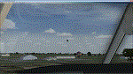
| LEMG-X-JVX |
|
Images related to this file:
File Description:

LEMG, Malaga, Spain.
Hello Flightsim friends.
This is an reworked ADE [Scruffy Duck] scenery of LEMG, Malaga Airport, Spain, for FSX
It was annoying to find that almost everything was wrong at LEMG in FSX.
Runway numbers, Exits, Entrances to the Apron etc.
I've tried to get all the runways, turn offs and runway signs in their correct positions.
The Runways are now: 13 and 31 instead of 14 and 32
-crows next to entrance D13 at the NW end of the runway 13 and south of the airport almost halfways.-Seagulls next to the shore line.-Fishingships, a Cruiseliner and a freighter at sea.-Oil tanks near Apron entrance D2 [extremely dense setting]- Some military objects on the MIL part of the airport plus extra buildings.-Somewhere in the mountains there should be Eagles I know they are there but heck, I didn't yet see them my self :-) The MAR approach should lead you past them though]
AVSIM upload only
| Filename: | LEMGXJVX.zip |
| License: | Freeware, limited distribution |
| Added: | 1st April 2010, 02:21:00 |
| Downloads: | 1,724 |
| Author: | Joost Visser |
| Size: | 435.24 KB |
| Category: Flight Simulator X - Scenery | |
| 2B3 Parlin Field, Newport, New Hampshire Airport |
|
Images related to this file:
File Description:
This airport was originally released as part of an FSX airport scenery package containing 21 airports, located in New Hampshire and Vermont. The link to the original 21 New Hampshire & Vermont Airport package is shown below. This file is not required, but allows you to download 21 related airports.
The 2B3 Parlin Field airport in the original 21 airport package was missing a required scenery file which corrects the airport altitude (from 784 ft. to 794 ft.) due to the mis-location of the stock FSX airport. This download provides all three of the required .bgl scenery files.
related download:
http://library.avsim.net/search.php?SearchTerm=new+hampshire+%26+Vermont+airports&CatID=root&Go=Search
This FSX scenery package contains the 2B3 Parlin Field airport in Newport, New Hampshire. This airport is intended to be used with FSX and the free addon - TileProxy. TileProxy provides real-time photorealistic satellite imagery in place of the stock auto generated FSX scenery or any other scenery package.
| Filename: | 2B3_Parlin_Field_Newport_New_Hampshire_Airport.zip |
| License: | Freeware |
| Added: | 2nd December 2013, 05:36:38 |
| Downloads: | 531 |
| Author: | John Greenwood |
| Size: | 631.59 KB |
| Category: Flight Simulator X - Scenery | |
| SLET - El Trompillo Airport - Santa Cruz de la Sierra, Bolivia |
|
File Description:
El Trompillo Airport (IATA: SRZ, ICAO: SLET) is located in the south part of Santa Cruz de la Sierra, Bolivia, about 2 km (1.25 miles) away from the central plaza. Airport type:(Public / Military).
After a series of improvements, in June 3, 2014 Airport regained its status as an international airport by converting to Santa Cruz de la Sierra in Bolivia the only city with two international airports, international airport suitable as retention and/or support times of high demand in the Viru Viru Airport (ICAO: SLVR) can not supply completely.
The airport operates 24 hours and resides at an elevation of 1,371 ft (418 m) above mean sea level. Have one runway designated 15/33 with an asphalt surface measuring 8,967 by 114.82 ft (2,733 m by 35 m), El Trompillo Tunnel for vehicles, passes under the runway and connects the 4th ring (considered the most important highway in the city).
Compatible with both FSX and P3D.
| Filename: | SLET__El_Trompillo_Airport__Santa_Cruz_de_la_Sierr.zip |
| License: | Freeware |
| Added: | 19th November 2015, 09:49:14 |
| Downloads: | 1,830 |
| Author: | Marcos A. Rivas Torrez |
| Size: | 16.68 MB |
| Category: Flight Simulator X - Scenery | |
| Avon Park Executive Airport Florida |
|
Images related to this file:
File Description:
Avon Park Executive Airport, Airport Code KAVO, is located in the
center of the Florida peninsula. It is within 80 miles of several major
Florida cities and International Airports including Tampa International
and Orlando International. Miami International is located about 150
miles SSE. Although used primarily by local businesses, it has repair
facilities for planes flown in for that purpose. In addition, it is
used as a temporary base for people attending the 12 Hours of Sebring
Gran Prix auto race as well as air shows held both at Sebring Regional
and Lakeland Linder airports.
The Terminal/Office building was created by me in Google Sketchup and
contains nothing from any other source. The windows are actual photos
taken of the building at the Avon Park Airport. I obtained permission
to use those photos from the Avon Park Executive Airport director. You
may use all or any part of this upload for any purpose that is legal.
| Filename: | Avon_Park_Executive_Airport_Florida.zip |
| License: | Freeware |
| Added: | 21st January 2013, 00:39:01 |
| Downloads: | 804 |
| Author: | Frank Watson |
| Size: | 2.08 MB |
| Category: Flight Simulator X - Scenery | |
| Town of Nantes - France |
|
File Description:
The town of Nantes (around 120 Km2) in photorealistic textures in 2m/pixel, full seasons and specific autogen.
It is made up of a new local mesh, various buildings, churches, and reference marks visual.
All specifics objects are made in Gmax with FsX textures.
Take off from Nantes Altantique (LFRS).
| Filename: | Town_of_Nantes__France.zip |
| License: | Freeware, limited distribution |
| Added: | 30th July 2007, 12:42:52 |
| Downloads: | 6,960 |
| Author: | marc-henri Guitteny |
| Size: | 79.52 MB |
© 2001-2026 AVSIM Online
All Rights Reserved
Privacy Policy |