
Where Flight Simulation Enthusiasts Gather from Around the World!
AVSIM Library - Search Results

| Category: Flight Simulator X - Scenery | |
| WV29 - Valley Point Airport |

|
Images related to this file:
File Description:
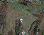
Valley Point (WV29) is a privately owned airport nestled in the hills of Albright, West Virginia. This has been updated from defualt FSX to include the north south grass runway.
Based on local a local flight instructor, the airport should always be approached for landing going north bound towards rising terrain (if the winds are less than 10 knots). This assists with braking. A go around should never be attempted going northbound after the wheels impact the ground.
Takeoffs should always be performed going south bound (if the winds are less than 10 knots) due to steeply rising terrain (300 feet above the airport) to the north.
| Filename: | WV29__Valley_Point_Airport.zip |
| License: | Freeware |
| Added: | 28th June 2021, 04:14:34 |
| Downloads: | 115 |
| Author: | David Abreu |
| Size: | 2.17 KB |
| Category: Flight Simulator X - Scenery | |
| Centrair RJGG V3.0 complete |
|
Images related to this file:
File Description:
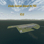
Chubu Centrair International Airport (IATA: NGO, ICAO: RJGG) is an airport on an artificial island in Ise Bay, 22 miles south of Nagoya in central Japan. Chubu is Japan's third off-shore airport, after Nagasaki Airport and Kansai International Airport, and is also the second airport built in Japan on a man-made island.
In this final version are added:
cars on parking garages
parking areas
static Air stairs
more realistic bagage loader
ANA logo on ground vehicles
Changed Skychefs catering trucks to NAC ( Nagoya Air Catering) catering trucks as in real life
benches on Chubu Airport's Sky Deck
lights on some static vehicles at night
fixed the readme desciption
| Filename: | Centrair_RJGG_V30_complete.zip |
| License: | Freeware |
| Added: | 20th November 2011, 00:13:22 |
| Downloads: | 8,051 |
| Author: | Morten Thomas van der Linden |
| Size: | 43.07 MB |
| Category: Flight Simulator X - Scenery | |
| EKHV Haderslev FSX/P3D |
|
Images related to this file:
File Description:
Haderslev airport (EKHV) is a small private airport in southern Jutland.
This scenery covers the airport area and surrounding countryside, complete with detailed airport layout, a considerable number of added 3-D objects, hand placed autogen vegetation and an 80cm/pixel ortophoto ground map with full season support.
Among the functional improvements over the stock airport is a more realistic taxi and parking layout, not least the addition of parking spots of which there are none in the stock airport.
I have attempted to keep size to a minimum by using nothing but stock objects. So it's not photoreal, but probably about as good as it gets in 5½ megabytes. :)
| Filename: | EKHV_Haderslev_FSXP3D.zip |
| License: | Freeware |
| Added: | 19th February 2017, 20:55:10 |
| Downloads: | 652 |
| Author: | Jens Peter Pedersen |
| Size: | 4.81 MB |
| Category: Flight Simulator X - Scenery | |
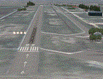
| Freeware Project Kobe X (RJBE) Japan |
|
Images related to this file:
File Description:
Freeware project KOBE X (RJBE) Japan. Contains fully detailed airport with custom ground polygons. Accurate 3d model and texture of all the building of the airport including the terminal, control tower, hangars, bridge and many more. Please note that this project was my initial experience in many fields of scenery design so take it as it is and enjoy flying in Japan. The design is never done but I think it was ready to be released. Still have some work to do with the animated jetways and night lighting for my next "payware" project (KSAN, San Diego Intl). It's going to be far better than this freeware.
You can download the world of ai installer and install the All Nippon Airways package and maybe the JAL too. The jetways are not animated but you can park a 747 in gate 1, a 767 in gate 5 and a 737 in gate 6 and be perfectly aligned with the jetway door.
Also I've not try this scenery in a less powerful computer than mine. I run a Windows 7, I7-950 @ 3.8 GHz and a GTX 570. So don't get mad if you're having bad performances :). With all sliders in the "display settings" set to max I've around 20 fps in the virtual cockpit of the level-d 767. You'll get a nicer airport with also the global texture resolution set to max, water effects set to High 2.x and traffic to ultra-high. Do not turn on Ground scenery shadows as it will make a shadow for the entire airport (ground poly).
I've some tutorial on my YouTube channel (n170toga) on how to make fsx sceneries if you are interested. Don't forget to subscribe there and have updates for the upcoming scenery. Please review this airport if you like as I will learn a lot for my next
project and it's only going to be better.
This scenery is a freeware and should be considered as a freeware. Arigato, Sagga Toure (Devinci), Devinci Design and Development (3De)
| Filename: | Freeware_Project_Kobe_X_RJBE_Japan.zip |
| License: | Freeware |
| Added: | 12th June 2011, 08:28:51 |
| Downloads: | 6,648 |
| Author: | Sagga Toure |
| Size: | 66.48 MB |
| Category: Flight Simulator X - Scenery | |
| EPGL * Gliwice - Trynek * |
|
File Description:
Gliwice Airport (ICAO code: EPGL) is a non-certified public civilian airport located in Upper Silesia,
in the south part of Poland that allows operations for business flights, sports aviation, and small cargo traffic.
It is located in Gliwice, in the Trynek district, and features a runway with an artificial surface.
Since 1969, it has been listed in the Civil Aviation Authority's airport registry under entry 17
(registration number 18). The main user of the airport is the Gliwice Aeroclub.
| Filename: | EPGL__Gliwice__Trynek_.zip |
| License: | Freeware |
| Added: | 10th February 2025, 17:35:55 |
| Downloads: | 45 |
| Author: | Dawid Drobik |
| Size: | 212.26 KB |
| Category: Flight Simulator X - Scenery | |
| Thomas Hudner AFB |
|
File Description:
Thomas Hudner AFB is a fictitious Air Force Base located at Henderson Island, a member of the Pitcairn Islands in the Pacific. Located in a sheltered bay on the east side of the island, the airport features a 7500' x 120' paved runway, several hangars, barracks, and a fire dept. This airport also features a Delta V rocket and launch pad, a container ship being unloaded offshore by hovercrafts, and a small military ship. The default FSX scenery at this island has been completely replaced with custom scenery and terrain based on satellite photos.
This scenery requires the FSX Acceleration expansion pack for all of the objects to show up properly. Also, for some reason, Ground Environment X causes the sand textures to show up as rain forest. This is purely a visual quirk and the airport will still work, but it is up to you. This airport is not designed for FS2004, but you may try it at your own risk. Special thanks to Ashton Lawson for his invaluable help on this project.
| Filename: | Thomas_Hudner_AFB.zip |
| License: | Freeware, limited distribution |
| Added: | 31st January 2009, 01:29:20 |
| Downloads: | 541 |
| Author: | Daniel Otto |
| Size: | 1.57 MB |
| Category: Flight Simulator X - Scenery | |
| SimFly Baghdogra X V0.84.70 (NEW) |
|
Images related to this file:
File Description:

INSTALLATION INFORMATION AND PROCEDURE IS IN THE EXECUTABLE FILE. PLEASE RUN THE INSTALLER AND FOLLOW THE INSTRUCTIONS. AFTER INSTALLATION IS COMPLETE PLEASE VIEW THE PDF FILE. THIS IS NEWER VERSION. PLEASE DOWNLOAD.
Bagdogra Airport, (IATA: IXB, ICAO: VEBD) is an international airport located in about 16 km (9.9 mi) west of the cities of Siliguri, 52 km (32 mi) away from Jalpaiguri and 65 km (40 mi) away from Darjeeling, the cities which the airport mainly serves, at Bagdogra in Darjeeling district in northern West Bengal, India. FEATURES- 1.High detailed representation of Baghdoghra Customs Airport (VEBD). 2.Includes current real world airport expansions and modifications (July 2016) 3. High resolution “realistic†looking textures (2048/2048) 4. Night lighting 5. Guaranted 20 FPS with 4GB RAM. OTHER FEATURES- 1. AIR FORCE AREA ADDED. 2. CUSTOM HIGH DETAILED GROUND POLYGON. 3. ADDED MANY CUSTOM MODELLED BUILDINGS AND AIRPORT OBJECTS. 4. COMPATIBLE WITH FSX, FSX SE, P3D V2 AND ABOVE. FOR MORE INFORMATION VIEW OUR WEBSITE AT http://simflydevelopers.wixsite.com/simflydevelopers/baghdogra-airport-vebd
SUPPORT-
[email protected]
WHATSAPP US AT- 91 8017751759
| Filename: | SimFly_Baghdogra_X_V08470__NEW.zip |
| License: | Freeware, limited distribution |
| Added: | 7th March 2017, 18:04:20 |
| Downloads: | 793 |
| Author: | Saptarshee Mandal @ Simfly developers |
| Size: | 83.35 MB |
| Category: Flight Simulator X - Scenery | |
| Agrinio-Itea |
|
Images related to this file:
File Description:
AS REAL AS IT GETS.
This is a detailed photorealistic scenery of Agrinio and the area from Ionio Pelagos in the West, to Itea in the East.
This scenery borders the south part of the Chalkida- Oinoi photoscenery.
See bellow for scenery choices.
Default FSX airports of Agrinio AB (LGAG) and Agrinio (GX01) were completely redone, positioned to their exact location, many buildings and objects were added in the airport compounds.
New aprons with commercial and military parking and 2 aircraft traffic files included.
| Filename: | AgrinioItea.zip |
| License: | Freeware |
| Added: | 13th August 2011, 17:05:04 |
| Downloads: | 2,183 |
| Author: | Angelo Tassoglou |
| Size: | 241.81 MB |
| Category: Flight Simulator X - Scenery | |
| Guildford Cathederal - England |
|
Images related to this file:
File Description:
This scenery adds the Guildford Cathedral to Orbx EU England Regional scenery package. Compatible with both FSX & P3D. Guildford Cathedral is the mother church of the Diocese of Guildford, covering 500 square miles of Surrey, north east Hampshire, the London Borough of Kingston and a part of West Sussex. With a seating capacity of 1000. Not tested with default FSX or any other setup. You must have Orbx EU England regional scenery to use the compiled scenery files as intended. By Bryan Wallis aka fltsimguy.
| Filename: | Guildford_Cathederal__England.zip |
| License: | Freeware, limited distribution |
| Added: | 26th January 2013, 03:54:32 |
| Downloads: | 848 |
| Author: | Bryan Wallis |
| Size: | 3.49 MB |
| Category: Flight Simulator X - Scenery | |
| Mesh-South America MeSA_G04 |
|
File Description:
FSX Mesh South America Project:
This terrain mesh file is a part of a whole project covering all the Continent
of South America and some islands, divided in tiles identified in a map by its
column (letters) and rows (numbers).
Those files were multi-LOD compiled from 90m SRTM2 source data, reprocessed
with 3DEM to remove voids and spikes, providing a 76.4m (LOD9) horizontal
resolution topography intended for use only in FSX updated with SP1.
Although not well documented, to improve performance, the updated FSX loads DEM
files in threads and only the closer terrain (about 5-10 NM from the point of view)
is rendered in high detail, while at far distances FSX shows up its default low
resolution mesh, when there is not a third part terrain mesh compiled in all
others intermediate level of details (multi-LOD).
THIS FILE:
FSX_MeSA_G04 (Column G x Row 04)
covers the area inside the boundaries:
N = 0º 0' S; S = 5º 37.5' S;
W = 45º 0' W; E = 37º 30' W;
AUTHORS:
Hely Heck Junior - Magrao ( [email protected] )
and Jose Lobo ( [email protected] )
TerraBrasilis: www.terra-brasilis.org
| Filename: | MeshSouth_America_MeSA_G04.zip |
| License: | Freeware |
| Added: | 15th June 2007, 00:10:58 |
| Downloads: | 867 |
| Author: | Hely Heck Jr. and José Lôbo |
| Size: | 35.9 MB |
© 2001-2026 AVSIM Online
All Rights Reserved
Privacy Policy |