
Where Flight Simulation Enthusiasts Gather from Around the World!
AVSIM Library - Search Results

| Category: Flight Simulator X - Scenery | |
| KCGS - College Park Airport - Maryland, USA |

|
Images related to this file:
File Description:
FSX Scenery - College Park Airport (IATA: CGS, ICAO: KCGS, FAA LID: CGS) is a public airport located in the City of College Park, in Prince George's County, Maryland, USA. It is the world's oldest continuously operated airport. College Park Airport was established in August 1909 by the United States Army Signal Corps to serve as a training location for Wilbur Wright to instruct two military officers to fly in the government's first airplane. For your flying pleasure by John B. Loney, Jr.
| Filename: | KCGS__College_Park_Airport__Maryland_USA.zip |
| License: | Freeware, limited distribution |
| Added: | 16th April 2016, 11:44:54 |
| Downloads: | 270 |
| Author: | John B. Loney, Jr. |
| Size: | 25.9 MB |
| Category: Flight Simulator X - Scenery | |
| PAKO - Nikolski Air Station - Alaska, USA |
|
File Description:
Nikolski Air Station (IATA: IKO, ICAO: PAKO, FAA LID: IKO) is an unattended airport located in Nikolski on Umnak Island in the Aleutians West Census Area of the U.S. state of Alaska. This former military airport is now owned by the Aleut Corporation. Scheduled commercial airline passenger service is subsidized by the Essential Air Service program. Current service to Nikolski is provided by PenAir using a Grumman Goose G-21A.
This airport has one runway 8/26 which is 3,512 feet long and 135 feet wide with a gravel surface. Custom models were added.
| Filename: | PAKO__Nikolski_Air_Station__Alaska_USA.zip |
| License: | Freeware |
| Added: | 28th August 2013, 12:12:38 |
| Downloads: | 992 |
| Author: | Wayne Roberts |
| Size: | 147.64 KB |
| Category: Flight Simulator X - Scenery | |
| Kavik River Camp - North Alaska, USA |
|
Images related to this file:
File Description:

Kavik River Camp is a remote outpost in north Alaska. Approximately 170 miles north of the Arctic Circle, the camp caters to hunters, scientists and thrill seekers during the summer months, and during winter, owner Sue Aikens upholds and maintains the site. Kavik was featured on National Geographic's "Life Below Zero".
| Filename: | Kavik_River_Camp__North_Alaska_USA.zip |
| License: | Freeware |
| Added: | 7th January 2016, 17:54:24 |
| Downloads: | 1,039 |
| Author: | Mark Piccolo - Soarfly Concepts |
| Size: | 4.04 MB |
| Category: Flight Simulator X - Scenery | |
| KTEX - Telluride Regional Airport - Colorado, USA |
|
Images related to this file:
File Description:
East Coast Simulations presents scenery for Telluride Regional Airport (KTEX/TEX) for FSX/P3D! Telluride Regional Airport (IATA: TEX, ICAO: KTEX, FAA LID: TEX) is a public airport six miles west of Telluride, in San Miguel County, Colorado. It is owned by the Telluride Regional Airport Authority. At an elevation of 9,078 feet (2767 m) above sea level, it was the highest commercial airport in North America with scheduled passenger flights, until Great Lakes Airlines ended service in 2014. This scenery includes all custom buildings and terminals with a season changing photoreal background.
| Filename: | KTEX__Telluride_Regional_Airport__Colorado_USA.zip |
| License: | Freeware |
| Added: | 30th June 2015, 23:47:41 |
| Downloads: | 1,698 |
| Author: | Wesley Chin and Kyle Kato |
| Size: | 92.55 MB |
| Category: Flight Simulator X - Scenery | |
| 79C - Brennand Airport - Neenah, Wisconsin - USA |
|
File Description:
Well this is my 1st attempt at creating/editing an airport so be gentle. I created all the models in sketchup and used ADE to compile the airport. All you should have to do is unzip it and place it with your other add-on scenery and activate it in FSX.
This is for FSX ONLY. A P3D Version also exists here in the library 79C_Brennand_V1_FOR_P3D_V2.
Brennand Airport (79C) located about 4 miles southwest of Neenah WI. This airport is between KATW and KOSH. Brennand has had new ownership since 2013 and they have made many improvements in that time to 79C. So I went out there and took lots of pictures to create what I have for us now. They have built a new building and hangar which I have added along with all the other building on the airport grounds. The runway has been widened from 20 feet to 30 feet and they added PAPI lights on both runways 18 and 36 all of which I have included. I have changed the grass parking areas to reflect the way they are currently set up. (For fun parking area 8 is in the EAA Chapter 41 hangar (Hangar 11) with the door open so you can taxi out of the hangar. Now just need to figure out how to animate the hangar door).
| Filename: | 79C__Brennand_Airport__Neenah_Wisconsin__USA.zip |
| License: | Freeware |
| Added: | 10th November 2014, 01:13:30 |
| Downloads: | 431 |
| Author: | Jon Verrett |
| Size: | 36.9 MB |
| Category: Flight Simulator X - Scenery | |
| KMRY - Monterey Regional Airport - California, USA |
|
Images related to this file:
File Description:
FSX Scenery - Monterey Regional Airport (IATA: MRY, ICAO: KMRY, FAA LID: MRY) is three miles (5 km) southeast of Monterey, in Monterey County, California, USA. It was created in 1936 and was known as the Monterey Peninsula Airport until the board of directors renamed it on September 14, 2011. The airport is owned by the several municipalities that make up the Monterey Peninsula Airport District. It is a public entity and its five-member board of directors is publicly elected. The airport has its origins with flights from the polo field of the Hotel Del Monte in 1910. In 1941, local communities formed the Monterey Peninsula Airport District and acquired land to build an airport. World War II intervened, and the U.S. Navy leased the land, opening Naval Auxiliary Air Station Monterey on May 23, 1943. The Navy remained at the airport until 1972. For your flying pleasure by John B. Loney, Jr.
| Filename: | KMRY__Monterey_Regional_Airport__California_USA.zip |
| License: | Freeware, limited distribution |
| Added: | 5th June 2016, 12:11:50 |
| Downloads: | 590 |
| Author: | John B. Loney, Jr. |
| Size: | 39.38 MB |
| Category: Flight Simulator X - Scenery | |
| AR09 - Bella Vista Field - Arkansas, USA |
|
Images related to this file:
File Description:
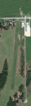
This is my first attempt at creating an airport for FSX. This airfield is located in Gravette, Arkansas, and is currently owned by Hendren Aviation. I added a few assets, so that it would appeal more to the casual simmer. Such changes, for example, is adding a helicopter pad, when in real life there isn't one. The changes are very mild, and are pointed out on the included BMP. This airport should definitely appeal to anyone who is a bush pilot. The approach from the south is a bit challenging.
You must have the Acceleration addon. This is version 2.0, which supersedes version 1.0.Version 1.0 was given to only 2 people for testing purposes, and it shouldn't have found it's way onto the internet. Please contact me if you ever come across version 1.0.
Future updates will include accurate models of the buildings, accurate night lighting (it's a grass airstrip, and as of right now, the only lighting comes from street lights and buildings), and a few changes to the airport background.
I hope everyone enjoys this scenery as much as I enjoyed learning and creating it.
| Filename: | AR09__Bella_Vista_Field__Arkansas_USA.zip |
| License: | Freeware, limited distribution |
| Added: | 14th May 2015, 17:25:41 |
| Downloads: | 294 |
| Author: | JackRiordan |
| Size: | 8.25 MB |
| Category: Flight Simulator X - Scenery | |
| KHIO - Hillsboro Oregon Airport - Oregon, USA |
|
File Description:
Presenting Portland-Hillsboro airport (KHIO) in Oregon, for FSX. This is a stand-alone scenery for everyone, but if you have my Aurora scenery then this will be a nice addition, since the aircraft that fly out of Aurora head to Hillsboro and back.
There are two folders. Unzip this entire zip to a temp folder of your choice. The readme file is in the folder called 'additional files.... etc.'.
There are two installation instructions...very short, very easy to understand...depending on whether you have Aurora or not. Please note the custom rwy lights...the objects and the lights themselves which show at night, of course. (both rwys). Note also the tower transparent windows and the weather anemometer on the roof. I have chased AI from Aurora to Hillsboro... works fine. Fun to do. As always, if there are any problems please do not hesitate to contact me at my e-mail address which is in the readme file. Bob.
| Filename: | KHIO__Hillsboro_Oregon_Airport__Oregon_USA.zip |
| License: | Freeware |
| Added: | 12th January 2016, 18:15:13 |
| Downloads: | 763 |
| Author: | Robert Lacy |
| Size: | 40.18 MB |
| Category: Flight Simulator X - Scenery | |
| KSEA - Seattle-Tacoma Intl - Washington, USA |
|
Images related to this file:
File Description:
This airport update is for KSEA and made only for FSX: Concourses A, B, C, D, S and N now updated to reflect todays situation, assigned parking also updated as per their website with extra parking, taxiways and taxi signs updated to the latest charts, extra fuel trucks, support vehicle roads rebuilt and many other scenery improvements, airport views are from inside the control tower (when in tower view) please view the readme before installation.
| Filename: | KSEA__SeattleTacoma_Intl__Washington_USA.zip |
| License: | Freeware, limited distribution |
| Added: | 11th September 2015, 02:17:58 |
| Downloads: | 29,783 |
| Author: | Ray Smith and Craig Scott |
| Size: | 1.68 MB |
| Category: Flight Simulator X - Scenery | |
| KGRI, Central Nebraska Regional Airport USA |
|
Images related to this file:
File Description:
New setup of this airport I came across in one of my virtual flights. It is located three miles northeast of Grand Island, in Hall County, Nebraska.
| Filename: | KGRI_Central_Nebraska_Regional_Airport_USA.zip |
| License: | Freeware |
| Added: | 20th February 2018, 17:49:25 |
| Downloads: | 402 |
| Author: | Tim van Ringen |
| Size: | 3.29 MB |
© 2001-2026 AVSIM Online
All Rights Reserved
Privacy Policy |