
Where Flight Simulation Enthusiasts Gather from Around the World!
AVSIM Library - Search Results

| Category: Flight Simulator X - Scenery | |
| Stellenbosch Airport (FASH), South Africa |

|
Images related to this file:
File Description:

Stellenbosch Airport in the Western Cape, South Africa. Highly detailed airport containing photo realistic ground textures, hangars and buildings.
Requires fsxWorx01.zip and updates (Be sure do download all Parts).
| Filename: | Stellenbosch_Airport_FASH_South_Africa.zip |
| License: | Freeware |
| Added: | 18th November 2012, 18:16:33 |
| Downloads: | 3,835 |
| Author: | Johan van Wyk, Andre Steyn, Aeroworx |
| Size: | 2.58 MB |
| Category: Flight Simulator X - Scenery | |
| Thessalia North - Greece |
|
Images related to this file:
File Description:
ThessaliaN Dn
AS REAL AS IT GETS.
This is a detailed photorealistic scenery containing the northern part
of Thessalia (Mount Olympos)and south-western part of Macedonia WITH NIGHT TEXTURES.
There are no airports in this photoscenery.
Just a lot of mountains and fields.
| Filename: | Thessalia_North__Greece.zip |
| License: | Freeware |
| Added: | 31st May 2016, 16:49:36 |
| Downloads: | 775 |
| Author: | Angelo Tassoglou |
| Size: | 221.86 MB |
| Category: Flight Simulator X - Scenery | |
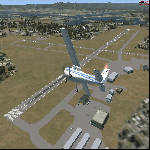
| KHLX - Twin County Airport - Virginia, USA |
|
File Description:
Twin County Airport is located in the heart of the beautiful Blue Ridge mountains of southwest Virginia, adjacent to Interstate 77 near exit 19. We are 6 miles west of Hillsville and 11 miles northeast of Galax
This is a complete re-work of the airport based on Google Maps. Created with Airport Design Editor by ScruffyDuck Software using current FAA documentation and Google Earth measurements, this package offers a replacement for FSX's stock airport. All these enhancements are as close to the real airport as I can get with stock library objects and custom buildings.
| Filename: | KHLX__Twin_County_Airport__Virginia_USA.zip |
| License: | Freeware |
| Added: | 11th October 2014, 01:02:53 |
| Downloads: | 259 |
| Author: | Wayne Roberts |
| Size: | 196.49 KB |
| Category: Flight Simulator X - Scenery | |
| KMKJ - Mountain Empire Airport - Virginia, USA |
|
Images related to this file:
File Description:
Mountain Empire Airport (ICAO: KMKJ, FAA LID: MKJ) is a public use airport in Smyth County, Virginia, United States.[1] It located nine nautical miles (10 mi, 17 km) northeast of the central business district of Marion (in Smyth County)[1] and 13 nautical miles (15 mi, 24 km) west of Wytheville (in Wythe County).[2] The airport is situated between Interstate 81 and U.S. Route 11 (Lee Highway), near Groseclose. It is owned by Smyth Wythe Airport Commission.
This is a complete re-work of the airport. Added taxiway, additional parking aprons and custom buildings.
Created with Airport Design Editor by ScruffyDuck Software using current FAA documentation and Google Earth measurements, this package offers a replacement for FSX's stock airport. All these enhancements are as close to the real airport as I can get with stock library objects and custom buildings.
| Filename: | KMKJ__Mountain_Empire_Airport__Virginia_USA.zip |
| License: | Freeware |
| Added: | 25th January 2015, 15:55:52 |
| Downloads: | 308 |
| Author: | Wayne Roberts |
| Size: | 339.5 KB |
| Category: Flight Simulator X - Scenery | |
| Death Valley National Park - California, USA |
|
Images related to this file:
File Description:
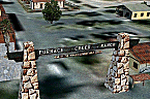
FSX Scenery--Death Valley. This scenery covers several areas of Death Valley National Park (CA). See the World's lowest golf coarse at Furnace Creek Ranch, the moving rocks at the RaceTrack, Scotty's Castle, Panamint Spring, and Stovepipe Wells. Custom designed buildings with photorealistic textures, night textures, and satellite image for the grounds. This scenery has been tested on FSX Gold Edition (FSX Deluxe and Acceleration Expansion Pack), FSGenesis 9.6 terrain mesh, and Win7 operating system. Requires RWEOBJv5.zip & RWEOBJc5.zip (or later) Object Libraries. By Ron Ezra.
| Filename: | Death_Valley_National_Park__California_USA.zip |
| License: | Freeware |
| Added: | 13th January 2016, 22:23:10 |
| Downloads: | 454 |
| Author: | Ron Ezra |
| Size: | 5.53 MB |
| Category: Flight Simulator X - Scenery | |
| KHOT - Memorial Springs Airport - Arkansas, USA |
|
Images related to this file:
File Description:
This scenery is an ADE update of the layout at Memorial Springs Airport in Arkansas, USA. This includes, updated parking spots, Adjusted Runway positions and length, Taxiways edited and Added, added buildings, relocation of some objects such as the ILS Transmitter for Runway 23/05 and The VOR, Checkershed and much more. I've tried to make this scenery as realistic as possible with the resources I have. If you have any contributions (e.g. pictures of the Airfield) please don't hesitate to contact me so I can update the Scenery. This is effectively version 1.0 of the scenery. Tested with FSX w/ SP2.
| Filename: | KHOT__Memorial_Springs_Airport__Arkansas_USA.zip |
| License: | Freeware |
| Added: | 23rd November 2015, 14:34:53 |
| Downloads: | 252 |
| Author: | Morgan Thomas |
| Size: | 3.96 MB |
| Category: Flight Simulator X - Scenery | |
| 0VG - Lee County Airport - Virginia, USA |
|
Images related to this file:
File Description:
Lee County Airport (FAA LID: 0VG) is a public use airport in Lee County, Virginia, United States.It is owned by Lee County and located five nautical miles (6 mi, 9 km) southwest of the central business district of Jonesville, Virginia.
Added taxiways and aircraft parking along with custom buildings. Created with Airport Design Editor by ScruffyDuck Software using current FAA documentation and Google Earth measurements, this package offers a replacement for FSX's stock airport. All these enhancements are as close to the real airport as I can get with stock library objects and custom buildings.
| Filename: | 0VG__Lee_County_Airport__Virginia_USA.zip |
| License: | Freeware |
| Added: | 21st November 2014, 01:40:00 |
| Downloads: | 317 |
| Author: | Wayne Roberts |
| Size: | 102.53 KB |
| Category: Flight Simulator X - Scenery | |
| CJX - Crooked Creek Airport - Alaska, USA |
|
Images related to this file:
File Description:
Crooked Creek Airport (IATA: CKD, FAA LID: CJX) is a public airport located two miles (3 km) south of the central business district of Crooked Creek, in the U.S. state of Alaska.
Increased runway length from 2,029 feet to 3,300 feet and width from 60 feet to 75 feet. Changes were made based on 2010 construction plans.
Created with Airport Design Editor 9x by ScruffyDuck Software using current FAA documentation and Google Earth measurements, this package offers a replacement for FSX's stock airport. All these enhancements are as close to the real airport as I can get with stock library objects and addition of custom models.
| Filename: | CJX__Crooked_Creek_Airport__Alaska_USA.zip |
| License: | Freeware |
| Added: | 23rd October 2014, 11:00:32 |
| Downloads: | 351 |
| Author: | Wayne Roberts |
| Size: | 244.27 KB |
| Category: Flight Simulator X - Scenery | |
| Remote Tower Base, Washington State USA |
|
File Description:
Remote Tower Base Operations, Washington State - Airport ID: TOWR (FSX). -
OK, all you Rotorheads - This is a fictional version of a very remote Helicopter landing pad on the Olympic Penn.. You must fly a Helo. I created it for my personal enjoyment and now I am releasing to the public as freeware. I hope you enjoy the "eye-candy". There are multiple radio and fire spotting towers in the area to check out. -
At least it gives you something to travel there for. -
This is an extremely challenging spot to land, especially using real Wx. The landing pad is basically a postage stamp. I created it and have a tough time landing here myself, so have fun with this one. -
You may also go directly to this airport by selecting TOWR as your starting airport. I also added a series of images so you can figure out how to get there from somewhere else. If you have my Wynoochie Lake scenery, its only 6 miles from there. (Just a heads-up) -
Designed with the FS X Sdk Scenery function of the Mission builder, Lee Swordy's AFCAD & the Abacus Scenery shortcut tool. -
This scenery is frame rate friendly.
| Filename: | Remote_Tower_Base_Washington_State_USA.zip |
| License: | Freeware |
| Added: | 3rd May 2007, 21:13:18 |
| Downloads: | 758 |
| Author: | Bob Caparoula |
| Size: | 5.85 MB |
| Category: Flight Simulator X - Scenery | |
| PFCL - Clarks Point Airport - Alaska, USA |
|
Images related to this file:
File Description:
Clarks Point Airport (IATA: CLP, ICAO: PFCL, FAA LID: CLP) is a state-owned public-use airport located in Clarks Point, a city in the Dillingham Census Area of the U.S. state of Alaska.
Increased runway length from 2,600 feet to 3,200 feet and renumbered runway to 18/36. Changes were made based on 2004 construction plans.
Created with Airport Design Editor 9x by Scruffy Duck Software using current FAA documentation and Google Earth measurements, this package offers a replacement for FSX's stock airport. All these enhancements are as close to the real airport as I can get with stock library objects and addition of custom models.
| Filename: | PFCL__Clarks_Point_Airport__Alaska_USA.zip |
| License: | Freeware |
| Added: | 18th October 2014, 23:47:21 |
| Downloads: | 630 |
| Author: | Wayne Roberts |
| Size: | 207.9 KB |
© 2001-2026 AVSIM Online
All Rights Reserved
Privacy Policy |