
Where Flight Simulation Enthusiasts Gather from Around the World!
AVSIM Library - Search Results

| Category: Flight Simulator X - Scenery | |
| Kiwi360 (KiwiFruit Country)- Custom buildings, helipad, Hi Res photoreal, Aerius R22 Repaint. Te Puke, New Zealand |

|
File Description:
Kiwi360 (formally know as Kiwifruit Country) is a theme park based around the Kiwifruit (AK.A Chinese Gooseberry or Zespri- The trade name) which is a major export of New Zealand grown predominately in the Bay of Plenty Region. The park is situated about midway between Tauranga and Whakatane, about 5km east of the township of Te Puke.
The Bay of Plentys sunny climate ensures good growing conditions for the delicious fruit and has also spawned a mini tourist industry of tours of the orchards and sorting/packing/coolstores. These include tourist flights by Aerius (http://www.aerius.co.nz ) using a Robinson R44 helicopter.
This scenery was made after a visit when carrying out a GPS survey: I took a few photos and whacked it up. It isn't perfect but will be useful for flights in small helos (I.e. Robinson R22, R44 or Hughes 300/269).
It includes the famous giant Kiwifruit slice, the helipad next to it; the main Kiwi 360 building; a large coolstore/packhouse and the backpackers next to the park. It also includes a lot of library objects (especially trees- If these are adversely affecting performance, you can disable this bgl)
This is placed on a high resolution aerial photo provided by Environment Bay of Plenty.
The scenery also has reflection maps and night maps for those who like getting up at the crack of dawn or simulating frost protection work (although I don't believe the pad is certified for night operations in real life).
The download also includes a repaint of the default Robinson R22 in the colours of ZK-HJZ (in actual fact an R44) kindly provided by James Eden from the ARNZ Forums (see the readme for the .cfg entry to add this repaint)
This helipad isn't in controlled airspace but Tauranga Tower is nearby and will need to be called before entering their airspace (above 2500ft LL for the CTA or within about 10nm of Tauranga for the CTZ) Radio procedures are carried out on Christchurch Information 125.5 for flight following/planning.
| Filename: | Kiwi360_KiwiFruit_Country_Custom_buildings_helipad.zip |
| License: | Freeware, limited distribution |
| Added: | 29th June 2008, 06:05:29 |
| Downloads: | 2,455 |
| Author: | Tim Barnes, James Eden |
| Size: | 11.63 MB |
| Category: Flight Simulator X - Scenery | |
| "Icebergs Ahoy" |
|
File Description:
This scenery is for ARNZ's Friday Night Flight 9th November 2007
Two sets of Icebergs have been reported roughly 60nm off the southern coast of New Zealand.
| Filename: | Icebergs_Ahoy.zip |
| License: | Freeware |
| Added: | 6th November 2007, 09:59:59 |
| Downloads: | 972 |
| Author: | Rob Sitter |
| Size: | 2.61 KB |
| Category: Flight Simulator X - Scenery | |
| Middle East Carrier Operations (MECOPS) |
|
Images related to this file:
File Description: This scenery has been developed for FSX Flight Simulator SP1 or SP2. It

has also been tested with Microsoft Acceleration , but compatibility is not
guaranteed by the author.
The scenery includes: Two carrier groups CVN68 and CVN69, ( carrier models from
Javier Fernandez ), two AI KC-135 tanker aircraft, AI F-18A aircraft approaching
the carrier, Navy destroyer and a Navy Cruiser as escort ships for the carrier,
a number of oil platforms and the ARS4 radar gauge which displays air targets
and boat targets.
The ARS4 radar gauge provides also a auto landing function for the carrier and a
auto tracking function for aircraft in order to support a A2A re-fueling. The
scenery package includes as well the program Arrcab, developed by Richard Hogan,
and the RCBCO gauge developed by Rob Barendregt. Arrcab or RCBCO are required to
support a catapult start from a carrier and the cable arrestor function for a
carrier landing.
This is not a load and fly package. Please take your time to read the included
documentation for the ARS4 gauge and the MECOPS scenery carefully. Do not skip
chapters because you may think, they are not important for you.
Do not start the installation of the scenery before you have finished the
reading of the documents.
For copyrights and credits please look at the documentation for this scenery.
| Filename: | Middle_East_Carrier_Operations_MECOPS.zip |
| License: | Freeware, limited distribution |
| Added: | 4th March 2013, 18:03:32 |
| Downloads: | 1,892 |
| Author: | Dietmar Loleit |
| Size: | 62.04 MB |
| Category: Flight Simulator X - Scenery | |
| RAF Bottlesford - Lincolnshire, England |
|
File Description:
Royal Air Force Station Bottesford or more simply RAF Bottesford is a former Royal Air Force station located on the Leicestershire-Lincolnshire county border, 6.8 miles (10.9 km) north west of Grantham, Lincolnshire and 7.6 miles (12.2 km) south of Newark-on-Trent, Nottinghamshire and about 107 miles (172 km) north-northwest of London, England.
Opened in 1942, it was used by both the Royal Air Force (RAF) and United States Army Air Forces (USAAF). During the war it was used primarily as a troop carrier airfield for paratroopers and as a bomber airfield before closing in 1948.
Today the remains of the airfield are located on private property with the technical site being used as an industrial estate.
Third party add-on's will be required to see all the building included in the scenery, you will need Ted Andrews RAF Small Buildings and his hanger library, for the vehicles Ian Pearson FSX Object library will be required, the RAF Ensign hedges are the from Mike Hudson's scenery. All of which are available from Ian Pearsons' website; www.ianpsdarkcorner.co.uk.
| Filename: | RAF_Bottlesford___Lincolnshire_England.zip |
| License: | Freeware |
| Added: | 10th October 2015, 11:37:40 |
| Downloads: | 345 |
| Author: | Terry Boissel |
| Size: | 15.94 KB |
| Category: Flight Simulator X - Scenery | |
| CYBL (2011) Version 2 for FS9, FSX and Prepar3D |
|
Images related to this file:
File Description:
CYBL (2011) portrays the Campbell River (British Columbia, Canada) Airport and surrounding area, including the BC Forest Service tanker base, as it appeared in late 2011. (Campbell River, a small city mid-way up the eastern shore of Vancouver Island, is the "salmon capital" of North America and the gateway to Desolation Sound - summer cruising grounds for thousands of yachts from across the Pacific Northwest. Hence, CYBL is host to a lot of visiting GA.) This add-on includes a selection of Custom AI and static aircraft painted to represent aircraft based or often seen at CYBL. CYBL has recently completed a major runway extension and terminal upgrade - both of which are reflected in CYBL (2011). CYBL (2011) is compatible with BC Roads (FS9 only), ORBX FTX USA Canada Pacific Northwest and both FS9 and FSX versions of Ultimate Terrain.
Generally, this new version is visually identical to its predecessor - even though quite different internally. As well, to the extent possible, it is compatible with Prepar3Dv2. (v2.03 fixes a vehicle texture issue in 2.02)
| Filename: | CYBL_2011_Version_2_for_FS9_FSX_and_Prepar3D.zip |
| License: | Freeware, limited distribution |
| Added: | 22nd June 2014, 17:20:43 |
| Downloads: | 4,228 |
| Author: | Don Grovestine |
| Size: | 43.78 MB |
| Category: Flight Simulator X - Scenery | |
| Singapore Changi - WSSS Package |
|
File Description:
This Airport package is being released in conjunction with the release of the ADE Design Utility (Airport Design Editor) to illustrate the power and design capabilities of the newest Version 1.40.
The main airport in my Scenery is the Singapore Changi WSSS Airport. I also included the additional Changi RSAF (Military) Airport. Changi RSAF (WSAC) is the 3rd runway at Singapore and is used by the Singapore Military. Even though it is runway 02R/20L for Singapore it is not attached to WSSS.
New Approach/Transitions have been added using the ADE Approach Editor Tool and both airports are up to date including all Terminal_Waypoints for SID Departures and Terminal Arrival Transitions to the ILS runways. Many Scenery features have also been added at each of the Airports. Optional files that add static aircraft to the EXPO area of WSAC and Freeway Vehicle Traffic for all the Freeway/MotorWays. Read the included Readme txt file for the added enhancements.
| Filename: | Singapore_Changi__WSSS_Package.zip |
| License: | Freeware, limited distribution |
| Added: | 3rd April 2009, 19:14:37 |
| Downloads: | 25,007 |
| Author: | Jim Vile |
| Size: | 580.61 KB |
| Category: Flight Simulator X - Scenery | |
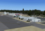
| I66 Clinton County, OH. |
|
Images related to this file:
File Description:
I66 Clinton County, OH. This is a small county airport out side Wilmington, OH. I made this for a friend of mine who lives outside the flight path.
| Filename: | I66_Clinton_County_OH.zip |
| License: | Freeware |
| Added: | 17th October 2010, 23:36:33 |
| Downloads: | 316 |
| Author: | Robert Touchtone |
| Size: | 6.81 KB |
| Category: Flight Simulator X - Scenery | |
| Courchevel Airport Scenery v1.0 |
|
File Description:
This is some very high detail scenery with some outstanding animations that include people walking around the airport, smoke emitting from chimneys, AI aircraft with flight plans specially made for the scenery, new airport mesh, New runway angle, Extra trees around air airport, Can crashes on the roads, custom buildings built in Gmax, an in-depth manual explaining the features of the scenery and also how to install the scenery, All the textures are merged into the BGL file, and much, much more.
| Filename: | Courchevel_Airport_Scenery_v10.zip |
| License: | Freeware |
| Added: | 7th October 2007, 18:03:26 |
| Downloads: | 10,989 |
| Author: | Steven Frost |
| Size: | 2.92 MB |
| Category: Flight Simulator X - Scenery | |
| KORH - Worcester Regional Airport - Massachusetts, USA |
|
Images related to this file:
File Description:
Worcester Regional Airport (IATA: ORH, ICAO: KORH, FAA LID: ORH) is a public airport located three miles (5 km) west of the central business district of Worcester, a city in Worcester County, Massachusetts, United States. The main airport property lies within Worcester and Leicester, with substantial supporting facilities in Paxton. Once owned by the City of Worcester, the airport has been owned and operated by the Massachusetts Port Authority (Massport) since June 2010. For your Flight Sim enjoyment by John B. Loney, Jr.
| Filename: | KORH__Worcester_Regional_Airport__Massachusetts_US.zip |
| License: | Freeware, limited distribution |
| Added: | 3rd July 2014, 02:02:08 |
| Downloads: | 1,082 |
| Author: | John B. Loney, Jr. |
| Size: | 15.82 MB |
| Category: Flight Simulator X - Scenery | |
| Chalet de Venema at Baker Lake |
|
Images related to this file:
File Description:

An addon scenery area for use with Microsoft FSX and the ORBX "FTX NA BLUE" Pacific Northwest scenery package. Includes scenery created with the Flight 1 Instant Scenery maker. You will need Runway 12 object libraries and other object libraries to see this scenery. Chalet de Venema at Baker Lake is in honor of ORBX founder, John Venema. Copyright 2010 by Brad Allen. FREEWARE ONLY.
| Filename: | Chalet_de_Venema_at_Baker_Lake.zip |
| License: | Freeware |
| Added: | 19th March 2010, 11:26:24 |
| Downloads: | 485 |
| Author: | Brad Allen |
| Size: | 1.04 MB |
© 2001-2026 AVSIM Online
All Rights Reserved
Privacy Policy |