
Where Flight Simulation Enthusiasts Gather from Around the World!
AVSIM Library - Search Results

| Category: Flight Simulator X - Scenery | |
| Selva00.. A WW2 Defence Airfield |

|
File Description:
MPBA is again becoming a known airfield now that "Beefy" Raphael has opened a hunting lodge near it. During WW2 it was home to Squadron 34 with its sleek P-39´s as part of the Panama Canal defences.
As time passed the jungle covered most of it and a ravine opened up crossing it almost at the middle. If you fly there with some hunters Beefy will be in the observation tower waving with his photographer who will take some pics of you and hunters. You should take off from MPTO for a nice 30 min flight......
(Now that the rainy season has arrived try the flight in Real weather for some excitement....)
| Filename: | Selva00_A_WW2_Defence_Airfield.zip |
| License: | Freeware, limited distribution |
| Added: | 14th July 2008, 23:01:41 |
| Downloads: | 396 |
| Author: | Gera Godoy Canova |
| Size: | 155.23 KB |
| Category: Flight Simulator X - Scenery | |
| Alf's UK Airfields Vol.28 Panshanger EGLG |
|
Images related to this file:
File Description:
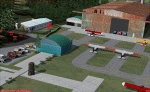
My Volume 28 is of Panshanger EGLG. Situated on the Eastern edge of Welwyn Garden City, it opened as a Flight Training School during WW2. Relinquished by the RAF in 1953 and used by De Havilland for a while, it is now operated by East Herts Flying School.
| Filename: | Alfs_UK_Airfields_Vol28_Panshanger_EGLG.zip |
| License: | Freeware |
| Added: | 5th May 2014, 15:05:24 |
| Downloads: | 938 |
| Author: | Alf Denham |
| Size: | 9.4 MB |
| Category: Flight Simulator X - Scenery | |
| Kopaida Airfield, Greece |
|
Images related to this file:
File Description:
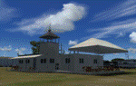
"Kopaida" airfield is a grass private strip, 105km NW of Athens located in the Kopaida drained lake plains between the towns of Aliartos, Kastro and Orchomenos and west of Yliki lake. It is a pure general aviation field and a hub of activity for numerous sport planes, gliders and motor gliders. The field includes a small tower and canteen and several owners of GA aircraft house them in the roomy hangar and also keep a mobile home or RV in the premises. The scenery includes a region and landclass bgl that will force a large area of the Kopaida plains around the airport to display US field textures. This was done because the US fields textures are rectangular and aligned N-E and W-E, in a similar way as the actual fields around the airport. A small photo background is used for the airfield itself. The photo background includes seasonal variations with slight colour variances as well as some autogen trees and shrubs. Custom GA traffic is also included. There is one trike doing circuits and TnGs and a Turbo Porter flying the circuit, simulating a skydiving sortie. The Turbo Porter used is the great freeware one created by Tim (Piglet) Conrad. I have also included a repaint for the F-GHVH, the Porter used by the GFFC, which sports a flashy "Alien" graffiti scheme.
*For FSX SP2 / Acceleration / P3D v1.00*
| Filename: | Kopaida_Airfield_Greece.zip |
| License: | Freeware |
| Added: | 3rd June 2014, 21:23:30 |
| Downloads: | 1,474 |
| Author: | Vassilios Dimoulas |
| Size: | 25.01 MB |
| Category: Flight Simulator X - Scenery | |
| Patches for Lighthouses of Annaba and Bejaia, Algeria and Corrected Faulty Terrain in Annaba and Oran |
|
Images related to this file:
File Description:

Those patches are setting into FSX the lighthouse of the Cap de Garde, in Annaba, Algeria and the ones of Bejaia. They also flatten two inaccuracies of terrain which are seen in Annaba, on the route to the airport and in Oran, East of the harbour.
| Filename: | Patches_for_Lighthouses_of_Annaba_and_Bejaia_Alger.zip |
| License: | Freeware |
| Added: | 16th July 2014, 16:36:40 |
| Downloads: | 313 |
| Author: | Gerard Guichard |
| Size: | 273.54 KB |
| Category: Flight Simulator X - Scenery | |
| NZWV - Waihi Beach Airfield, New Zealand |
|
Images related to this file:
File Description:
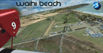
Waihi Beach (ICAO: NZWV) is a small airstrip north of Tauranga and near the small beach settlement of the same name, in the Bay of Plenty of New Zealand. It is a grass strip with offset thresholds giving usable landing lengths of 640m and 517m for RWY 13 and 31 respectively, a width of 55m and a group rating of 5. No night lighting or fuel is available. A very basic airstrip, there is only one recently built hanger and the airstrip is slowly being encroached on by
new housing developments. The airstrip itself is usually very sodden due to its low elevation but is a nice stop over for sightseeing from Tauranga and up the Coromandel peninsula.
The FSX model includes custom textures and models placed on a high resolution aerial image and a 15m mesh. It makes extensive use of items from the free VLC object libraries which are required to be installed (Available from www.vectorlandclass.co.nz Downloads menu). This scenery and
the VLC libraries have been funded by sales of VectorLandClass and although you do not need VLC to use it, your purchase helps further development.
| Filename: | NZWV__Waihi_Beach_Airfield_New_Zealand.zip |
| License: | Freeware, limited distribution |
| Added: | 1st November 2012, 10:01:38 |
| Downloads: | 1,006 |
| Author: | Tim Barnes / VectorLandClass |
| Size: | 11.13 MB |
| Category: Flight Simulator X - Scenery | |
| KACY - Atlantic City Intl - New Jersey, USA |
|
Images related to this file:
File Description:
FSX Scenery - Atlantic City International Airport KACY. Atlantic City International Airport (IATA: ACY, ICAO: KACY, FAA LID: ACY) is a joint civil-military airport 10 miles (16 km) northwest of Atlantic City, New Jersey, in Egg Harbor Township, the Pomona section of Galloway Township and in Hamilton Township.
This package is complete. No other downloads necessary. Tested only in FSX Acceleration. For you Flight Sim flying pleasure by John B. Loney, Jr.
| Filename: | KACY__Atlantic_City_Intl__New_Jersey_USA.zip |
| License: | Freeware, limited distribution |
| Added: | 26th January 2016, 09:01:42 |
| Downloads: | 1,727 |
| Author: | John B. Loney, Jr. |
| Size: | 6.3 MB |
| Category: Flight Simulator X - Scenery | |
| 70 Colombia Airports |
|
File Description:
70 Colombia airports/airfields for FSX. Mainly based on GoogleEarth. Changes to default airports and many new airports added. Largely based on my formerr FS9 colombian airport sceneries. I am using the FreeMesh X Global 1.0 from https://www.avsim.com/forums/topic/467933-freemesh-x-global-10-release-announcement/ but most sceneries should work also with the default or any other mesh. All files start with the ICAO identifier of the airport; so you can take out what you don't like or use only what you like.
Airports included are: ACM (IATA Code), SK53,SKAG,SKAO (now SKMJ) SKAS, SKBC, SKBE, SKBM, SKBN, SKBQ, SKBS, SKBU, SKCA, SKCB, SKCI, SKCN, SKCR, SKCZ, SKEB, SKFE, SKFL, SKGA, SKGI, SKGY, SKHA, SKHC, SKIB, SKIM, SKIO, SKIR, SKLA, SKLB, SKLC, SKLP, SKLT, SKMF, SKMG, SKMO, SKMO, SKNA, SKNV, SKOE, SKOT, SKPA, SKPD, SKPI, SKPP, SKPV, SKPZ, SKQU, SKRI, SKSA, SKSF, SKSJ, SKSV, SKTB, SKTM, SKTQ, SKUA, SKUM, SKUR, SKVG,
SLVP, SQFR, SQOA, SQPS, SQUJ, SQVZ, Z09A
| Filename: | 70_Colombia_Airports.zip |
| License: | Freeware |
| Added: | 6th January 2019, 17:39:01 |
| Downloads: | 2,433 |
| Author: | Detkev J. Rohmer |
| Size: | 106.4 MB |
| Category: Flight Simulator X - Scenery | |
| RAF Dalton |
|
File Description:
RAF Dalton was named after a local village although it was closer to RAF Topcliffe who it was intended to be the
satellite for.
RAF Dalton was home to No. 102 Squadron beginning in November 1941. No. 102 Squadron returned to Topcliffe in June
1942 and for a time Dalton hosted No. 1652 Heavy Conversion Unit (HCU) flying Halifaxes. The airfield was improved in
1942 and in early 1943 was allocated to No. 6 Group Royal Canadian Air Force (RCAF). Canadian squadrons stationed
here at one time or another included No. 428 Squadron, No. 424 Squadron, No. 420 Squadron, and No. 1666 Heavy
Conversion Unit (which moved to RAF Wombleton in October 1943). The station also housed no. 1691 Bomber Gunnery Flight
(BGF) RCAF and its successor, No. 1695 Bomber Defence Training Flight (BDTF) RCAF, the last RCAF unit to serve at this
station.
In November 1944, control passed from No. 6 Group to the new No. 7 (Training) Group. By August 1945 all units at
Dalton were disbanded or transferred and the Station closed in 1946.
Source:Wikipedia
| Filename: | RAF_Dalton.zip |
| License: | Freeware |
| Added: | 26th February 2017, 07:30:47 |
| Downloads: | 80 |
| Author: | Terry Boissel |
| Size: | 1.57 MB |
| Category: Flight Simulator X - Scenery | |
| RAF Marham |
|
File Description:
FSX scenery of RAF Marham in the UK. A very detailed, but frame-rate efficient scenery of this busy Tornado GR4 airfield. Designed for use with the FSX-converted MAIW GR4 AI package. Includes photo ground tiles with kind permission of Just Flight.
Visit the Marham support Forum at http://www.airfieldconstructiongroup.org/
| Filename: | RAF_Marham.zip |
| License: | Freeware, limited distribution |
| Added: | 6th March 2010, 23:02:18 |
| Downloads: | 2,870 |
| Author: | John Young |
| Size: | 27.58 MB |
| Category: Flight Simulator X - Scenery | |
| Frankfurt Main Airport (EDDF) v5.3 |
|
Images related to this file:
File Description:
This minor update supersedes v5.2 and includes the standard texture and scenery files for download. Updates include improved night lighting for taxiway N and the de-icing pads, additional taxiway textures for L and N plus additional fuel tanks as per the real-world airport.
Also includes update airline codes for gate parking and other minor defect fixes.
See readme/help file for more details. Stay tuned for v6 which will add further updates to this freeware FSX Frankfurt scenery.
| Filename: | Frankfurt_Main_Airport_EDDF_v53.zip |
| License: | Freeware |
| Added: | 9th February 2012, 17:01:05 |
| Downloads: | 1,447 |
| Author: | Mark Aldridge |
| Size: | 5.85 MB |


© 2001-2026 AVSIM Online
All Rights Reserved
Privacy Policy |