
Where Flight Simulation Enthusiasts Gather from Around the World!
AVSIM Library - Search Results

| Category: Flight Simulator X - Scenery | |
| RAF Kirton in Lindsey - Lincolnshire, England |

|
File Description:
It appears to have been an RAF habit (inherited from the RFC to name its bases after the nearest railway station, possibly to simplify the process of issuing Rail Warrants to personnel posted there. By that token, the site should be RAF Kirton Lindsey, Kirton Lindsey being the name of the nearby railway station constructed in 1849. No.255 Squadron's Operations Record Book (ORB) consistently uses that version of the name. So does the airfield's separate ORB, from the date of the site's WWII creation (15 May 1940) through to May 1941. After mid-1941 and the departure of No.255 Squadron, use of RAF Kirton-in-Lindsey. Kirton in Lindsey begins to appear in the site's own records – eventually dominating.
On 25 March 2013 it was announced to dispose of the airfield and technical facilities with only accommodation remaining. The airfield used to host No. 1 Air Control Centre (1ACC), the RAF’s only deployable ground-based early warning and air control radar unit, which was parented by RAF Scampton
The Station has had a varied selection of personnel occupying it, the RFC, RAF, USAAF, and before becoming an RAF Station for the last time it was the home of the Royal Artillery Regiment responsible for operating the Rapier sam. The Station finally closed in 2013.
| Filename: | RAF_Kirton_in_Lindsey__Lincolnshire_England.zip |
| License: | Freeware |
| Added: | 29th October 2015, 23:44:17 |
| Downloads: | 161 |
| Author: | Terry Boissel |
| Size: | 19 KB |
| Category: Flight Simulator X - Scenery | |
| Ship in Distress near Kodiak, Alaska |
|
File Description:
This cargo vessel was created by Johan Kotze using Gmax.
The vessel is simulating a ship in distress and has smoke coming out several places, suggesting a fire on board.
The crew have launched one of the life rafts, floating to the stern of the vessel and have requested urgent assistance and require airlift to safety.
The ship has a helipad at the stern and has lights.
The ship is 150nm NE of Kodiak, Alaska at N58 23.05 W147 53.09 .
FS2004 and FSX files included.
| Filename: | Ship_in_Distress_near_Kodiak_Alaska.zip |
| License: | Freeware |
| Added: | 12th September 2015, 18:13:58 |
| Downloads: | 249 |
| Author: | Johan Kotze |
| Size: | 1001.43 KB |
| Category: Flight Simulator X - Scenery | |
| LFTQ Chateaubriant airfield in brittany, France |
|
File Description:
Airfield for GA, missed in FSX. LFTQ is located between Rennes and Angers, France
| Filename: | LFTQ_Chateaubriant_airfield_in_brittany_France.zip |
| License: | Freeware, limited distribution |
| Added: | 20th March 2019, 16:51:36 |
| Downloads: | 336 |
| Author: | Jean-Pierre Kozerawski |
| Size: | 619.44 KB |
| Category: Flight Simulator X - Scenery | |
| Merida Airport (MMMD) in Yucatan, Mexico |
|
Images related to this file:
File Description:
This is a scenery of Manuel Crescencio Rejón International Airport (ICAO: MMMD) in Merida, Mexico, for FSX. It was made with the Airport Design Editor program. Airport layout and approaches correspond to the latest Jeppesen charts. Buildings are made with GMAX.
| Filename: | Merida_Airport_MMMD_in_Yucatan_Mexico.zip |
| License: | Freeware, limited distribution |
| Added: | 7th December 2022, 16:58:57 |
| Downloads: | 326 |
| Author: | Winfried Orthmann |
| Size: | 2.61 MB |
| Category: Flight Simulator X - Scenery | |
| Santa Lucia airport (MMSM) in Mexico |
|
Images related to this file:
File Description:
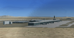
Santa Lucia airport is a new facility serving Mexico City, opened in 2022. The FSX scenery of this airport was built with the Airport Design Editor program, based on satellite images from Google Earth and on actual Jeppesen charts. The buildings are made with GMAX.
| Filename: | Santa_Lucia_airport_MMSM_in_Mexico.zip |
| License: | Freeware |
| Added: | 23rd December 2022, 21:34:40 |
| Downloads: | 755 |
| Author: | Winfried Orthmann |
| Size: | 5.49 MB |
| Category: Flight Simulator X - Scenery | |
| Roros Airport (ENRO) in Roros, Norway |
|
Images related to this file:
File Description:
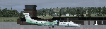
Roros Airport (IATA: RRS, ICAO: ENRO; Norwegian: Roros lufthavn) is a regional airport located 2 kilometers (1.2 mi) from the town of Roros, Norway. The asphalt runway has the physical dimensions 1,740 by 40 meters (5,710 by 130 ft) and is aligned 14/32. Scheduled services are provided to Oslo by Wideroe. The main general aviation user is Rørosfly, a pilot school, and the aviation club Roros Flyklubb. (Source of information: Wikipedia August 20, 2016)
| Filename: | Roros_Airport_ENRO_in_Roros_Norway.zip |
| License: | Freeware |
| Added: | 20th August 2016, 15:40:59 |
| Downloads: | 685 |
| Author: | Hans Christian Knudsen and Knudsenair Simulations |
| Size: | 121.82 KB |
| Category: Flight Simulator X - Scenery | |
| GLASGOW_SODE Enhancements |
|
File Description:
SODE 1.63 required.
Snowplows, static and animated and grass cutting tractors all according to weather conditions.
This pack also includes updates that replace the following Scottish_SODE scenery and objects.
Edinburgh, Sumburgh, Scatsa, Baltasound, Fairisle, Papa Stour, Skerries, Tingwall, Kirkwall
Updates are - Added "modern" type snowplow.Slightly improved Older snowplow. Improved logic for SimObject appearance. eg - Animated plows "snow" only. All snowplows= minus 20 to +5 celsius etc.
| Filename: | GLASGOW_SODE_Enhancements.zip |
| License: | Freeware, limited distribution |
| Added: | 7th October 2018, 01:24:29 |
| Downloads: | 222 |
| Author: | john watts |
| Size: | 17.26 MB |
| Category: Flight Simulator X - Scenery | |
| EGNJ - Humberside Airport - Kirmington, England |
|
Images related to this file:
File Description:

Humberside is our most recent release, we have tried a few new tweaks for this scenery and we had literally no resources to aid us during construction so that was fun!
Features for this scenery include:
- High poly volumetric grass.
- Standing water on the runway and aprons.
- Wigwags and guard lights.
- HD ground detailing.
- Customised AFCAD for Realistic AI performance.
| Filename: | EGNJ__Humberside_Airport__Kirmington_England.zip |
| License: | Freeware, limited distribution |
| Added: | 27th July 2015, 17:40:56 |
| Downloads: | 1,809 |
| Author: | Mark Piccolo - Soarfly Concepts |
| Size: | 20.25 MB |
| Category: Flight Simulator X - Scenery | |
| FAPF - Piet Retief Airfield - South Africa |
|
Images related to this file:
File Description:
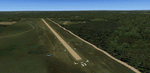
Gmax representation of Piet Retief Airfield (FAPF), Mpumalanga, South Africa with photoreal textures. Piet Retief airfield is a small airfield with a grass/dirt runway measuring 1 371m. The airfield is situated between the trees of the lush Sappi forests between the town of Piet Retief and the Swaziland border at an elevation of 4 420ft. There is an NDB for a "Breakcloud" procedure onto rwy 15.
| Filename: | FAPF__Piet_Retief_Airfield__South_Africa.zip |
| License: | Freeware |
| Added: | 17th August 2014, 22:03:31 |
| Downloads: | 1,102 |
| Author: | Kobus van Wyk, Aeroworx |
| Size: | 27.17 MB |
| Category: Flight Simulator X - Scenery | |
| White Island Photoreal Scenery (2nd of 4 releases) |
|
File Description:
This is the second of four photoreal scenery releases covering the main offshore islands in the Bay of Plenty, New Zealand.
This scenery was created from a scanned aerial photograph owned by Environment Bay of Plenty (The Bay of Plenty Regional Council). The imagery has been de-sampled for use in Flight Simulator X and utilizes the default terrain mesh. The textures are intended for summer daylight flying only, although due to the sparse nature of White Islands’ vegetation, the Islands appearance remains relatively consistent throughout the year.
It includes Steam, autogen objects (including a library object which vaguely resembles the abandoned Sulphur works) and animated birds.
| Filename: | White_Island_Photoreal_Scenery_2nd_of_4_releases.zip |
| License: | Freeware, limited distribution |
| Added: | 30th April 2007, 23:46:45 |
| Downloads: | 2,930 |
| Author: | Tim Barnes |
| Size: | 4.77 MB |


© 2001-2026 AVSIM Online
All Rights Reserved
Privacy Policy |