
Where Flight Simulation Enthusiasts Gather from Around the World!
AVSIM Library - Search Results

| Category: Flight Simulator X - Scenery | |
| PAKO - Nikolski Air Station - Alaska, USA |

|
File Description:
Nikolski Air Station (IATA: IKO, ICAO: PAKO, FAA LID: IKO) is an unattended airport located in Nikolski on Umnak Island in the Aleutians West Census Area of the U.S. state of Alaska. This former military airport is now owned by the Aleut Corporation. Scheduled commercial airline passenger service is subsidized by the Essential Air Service program. Current service to Nikolski is provided by PenAir using a Grumman Goose G-21A.
This airport has one runway 8/26 which is 3,512 feet long and 135 feet wide with a gravel surface. Custom models were added.
| Filename: | PAKO__Nikolski_Air_Station__Alaska_USA.zip |
| License: | Freeware |
| Added: | 28th August 2013, 12:12:38 |
| Downloads: | 993 |
| Author: | Wayne Roberts |
| Size: | 147.64 KB |
| Category: Flight Simulator X - Scenery | |
| The British Dependant Territory of the Pitcairn Islands |
|
File Description:
If you look at a world map and see a group of tiny islands next to the bottom right of French Polynesia in the Pacific Ocean, tagged as belonging to GB or UK, these are the Pitcairn Islands. To actually get there takes weeks by ship as there are no airports and only Pitcairn is inhabited. Well now you can get there much more easily with these little airports in the FSX world. You can even re-fuel on Pitcairn but just don't try and land your large trans continental jets there!
| Filename: | The_British_Dependant_Territory_of_the_Pitcairn_Is.zip |
| License: | Freeware |
| Added: | 28th March 2009, 15:30:28 |
| Downloads: | 591 |
| Author: | Andrew Randall |
| Size: | 4.83 KB |
| Category: Flight Simulator X - Scenery | |
| Kerkyra - LGKR |
|
Images related to this file:
File Description:
AS REAL AS IT GETS.
This is a highly detailed photorealistic scenery of the beautiful island of Kerkyra.
The scenery contains many objects like cars, boats and buldings in the City of Kerkyra.
Default FSX airport of the island (LGKR) was corrected and repositioned to the exact location and some buildings and trees were added in the airport vicinity.
Airport vehicle trafic and a small air trafic file included.
The scenery also includes autogen buildings, vegetation and road trafic near the city to enhance and animate the landscape.
| Filename: | Kerkyra__LGKR.zip |
| License: | Freeware |
| Added: | 22nd June 2011, 02:42:10 |
| Downloads: | 8,540 |
| Author: | Angelo Tassoglou |
| Size: | 137.18 MB |
| Category: Flight Simulator X - Scenery | |
| EDHI-Finkenwerder |
|
File Description:
Well it starts as always, I can't find a usable freeware airport in this case for the
EDHI Hamburg Finkenwerder Airbuswerke so I'll build it myself again ...............
Well what can I say here it is as real as possible with many details with the after a lot
of work Standard Scenery built ..........
So, of course, fly to Finkenwerder with an Airbus and leave it there in one
overtake the halls, during the waiting time you take a helicopter or a vehicle and see
you on the premises at .......
I
| Filename: | EDHIFinkenwerder.zip |
| License: | Freeware |
| Added: | 12th February 2021, 18:55:25 |
| Downloads: | 916 |
| Author: | Ewald Wagner |
| Size: | 55.96 MB |
| Category: Flight Simulator X - Scenery | |
| Caribbean AI Ship Traffic for 63 AI Ships |
|
Images related to this file:
File Description:
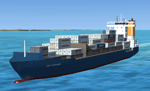
This package contains traffic files for the Caribbean Sea for the ships included in my package "63 AI Ships and AI Ship Traffic for South America and Europe V1". The new AI Ship routes are mainly concentrated in the Eastern part of the Carribbean along the Antilles from Puerto Rico to Tobago, but routes also include Panama, Colombia, Venezuela, Jamaica and Florida.
You will need to download and install "ai_ships_and_ai_ship_traffic_2013_v1.zip" before you can benefit from this package. This package does not contain any ships, but just the AI routes for the Caribbean Sea.
| Filename: | Caribbean_AI_Ship_Traffic_for_63_AI_Ships.zip |
| License: | Freeware |
| Added: | 9th March 2013, 22:56:28 |
| Downloads: | 11,021 |
| Author: | Henrik Nielsen |
| Size: | 716.81 KB |
| Category: Flight Simulator X - Scenery | |
| Gary Gale Seaplane Base - 0FL8 |
|
Images related to this file:
File Description:
Gary Gale Seaplane Base (0FL8) is a private seaplane base located in Florida, County: Duval, City: Jacksonville, GPS (Degrees): Lat: 30�° 11' 38'', Lng: -81�° 40' 55'', GPS (Seconds): Lat: 30.193889, Lng: -81.681944, GPS determination method: Estimated, Distance from central business district: 8 mi (SW). The scenery was made with ADE9X and is in the correct position according to satellite views. I added Seaplane docks, static seaplanes and a medium and small marina to make landing here more interesting. The real Seaplane base does not have docking for seaplanes/float planes.
| Filename: | Gary_Gale_Seaplane_Base__0FL8.zip |
| License: | Freeware |
| Added: | 13th October 2011, 21:39:44 |
| Downloads: | 293 |
| Author: | Bruce Bouley |
| Size: | 4 MB |
| Category: Flight Simulator X - Scenery | |
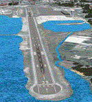
| PACK - Chefornak Airport - Alaska, USA |
|
Images related to this file:
File Description:
Chefornak Airport (IATA: CYF, ICAO: PACK, FAA LID: CFK) is a state-owned public-use airport in Chefornak,a city in the Bethel Census Area of the U.S. state of Alaska. The airport is on the Kinia River.
A new airstrip has been built further out from the village due to concerns with the current airstrip being near the school and pedestrian traffic, however, the runway must settle for several years before it is ready to be used. A new runway designated 5/23 was added.
| Filename: | PACK__Chefornak_Airport___Alaska_USA.zip |
| License: | Freeware |
| Added: | 17th October 2014, 01:26:08 |
| Downloads: | 661 |
| Author: | Wayne Roberts |
| Size: | 451.25 KB |
| Category: Flight Simulator X - Scenery | |
| Jersey X-HD |
|
Images related to this file:
File Description:

Jersey is a small airport located on the island of Jersey in the English Channel. Originally opened in March 1937 the airport has been through several changes and improvements. This scenery is an accurate representation of the airport today.
Features include: -High definition ground image. -High definition ground detailing. -Accurate ground markings. -Vehicles hidden inside closed hangars. -Beautiful night lighting. -Custom AFCAD for improved AI. -3D Approach lights. -Many static objects. -Reflective windows on tower. -Very frame rate friendly. -Hold short guards and PAPIs. -Illuminated Taxiway center light effect.
| Filename: | Jersey_XHD.zip |
| License: | Freeware, limited distribution |
| Added: | 20th January 2017, 17:42:42 |
| Downloads: | 3,362 |
| Author: | Mark Piccolo - Soarfly Concepts |
| Size: | 23.66 MB |
| Category: Flight Simulator X - Scenery | |
| Zegrze Pomorskie 1953-2013 * Update * |
|
Images related to this file:
File Description:
Zegrze Pomorskie Airport (old code EPKO) is a beautifully placed aerodrome in the north of Poland, ca. 20 km. from Koszalin city (107,000 habitants). For almost 50 years it was the base of a Polish 26th Fighter Regiment transformed later to Polish 9th Fighter Regiment.
SCENERY FEATURES:
-Compatible with FSX SP2/ACC only, blended to default FSX!
-Detailed reconstruction of the airport.
-Seasonal ground textures (0.30m per pixel).
-Very Hight accuracy of all objects (blends, naormal maps, specular maps).
-Precisely created aprons, taxiways and runway with seasonal textures, made in GMax.
-Landclass incuded.
| Filename: | Zegrze_Pomorskie_19532013__Update_.zip |
| License: | Freeware, limited distribution |
| Added: | 29th August 2013, 16:58:13 |
| Downloads: | 4,432 |
| Author: | Pawel Aziukiewicz |
| Size: | 314.95 MB |
| Category: Flight Simulator X - Scenery | |
| USA East 10 metre mesh, Batch 4, Part 9 of 9 |
|
File Description:
USA EAST USGS 10 metre mesh terrain - FSX only, includes: IA, MN, WI, IL, IN, MI, OH, PA, NY, VT, NH, ME, MA, CT, RI. Part 9 of 9!
This constitutes 10 metre terrain mesh for a section of the USA, The whole USA East mesh files will abutt the US West Coast 10m mesh already available elsewhere, that was made by: Raimondo Taburet. Make sure you have your scenery terrain settings at about 5 metres in the FSX display dialogue for the mesh to show properly!
| Filename: | USA_East_10_metre_mesh_Batch_4_Part_9_of_9.zip |
| License: | Freeware |
| Added: | 11th May 2009, 10:18:22 |
| Downloads: | 1,020 |
| Author: | Wayne Evans |
| Size: | 28.84 MB |
© 2001-2026 AVSIM Online
All Rights Reserved
Privacy Policy |