
Where Flight Simulation Enthusiasts Gather from Around the World!
AVSIM Library - Search Results

| Category: Flight Simulator X - Scenery | |
| Type81 Tribal Class Frigates |

|
Images related to this file:
File Description:

FSX Type81 Tribal Class Frigates. Helicopter landable, provided in both static and AI form. All have rotating radar and smoke effect. Four versions are provided, Ashanti, Nubian, Gurkha, and Eskimo, depicting the vessels at various stages in their life. Can be used alone or as escort to an Aircraft Carrier. All four are provided both with and without wake. By Mike Hudson
| Filename: | Type81_Tribal_Class_Frigates.zip |
| License: | Freeware |
| Added: | 11th December 2012, 00:58:06 |
| Downloads: | 308 |
| Author: | Mike Hudson |
| Size: | 5.76 MB |
| Category: Flight Simulator X - Scenery | |
| Type12M Rothesay Class Frigates |
|
Images related to this file:
File Description:
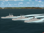
FSX Type12M Rothesay Class Frigates. Provided in both static and AI form. All have rotating radar and smoke effect. Three versions are provided, Rothesay, Yarmouth, and Plymouth, depicting the vessels at various stages in their life. Two are helicopter landable. Can be used alone or as escort to an Aircraft Carrier. All three are provided both with and without wake. By Mike Hudson
| Filename: | Type12M_Rothesay_Class_Frigates.zip |
| License: | Freeware |
| Added: | 31st January 2013, 16:00:50 |
| Downloads: | 283 |
| Author: | Mike Hudson |
| Size: | 5.64 MB |
| Category: Flight Simulator X - Scenery | |
| KERI - (Erie International Airport Tom Ridge Field) |
|
File Description:
This is an improvement of what came with the default scenery in FSX for KERI. I have added all the hangars including the new one on the east end of the airport. Replaced the default terminal with new buildings and added the three moving jetways that work well with AI traffic. Replaced the default boundary and roads in the area surrounding the airport.
| Filename: | KERI__Erie_International_Airport__Tom_Ridge_Field.zip |
| License: | Freeware |
| Added: | 3rd October 2007, 23:53:01 |
| Downloads: | 1,374 |
| Author: | Bill Good |
| Size: | 1.87 MB |
| Category: Flight Simulator X - Scenery | |
| WAMR or WAEW 2018 dcda v0.9 |
|
Images related to this file:
File Description:
This is a simple update to the airport on the island of Morotai, Indonesia.
Two version, one for the old ICAO code WAMR and one for the new code WAEW, (only install one version as you choose).
Runway location and direction corrected, added aprons, parking, fuel vehicle, RNAV approaches. ADE image in the ZIP. More details and instructions in the README file.
| Filename: | WAMR_or_WAEW_2018_dcda_v09.zip |
| License: | Freeware |
| Added: | 24th January 2018, 23:26:10 |
| Downloads: | 481 |
| Author: | Dale Hanych |
| Size: | 297.01 KB |
| Category: Flight Simulator X - Scenery | |
| The new St. George Regional KSGU, St. George, Utah |
|
Images related to this file:
File Description:
The KSGU depicted in the stock FSX scenery was closed in 2011 and operations moved to the new KSGU built approx. 6 miles to the south east. This is the new version, the old one has been removed. As per charts here is no ILS approach for R1, and the localizer for R19 is offset by 7 degrees. See Skyvector.com for charts.
| Filename: | The_new_St_George_Regional_KSGU_St_George_Utah.zip |
| License: | Freeware |
| Added: | 24th September 2018, 16:46:04 |
| Downloads: | 632 |
| Author: | Sidney Schwartz |
| Size: | 7.61 MB |
| Category: Flight Simulator X - Scenery | |
| Mountain & Desert Texture Mod (Fixed) |
|
File Description:
Created to modify the existing textures in FSX to offer a better representation of AB, BC, AK mountain regions, and reduces the amount "desert" texture look overall. The small batch file simply copies and renames better existing textures from within FSX - to be applied for these regions. Overall it reduces the amount of light desert textures, gives you more rock where there was sand, provides a greener sub base and transitions, darker mountian slides, and reduces the plain white snow coverage in the mountains allowing more rock to be shown. Blocky shadows in snow are now minimal, due to the snow textures changes and contrast in terrain. Updated - This version superceeds the original version 1.0a, and is for both new and previous installations. Existing users please download this updated version and follow the instructions within the readme.
| Filename: | Mountain__Desert_Texture_Mod_Fixed.zip |
| License: | Freeware, limited distribution |
| Added: | 17th November 2006, 11:17:17 |
| Downloads: | 8,371 |
| Author: | Garett Schmidt |
| Size: | 279.31 KB |
| Category: Flight Simulator X - Scenery | |
| YLUW Leeuwin Estate Winery, Western Australia |
|
File Description:
YLUW Leeuwin Estate, one of the founding wineries of the now famous Margaret River district, consistently produces wines that rank with the world's finest. In 1972, following an extensive search for the area most suitable to produce the best varietal wines in Australia, legendary American winemaker, Robert Mondavi, identified the future site of the Leeuwin vineyard. Originally a cattle farm, Leeuwin Estate evolved, under the direction of Denis and Tricia Horgan, with Robert Mondavi acting as consultant and mentor. A nursery was planted in 1974 and the initial vineyards were deep-ploughed, deep-ripped, emptied of stone, planned, pegged, measured, marked and eventually planted by hand over a five year period from 1975. Featuring state-of-the art facilities, the winery building was opened in 1978, celebrating with a trial vintage. Leeuwin enjoyed its first commercial vintage in 1979, and was thrust into the international spotlight when Decanter Magazine gave its highest recommendation to the 1980 "Art Series" Chardonnay in an international blind tasting. Maintaining a team of highly skilled and dedicated winemakers, and now under the direction of two generations of the founding family, Leeuwin now exports to over 30 countries. www.leeuwinestate.com.au/?page=4 REQUIRES Blencowe_LibraryKit.zip
REQUIRES blencowe_librarykit_309494.zip (Available HERE)
| Filename: | YLUW_Leeuwin_Estate_Winery_Western_Australia.zip |
| License: | Freeware |
| Added: | 28th February 2013, 13:55:25 |
| Downloads: | 235 |
| Author: | Alan Blencowe |
| Size: | 3.66 MB |
| Category: Flight Simulator X - Scenery | |
| RAF Tempsford |
|
File Description:
RAF Tempsford was perhaps the most secret airfield in the Second World War. It was home to the Special Duties Squadrons, No. 138, which dropped Special Operations Executive (SOE) agents and their supplies into occupied Europe, and No. 161, which specialised in personnel delivery and retrieval by landing in occupied Europe. RAF Tempsford is very close to Little Gransden Airfield and can be clearly seen from flights climbing out from the westerly runway 28. Other active airfields nearby include the former RAF bases at Gransden Lodge and Bourn.
By 2002 part of the former Tempsford airfield was a concrete-making facility and some of the main airfield buildings had been turned into various commercial workshops. A nearby public footpath led to the end of a substantially intact runway and then on to Gibraltar Farm, the agents' final dispatch point.
This barn contains several plaques and memorials to the agents, both men and women, who were flown from the airfield, many of whom were later killed after being captured and tortured. A memorial is also to be found in St Peter's Church, in the nearby village of Tempsford, and the Tempsford Memorial is outside the church, commemorating the men and women who served as secret agents in occupied Europe during the Second World War and the RAF aircrew who transported them.
Source:Wikipedia
| Filename: | RAF_Tempsford.zip |
| License: | Freeware |
| Added: | 20th March 2017, 19:45:06 |
| Downloads: | 123 |
| Author: | Terry Boissel |
| Size: | 227.97 KB |
| Category: Flight Simulator X - Scenery | |
| Columbia SC (KCAE) |
|
Images related to this file:
File Description:
The Columbia Metropolitan Airport Authority has provided substantial information about KCAE online, making it possible to pretty accurately model this airport. The taxiway signs have been placed according to exhibits in the airport's certification manual, and taxiway designations have been revised in accordance with upgrades to be effective mid-Novemer 2012. Most buildings have been custom modeled in accordance with information available on the internet, including Microsoft Bing birdseye views. The airport layout and landclass changes are in accordance with Google Earth imagery.
If you have Jim Dhaenens' lightobj.bgl installed, apron lighting will be included, and if you have
KB_static_aircraft_FSX installed (available at www.kb-sim.com/screens_static_aircraft.html),
additional parked aircraft will be visible. The layout of scenery is optimized for use with
Ultimate Terrain X-USA. FSX runs smoothly with this scenery on my computer, but it has not been
tested on a low-end system. Sometime after starting this project, it came to my attention that a
good scenery for KCAE was already available (but not listed at www.freewarescenery.com) from Jim
Hill that is another option as well as adjusting scenery complexity.
The new taxiway designations are not yet shown in the latest observed FAA airport diagram. An airfield sketch provided to pilots by the Columbia Metropolitan Airport is included in the package to show the taxiway designation changes.
| Filename: | Columbia_SC_KCAE.zip |
| License: | Freeware |
| Added: | 14th December 2012, 01:28:23 |
| Downloads: | 1,695 |
| Author: | Art Poole |
| Size: | 3.43 MB |
| Category: Flight Simulator X - Scenery | |
| LFLJ - Courchevel, France |
|
File Description:
This FSX scenery package contains the LFLJ Courchevel airport in the French Alps. The airport has a very short, upslope runway of only 525 m (1,722 ft). The airport is considered one of the seven most dangerous in the world. It has a difficult approach, a 300 foot upslope runway and is adjacent to the Courchevel ski runs. The Courchevel airport altitude is the highest in Europe, with a mean elevation of 6,520 feet. This airport is intended to be used with FSX and the free addon - TileProxy. TileProxy provides real-time photorealistic satellite imagery in place of the stock auto generated FSX scenery or any other scenery package. The Courchevel airport was originally released as part of an FSX airport scenery package containing 15 airports, located in the French Alps. The link to the original 15 French Alps Airport package is shown below. This file is not required, but allows you to download 15 related French Alps airports. The LFLJ, Courchevel airport in the original 15 airport package was missing a required scenery file which corrects the airport altitude (from 6420 ft. to 6520 ft.) due to the mis-location of the stock FSX airport. This download provides all three of the required .bgl scenery files.
related download:
http://library.avsim.net/search.php?SearchTerm=french+alps+airports&CatID=root&Go=Search
| Filename: | LFLJ__Courchevel_France.zip |
| License: | Freeware |
| Added: | 30th November 2013, 20:20:07 |
| Downloads: | 6,041 |
| Author: | John Greenwood |
| Size: | 655.63 KB |


© 2001-2026 AVSIM Online
All Rights Reserved
Privacy Policy |