
Where Flight Simulation Enthusiasts Gather from Around the World!
AVSIM Library - Search Results

| Category: Flight Simulator X - Scenery | |
| NSA - Pine Gap Australia |

|
Images related to this file:
File Description:

Joint Defense Facility Pine Gap is a satellite tracking station in the Australian outback operated by the United States intelligence community. The location is strategically significant because it controls United States spy satellites as they pass over the one third of the globe which includes China, the Asian parts of Russia and the Middle East. Central Australia was chosen because it was too remote for spy ships passing in international waters to intercept the signal. The facility has been described as the ground control and processing station for geosynchronous satellites engaged in signals intelligence collection. JDF Pine Gap is ran by the CIA, NSA, and NRO and is a key location in the global ECHELON surveillance network. Includes a helipad startup location with YPGP ident. Scenery by Jason L. Terry.
| Filename: | NSA__Pine_Gap_Australia.zip |
| License: | Freeware |
| Added: | 16th August 2014, 11:01:35 |
| Downloads: | 544 |
| Author: | Jason L. Terry |
| Size: | 1.21 MB |
| Category: Flight Simulator X - Scenery | |
| Southern California Navy Outlying Fields |
|
File Description:
Two unique WWII-era Navy outlying fields.
Hourglass Field:
This is a very simple representation of a satellite field of Kearny NAAS, later Miramar NAS. Hourglass field was originally built in the 1930s and was retained by the navy until 1962 when the site was sold to the San Diego Community College district.
Miramar Community College was built on the site in 1967.
The site was popular with drag racers during the 1950s.
Mile Square:
This is a very simple representation of what was originally a satellite field of Los Alamitos NAAS during WWII and the 1950s and was later reassigned as a helicopter practice field to Tustin MCAS, until it was abandoned in the 1980s.
The airfield was covered by a golf course in the early 2000s.
| Filename: | Southern_California_Navy_Outlying_Fields.zip |
| License: | Freeware |
| Added: | 17th December 2023, 20:00:45 |
| Downloads: | 35 |
| Author: | Aris Lazerson |
| Size: | 535.85 KB |
| Category: Flight Simulator X - Scenery | |
| Pearl Harbor and Waikiki |
|
File Description:
This is a simple landclass and waterclass update for FSX with SP2/Acceleration that does the following:
- A complete make-over of Ford Island so that it more closely matches its present day appearance, including addition of the USS Missouri
- Some updates to the South East Lock in Pearl Harbor to more closely match it's present day appearance
- Updates to Sand Island in an attempt to more closely match reality
- Uses a darker waterclass for Pearl Harbor and Kaneohe Bay in an attempt to more closely match reality
- Adds some missing beaches along the southern coast of Oahu, including Waikiki
- Adds shallow, coral reef waterclass where appropriate along the southern coast of Oahu in an attempt to more closely match reality
- Diamond Head uses a volcanic rock texture
| Filename: | Pearl_Harbor_and_Waikiki.zip |
| License: | Freeware |
| Added: | 6th February 2014, 18:11:00 |
| Downloads: | 2,778 |
| Author: | Gregg Douglass |
| Size: | 7.74 MB |
| Category: Flight Simulator X - Scenery | |
| MYAM - Marsh Harbour, Andros, The Bahamas |
|
Images related to this file:
File Description:

Marsh Harbour is the third busiest airport in the Bahamas, and now has a new runway, a new terminal, and the addition of a control tower and fire station. Completion of scenery for Marsh Harbour has been delayed since beginning work on the Bahamas' airports due to construction and a long delay in opening the new facilities, which occurred on May 27, 2014. There are currently no plans for opening the control tower, and it is not operational in this scenery. The scenery includes custom scenery objects, placement of library objects and landclass changes. Scenery is based on Google Earth and photos taken locally, and it is optimized for use with UTX-TAC. Some scenery details have changed from what is shown in screenshots included with the installation package.
| Filename: | MYAM__Marsh_Harbour_Andros_The_Bahamas.zip |
| License: | Freeware |
| Added: | 28th June 2014, 05:54:38 |
| Downloads: | 890 |
| Author: | Art Poole |
| Size: | 2.5 MB |
| Category: Flight Simulator X - Scenery | |
| 86 AI Ships and AI Ship Traffic |
|
Images related to this file:
File Description:

This package contains 86 new ship models and AI ship traffic routes for these ships and other ships included in the Global AI Ship Project. In particular it includes a number of ferries mostly for European routes, but it also reinforces AI ship traffic across the globe with new models and routes. It also includes updates for wake files and corrections to mdl files and sim.cfg for earlier releases to make these ships work better in P3Dv3.1 and above. If you have downloaded and installed the other packages in the project this is an incremental package - if you have not installed the other packages then download the total package instead (available from end March 2016). This package contains models by Henrik Nielsen, Erwin Welker, and Jean-Pierre Fillion.
| Filename: | 86_AI_Ships_and_AI_Ship_Traffic.zip |
| License: | Freeware |
| Added: | 25th March 2016, 15:12:07 |
| Downloads: | 3,659 |
| Author: | Henrik Nielsen |
| Size: | 153.19 MB |
| Category: Flight Simulator X - Scenery | |
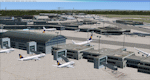
| Frankfurt Main Airport (EDDF) v7 - manual install package |
|
Images related to this file:
File Description:

This major update represents EDDF in the December 2012 timeframe.
With the increasing development of the proposed Terminal 3 area now in use as extended apron parking, this update provides operational ramps for G and H gates including ramp parking for both airline and cargo aircraft, helicopter parking at gates H8 and H12, apron night lighting, vehicular traffic etc. In addition this update features a new Gmax custom fuel tank farm along with custom Frankfurt logos, the recently opened A-plus terminal (7 new gates including 4 A380 gates) in October 2012, a new Air Rail Center model and a new set of cargo offices/buildings that have been placed in the South Cargo area as well as the replacement of the standard FSX blast fences with a new Gmax fence model which adds even further realism to this scenery.
Also, a first time feature for this scenery, it now supports GSX (Ground Services for FSX). The G and H aprons have been customized to support GSX functionality with the correct positioning of the ground service vehicles and pushback operations based on scenery topology. The associated airport .ini file is supplied in this package.
Default FSX scenery is required. See readme/help file for more details.
| Filename: | Frankfurt_Main_Airport_EDDF_v7__manual_install_pac.zip |
| License: | Freeware |
| Added: | 23rd December 2012, 22:29:21 |
| Downloads: | 6,001 |
| Author: | Mark Aldridge |
| Size: | 13.82 MB |
| Category: Flight Simulator X - Scenery | |
| Frankfurt Main Airport (EDDF) v7 - auto install |
|
Images related to this file:
File Description:
This major update represents EDDF in the December 2012 timeframe.
With the increasing development of the proposed Terminal 3 area now in use as extended apron parking, this update provides operational ramps for G and H gates including ramp parking for both airline and cargo aircraft, helicopter parking at gates H8 and H12, apron night lighting, vehicular traffic etc. In addition this update features a new Gmax custom fuel tank farm along with custom Frankfurt logos, the recently opened A-plus terminal (7 new gates including 4 A380 gates) in October 2012, a new Air Rail Center model and a new set of cargo offices/buildings that have been placed in the South Cargo area as well as the replacement of the standard FSX blast fences with a new Gmax fence model which adds even further realism to this scenery.
Also, a first time feature for this scenery, it now supports GSX (Ground Services for FSX). The G and H aprons have been customized to support GSX functionality with the correct positioning of the ground service vehicles and pushback operations based on scenery topology. The associated airport .ini file is supplied in this package.
Default FSX scenery is required. See readme/help file for more details.
| Filename: | Frankfurt_Main_Airport_EDDF_v7__auto_install.zip |
| License: | Freeware |
| Added: | 23rd December 2012, 22:28:57 |
| Downloads: | 12,700 |
| Author: | Mark Aldridge |
| Size: | 13.43 MB |
| Category: Flight Simulator X - Scenery | |
| Carrier CVN75_V2 North Sea |
|
File Description:
This is a update version of my scenery DL_CVN75.zip.
Changes in Version 2 of the cenery:
1.The Carrier model is now a private object and no longer part of the standard FSX object lib..
This allows the installation and registration in FSX scenery setting to be done like any
other addon objects.
The registration of the scenery in FSX below " Global, Generic & Vehicle Libraries" is no
longer required !!!!
2.Version 2 has more stuff on deck of the carrier.
3.The Number 75 is more accurate according to the real carrier.
4.The ILS frequencies ( e.g. GS) is more accurat adjusted in relation to the cable zone.
Scenery: Carrier Group North sea. Close to the Island of Sylt The Scenery includes: - The USS Carrier Harry Truman, CVN 75 with full function as an Airport with ILS approach capability.
F18-Fighters and a Navy-Heli on the Carrier. - 2 flying Helicopters over the Carrier. - 4 Navy-Destroyers escorting the Carrier. In addition to the Carrier-Group: - A Oilrig about 30 nm northwest from the Carrier. The Heli-Pat is a landable Platform !! - 2 moving Destroyer based on a "Boats Traffic Plan" which are moving around the group according to the time schedule in the plan.
| Filename: | Carrier_CVN75_V2__North_Sea.zip |
| License: | Freeware |
| Added: | 26th December 2008, 10:44:37 |
| Downloads: | 3,484 |
| Author: | Dietmar Loleit |
| Size: | 4.83 MB |
| Category: Flight Simulator X - Scenery | |
| RAF Shepherds Grove - Suffolk, England |
|
File Description:
RAF Shepherds Grove is a former Royal Air Force station located 9.9 miles (15.9 km) north-east of Bury St Edmunds, Suffolk, England.
The Station was originally built for the United States Army Air Forces (USAAF) Eighth Air Force during the Second World War. However the facility was not used by the USAAF and was opened by No. 3 Group RAF on 3 April 1944. The name came from a small copse nearby and the airfield is close to Walsham le Willows in Suffolk.
It was occupied by No. 196 Squadron RAF in January 1945 as a base for Operation Varsity, supporting the Rhine crossing.
Various American units occupied the station after WW2 but ended their use of the unit in December 1958.
On 22 July 1956, No. 82 Squadron RAF was activated at Shepherds Grove as a Thor missile unit. Thor launching sites were built on the main airfield and became operational in 1959.
The base was closed in 1966. Third party files are required - see the readme.txt for details.
| Filename: | RAF_Shepherds_Grove__Suffolk_England.zip |
| License: | Freeware |
| Added: | 4th December 2015, 09:34:13 |
| Downloads: | 159 |
| Author: | Terry Boissel |
| Size: | 13.26 KB |
| Category: Flight Simulator X - Scenery | |
| YGNW Gnowangerup Shire airstrip and town, Western Australia |
|
File Description:
YGNW Gnowangerup Shire Airstrip. The Shire of Gnowangerup is a Local Government Area in the Great Southern region of Western Australia, about 120 kilometres north of Albany and about 370 kilometres southeast of the capital, Perth. The Shire covers an area of 4,268 square kilometres, and its seat of government is the town of Gnowangerup. Gnowangerup was initially gazetted as a Road Board in 1912, taking in eastern sections of Broomehill and Tambellup. On 1 July 1961, it became a Shire Council following changes to the Local Government Act. The area of gnowangerup is mainly wheat sheep on sandplain country. In the 1960's it was reported to have good rainfall but when the clearing started, the rainfall changed. Farmers who managed large properties were able to survive because of the economies of scale. At regular intervals, farmers in this area now have to cart water for their stock. REQUIRES Blencowe_LibraryKit.zip
REQUIRES blencowe_librarykit_309494.zip (Available HERE)
| Filename: | YGNW_Gnowangerup_Shire_airstrip_and_town_Western_A.zip |
| License: | Freeware |
| Added: | 28th February 2013, 02:44:27 |
| Downloads: | 261 |
| Author: | Alan Blencowe |
| Size: | 5.39 MB |
© 2001-2026 AVSIM Online
All Rights Reserved
Privacy Policy |