
Where Flight Simulation Enthusiasts Gather from Around the World!
AVSIM Library - Search Results

| Category: Flight Simulator X - Scenery | |
| CYBA - Banff Airfield |

|
File Description:
Welcome to Beautiful Banff - CYBA :)
Banff is the largest town in Banff National Park, in Alberta's Rockies, Canada. It is also the first incorporated municipality located within a national park in Canada. At 1,463 m (4,800 ft), it is the town with the highest elevation in Canada.
It is surrounded by mountains, notably Mount Rundle, Sulphur Mountain, Mount Norquay, and Cascade Mountain and situated above Bow Falls near the junction of the Bow and Spray Rivers. Banff is located 126 km (78 mi) west of Calgary and 58 km (36 mi) east of Lake Louise, on the Trans-Canada Highway. The Town is a member of the Calgary Regional Partnership.
I have put a little " winter life" in this awesome airfield. 2 fuel parking, Helipad and more....
Hope you'll enjoy the scenery on final landing! ;)
No A.I set up!
| Filename: | CYBA__Banff_Airfield.zip |
| License: | Freeware |
| Added: | 11th March 2009, 01:08:10 |
| Downloads: | 1,846 |
| Author: | Daniel Louvet |
| Size: | 384.91 KB |
| Category: Flight Simulator X - Scenery | |
| Catalunya Coast V1.0 |
|
File Description:
Catalonia is with Barcelona, the Costa Brava and many other places and sights
a popular tourist aim primarily for European.
The standard scenery of FSX in Spain and therefore also Catalonia has been improved strongly.
But there are areas which urgently required a revision, though.
So the shoreline was modelled by Catalonia only roughly (see the pictorial material).
In addition, many coastal places etc. are missing in the standard.
With this scenery expansion which will contain the whole Catalonia in the final construction stage,
the coast of Catalonia has been improved in a first step.
The following has been done:
- correction of the complete coastal line of Catalonia
- insert of 61 towns and villages along the coast
- insert of 123 beaches
- insert of 59 ports/marinas with landing stages and ships
- modification of offshore landscapes
- inking the offshore sea zones
| Filename: | Catalunya_Coast_V10.zip |
| License: | Freeware, limited distribution |
| Added: | 11th February 2007, 15:14:11 |
| Downloads: | 7,273 |
| Author: | Bodo Hesse |
| Size: | 1.68 MB |
| Category: Flight Simulator X - Scenery | |
| Montserrat Island - Leeward Islands, Lesser Antilles, Caribbean Sea |
|
Images related to this file:
File Description:
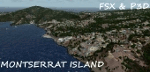
A representation of Montserrat using photo-real scenery along with hand placed autogen.
Montserrat is a British overseas territory located in the Leeward Islands, part of the chain of islands called the Lesser Antilles in the Caribbean Sea. Its capital city of Plymouth was destroyed by an eruption of the previously dormant Soufriere Hills volcano in 1995. Between 1997 and 2005, Montserrat had been accessible only by helicopters or boats.
The airport's name was changed in July 2008 to honour John Osborne, long-standing Chief Minister of Montserrat and the airline FlyMontserrat has its headquarters on the airport property.
For the best results of this scenery, PWSceneries Volume 5 has to be installed. Features included are custom photo scenery covering the entire island, hand placed autogen, detailed 3D Objects and custom buildings. Works in FSX and P3D.
| Filename: | Montserrat_Island__Leeward_Islands_Lesser_Antilles.zip |
| License: | Freeware |
| Added: | 24th September 2015, 10:59:37 |
| Downloads: | 838 |
| Author: | Kenje Thomas |
| Size: | 132.48 MB |
| Category: Flight Simulator X - Scenery | |
| RAF Hilbaldstow - Lincolnshire, England |
|
File Description:
RAF Hibaldstow is a former Royal Air Force satellite airfield located south of Hibaldstow in Lincolnshire and 8.3 miles (13.4 km) south east of Scunthorpe, Lincolnshire, England. The airfield was built with greater things in mind, but it only became a satellite airfield for RAF Kirton-in-Lindsey in 1941. When the runways were constructed, some of the hardcore was made from material taken from demolished bungalows on the site.
The airfield was commissioned on 12 May 1941 when No. 255 Squadron RAF took up residence with their Boulton Paul Defiant night fighters. These planes had been drawn from RAF Kirton-in-Lindsey and made one 'kill': an He 111 which was shot down near Louth on 5 June 1941.
On 6 August 1947 the station finally closed and during 1960-61 it was sold off for use as agricultural land. It was also used for Sunday markets, as a skid-pan by Lincolnshire Police and by a local parachute club. The control tower was converted to a two-storey house in 1976.
| Filename: | RAF_Hilbaldstow__Lincolnshire_England.zip |
| License: | Freeware |
| Added: | 24th October 2015, 22:00:30 |
| Downloads: | 202 |
| Author: | Terry Boissel |
| Size: | 24.85 KB |
| Category: Flight Simulator X - Scenery | |
| EGVL - RAF Little Rissington - Gloucestershire, England |
|
File Description:
RAF Little Rissington (ICAO: EGVL) is an RAF aerodrome and former RAF station in Gloucestershire, England. It was once home to the Central Flying School, the Vintage Pair and the Red Arrows.
Built during the 1930s, the station was opened in 1938 and closed in 1994. The married-quarters and main technical site were sold in 1996 (the former becoming the village of Upper Rissington), but the aerodrome has been retained by the Ministry of Defence and remains active along with the southern technical sites, under the operational control of HQ No.2 Flying Training School at RAF Syerston.
It is now home to 637 Volunteer Gliding Squadron as the primary military unit, who provide elementary flying training for Combined Cadet Force and Air Training Corps cadets. The airfield is also used by the forces as a relief landing ground, training area and parachute dropping area. In previous years, the Royal Air Force estate has been used as a film set, including The Avengers, part of the ice chase in Die Another Day, and the Thunderbirds film. Souce: Wikipedia
| Filename: | EGVL__RAF_Little_Rissington__Gloucestershire_England.zip |
| License: | Freeware |
| Added: | 23rd November 2015, 14:41:23 |
| Downloads: | 468 |
| Author: | Terry Boissel |
| Size: | 19.74 KB |
| Category: Flight Simulator X - Scenery | |
| FSX_MeSA_H06 |
|
File Description:
FSX Mesh South America Project:
This terrain mesh file is a part of a whole project covering all the Continent
of South America and some islands, divided in tiles identified in a map by its
column (letters) and rows (numbers).
Those files were multi-LOD compiled from 90m SRTM2 source data, reprocessed
with 3DEM to remove voids and spikes, providing a 76.4m (LOD9) horizontal
resolution topography intended for use only in FSX updated with SP1.
Although not well documented, to improve performance, the updated FSX loads DEM
files in threads and only the closer terrain (about 5-10 NM from the point of view)
is rendered in high detail, while at far distances FSX shows up its default low
resolution mesh, when there is not a third part terrain mesh compiled in all
others intermediate level of details (multi-LOD).
THIS FILE:
FSX_MeSA_H06 (Column H x Row 06)
covers the area inside the boundaries:
N = 11º 15' S; S = 16º 52.5' S;
W = 37º 30' W; E = 30º 0' W;
AUTHORS:
Hely Heck Junior - Magrao ( [email protected] )
and Jose Lobo ( [email protected] )
| Filename: | FSX_MeSA_H06.zip |
| License: | Freeware |
| Added: | 15th June 2007, 15:19:51 |
| Downloads: | 998 |
| Author: | Hely Heck Jr. and José Lôbo |
| Size: | 1.61 MB |
| Category: Flight Simulator X - Scenery | |
| FSX_MeSA_H05 |
|
File Description:
FSX Mesh South America Project:
This terrain mesh file is a part of a whole project covering all the Continent
of South America and some islands, divided in tiles identified in a map by its
column (letters) and rows (numbers).
Those files were multi-LOD compiled from 90m SRTM2 source data, reprocessed
with 3DEM to remove voids and spikes, providing a 76.4m (LOD9) horizontal
resolution topography intended for use only in FSX updated with SP1.
Although not well documented, to improve performance, the updated FSX loads DEM
files in threads and only the closer terrain (about 5-10 NM from the point of view)
is rendered in high detail, while at far distances FSX shows up its default low
resolution mesh, when there is not a third part terrain mesh compiled in all
others intermediate level of details (multi-LOD).
THIS FILE:
FSX_MeSA_H05 (Column H x Row 05)
covers the area inside the boundaries:
N = 5º 37.5' S; S = 11º 15' S;
W = 37º 30' W; E = 30º 0' W;
AUTHORS:
Hely Heck Junior - Magrao ( [email protected] )
and Jose Lobo ( [email protected] )
| Filename: | FSX_MeSA_H05.zip |
| License: | Freeware |
| Added: | 15th June 2007, 15:08:10 |
| Downloads: | 945 |
| Author: | Hely Heck Jr. and José Lôbo |
| Size: | 22.93 MB |
| Category: Flight Simulator X - Scenery | |
| FSX_MeSA_H04 |
|
File Description:
FSX Mesh South America Project:
This terrain mesh file is a part of a whole project covering all the Continent
of South America and some islands, divided in tiles identified in a map by its
column (letters) and rows (numbers).
Those files were multi-LOD compiled from 90m SRTM2 source data, reprocessed
with 3DEM to remove voids and spikes, providing a 76.4m (LOD9) horizontal
resolution topography intended for use only in FSX updated with SP1.
Although not well documented, to improve performance, the updated FSX loads DEM
files in threads and only the closer terrain (about 5-10 NM from the point of view)
is rendered in high detail, while at far distances FSX shows up its default low
resolution mesh, when there is not a third part terrain mesh compiled in all
others intermediate level of details (multi-LOD).
THIS FILE:
FSX_MeSA_H04 (Column H x Row 04)
covers the area inside the boundaries:
N = 0º 0' S; S = 5º 37.5' S;
W = 37º 30' W; E = 30º 0' W;
AUTHORS:
Hely Heck Junior - Magrao ( [email protected] )
and Jose Lobo ( [email protected] )
| Filename: | FSX_MeSA_H04.zip |
| License: | Freeware |
| Added: | 15th June 2007, 15:07:51 |
| Downloads: | 946 |
| Author: | Hely Heck Jr. and José Lôbo |
| Size: | 3.56 MB |
| Category: Flight Simulator X - Scenery | |
| Mesh South America / MeSA E03 |
|
File Description:
FSX Mesh South America Project:
This terrain mesh file is a part of a whole project covering all the Continent
of South America and some islands, divided in tiles identified in a map by its
column (letters) and rows (numbers).
Those files were multi-LOD compiled from 90m SRTM2 source data, reprocessed
with 3DEM to remove voids and spikes, providing a 76.4m (LOD9) horizontal
resolution topography intended for use only in FSX updated with SP1.
Although not well documented, to improve performance, the updated FSX loads DEM
files in threads and only the closer terrain (about 5-10 NM from the point of view)
is rendered in high detail, while at far distances FSX shows up its default low
resolution mesh, when there is not a third part terrain mesh compiled in all
others intermediate level of details (multi-LOD).
THIS FILE:
FSX_MeSA_E03 (Column E x Row 03)
covers the area inside the boundaries:
N = 5º 37,5' N; S = 0º 0' S;
W = 60º 0' W; E = 52º 30' W;
| Filename: | Mesh_South_America__MeSA_E03.zip |
| License: | Freeware |
| Added: | 13th June 2007, 21:41:26 |
| Downloads: | 1,256 |
| Author: | Hely Heck Jr. and José Lôbo |
| Size: | 83.82 MB |
| Category: Flight Simulator X - Scenery | |
| FSX_MeSA_G08 |
|
File Description:
FSX Mesh South America Project:
This terrain mesh file is a part of a whole project covering all the Continent
of South America and some islands, divided in tiles identified in a map by its
column (letters) and rows (numbers).
Those files were multi-LOD compiled from 90m SRTM2 source data, reprocessed
with 3DEM to remove voids and spikes, providing a 76.4m (LOD9) horizontal
resolution topography intended for use only in FSX updated with SP1.
Although not well documented, to improve performance, the updated FSX loads DEM
files in threads and only the closer terrain (about 5-10 NM from the point of view)
is rendered in high detail, while at far distances FSX shows up its default low
resolution mesh, when there is not a third part terrain mesh compiled in all
others intermediate level of details (multi-LOD).
THIS FILE:
FSX_MeSA_G08 (Column G x Row 08)
covers the area inside the boundaries:
N = 22º 30' S; S = 28º 7.5' S;
W = 45º 0' W; E = 37º 30' W;
AUTHORS:
Hely Heck Junior - Magrao ( [email protected] )
and Jose Lobo ( [email protected] )
| Filename: | FSX_MeSA_G08.zip |
| License: | Freeware |
| Added: | 15th June 2007, 15:04:47 |
| Downloads: | 1,138 |
| Author: | Hely Heck Jr. and José Lôbo |
| Size: | 12 MB |


© 2001-2026 AVSIM Online
All Rights Reserved
Privacy Policy |