
Where Flight Simulation Enthusiasts Gather from Around the World!
AVSIM Library - Search Results

| Category: Flight Simulator X - Scenery | |
| The Hawaiian Islands - Kauai, Part 5 of 5 |

|
File Description:
The complete scenery package is 446MB in size. In order to accommodate AvSim's file size requirement, this scenery has been broken into five smaller files. However, all five files --Hawaii-Kauai-RS-01 through Hawaii-Kauai-RS-05-- are necessary for this scenery to work properly. My apologies in advance for the added complexity this involves. "Hawaii-Kauai-RS-01" includes a ReadMe with detailed instructions on how to install this scenery.
| Filename: | The_Hawaiian_Islands__Kauai_Part__5_of_5.zip |
| License: | Freeware |
| Added: | 13th July 2010, 17:09:16 |
| Downloads: | 4,288 |
| Author: | Rich Sorochak |
| Size: | 84.08 MB |
| Category: Flight Simulator X - Scenery | |
| Wickenburg, AZ Photo Scenery |
|
File Description:
Wickenburg is a small town located 60 miles northwest of Phoenix. The population is roughly 5,000. The runway was recently extended. In fact, the work was in progress when the USGS photo was taken.
This area is covered in the MegaScenery Phoenix package. I don't know if the two sceneries are compatible. If you have MegaScenery Phoenix, this package may still be valuable if you like full autogen. Almost every building is modeled.
| Filename: | Wickenburg_AZ_Photo_Scenery.zip |
| License: | Freeware |
| Added: | 20th July 2007, 16:30:00 |
| Downloads: | 1,545 |
| Author: | Kevin Burns |
| Size: | 23.3 MB |
| Category: Flight Simulator X - Scenery | |
| YGID Gidgee Gold Mine, Sandstone, Western Australia |
|
File Description:
The Gidgee Gold Mine in Western Australia, is 82 km north of the town of Sandstone. Its name is derived from the nearby Gidgee Station. The mine was, until recently, owned by APEX Minerals NL, but purchased by Panoramic Resources in February 2011. The mine is currently in care and maintenance. REQUIRES Blencowe_LibraryKit.zip
REQUIRES blencowe_librarykit_309494.zip (Available HERE)
| Filename: | YGID_Gidgee_Gold_Mine_Sandstone_Western_Australia.zip |
| License: | Freeware |
| Added: | 28th February 2013, 02:40:59 |
| Downloads: | 246 |
| Author: | Alan Blencowe |
| Size: | 3.6 MB |
| Category: Flight Simulator X - Scenery | |
| El Avila Heliport (SVHA) - Venezuela |
|
Images related to this file:
File Description:
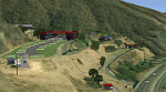
Private heliport El Avila is one of the FBO (Facilities-Based Operator) largest in South America, adapted to the latest technology. Located 9 km from Caracas, capital of Venezuela. New in FSX.
With photo-terrain scenery from satellite imagery of Google Earth.
Not compatible with versions prior to FSX.
This scenery requires SP1, SP2, or the Acceleration expansion pack in order to be displayed correctly.
Also includes a friendly Auto-Install.
| Filename: | El_Avila_Heliport_SVHA__Venezuela.zip |
| License: | Freeware |
| Added: | 13th July 2013, 19:20:04 |
| Downloads: | 952 |
| Author: | David Maldonado |
| Size: | 73.99 MB |
| Category: Flight Simulator X - Scenery | |
| Puerto Ordaz (SVPR) - Venezuela |
|
File Description:
The International Airport Manuel Carlos Piar, is the sixth airport
in importance inside Venezuela and the principal air terminal of the
south of the country. Puerto Ordaz is a planned city in southern Venezuela.
Founded in 1952 as a mining export port on the banks of the Caroni River.
Photo-terrain area improved with Autogen files.
Only compatible with versions to FSX, P3Dv1.x or P3Dv2.x.
Also includes a friendly Auto-Install.
| Filename: | Puerto_Ordaz_SVPR__Venezuela.zip |
| License: | Freeware |
| Added: | 17th March 2014, 05:33:05 |
| Downloads: | 2,235 |
| Author: | David Maldonado |
| Size: | 104.69 MB |
| Category: Flight Simulator X - Scenery | |
| Ireland EIKN Knock Airport |
|
File Description:
Ireland West Airport Knock is a small airport on the West coast of Ireland. The runway is 7,500feet in length and has landed 747's in comfort. In 2010, passenger numbers were almost 600,000. The scenery includes custom buildings, aircrew, default and custom vehicles with specular shine and reflections. It also includes sound effects and some animations. Parts of the scenery can be switched on or off according to user preference. Please enjoy.
| Filename: | Ireland_EIKN_Knock_Airport.zip |
| License: | Freeware |
| Added: | 26th October 2011, 01:53:46 |
| Downloads: | 4,977 |
| Author: | George Keogh |
| Size: | 53.93 MB |
| Category: Flight Simulator X - Scenery | |
| WMKK Kaula Lumpur International Airport |
|
Images related to this file:
File Description:
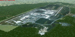
Kaula Lumpur International Airport.
FSX freeware scenery for KLIA, main airport
of Malaysia. This file include photoscenery, generic buildings and default jetways to fit on the right place of real world airport. Almost all the things in default one are in the wrong place. All the objects in the airport is made from default textures and XML files, so the frame rate should not be a problem. By Jirayu Tanabodee from A_A Sceneries.
| Filename: | WMKK_Kaula_Lumpur_International_Airport.zip |
| License: | Freeware, limited distribution |
| Added: | 11th July 2012, 04:04:19 |
| Downloads: | 7,822 |
| Author: | Jirayu Tanabodee |
| Size: | 4.67 MB |
| Category: Flight Simulator X - Scenery | |
| YKEB Kellerberrin, Western Australia |
|
File Description:
YKEB Kellerberrin was modelled at the request of Councillor Cole. In this updated version, the silos have been added and the landclass for the town south of the highway has been masked giving a more realistic impression from the air. Kellerberrin is a town in the Wheatbelt region of Western Australia, 205 kilometres east of Perth on the Great Eastern Highway. The railway line from Northam to Southern Cross was constructed through here in 1893-94, and this section opened for traffic in 1895. Kellerberrin was one of the original stations when the line opened. By 1898 there was a demand for small blocks of land in the area, and the government surveyed a number of 20-acre lots the same year. The area was gazetted as Kellerberrin townsite in 1901, and the government soon made more land available for settlers. Early settlers from 1890 to 1910 from Ireland settled in the area of Kellerberrin and Wittem. Their family name
was English. A road was named after this family. The name Kellerberrin is Aboriginal, and is derived from the name of a nearby hill. The hill was first recorded as "Killaburing Hill" by an explorer in 1861, but in 1864 the explorer Charles Hunt recorded it as Kellerberrin Hill. One source claims that Kellerberrin is the name for the fierce ants that are found in the area, while another gives it as meaning "camping place near where rainbow birds are found" - kalla means camping place or place of, and berrin berrin is the rainbow bird. (repeating the name makes it plural) It also serves as a stop on the Prospector and Avonlink rural train services. REQUIRES Blencowe_LibraryKit.zip
REQUIRES blencowe_librarykit_309494.zip (Available HERE)
| Filename: | YKEB_Kellerberrin_Western_Australia.zip |
| License: | Freeware |
| Added: | 28th February 2013, 13:52:02 |
| Downloads: | 246 |
| Author: | Alan Blencowe |
| Size: | 2.69 MB |
| Category: Flight Simulator X - Scenery | |
| X2CB - RAF Chilbolton - Hampshire, England |
|
File Description:
RAF Chilbolton (ICAO X2CB) is a former Royal Air Force station in Hampshire, England. The airfield is located in Chilbolton approximately 4 miles (6.4 km) south-southeast of Andover; about 62 miles (100 km) southwest of London Opened in 1940, it was used by both the Royal Air Force and then later by the United States Army Air Forces. During the war it was used primarily as a troop carrier airfield for parachutists. After the war it was used for jet aircraft testing before being closed in 1946. Today the remains of the airfield are located on private property being used as agricultural fields.
| Filename: | X2CB__RAF_Chilbolton__Hampshire_England.zip |
| License: | Freeware |
| Added: | 1st April 2016, 08:06:40 |
| Downloads: | 115 |
| Author: | Terry Boissel |
| Size: | 2.77 MB |
| Category: Flight Simulator X - Scenery | |
| X3SY - RAF Saltby - Leicestershire, England |
|
File Description:
RAF Saltby (ICAO X3SY)was a World War II airfield in Leicestershire, England. The airfield is located approximately 8 miles (13 km) northeast of Melton Mowbray; about 90 miles (140 km) north-northwestof London.
It was opened in 1942, and was used by both the Royal Air Force and United States Army Air Forces. During the war it was used primarily as a transport airfield. Like many airfields of the time it closed after the war in 1945 but kept in reserve until 1955.
Today the remains of the airfield are located on private property and, now known as Saltby Airfield, is used primarily for gliding.
Source: Wikipedia
| Filename: | X3SY__RAF_Saltby__Leicestershire_England.zip |
| License: | Freeware |
| Added: | 27th April 2016, 15:39:01 |
| Downloads: | 130 |
| Author: | Terry Boissel |
| Size: | 1.36 MB |


© 2001-2026 AVSIM Online
All Rights Reserved
Privacy Policy |