
Where Flight Simulation Enthusiasts Gather from Around the World!
AVSIM Library - Search Results

| Category: Flight Simulator X - Scenery | |
| HALA - Hawassa Intl. - Hawassa, Ethiopia |

|
Images related to this file:
File Description:
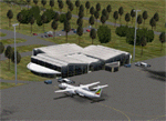
This project adds the booming city of Hawassa, Ethiopia, creates the new international airport (HALA), moves (and rebuilds) the downtown airport (recoded to HALX), and includes AI flight plans for the Ethiopian Airlines service that began April 2016. Tested in both the default FSX: Acceleration and with FTX Global/Vector, accurate coastlines, lakes, road data, and SRTMGL1 (30m) mesh, as well as corrected landclass are provided based on the latest available satellite imagery. The Hawassa International Airport was created using information from the current satellite footprint and the promotional video from Ethiopian Airports Enterprise (EAE). Although there is still very little published data on the airport, it is fully functional.
Updates were created or rebuilt in a manner which carefully aligns airport data with current satellite imagery. Scenery was created using Airport Design Editor X v1.70.6042, SBuilderX 3.13, and the FSX Object Placement Tool. Scenery objects were added and modified from stock FSX scenery to resemble as closely as possible the actual airports. The FSX apron lights included are from the set created by Jim Dhaenens. Thanks to Ron Blehm for bringing this part of the world to my attention.
| Filename: | HALA__Hawassa_Intl___Hawassa_Ethiopia.zip |
| License: | Freeware |
| Added: | 20th July 2016, 09:06:40 |
| Downloads: | 1,016 |
| Author: | Carlyle Sharpe |
| Size: | 10.41 MB |
| Category: Flight Simulator X - Scenery | |
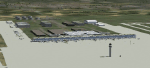
| KBUF Buffalo-Niagra International. Buffalo, NY. |
|
File Description:
KBUF Buffalo-Niagra International Airport. Buffalo, NY. This file if for FSX SP2 only. SP2 is needed to see some of the scenery extras that were added. All gates are correct and visible. All airlines and Cargo carriers and military ramps added. Some new buildings added. Plus many extras.
| Filename: | KBUF_BuffaloNiagra_International_Buffalo_NY.zip |
| License: | Freeware |
| Added: | 21st November 2010, 17:44:14 |
| Downloads: | 1,581 |
| Author: | Rob Touchtone |
| Size: | 198.33 KB |
| Category: Flight Simulator X - Scenery | |
| TNCM - Princess Juliana Intl. Airport - St Maarten |
|
Images related to this file:
File Description:

FSX Scenery--Princess Juliana International Airport (TNCM) in Saint Marteen, Netherlands Antilles. Tested with WOAI, UGA and Alpha India AI packages. Features detailed gate positions and names, parking lights, GA parking and business jets parking. Runway numbers corrected. Adds new terminal, built with default buildings. by Giorgio Nicola.
| Filename: | TNCM__Princess_Juliana_Intl_Airport__St_Maarten.zip |
| License: | Freeware, limited distribution |
| Added: | 7th February 2011, 14:22:41 |
| Downloads: | 11,015 |
| Author: | Giorgio Nicola |
| Size: | 650.91 KB |
| Category: Flight Simulator X - Scenery | |
| Utah Complete v1.0 with Salt Lake City International Airport (KSLC) Scenery |
|
File Description:
This download includes Utah Complete v1.0 with my Salt Lake City International Airport Scenery. Utah Complete is a widespread project covering much of the state of Utah. This scenery upgrades the landscape, adds many scenery objects, improves many Utah airports, corrects flaws in default scenery, adds ski trails at ski resorts, enhances terrain in select locations, and provides an overall more realistic experience. In addition, Salt Lake City International Airport (KSLC) has been significantly improved with new custom GMAX buildings (including the terminal complex), updated AFCAD, and more realistic object placement. Other airports featured include: Provo (KPVU), Ogden (KOGD), St. George (KSGU), Logan-Cache (KLGU), Heber Valley (36U), Cedar City (KCDC), Moab (KCNY), Vernal (KVEL), and more!
| Filename: | Utah_Complete_v10_with_Salt_Lake_City_Internationa.zip |
| License: | Freeware, limited distribution |
| Added: | 19th September 2007, 00:44:01 |
| Downloads: | 16,739 |
| Author: | James Udall |
| Size: | 4.19 MB |
| Category: Flight Simulator X - Scenery | |
| 9K2 - Kokhanok Airport Kokhanok, Alaska, USA |
|
Images related to this file:
File Description:
The airport is referred to by the International Air Transport Association (IATA) using the airport code KNK. The Federal Aviation Administration (FAA) uses the abbreviation 9K2.
Changes: Increased size of parking apron. Changed runway from 2,900 ft long and 60 feet wide to 3,300 ft. long and 75 feet wide. Also added additional parking and custom models.Changes were based on 2005 construction plans.
Created with Airport Design Editor 9x by ScruffyDuck Software using current FAA documentation and Google Earth measurements, this package offers a replacement for FSX's stock airport. All these enhancements are as close to the real airport as I can get with stock library objects and custom buildings.
| Filename: | 9K2__Kokhanok_Airport_Kokhanok_Alaska_USA.zip |
| License: | Freeware |
| Added: | 22nd December 2014, 15:22:44 |
| Downloads: | 780 |
| Author: | Wayne Roberts |
| Size: | 378.52 KB |
| Category: Flight Simulator X - Scenery | |
| KUTS - Huntsville Airport - Texas, USA |
|
Images related to this file:
File Description:
FSX Scenery - Bruce Brothers Huntsville Regional Airport, also known as Huntsville Municipal Airport, (IATA: HTV, ICAO: KUTS, FAA LID: UTS), is a city owned, public use airport located two nautical miles (4 km) northwest of the central business district of Huntsville, a city in Walker County, Texas, United States. It is included in the National Plan of Integrated Airport Systems for 2011-2015, which categorized it as a general aviation facility. Although most U.S. airports use the same three-letter location identifier for the Federal Aviation Administration (FAA) and International Air Transport Association (IATA), this airport is assigned UTS by the FAA and HTV by the IATA. For your flying pleasure by John B. Loney, Jr.
| Filename: | KUTS__Huntsville_Airport__Texas_USA.zip |
| License: | Freeware, limited distribution |
| Added: | 7th September 2015, 22:30:00 |
| Downloads: | 459 |
| Author: | John B. Loney, Jr. |
| Size: | 8.64 MB |
| Category: Flight Simulator X - Scenery | |
| VVCS - Con Dao Airport, Con Son Island, Vung Tau Province, Vietnam |
|
Images related to this file:
File Description:
Côn Äảo Airport or Cá» á»ng Airport (IATA: VCS, ICAO: VVCS) (Vietnamese: Sân bay Cá» á»ng) is located on Côn SÆ¡n Island, the largest island of Côn Äảo archipelago off the coast of Bà Rịa–VÅ©ng Tà u Province, Vietnam.
There is Vietnam Airlines operated by VASCO fly from and to here from Can Tho Airport and Tan Son Nhat International Airport.
There are also 3 battlecruisers, 3 destroyers, 1 aircraft carrier and an oil tanker. They depart from Con Dao Airport at 7 A.M with FSX system time.
You should install FTX ORBX global (And Vector if possible)
| Filename: | VVCS__Con_Dao_Airport_Con_Son_Island_Vung_Tau_Prov.zip |
| License: | Freeware |
| Added: | 1st July 2017, 18:26:23 |
| Downloads: | 1,037 |
| Author: | Minh Bui |
| Size: | 30.55 MB |
| Category: Flight Simulator X - Scenery | |
| TBPB |
|
File Description:
Grantley Adams International Airport (GAIA), (IATA: BGI, ICAO: TBPB) is found in Seawell, Christ Church on the island of Barbados. The former name of the airport was Seawell Airport before being dedicated in honour of the first Premier of Barbados, Sir Grantley Herbert Adams in 1976. The airport's timezone is GMT �4, and is located in World Area Code region #246 (by the U.S. Department of Transportation). GAIA is the only designated port of entry for persons arriving and departing by air in Barbados.
| Filename: | TBPB.zip |
| License: | Freeware |
| Added: | 5th May 2011, 21:58:21 |
| Downloads: | 1,448 |
| Author: | Anwar Gonzalez |
| Size: | 12.9 KB |
| Category: Flight Simulator X - Scenery | |
| EDDB BBI Berlin Brandenburg International |
|
Images related to this file:
File Description:
This is a FS-X conversion of my FS2004 freeware scenery for EDDB, BBI (former Berlin Schoenefeld after its extension to Berlin Brandenburg International). It is made by photos and maps from drafts and pictures of an exhibition and is therefore a fictional airport which not yet exists! The airport should be ready to use in 2011 and replayce SXF/EDDB, THF/EDDI and TXL/EDDT. Parts based on ga_eddb1 by Georg Aubele with his kind permission. Cleared to land - before the airport is built! 2006-08-07/2010-01-10 by Gernot Zander
| Filename: | EDDB_BBI_Berlin_Brandenburg_International.zip |
| License: | Freeware |
| Added: | 11th January 2010, 10:42:16 |
| Downloads: | 3,960 |
| Author: | Gernot Zander |
| Size: | 2.99 MB |
| Category: Flight Simulator X - Scenery | |
| CYHU Montreal/St-Hubert Airport v1.0 |
|
Images related to this file:
File Description:
Montreal/Saint-Hubert Airport is located 16 km (9.9 mi) east of downtown Montreal.
In operation since 1928, it was Montreal's first and only airport until the construction of Montreal-Pierre Elliott Trudeau International Airport. As of 2011, it is Canada's busiest general aviation airport, and is ranked as Canada's 6th busiest airport by aircraft movements.
What is included in this scenery:
- The airport runways and taxiways had been redone, Taxiway R has been added to better reflect the reality that the default version of FSX;
-All buildings and hangar of the airport;
-All buildings Helicraft (CTG2) and areas for helicopters, static helicopters;
-The new commuter train station;
-Streetlights on 116 highway and Clairevue blvd;
-Several static aircraft and service vehicles and cars parked along the road to the airport;
-Canadian Space Agency;
-The ski resort of St-Bruno;
-All signs track in 3D;
| Filename: | CYHU_MontrealStHubert_Airport_v10.zip |
| License: | Freeware, limited distribution |
| Added: | 29th March 2013, 06:38:12 |
| Downloads: | 5,018 |
| Author: | Pierre Gallant, Jean-Pierre Fillion |
| Size: | 21.31 MB |
© 2001-2026 AVSIM Online
All Rights Reserved
Privacy Policy |