
Where Flight Simulation Enthusiasts Gather from Around the World!
AVSIM Library - Search Results

| Category: Flight Simulator X - Scenery | |
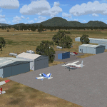
| CYZS Coral Harbor |

|
File Description:
Coral Harbour Airport (IATA: YZS, ICAO: CYZS) is located 6 NM (11 km; 6.9 mi) northwest of Coral Harbour, Nunavut, Canada, and is operated by the government of Nunavut.
This scenery is to be considered Semi Fictional. It is this way as the default is very drab and boring. Please be advised I have set this scenery in what I call transition WX seasons. This means basically what see on charts maybe not accurate and may req you to think ahead to take off and land. WX up here can be no bodies friend and your nightmare if you loose your bearing and mind. So use your melon, eye's and ears, nose or else. the more experience you gain in Arctic flight the better you'll get and you'll see why im advising caution in re WX. Scnery is dedicated to Sidney Schwartz and Gilles Gauthier. This file requires Gilles Gauthier's Nunavut Landscapes file name Nunavut_landscape.zip. It also requires Sidney Schwartz's Baggage carts file name baggage_carts_ss.zip
| Filename: | CYZS_Coral_Harbor.zip |
| License: | Freeware, limited distribution |
| Added: | 4th April 2011, 22:03:38 |
| Downloads: | 960 |
| Author: | Tim Hobin |
| Size: | 1.47 MB |
| Category: Flight Simulator X - Scenery | |
| KORD-Chicago O'Hare 2018 |
|
File Description:
Chicago O'Hare 2018
===================
This airport has been undergoing frequent change ever since I first landed there in 2005. Fortunately, the core buildings have remained essentially the same, but runways have come and some have gone.
I got very close to releasing a 2016 version, but held back for more data. Then I looked again this year and discovered another runway gone, new ones in construction etc.
So, what I have decided to release is basically as up to date as I can make it, using Google Earth to judge the state of things in March 2018, and Charts from August 18th 2018. A lot of Taxiway labelling has changed yet again, and I dare say I've missed some of the taxi signs. One taxiway isn't on the March image, but is on the chart, so I've added it as best I can.
I think this will always be a work in progress.
| Filename: | KORDChicago_OHare_2018.zip |
| License: | Freeware |
| Added: | 20th August 2018, 15:50:08 |
| Downloads: | 1,775 |
| Author: | Martin Connor |
| Size: | 20.5 MB |
| Category: Flight Simulator X - Scenery | |
| Wynoochee Lake WA - (Bob's Fly-in Cabin) |
|
File Description:
Wynoochee Lake WA (Bob's Fishing Cabin) - Airport ID: BOB (FSX). - -
This is a fictitious fly-in lodge that I created for a quiet spot to fly into for weekend trips from the Seattle area. My cabin is located about 40 miles due south of Port Angeles, WA and about 50 miles due west of Seattle. - -
Wynoochee Lake is a real location, but my scenery around the lake is fictitious. - -
You will find my dirt airstrip to be quite challenging, although completely fly-able. My location is even more challenging at dawn or dusk with Weather. There are no approach lights, its just a rugged bush strip. - -
It is extra challenging with crash detection turned on - watch out for those birds, they're everywhere and that old tree just of the side of the dirt strip - don't get too close! - -
This is freeware. I hope you enjoy it. - -
Designed with the FS X Sdk Scenery function of the Mission builder,Abacus Scenery shortcut tool and Lee Swordy's AFCAD. - -
This scenery is frame rate friendly. - - Please read the "readme" - -
by Bob Caparoula
www.flydeervalley.com
| Filename: | Wynoochee_Lake_WA___Bobs_Flyin_Cabin.zip |
| License: | Freeware |
| Added: | 2nd February 2007, 21:10:37 |
| Downloads: | 1,455 |
| Author: | Bob Caparoula |
| Size: | 4.64 KB |
| Category: Flight Simulator X - Scenery | |
| Neujellingsdorf/Fehmarn, Germany ** Version 1.2 ** |
|
Images related to this file:
File Description:
This Version is only a small update wich makes the scenery a bit more realistic.
This small private Airstrip is situated on the island of Fehmarn in nothern Germany. It does not exist in the standard FSX. Because this strip does'nt have an ICAO-code I created one: ED01. Under this code you can find the airstrip in the FSX airport list.
I addited a photo-based background featuring all four seasons, although this airstrip is closed during the winter in real life.
During the summerseason it is mainly used for sightseeing trips over Fehmarn with a C172 offered by the one-aircraft-company "Fehmarn Air" (http://www.fehmarn-air.de/).
Libraries needed to install first if not already installed:
http://library.avsim.net/download.php?DLID=192454
B: FlightPort Dynamic Library_FSX for a lot of other objects
http://www.flightport.de/libraries/flightport-library/
C: FS_Piloten_Objektlibary
http://www.fs-piloten.de/thread.php?threadid=1063&sid=d07a13eb9fcb4469700df5c3de1fd6c1
| Filename: | NeujellingsdorfFehmarn_Germany__Version_12_.zip |
| License: | Freeware |
| Added: | 16th July 2016, 18:01:47 |
| Downloads: | 784 |
| Author: | Wolfgang Allers |
| Size: | 27.05 MB |
| Category: Flight Simulator X - Scenery | |
| Mid West Victoria UPDATED. 14 airports. YARA YSWL YMBU YSTA YDOD YWYF YBIR YHPN YKER YSLK YSWH + *NEW* YNHL YHML YWKB |
|
Images related to this file:
File Description:
This is an updated version (original Jan 2018). Fixed some ground texture problems plus a lot of added and improved objects and 3 NEW airports. There are 14 airports starting at Ararat and extending up to the Murray at Swan Hill. YARA Ararat YSWL Stawell YMBU Maryborough YSTA Saint Arnaud YDOD Donald YWYF Wycheproof YBIR Birchip YHPN Hopetoun YKER Kerang YSLK Sealake YSWH Swanhill + *NEW* YNHL Nhill YHML Hamilton YWKB Warracknabeal. A lot of airports but not a quicky slap dash effort. It is several hundred hours over many months. Surrounding scenery modified to match real life. Towns, race courses, forests, sewage treatment ponds, obstacles (towers etc) have been added. Included is an AI traffic file that covers all airports that don't already have AI. These files are for Flight Simulator X. Made using Airport Design Editor using some objects borrowed from Robert Budd's excellent Baccus Marsh. RECOMMENDED The scenery is designed to interface with ORBX FTX_AU scenery for Australia (payware). It will work without ORBX but will not interface as well with standard scenery.
| Filename: | Mid_West_Victoria_UPDATED_14_airports_YARA__YSWL__.zip |
| License: | Freeware |
| Added: | 16th May 2019, 18:19:35 |
| Downloads: | 418 |
| Author: | Colin Jeffery |
| Size: | 5.23 MB |
| Category: Flight Simulator X - Scenery | |
| LEMG-Xv4 |
|
Images related to this file:
File Description:
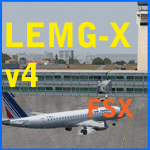
Shortly after the release of LEMG-Xv3 I've noticed it contained too many errors..A complete redo of the RWY 13+31 entrances. It's a little more complicated then FSX made it look like. Yet after finishing v4 I discovered a picture of the building of a second runway. I've tried to include this in my scenery. As in the pictures,it's under construction. This is the 2011situation. Includes D gates [T3 terminal] Jetways at the "D" gates now working. Removed buildings in the area, near the north side of the airport to make room for the new Runway. Adjusted Apron A1 for small aircraft. Added several parking spaces [A2 an A1 platform] Added some static planes on request. After some trial and error actions I was finally able to make some transitions plus missed approaches. You'll now have a proper RWY 13 - MAR transition [ILS13 in the GPS] A GDA Transition to [BLN2B / VIBAS1K] plus VJF1B STAR] Freeware scenery for FSX, just for fun.Made with ADE 1.47.07 Happy Landings!
| Filename: | LEMGXv4.zip |
| License: | Freeware, limited distribution |
| Added: | 30th April 2011, 00:16:20 |
| Downloads: | 2,324 |
| Author: | Joost Visser |
| Size: | 13.35 MB |
| Category: Flight Simulator X - Scenery | |
| CYBL (2011) Version 2 for FS9, FSX and Prepar3D |
|
Images related to this file:
File Description:
CYBL (2011) portrays the Campbell River (British Columbia, Canada) Airport and surrounding area, including the BC Forest Service tanker base, as it appeared in late 2011. (Campbell River, a small city mid-way up the eastern shore of Vancouver Island, is the "salmon capital" of North America and the gateway to Desolation Sound - summer cruising grounds for thousands of yachts from across the Pacific Northwest. Hence, CYBL is host to a lot of visiting GA.) This add-on includes a selection of Custom AI and static aircraft painted to represent aircraft based or often seen at CYBL. CYBL has recently completed a major runway extension and terminal upgrade - both of which are reflected in CYBL (2011). CYBL (2011) is compatible with BC Roads (FS9 only), ORBX FTX USA Canada Pacific Northwest and both FS9 and FSX versions of Ultimate Terrain.
Generally, this new version is visually identical to its predecessor - even though quite different internally. As well, to the extent possible, it is compatible with Prepar3Dv2. (v2.03 fixes a vehicle texture issue in 2.02)
| Filename: | CYBL_2011_Version_2_for_FS9_FSX_and_Prepar3D.zip |
| License: | Freeware, limited distribution |
| Added: | 22nd June 2014, 17:20:43 |
| Downloads: | 4,228 |
| Author: | Don Grovestine |
| Size: | 43.78 MB |
| Category: Flight Simulator X - Scenery | |
| CYXX (2012) Version 2 for FS9, FSX and Prepar3D |
|
Images related to this file:
File Description:

CYXX (2012) portrays the Abbotsford (British Columbia, Canada) Airport - home of the Abbotsford Air Show - and surrounding area as it appeared in late 2012. Abbotsford lies just east of Vancouver and only a short distance north of the US border. CYXX is home to Conair Aviation (a large operator of forest fire-fighting air-tankers), Cascade Aerospace (a major aircraft maintenance operation) and several helicopter training, service and operations facilities.) The recently completed major runway and taxiway extensions are reflected in CYXX (2012). This add-on includes a large selection of custom AI and static aircraft painted to represent airline and privately-owned aircraft based or often seen at CYXX, including every aircraft type currently operated by Conair. CYXX (2012) is compatible with BC Roads (FS9 only), Vancouver+, ORBX FTX USA Canada Pacific Northwest and both FS9 and FSX versions of Ultimate Terrain.
Generally, this new version is visually identical to its predecessor - even though quite different internally. As well, to the extent possible, it is compatible with Prepar3Dv2.
| Filename: | CYXX_2012_Version_2_for_FS9_FSX_and_Prepar3D.zip |
| License: | Freeware, limited distribution |
| Added: | 20th June 2014, 11:41:28 |
| Downloads: | 4,763 |
| Author: | Don Grovestine |
| Size: | 108.71 MB |
| Category: Flight Simulator X - Scenery | |
| NAS Sunnyvale CA (KNUQ) |
|
Images related to this file:
File Description:

In 1931, the city of Sunnyvale acquired a 1,000 acre (4 km���²) parcel of farmland bordering San Francisco Bay, then "sold" the parcel for $1 to the US government as a home base for the Navy airship USS Macon.
The location proved to be ideal for an airport, since the area is often clear while other parts of the San Francisco Bay are covered in fog. This is due to the Coast Range to the west which blocks the cold oceanic air which is the cause of San Francisco fog.
The base, originally named Airbase Sunnyvale CAL (it was thought that calling it Mountain View would cause officials to fear airships colliding with mountainsides), was accepted by the U.S. Navy on February 12, 1931 and dedicated NAS Sunnyvale on April 12, 1933. After the death of Rear Admiral William A. Moffett, in the loss of the USS Akron on April 4, 1933, the Air Field (but not the Naval Air Station) was renamed Moffett Field on September 1, 1933.
| Filename: | NAS_Sunnyvale__CA_KNUQ.zip |
| License: | Freeware |
| Added: | 6th October 2010, 00:16:16 |
| Downloads: | 768 |
| Author: | John Stinstrom & Jim Dhaenens |
| Size: | 7 MB |
| Category: Flight Simulator X - Scenery | |
| Area 51 V1.1 |
|
Images related to this file:
File Description:
In V1 I added tower comms, taxiways/signs, and deleted start points for all those dirt & other closed runways and made the primary/secondary 14/32.
In V1.1 I have gone through the rest of the airport, aligning and cleaning up scattered oddly placed buildings and placed them in a logical manner - aligned with roads. with parking lots and/or pavement or concrete around their base. Gravel roads added thru the warehouses, sand maintenance roads to water tower and power station, Rec center pool and ballfield touched up. Fire station is in same place but turned towards flight line and added the trucks an ambulance. Fencing all around the flight line.
Also you get the F-117 and Janet 737 WITH traffic file. The Janet 737 is the shuttle aircraft for the Area 51 workers. Watch as the Janet flights arrive each morning from KLAS and depart each night Mon-Fri. KLAS (Las Vegas) Bgl also included with assigned parking at the Janet Terminal.
| Filename: | Area_51_V11.zip |
| License: | Freeware |
| Added: | 24th October 2014, 11:47:01 |
| Downloads: | 2,456 |
| Author: | Jeff Reed |
| Size: | 17.66 MB |
© 2001-2026 AVSIM Online
All Rights Reserved
Privacy Policy |