
Where Flight Simulation Enthusiasts Gather from Around the World!
AVSIM Library - Search Results

| Category: Flight Simulator X - Scenery | |
| Centrair RJGG V3.0 complete |

|
Images related to this file:
File Description:
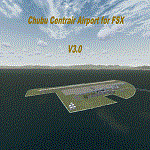
Chubu Centrair International Airport (IATA: NGO, ICAO: RJGG) is an airport on an artificial island in Ise Bay, 22 miles south of Nagoya in central Japan. Chubu is Japan's third off-shore airport, after Nagasaki Airport and Kansai International Airport, and is also the second airport built in Japan on a man-made island.
In this final version are added:
cars on parking garages
parking areas
static Air stairs
more realistic bagage loader
ANA logo on ground vehicles
Changed Skychefs catering trucks to NAC ( Nagoya Air Catering) catering trucks as in real life
benches on Chubu Airport's Sky Deck
lights on some static vehicles at night
fixed the readme desciption
| Filename: | Centrair_RJGG_V30_complete.zip |
| License: | Freeware |
| Added: | 20th November 2011, 00:13:22 |
| Downloads: | 8,051 |
| Author: | Morten Thomas van der Linden |
| Size: | 43.07 MB |
| Category: Flight Simulator X - Scenery | |
| LATI - Tirana Intlnational Airport Nene Tereza - Tirana, Albania |
|
File Description:
Tirana International Airport Nene Tereza (IATA: TIA, ICAO: LATI) is Albania's only international airport. It is commonly known as Rinas International Airport, as it is located 6 NM (11 km; 6.9 mi) northwest of Tirana, in the village of
Rinas. In 2001, the airport was named after Mother Teresa. Tirana International Airport Nene Tereza was constructed in a period of two years, from 1955 to 1957.
After the fall of communism political and social changes caused an increase in the number of airlines operating in the airport. Notably its reconstruction, started in 2005 and terminated in 2008, made possible a relevant increase in
the processing capacity of the airport, which saw its number of passengers per year doubling from 2005 to 2010, when it reached 1.5M. The airport currently has a capacity to process 1.8M passengers per year and it is thought that such
capacity will suffice to handle the expected increase given the visa liberalization for the citizens of Albania in the Schengen Area, which started at the end of 2010.
This file has the right coordenates, with the apron and characteristics of the airport and buildings, also it is set to the correct altitud of 126 feet or 38 meters.
| Filename: | LATI__Tirana_Intlnational_Airport_Nene_Tereza__Tir.zip |
| License: | Freeware |
| Added: | 24th October 2012, 22:31:54 |
| Downloads: | 6,417 |
| Author: | Anwar Gonzalez |
| Size: | 5.62 MB |
| Category: Flight Simulator X - Scenery | |
| Avalon Airport |
|
File Description:
Avalon airport is an airport in Victoria Australia it is only about a 15 minute flight from Melbourne International airport it is one of the hubs for Low cost airline Jetstar. In FSX its scenery is very sparse considering it is the location of the Australian international Air show. I have created this scenery with Abacus Scenery editor and it adds an environment which represents an Air Show it also adds a terminal (not exact to the real one) and a few other enhancements to the Airport environment.
Note, uses default AFCAD
| Filename: | Avalon_Airport.zip |
| License: | Freeware, limited distribution |
| Added: | 27th February 2007, 02:43:58 |
| Downloads: | 2,046 |
| Author: | Scott Hickey |
| Size: | 444.98 KB |
| Category: Flight Simulator X - Scenery | |
| SLET - El Trompillo Airport - Santa Cruz de la Sierra, Bolivia |
|
File Description:
El Trompillo Airport (IATA: SRZ, ICAO: SLET) is located in the south part of Santa Cruz de la Sierra, Bolivia, about 2 km (1.25 miles) away from the central plaza. Airport type:(Public / Military).
After a series of improvements, in June 3, 2014 Airport regained its status as an international airport by converting to Santa Cruz de la Sierra in Bolivia the only city with two international airports, international airport suitable as retention and/or support times of high demand in the Viru Viru Airport (ICAO: SLVR) can not supply completely.
The airport operates 24 hours and resides at an elevation of 1,371 ft (418 m) above mean sea level. Have one runway designated 15/33 with an asphalt surface measuring 8,967 by 114.82 ft (2,733 m by 35 m), El Trompillo Tunnel for vehicles, passes under the runway and connects the 4th ring (considered the most important highway in the city).
Compatible with both FSX and P3D.
| Filename: | SLET__El_Trompillo_Airport__Santa_Cruz_de_la_Sierr.zip |
| License: | Freeware |
| Added: | 19th November 2015, 09:49:14 |
| Downloads: | 1,830 |
| Author: | Marcos A. Rivas Torrez |
| Size: | 16.68 MB |
| Category: Flight Simulator X - Scenery | |
| vobl2020 |
|
Images related to this file:
File Description:
Kempegowda International Airport (IATA: BLR, ICAO: VOBL) is an international airport serving Bengaluru, the capital of the Indian state of Karnataka, in the Southern part of India. Spread over 4,000 acres (1,600 ha), it is located about 30 kilometres (19 mi) north of the city near the suburb of Devanahalli. It is owned and operated by Bengaluru International Airport Limited (BIAL), a public–private consortium.
This scenery is an update to the scenery created by Morten Thomas Van Der Linden. Includes the new south runway 27L/09R and updated taxiways, aprons (T2 aprons), parking stands (upto Stand 112) and radio frequencies. PLEASE FOLLOW INSTRUCTIONS PROVIDED IN THE READ ME TEXT FILE.
| Filename: | vobl2020.zip |
| License: | Freeware |
| Added: | 4th November 2020, 19:53:07 |
| Downloads: | 1,370 |
| Author: | Brandon Rodrigues |
| Size: | 22.27 MB |
| Category: Flight Simulator X - Scenery | |
| KPVD, Theodore Francis Green State Airport, Providence, Rhode Island |
|
Images related to this file:
File Description:
Complete new setup, done with ADE, from top-down images. T.F. Green Airport is 6 miles south of Providence. It is a public international airport, categorized by the FAA as a small hub primary commercial service facility.
| Filename: | KPVD_Theodore_Francis_Green_State_Airport_Providen.zip |
| License: | Freeware |
| Added: | 24th November 2017, 17:25:20 |
| Downloads: | 1,269 |
| Author: | Tim van Ringen |
| Size: | 727.13 KB |
| Category: Flight Simulator X - Scenery | |
| CYYR, Goose Bay Airport, Labrador Canada |
|
Images related to this file:
File Description:
New setup of this airport I came across in one of my virtual flights. Goose Bay Airport is a major international airport located in Goose Bay, Labrador on Canada's East Coast. It also is operated as an air force base by the Royal Canadian Air Force.
| Filename: | CYYR_Goose_Bay_Airport_Labrador_Canada.zip |
| License: | Freeware |
| Added: | 19th March 2018, 04:11:35 |
| Downloads: | 1,426 |
| Author: | Tim van Ringen |
| Size: | 3.33 MB |
| Category: Flight Simulator X - Scenery | |
| China International Airports: ZBTJ Tianjin / Binhai - Update |
|
Images related to this file:
File Description:

Tianjin Binhai International Airport in FSX is outdated. This scenery represents the airport as it is in 2021. The layout of the airport corresponds to satellite images and actual charts, the buildings are made with GMAX. In this update a missing model for the airbridges was added.
| Filename: | China_International_Airports_ZBTJ_Tianjin__Binhai_.zip |
| License: | Freeware, limited distribution |
| Added: | 9th October 2021, 20:53:29 |
| Downloads: | 718 |
| Author: | Winfried Orthmann |
| Size: | 65.02 MB |
| Category: Flight Simulator X - Scenery | |
| SVCS |
|
File Description:
Oscar Machado Zuloaga International Airport is an small airport locate in the town of Charallave in the Miranda state, Venezuela.
This file has the right coordinates, with the apron and characteristics of the airport. The runways and runways were resized the gates placed on correct location.
| Filename: | SVCS.zip |
| License: | Freeware |
| Added: | 21st April 2011, 23:38:18 |
| Downloads: | 726 |
| Author: | Anwar Gonzalez |
| Size: | 10.17 KB |
| Category: Flight Simulator X - Scenery | |
| Montego Bay Airport Scenery |
|
File Description:
Scenery for Sangster International Airport (MKJS) and surrounding area near Montego Bay, Jamaica. Includes landclass and airport runway-taxiway-parking changes per Google Earth imagery and photos and diagrams provided by Anthony Scott. Also includes a new terminal building and replacement of the "floating" airport generic buildings.
| Filename: | Montego_Bay_Airport_Scenery.zip |
| License: | Freeware |
| Added: | 14th November 2008, 21:56:20 |
| Downloads: | 7,705 |
| Author: | Art Poole |
| Size: | 619.83 KB |
© 2001-2026 AVSIM Online
All Rights Reserved
Privacy Policy |