
Where Flight Simulation Enthusiasts Gather from Around the World!
AVSIM Library - Search Results

| Category: Flight Simulator X - Scenery | |
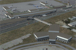
| CYSG - St. Georges Aerodrome - Quebec, Canada - v1.2 |

|
Images related to this file:
File Description:
Saint-Georges Aerodrome, (ICAO: CYSG), is a general aviation aerodrome located 1.5 nautical miles (2.8 km; 1.7 mi) west-southwest of Saint-Georges, Quebec, Canada near the border with Maine. The airport has a long, paved runway, suitable for use by jets. This scenery FSX and P3D Airport St-Georges was inspired by the great FS2004 scenery of the late pilot Virtual Hugues Caron img12. It was made very humbly in his memory. This scenery been validated and tested with FSX SP1, SP2, Acceleration and P3D v2. This is a complete reproduction, more accurate and realistic in Saint-Georges Beauce airport with all the buildings around it. For technical information or assistance contact one of the following email addresses support: [email protected] or [email protected]. Web site : http://imaginairvirtuel.qc.ca
In addition to compatibility P3D added, version 1.2 will replace and improve version 1.1. It is suggested to uninstall version 1.1 and replace it.
| Filename: | CYSG__St_Georges_Aerodrome__Quebec_Canada__v12.zip |
| License: | Freeware, limited distribution |
| Added: | 8th March 2015, 22:27:34 |
| Downloads: | 1,416 |
| Author: | Georges Bourgouin |
| Size: | 7.67 MB |
| Category: Flight Simulator X - Scenery | |
| 3 gps oil platforms addon scenarys from fsxf. For missions. |
|
File Description:
3 GPS oil platforms addon scenarys from FSXF.
All Oil Platforms are in the Gulf of Mecico, They have some ships around them,
FSX-GPS Oil platforms is good for Missions. These are the Mission platforms.
-----------------------------------------------------------------------------------------------
This is for the Layafette oil platform, The airport name is Lafayette Oil Platform.(KLFO) The NDB(none directional beacon) frequency is 477.0,
NDB Range is 100 NM. Layafette Oil platform is 65 NM. South of Layafette Regl. Louisiana-KLFT
-----------------------------------------------------------------------------------------------
This is for the Galveston oil platform, The airport name is Galveston oil platform. (KGLO) The NDB Frequency is 396.0, NDB. range is 100 NM.
Galveston oil platform is 7 NM. South of Scholes Intl. at Galveston Texas-KGLS
---------------------------------------------------------------------------------------------
This is for the Corpus Christi oil platform, The airport name is Corpus Christi oli platform. (KNGO) The NDB Frequency is 391.0. NDB. range is 100 NM.
Corpus Christi oil platform is 7 NM. South of Corpus Christi NAS. Texas-KNGP
------------------------------------------------------------------------------
| Filename: | 3_gps_oil_platforms_addon_scenarys_from_fsxf_For_m.zip |
| License: | Freeware |
| Added: | 4th July 2008, 23:32:50 |
| Downloads: | 1,451 |
| Author: | Timothy T. Marson |
| Size: | 3.35 KB |
| Category: Flight Simulator X - Scenery | |
| LEMG-X-JVX |
|
Images related to this file:
File Description:

LEMG, Malaga, Spain.
Hello Flightsim friends.
This is an reworked ADE [Scruffy Duck] scenery of LEMG, Malaga Airport, Spain, for FSX
It was annoying to find that almost everything was wrong at LEMG in FSX.
Runway numbers, Exits, Entrances to the Apron etc.
I've tried to get all the runways, turn offs and runway signs in their correct positions.
The Runways are now: 13 and 31 instead of 14 and 32
-crows next to entrance D13 at the NW end of the runway 13 and south of the airport almost halfways.-Seagulls next to the shore line.-Fishingships, a Cruiseliner and a freighter at sea.-Oil tanks near Apron entrance D2 [extremely dense setting]- Some military objects on the MIL part of the airport plus extra buildings.-Somewhere in the mountains there should be Eagles I know they are there but heck, I didn't yet see them my self :-) The MAR approach should lead you past them though]
AVSIM upload only
| Filename: | LEMGXJVX.zip |
| License: | Freeware, limited distribution |
| Added: | 1st April 2010, 02:21:00 |
| Downloads: | 1,725 |
| Author: | Joost Visser |
| Size: | 435.24 KB |
| Category: Flight Simulator X - Scenery | |
| MMTJ - Gen Abelardo L Rodriguez Intl - Tijuana, Mexico ----- KSDM - Brown Mun - San Diego, California - USA |
|
Images related to this file:
File Description:
This scenery adds the new Cross Border Xpress (CBX) terminal to MMTJ, which opened on December 9, 2015, making it the first airport in the world to have connecting terminals in two different countries. All of MMTJ is also updated to reflect the most current airport layout. The neighboring KSDM is also completely updated and included in this scenery package. This scenery is optimized to fit seamlessly with FTX Global/Vector and also includes an optional CVX file which adds roads for default FSX users. All elements of both airports were traced directly from current satellite imagery and updated to reflect current satellite positioning. Scenery was created using Airport Design Editor X v1.61.5298, SBuilderX 3.13, and the FSX Object Placement Tool. Scenery objects were added and modified from stock FSX scenery to resemble as closely as possible the actual airports. The FSX apron lights included are from the set created by Jim Dhaenens.
| Filename: | MMTJ__Gen_Abelardo_L_Rodriguez_Intl__Tijuana_Mexic.zip |
| License: | Freeware |
| Added: | 3rd January 2016, 12:58:36 |
| Downloads: | 2,671 |
| Author: | Carlyle Sharpe |
| Size: | 3.58 MB |
| Category: Flight Simulator X - Scenery | |
| LFST - Strasbourg-Entzheim, France |
|
Images related to this file:
File Description:
A very detailed rendition of Strasbourg-Entzheim airport (France).
This scenery has been made for FSX SP2 or Acceleration and DirectX9.
However, it has been tested successfully with DX10 free shaders from Steve Parsons (not tested with DX10 Scenery Fixer SteveFSX)and with Prepar3D v.2.1.
Almost all the buildings have been built accurately, based on numerous pictures.
Runway, taxiways and aprons are covered with textured polygons so as to keep the look of the pavement regardless of extra add-ons installed. These textured polygons enable a smooth transition with the photorealistic ground (blend effect).
Aprons markings are up to date. This scenery is ready to accommodate your AI traffic : the stands are assigned to the main airlines serving the airport and their settings match with the real ones (nose-in, nose-out, drive through).
I have spent more than 2 years to make this photorealistic scenery.
I hope you enjoy discovering Strasbourg airport, have nice flights!
| Filename: | LFST__StrasbourgEntzheim_France.zip |
| License: | Freeware, limited distribution |
| Added: | 9th March 2014, 22:52:25 |
| Downloads: | 16,954 |
| Author: | Jacques-Paul Bollard |
| Size: | 66.87 MB |
| Category: Flight Simulator X - Scenery | |
| KIND - Indianapolis Intl, Indiana, USA |
|
Images related to this file:
File Description:
This is an up-to-date version of Indianapolis Intl airport with two optional files and made only for FSX users, do not use in P3D: There is one version with the Crosswind runway 14/32 activated where all 3 runways will be used for takeoff/landing and one version as the default airport runway operation,
This update removes the "jfk jetways" mainly for those who have had issues installing the textures to get these jetways to display, these jetways have now been replaced by jetway extensions that use there own textures, the terminal and its piers completely rebuilt, assigned parking as per their website with extra parking, the Fedex ramp updated and buildings replaced, all taxiways and taxi signs updated to the latest charts, support vehicle roads rebuilt, extra fuel trucks, Helipad added to the GA apron and many other scenery improvements and objects added, airport views are from inside the control tower (when in tower view) please view the readme before installation.
| Filename: | KIND__Indianapolis_Intl_Indiana_USA.zip |
| License: | Freeware, limited distribution |
| Added: | 11th March 2020, 18:46:54 |
| Downloads: | 30,500 |
| Author: | Ray Smith |
| Size: | 4.2 MB |
| Category: Flight Simulator X - Scenery | |
| GPS Enabled Acceleration Carrier |
|
File Description:
This carrier is for FSX Acceleration owners and allows the user to start from the deck in FSX, by using the supplied airport code EG51. The carrier is the Acceleration model and includes full use of the cat launch and arrestor cable. Their are two models supplied, a static and a moving version. The static version allows the use of GPS approach from any airport in the world, and start from the deck all day. The moving version allows the same features before 7am GMT and after arrival at the destination port at Lands End (10:15am GMT). The user could use the FSX menu to get on board the deck area of this carrier prior to 7am GMT and then sail with it. The Lands End destination allows full use of GPS facilities whilst the carrier is in that port too, EG53 is the airport code. This is from 10:15 to 14:00 GMT before it starts the return journey.
| Filename: | GPS_Enabled_Acceleration_Carrier.zip |
| License: | Freeware, limited distribution |
| Added: | 23rd February 2008, 14:45:52 |
| Downloads: | 1,818 |
| Author: | Steve Brooks |
| Size: | 103.01 KB |
| Category: Flight Simulator X - Scenery | |
| Ireland VFR Small Airports Part 3 |
|
Images related to this file:
File Description:
Ireland VFR Small Airports Part 3. This scenery consists of 1. EIKY Kerry International Airport, 2. EIBN Bantry Airfield, 3. EIBR Birr Airfield, and 4. Clonbullogue Airfield.
Kerry is situated in the South West of Ireland and serves as a gateway to the world famous Lakes of Killarney, The Ring of Kerry and the Dingle Peninsula. Bantry is ideal for visiting the rugged beauty of West Cork. Clonbullogue is home to the Irish Parachute Club and is situated approximately 30 miles southwest of EIDW Dublin. Birr is almost in the centre of Ireland and is home to a very active group of GA aviators.
The scenery has been created almost entirely from real photographs and all objects have been placed accurately using ordinance survey data and satellite imagery. It also includes animated marshallers, aircrew and passengers together with animated animals and vehicles. Appropriate sound effects have been added to each file together with smoke and strobe lighting. Full night lighting is included, with flood and wash lighting of the aprons and carparks. Each airport has been sub-divided into seperate elements, which can be switched on or off according to the users preference and hardware setup. It caters for GA enthuasiasts and for those who prefer to fly the heavies.
This scenery has not been designed as a standalone, it calls on many objects from my Ireland VFR Small Airports parts 1 and 2. It has also been designed to complement photographic scenery but will also work with the default terrain and I have inlcuded a set of landclass and photoreal textures. It also includes an extended set of photoscenery treescapes. Full installation instructions, settings, credits and tips can be found in the README file.
Please enjoy and I hope you like my airports as much as I enjoyed making them.
| Filename: | Ireland_VFR_Small_Airports_Part_3.zip |
| License: | Freeware, limited distribution |
| Added: | 8th April 2012, 22:40:52 |
| Downloads: | 3,746 |
| Author: | George Keogh |
| Size: | 81.33 MB |
| Category: Flight Simulator X - Scenery | |
| Helicopter test at Chittagong |
|
Images related to this file:
File Description:

Chittagong, in Bangladesh, is known for its ship dismantling industry. The scenery is a piloting test, but also a way to make aware of the workers conditions. Even if some building have been added to VGEG, it is not an airport scenery.
| Filename: | Helicopter_test_at_Chittagong.zip |
| License: | Freeware |
| Added: | 20th June 2014, 11:49:42 |
| Downloads: | 333 |
| Author: | Jean-Pierre Fillion |
| Size: | 1.77 MB |
| Category: Flight Simulator X - Scenery | |
| KCTJ - West Georgia Regional Airport/O V Gray Field - Carrollton, GA |
|
File Description:
By request, here is an improved version of the stock West Georgia Regional Airport. I added missing aprons and taxiways,
additional hangars, removed many default buildings and replaced them with more appropriate buildings. Added static
vehicles and airplanes, light poles, and other objects.
| Filename: | KCTJ__West_Georgia_Regional_AirportO_V_Gray_Field_.zip |
| License: | Freeware |
| Added: | 24th December 2008, 02:04:41 |
| Downloads: | 576 |
| Author: | Jim Cook |
| Size: | 6.65 KB |
© 2001-2026 AVSIM Online
All Rights Reserved
Privacy Policy |