
Where Flight Simulation Enthusiasts Gather from Around the World!
AVSIM Library - Search Results

| Category: Flight Simulator X - Scenery | |
| East Coast Victoria v2 for ORBX v2 YLKE Lakes Entrance YGRL Great Lakes Airport YORB Orbost YMCO Mallacoota |

|
Images related to this file:
File Description:
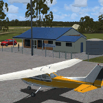
'East Coast Victoria v2' is made to match ORBX Australia v2 scenery. For ORBX v1 or no ORBX use 'East Coast Victoria'. There are 4 airports. YLKE Lakes Entrance YGRL Great Lakes Airport YORB Orbost YMCO Mallacoota. ORBX has done 2 of these (YORB, YMCO) as they have done every airport included with FSX in Australia to a reasonable standard. If I had not already done them for ORBX V1 I would not have bothered. However these are better than ORBX because the surroundings have been modified to match real life. Towns have been added or shifted. Forests cut down or added. There are also custom accurate versions of the terminal buildings. Included is an AI traffic files that covers the airports (little or no traffic from ORBX). In short a lot more time spent by me as I did not have to do every airport in Australia! These files are for Flight Simulator X. Made using Airport Design Editor using some objects borrowed from Robert Budd's excellent Baccus Marsh. REQUIRED The scenery is designed to interface with ORBX FTX_AU V2 scenery for Australia (payware).
| Filename: | East_Coast_Victoria_v2____for_ORBX_v2____YLKE_Lake.zip |
| License: | Freeware |
| Added: | 16th September 2019, 16:27:48 |
| Downloads: | 393 |
| Author: | Colin Jeffery |
| Size: | 6.32 MB |
| Category: Flight Simulator X - Scenery | |
| West Coast Victoria v2 for ORBX v2 YWBL Warrnambool YPOD Portland YPFA Port Fairy |
|
Images related to this file:
File Description:
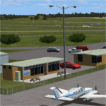
'West Coast Victoria v2' is made to match ORBX Australia v2 scenery. Use 'West Coast Victoria' for ORBX v1 or no ORBX. There are 3 airports YWBL Warrnambool YPOD Portland YPFA Port Fairy. ORBX has done 2 of these (YWBL, YPOD) as they have done every airport included with FSX in Australia to a reasonable standard. If I had not already done them for ORBX V1 I would not have bothered. However these are better than ORBX because the surroundings have been modified to match real life. Towns have been added or shifted. Forests cut down or added. There are also custom accurate versions of the actual terminal buildings. Included are AI traffic files that cover all 3 airports + YHML Hamilton nearby (little or no traffic from ORBX). In short a lot more time spent. ORBX had to do every airport has in Australia! Recommend installing the excellent YHML Hamilton (by Anthony Lynch). These files are for Flight Simulator X. Made using Airport Design Editor using some objects borrowed from Robert Budd's excellent Baccus Marsh and 'Static aircrafts' by Jean-Pierre Fillion. REQUIRED The scenery is designed to interface with ORBX FTX_AU V2 scenery for Australia (payware).
| Filename: | West_Coast_Victoria_v2_for_ORBX_v2____YWBL_Warrnam.zip |
| License: | Freeware |
| Added: | 8th October 2019, 20:00:14 |
| Downloads: | 323 |
| Author: | Colin Jeffery |
| Size: | 8.56 MB |
| Category: Flight Simulator X - Scenery | |
| Murray river and SE Victoria v2 for ORBX v2. YRIO Robinvale YBRN Balranald YDLQ Deniliquin YLEG Leongatha YYRM Yarram |
|
Images related to this file:
File Description:
'Murray and SE Victoria v2' is made to match ORBX Australia v2 scenery. Use 'Murray + SE Victoria airports' for ORBX v1 or no ORBX. There are 5 airports. 3 airports near the Murray river in Victoria and NSW - YRIO Robinvale, YBRN Balranald, YDLQ Deniliquin. 2 airports in SE Victoria - YLEG Leongatha, YYRM Yarram. ORBX has done these as they have done every airport included with FSX in Australia to a reasonable standard. If I had not already done them for ORBX V1 I would not have bothered. However these are better than ORBX because the surroundings have been modified to match real life. Towns have been added or shifted. Forests cut down or added. Race courses, sewage treatment ponds and other stuff added. Local obstacles (towers etc) added. There are Included are 2 AI traffic files that cover the airports. These files are for Flight Simulator X. Made using Airport Design Editor using some objects borrowed from Robert Budd's excellent Baccus Marsh and 'Static aircrafts' by Jean-Pierre Fillion. REQUIRED The scenery is designed to interface with ORBX FTX_AU V2 scenery for Australia (payware).
| Filename: | Murray_river_and_SE_Victoria_v2_for_ORBX_v2_YRIO_R.zip |
| License: | Freeware |
| Added: | 15th December 2019, 19:06:10 |
| Downloads: | 317 |
| Author: | Colin Jeffery |
| Size: | 10.06 MB |
| Category: Flight Simulator X - Scenery | |
| Goma Intl (FZNA) DRC and Gisenyi (HRYG) Rwanda |
|
Images related to this file:
File Description:
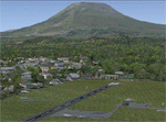
This project includes the neighboring Goma Intl (FZNA) and Gisenyi (HRYG) airports. After Goma's only runway was severely damaged by the eruption of Mount Nyiragongo in 2002, the runway, originally 3000m long, was reduced to 1800m of serviceable pavement after lava flowed onto the northern part runway and through the city center. In 2013, German NGO Welthungerhilfe ("World Hunger Aid") signed a contract to rehabilitate 500m of runway damaged by the lava flow. Goma resumed scheduled international flights in 2015, and this project reflects the airport as of March 2016, with runway 18/36 renumbered to 17/35. SRTMGL1 (30m) mesh brings the volcanoes in the area into much greater detail. This scenery is complimented by the Kigali Intl (HRYR) scenery (FSX_HRYR_Kigali_2016.zip).
Updates were created or rebuilt in a manner which carefully aligns airport data with current satellite imagery. Scenery was created using Airport Design Editor X v1.70.6042, SBuilderX 3.13, and the FSX Object Placement Tool. Scenery objects were added and modified from stock FSX scenery to resemble as closely as possible the actual airports. The FSX apron lights included are from the set created by Jim Dhaenens.
| Filename: | Goma_Intl_FZNA_DRC_and_Gisenyi_HRYG_Rwanda.zip |
| License: | Freeware |
| Added: | 4th August 2016, 21:11:20 |
| Downloads: | 2,284 |
| Author: | Carlyle Sharpe |
| Size: | 5.25 MB |
| Category: Flight Simulator X - Scenery | |
| Bhutan Airports and Paro Valley |
|
Images related to this file:
File Description:
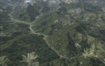
This project adds and updates all of the airports of Bhutan. Bathpalathang (VQBT) and Gelephu (VQGP) are added, Yongphulla (VQ10) is updated and recoded as VQTY, and Paro (VQPR) is fully updated to reflect current satellite imagery. These are all fully functioning AI airports as well. Special attention was given to the entire Paro Valley, and numerous road/river vectors were updated around Gelephu. Accurate coastlines, lakes, road and river data, as well as corrected landclass are provided based on the latest available satellite imagery. They are optimized to fit seamlessly with FTX Vector's roads/water, but they should be fully functional in all FSX configurations.
GA-encoded flight plans for the Buddha Air/Kathmandu charter are provided to enhance service to Paro. NASA SRTM Global 3 arc second terrain mesh is also included for all of Bhutan. Updates were created or rebuilt in a manner which carefully aligned airport data with current satellite imagery, when available. Scenery was created using Airport Design Editor X v1.61.5298, SBuilderX 3.13, and the FSX Object Placement Tool. Scenery objects were added and modified from stock FSX scenery to resemble as closely as possible the actual airports.
| Filename: | Bhutan_Airports_and_Paro_Valley.zip |
| License: | Freeware |
| Added: | 19th January 2015, 06:09:17 |
| Downloads: | 11,446 |
| Author: | Carlyle Sharpe |
| Size: | 21.4 MB |
| Category: Flight Simulator X - Scenery | |
| Remote Tower Base, Washington State USA |
|
File Description:
Remote Tower Base Operations, Washington State - Airport ID: TOWR (FSX). -
OK, all you Rotorheads - This is a fictional version of a very remote Helicopter landing pad on the Olympic Penn.. You must fly a Helo. I created it for my personal enjoyment and now I am releasing to the public as freeware. I hope you enjoy the "eye-candy". There are multiple radio and fire spotting towers in the area to check out. -
At least it gives you something to travel there for. -
This is an extremely challenging spot to land, especially using real Wx. The landing pad is basically a postage stamp. I created it and have a tough time landing here myself, so have fun with this one. -
You may also go directly to this airport by selecting TOWR as your starting airport. I also added a series of images so you can figure out how to get there from somewhere else. If you have my Wynoochie Lake scenery, its only 6 miles from there. (Just a heads-up) -
Designed with the FS X Sdk Scenery function of the Mission builder, Lee Swordy's AFCAD & the Abacus Scenery shortcut tool. -
This scenery is frame rate friendly.
| Filename: | Remote_Tower_Base_Washington_State_USA.zip |
| License: | Freeware |
| Added: | 3rd May 2007, 21:13:18 |
| Downloads: | 759 |
| Author: | Bob Caparoula |
| Size: | 5.85 MB |
| Category: Flight Simulator X - Scenery | |
| YTTI Troughton Island, Western Australia |
|
File Description:
YTTI Troughton Island - ShoreAir operates Troughton Island airstrip as an alternate to Mungalalu-Truscott. It has a 980m x 30m unsealed runway. Troughton Island sits 6 metres above sea level on a natural reef. Troughton is managed by two people who spend one month at a time on the island. During that time they are almost completely isolated from the outside world. Although they are isolated they are not alone; previous occupants of the island brought in quails and children's pythons that were once pets that escaped their cages during a cyclone. Now there is a healthy population of snakes living off the quails. Today Troughton Island is maintained as an emergency landing area for aircraft that are unable to reach Truscott. It also serves as a landing area if Truscott is inaccessible due to weather conditions. The Bureau of Meteorology has a weather station on Troughton island. Mungalalu-Truscott aerodrome supports all the FPSO (floating production storage and offloading facility) operations in the WA and NT waters of the Timor Sea, while the alternate aerodrome at Troughton Island is 20 nautical miles north of the main air route to Timor Sea facilities. REQUIRES Blencowe_LibraryKit.zip
REQUIRES blencowe_librarykit_309494.zip (Available HERE)
| Filename: | YTTI_Troughton_Island_Western_Australia.zip |
| License: | Freeware |
| Added: | 28th February 2013, 14:01:54 |
| Downloads: | 279 |
| Author: | Alan Blencowe |
| Size: | 2.37 MB |
| Category: Flight Simulator X - Scenery | |
| Columbia SC (KCAE) |
|
Images related to this file:
File Description:
The Columbia Metropolitan Airport Authority has provided substantial information about KCAE online, making it possible to pretty accurately model this airport. The taxiway signs have been placed according to exhibits in the airport's certification manual, and taxiway designations have been revised in accordance with upgrades to be effective mid-Novemer 2012. Most buildings have been custom modeled in accordance with information available on the internet, including Microsoft Bing birdseye views. The airport layout and landclass changes are in accordance with Google Earth imagery.
If you have Jim Dhaenens' lightobj.bgl installed, apron lighting will be included, and if you have
KB_static_aircraft_FSX installed (available at www.kb-sim.com/screens_static_aircraft.html),
additional parked aircraft will be visible. The layout of scenery is optimized for use with
Ultimate Terrain X-USA. FSX runs smoothly with this scenery on my computer, but it has not been
tested on a low-end system. Sometime after starting this project, it came to my attention that a
good scenery for KCAE was already available (but not listed at www.freewarescenery.com) from Jim
Hill that is another option as well as adjusting scenery complexity.
The new taxiway designations are not yet shown in the latest observed FAA airport diagram. An airfield sketch provided to pilots by the Columbia Metropolitan Airport is included in the package to show the taxiway designation changes.
| Filename: | Columbia_SC_KCAE.zip |
| License: | Freeware |
| Added: | 14th December 2012, 01:28:23 |
| Downloads: | 1,696 |
| Author: | Art Poole |
| Size: | 3.43 MB |
| Category: Flight Simulator X - Scenery | |
| 52F North West Regional Airport (DFW TX) |
|
Images related to this file:
File Description:
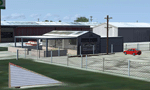
This airport scenery does not require any other software other than Microsoft Flight Sim X SP1 (minimum) - SP2 required for mission and display of some of the scenery items. However, it could help with performance on your PC if you install any accurate photo scenery for DFW. One such scenery is MEGASCENERY DFW photo scenery from http://www.megascenery.com/.
This is a custom developed scenery for airport, 52F - Northwest Regional, Roanoke, TX. 52F is next to Fort Worth Alliance in the Dallas Fort Worth Metroplex. It's a nice little airport.
This scenery package also includes a Mission called "52Foxtrot - Approach to Rwy 35 - Thermals". It is more of a free flight than the traditional FSX missions. The ones who fly for real at 52F-Northwest regional knows the quirks when coming into land at runway 35 on a hot day. The thermals at the cleared land and the sinking feeling when flying over the wooded area nearing the approach to 35. These thermal lifts and sinks have been modeled here. However, the only way to experience these thermals in FSX is via Missions. Once you select the mission "52Foxtrot - Approach to Rwy 35 - Thermals" and by selecting option "Enable changes in selected Mission", you could fly around like you would under "free flight". Except this time, you would have these thermal effects around 52F and get to experience what it's really like to fly and land at 52F.
| Filename: | 52F_North_West_Regional_Airport_DFW_TX.zip |
| License: | Freeware, limited distribution |
| Added: | 24th March 2010, 01:23:59 |
| Downloads: | 3,335 |
| Author: | Manny Mahadevan |
| Size: | 19.06 MB |
| Category: Flight Simulator X - Scenery | |
| Mid West Victoria v2 for ORBX v2. 14 airports. YARA YSWL YMBU YSTA YDOD YWYF YBIR YHPN YKER YSLK YSWH YNHL YHSM YWKB |
|
Images related to this file:
File Description:
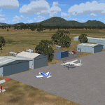
'Mid Western Victoria v2' is made to match ORBX Australia v2 scenery. Use 'Mid West Victoria update' for ORBX v1 or no ORBX. NOTE this is an UPDATE with Horsham replacing Hamilton in the instructions (it is Horsham in the actual scenery). There are 14 airports starting at Ararat and extending up to the Murray at Swan Hill. YARA Ararat YSWL Stawell YMBU Maryborough YSTA Saint Arnaud YDOD Donald YWYF Wycheproof YBIR Birchip YHPN Hopetoun YKER Kerang YSLK Sealake YSWH Swanhill YNHL Nhill YHSM Horsham YWKB Warracknabeal. A lot of airports but this is several hundred hours of effort over many months. ORBX has done these as they have done every airport included with FSX in Australia to a reasonable standard. If I had not already done them for ORBX V1 I would not have bothered. However these are better than ORBX because the surroundings have been modified to match real life. Towns have been added or shifted. Forests cut down or added. Race courses, sewage treatment ponds and other stuff added. Local obstacles (towers etc) added. There are 6 custom terminal buildings accurate to real life. Included is an AI traffic file that covers airports that dont already have AI. These files are for Flight Simulator X. Made using Airport Design Editor using some objects borrowed from Robert Budd's excellent Baccus Marsh and 'Static aircrafts' by Jean-Pierre Fillion. REQUIRED The scenery is designed to interface with ORBX FTX_AU V2 scenery for Australia (payware).
| Filename: | Mid_West_Victoria_v2_for_ORBX_v2_14_airports_YARA_.zip |
| License: | Freeware |
| Added: | 2nd May 2020, 23:11:14 |
| Downloads: | 258 |
| Author: | Colin Jeffery |
| Size: | 10.49 MB |


© 2001-2026 AVSIM Online
All Rights Reserved
Privacy Policy |