
Where Flight Simulation Enthusiasts Gather from Around the World!
AVSIM Library - Search Results

| Category: Flight Simulator X - Scenery | |
| FSX_MeSA_G08_Patch |

|
File Description:
This terrain mesh file should substitute the before one we uploaded with the same name, which presents a small area with some voids that were not detected in our tests.
Please, accept our apologies for this mistake.
It was multi-LOD compiled from 90m SRTM2 source data, reprocessed
with 3DEM to remove voids and spikes, providing a 76.4m (LOD9) horizontal
resolution topography intended for use only in FSX updated with SP1.
FSX_MeSA_G08_Patch (Column G x Row 08) covers the area inside the boundaries:
N = 22º 30' S; S = 28º 7.5' S;
W = 45º 0' W; E = 37º 30' W;
Authors:
Hely Heck Junior - Magrao ( [email protected] )
and Jose Lobo ( [email protected] )
TerraBrasilis: www.terra-brasilis.org
| Filename: | FSX_MeSA_G08_Patch.zip |
| License: | Freeware |
| Added: | 24th June 2007, 18:09:48 |
| Downloads: | 633 |
| Author: | Hely Heck Jr. and José Lôbo |
| Size: | 10.39 MB |
| Category: Flight Simulator X - Scenery | |
| Nashua Municipal Airport (Boire Field) - KASH |
|
File Description:
This airport was made using Airport Design Editor 9x. (ADE9x). Nashua Municipal Airport, or Boire Field is a general aviation airport located in Nashua, New Hamshire. I made it based on Google Earth and Bing maps. I have replaced most of the stock buildings and added more accurate ones. The flight simulator made the taxiways 75 feet wide but they are only supposed to be 50 feet wide. That is something else I fixed. I also added static aircraft on the ramp and cars in the parking lot. The scenery complexity can not be set to to very sparse or nothing will not show up. Please read the readme for instructions. This file is for Flight Simulator X only.
| Filename: | Nashua_Municipal_Airport_Boire_Field__KASH.zip |
| License: | Freeware |
| Added: | 11th December 2011, 06:40:36 |
| Downloads: | 345 |
| Author: | Tyler Lawrence |
| Size: | 11.38 KB |
| Category: Flight Simulator X - Scenery | |
| Alaska Airfields - Iditarod Edition |
|
File Description:
NOW UPDATED with the needed altitude files found in "Alaska Airfields" and "Alaska Airfields Pack 2" so you can use this pack as a stand-alone scenery if you want to.
-------------------------------
This is my Iditarod modification of the six airfields along the Iditarod trail I have made so far (Alaska Airfields 1.2 and Alaska Airfields Pack 2 - 1.0). They are made to use during the Iditarod dog-sled race to make it more "alive" at the checkpoints. I hope you enjoy them as much as I enjoyed making them.
PLEASE NOTE: These sceneries are made with FSX Acceleration and Flight 1's Ultimate Alaska X installed. I don't know how they look or work without these add-ons.
| Filename: | Alaska_Airfields__Iditarod_Edition.zip |
| License: | Freeware |
| Added: | 3rd March 2012, 03:25:20 |
| Downloads: | 2,614 |
| Author: | Torbjorn Kuntze |
| Size: | 37.85 KB |
| Category: Flight Simulator X - Scenery | |
| East Coast Victoria YLKE Lakes Entrance YGRL Great Lakes Airport YORB Orbost YMCO Mallacoota |
|
Images related to this file:
File Description:
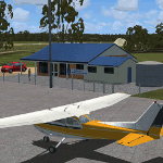
There are 4 airports. YLKE Lakes Entrance YGRL Great Lakes Airport YORB Orbost YMCO Mallacoota. A few airports but this is no quicky slap dash effort but hundred+ hours. Surrounding scenery modified to match real life. Towns have been added or shifted. Forests cut down or added. Sewage treatment ponds and other stuff added. Included is an AI traffic files that covers the airports. These files are for Flight Simulator X. Made using Airport Design Editor using some objects borrowed from Robert Budd's excellent Baccus Marsh. RECOMMENDED The scenery is designed to interface with ORBX FTX_AU scenery for Australia (payware). It will work without ORBX but will not interface as well with standard scenery.
| Filename: | East_Coast_Victoria____YLKE_Lakes_Entrance_YGRL_Gr.zip |
| License: | Freeware |
| Added: | 1st September 2019, 08:19:08 |
| Downloads: | 251 |
| Author: | Colin Jeffery |
| Size: | 6.31 MB |
| Category: Flight Simulator X - Scenery | |
| FSX British Columbia Airfields 1-3 For Default Scenery |
|
File Description:
60 British Columbia airfields/seaplane bases with surrounding scenery like lakes, landclass etc.. These sceneries are for the FSX default scenery, i.e. a scenery that does not have enhancements like Ultimate Terrain or ORBX which correct or add e.g. lakes, towns etc.
However, I do use additional freeware mesh sceneries, which are the "FSX Canada 19M Terrain Mesh" parts 1 and 2 by Raimundo Taburet (LOD 11) and the North America/Canada mesh from "FreeMesh X Global 1.0" (LOD 10). But in principle my sceneries should work with any mesh.
All files are named by their ICAO ID, so you can easlily remove any airfiled that you don't need or don't like.
| Filename: | FSX_British_Columbia_Airfields_13_For_Default_Scen.zip |
| License: | Freeware |
| Added: | 20th November 2020, 05:32:29 |
| Downloads: | 178 |
| Author: | Detlev J. Rohmer |
| Size: | 196.16 KB |
| Category: Flight Simulator X - Scenery | |
| SEGU - Jose Joaquin de Olmedo International Airport - Guayaquil, Ecuador |
|
Images related to this file:
File Description:
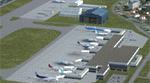
Building upon Menno Robert's original SEGU airport as a starting point, this project updates the coordinates of the airport, adds more visual detail, further expands aprons and the new terminal, and optimizes the scenery to fit seamlessly with FTX Global/Vector. This airport should also be fully functional in all FSX configurations. The airport is updated to reflect current satellite imagery and positioning. Scenery was created using Airport Design Editor X v1.61.5298, SBuilderX 3.13, and the FSX Object Placement Tool. Scenery objects were added and modified from stock FSX scenery to resemble as closely as possible the actual airport.
Thank you to Menno Robert for granting permission to edit his original SEGU file.
| Filename: | SEGU__Jose_Joaquin_de_Olmedo_International_Airport.zip |
| License: | Freeware |
| Added: | 4th July 2015, 18:22:13 |
| Downloads: | 4,222 |
| Author: | Carlyle Sharpe |
| Size: | 2.79 MB |
| Category: Flight Simulator X - Scenery | |
| Toulouse Blagnac (LFBO) v1 |
|
File Description:
This is an addon scenery for FSX of the Toulouse Blagnac Airport LFBO. It has been made using the excellent freeware tool Airport Design Editor for the layout. I have used Sketchup from Google and Model Converter X to design the buildings of the airport.
You will find all the terminals of LFBO and the control tower, as well as the Airbus facilities of the A380 Lagardere plant North East of LFBO, the A380 delivery center Henry Ziegler North West of LFBO, and some buildings of the Airbus facilities in Blagnac, West of LFBO. All buildings have photo textures, most of them taking with my camera, as I am working in the area. All buildings include night textures. You have two landing pads for helicopters like in reality South East of LFBO.
I used google earth for some items position, but the current view not being up to date, I used my knowledge of the area to correctly position the taxiways, parkings, gates and building position.
I used the FSX generic buildings for the other missing buildings, however they have the size and position which corresponds as far as possible to the position of the real buildings. The surroundings of the airport not being too realistic with Ultimate Terrain X or with FSX, I have modified the landclass of the surroundings to make them look more in accordance with reality. I have changed the parking assignment to make sure that the usual traffic will park on the parkings E, F D AB, V and U.
| Filename: | Toulouse_Blagnac_LFBO_v1.zip |
| License: | Freeware |
| Added: | 21st December 2011, 13:09:29 |
| Downloads: | 23,276 |
| Author: | Jose Mauriz |
| Size: | 34.72 MB |
| Category: Flight Simulator X - Scenery | |
| Quebec city 2.0 |
|
Images related to this file:
File Description:
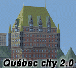
Quebec city version 2.00 for Flight Simulator X.
FSX Scenery--Quebec City 2.0, Canada. Quebec city (Ville de Quebec in French) is the capital of the Canadian province of Quebec. This highly detailed scenery include more than 135 custom buildings. Come and see what Quebec City looks likes with its major landmarks in your flight simulator. Many new FSX features have been used to build this great scenery like animations and custom special effects. Also, see the CYQB airport scenery by Gilles Boily then enjoy flying in Quebec City. By Jean St-Cyr, Gilles Boily, Gilles Gauthier and Jean-Pierre Fillion.
This is and update version of Quebec city fsx scenery. Keep the first version since it is intended for low-end computers.
Thanks
Jean St-Cyr
| Filename: | Quebec_city_20.zip |
| License: | Freeware, limited distribution |
| Added: | 31st October 2009, 00:17:10 |
| Downloads: | 12,898 |
| Author: | Jean St-Cyr, Gilles Boily, Gilles Gauthier and Jean-Pierre Fillion |
| Size: | 65.2 MB |
| Category: Flight Simulator X - Scenery | |
| Chatham Islands: Updated Airports, Landclass, Water Data, and Flight Plans |
|
Images related to this file:
File Description:
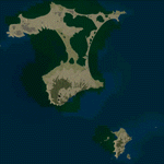
This project significantly updates New Zealand's Chatham Islands and includes more accurate coastlines, lakes, road and river data, as well as corrected landclass and a fully updated Chatham Islands/Tuuta Airport (NZCI). Napier (NZNR) aprons and terminal are also updated to more closely reflect the actual airport and accommodate Air Chathams, and the Pitt Island Airstrip (NZPI) is added to FSX. All updates were done in a manner which carefully aligned airport data with current satellite imagery. These airports are served by Air Chathams. Scenery was created using Airport Design Editor X v1.47.07, SBuilderX 3.13, and the FSX Object Placement Tool. Scenery objects were added and modified from stock FSX scenery to resemble as closely as possible the actual airports.
| Filename: | Chatham_Islands_Updated_Airports_Landclass_Water_D.zip |
| License: | Freeware |
| Added: | 8th July 2011, 21:44:02 |
| Downloads: | 1,674 |
| Author: | Carlyle Sharpe |
| Size: | 17.78 MB |
| Category: Flight Simulator X - Scenery | |
| F45 - North Palm Beach County General Aviation Airport - West Palm Beach, Florida (USA) |
|
Images related to this file:
File Description:
North Palm Beach County Airport, located northwest of West Palm Beach, Florida, was opened in 1994 as a designated reliever for KPBI. All of the buildings have been custom modeled in accordance with information available on the internet including Microsoft Bing birdseye views. The airport layout and landclass changes are in accordance with Google Earth imagery.
If you have Jim Dhaenens' lightobj.bgl installed, apron lighting will be included, and if you have KB_static_aircraft_FSX installed (available at www.kb-sim.com/screens_static_aircraft.html), additional parked aircraft will be visible.
The layout of scenery is optimized for use with Ultimate Terrain X-USA. There is no FAA airport diagram for this airport, but a taxiway diagram provided by the local Airport Authority is included in this package.
| Filename: | F45__North_Palm_Beach_County_General_Aviation_Airp.zip |
| License: | Freeware |
| Added: | 22nd August 2013, 20:48:03 |
| Downloads: | 1,152 |
| Author: | Art Poole |
| Size: | 1.27 MB |


© 2001-2026 AVSIM Online
All Rights Reserved
Privacy Policy |