
Where Flight Simulation Enthusiasts Gather from Around the World!
AVSIM Library - Search Results

| Category: Flight Simulator X - Scenery | |
| Ermelo Airport (FAEO), South Africa |

|
Images related to this file:
File Description:
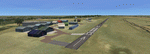
Ermelo is a delightfully cool, high- lying town on the eastern highveld of Mpumalanga District of South Africa. Because of its geographical situation on the eastern border of the jutting out position of Swaziland, it is a popular refueling airfield for smaller aircraft, when not flying through the airspace of Swaziland from the NE of Limpopo Province to the SE of Kwazulu Natal or back. An airfield that is very often covered in morning fog during the months from February to May.
A photo realistic attempt of the airport was made by the team and the result was quite an accurate replica on the true footprints of the actual buildings. Does require fsxWorx01.zip and updates.
| Filename: | Ermelo_Airport_FAEO_South_Africa.zip |
| License: | Freeware |
| Added: | 12th April 2013, 20:26:50 |
| Downloads: | 2,350 |
| Author: | Hannes Steyn, Martin du Preez, Aeroworx |
| Size: | 15.27 MB |
| Category: Flight Simulator X - Scenery | |
| PACD - Cold Bay Airport - Alaska, USA |
|
File Description:
Cold Bay Airport (IATA: CDB, ICAO: PACD, FAA LID: CDB) is a state owned, public use airport located in Cold Bay,a city in the Aleutians East Borough of the U.S. state of Alaska. First built as a United States Army Air Forces airfield during World War II, it is one of the main airports serving the Alaska Peninsula.
There is a National Weather Service (NWS) office (which sends up radiosonde balloons twice a day) colocated with the FAA Flight Service Station at the airport. The NWS ranks Cold Bay as the cloudiest city in the United States.
Changes were made based on 2011 construction plans and photos taken in 2013. Custom buildings were made for all services at the airport.
| Filename: | PACD__Cold_Bay_Airport__Alaska_USA.zip |
| License: | Freeware |
| Added: | 24th July 2013, 00:34:15 |
| Downloads: | 2,536 |
| Author: | Wayne Roberts |
| Size: | 5.53 MB |
| Category: Flight Simulator X - Scenery | |
| LGSM Samos International Airport, Greece |
|
Images related to this file:
File Description:
LGSM Samos International Airport, Greece.
The island of Samos lies in the Eastern Aegean and is a very popular tourist destination for flights from Berlin, Munich, Gatwick, Oslo, Copenhagen, Rome and many others. It is widely regarded as the most dangerous airport in Greece, mountainous terrain requires a sharp right hand turn onto runway 09 and landings are invariably subject to strong turbulence.
The airport has been designed to sit on the excellent photoreal scenery by Dimitris Ntaskas, which is available here on Avsim and called 'samos_305814.zip'. It also uses many objects from my lgkf_kefallinia.zip scenery also available here at Avsim. The scenery has been designed for and tested with DX9 and FSXA only, if used with the default terrain many objects will be misplaced.
The scenery features a very detailed airport, repositioned according to satellite imagery and is based on real photographs. Full night lighting is included with washed lighting of the apron and carparks. The nearby town of Pythagorio has been modelled and includes some local landmarks. I have included many autogen style buildings based on photographs of Samos and also autogen trees native to the region.
The airport includes many animations, including olive trees, flags, people, windsocks, birds, road traffic and waves. Local Air traffic between the neighbouring islands of Chios, Mykonos, Kos and Rhodes is included, as is a panoramic view from inside the new tower. All the files have been sub-divided and can be switched on or off according to user preference.
Full installation instructions, settings, hints and tips can be found in the readme file. Please enjoy and I hope you like my scenery as much as I enjoyed building it.
| Filename: | LGSM_Samos_International_Airport_Greece.zip |
| License: | Freeware, limited distribution |
| Added: | 27th February 2013, 02:45:01 |
| Downloads: | 23,204 |
| Author: | George Keogh |
| Size: | 47.62 MB |
| Category: Flight Simulator X - Scenery | |
| RAF Wombleton |
|
File Description:
RAF Wombleton opened in 1943 as a sub-station of RAF Topcliffe. It was part of RAF Bomber Command's No. 6 Group RCAF,
and along with the main station at Topcliffe and the station at Dishforth, was designated part of No 61 (Training)
Base. In November 1944, No 61 Base was transferred to No 7 (Training) Group and it was renumbered No 76 Training
Base. No 1666 Heavy Conversion Unit (HCU) was the first unit to move to Wombleton. Aircrew who were originally trained
on twin-engined aircraft such as Wellingtons or Whitley’s received conversion training on heavy four-engined bombers
such as the Halifax or Lancaster. No 1666 HCU remained at Wombleton until the end of the war. The RAF took over the
station and stayed for several years.
Source: Wikipedia
| Filename: | RAF_Wombleton.zip |
| License: | Freeware |
| Added: | 31st March 2017, 15:32:33 |
| Downloads: | 105 |
| Author: | Terry Boissel |
| Size: | 212.66 KB |
| Category: Flight Simulator X - Scenery | |
| RAF Winthorpe |
|
File Description:
RAF Winthorpe opened in September 1940 and was used as a satellite for RAF Swinderby. It had a long and varied career, mainly as a Heavy Conversion unit. I am not going into too much history here as an in-depth history can be viewed on the very good Newark Air Museum site www.newarkairmuseum.org
The runways, peri track and hangars are pretty much as was; As are the vast majority of the buildings, however, I cannot guarantee that the building used are 100% the correct type of building or in the actual place on the airfield, although I have done my best. (Much of the map I had was out of focus and the building listings were not complete. Anyway, I hope you enjoy my version of RAF Winthorpe.
| Filename: | RAF_Winthorpe.zip |
| License: | Freeware |
| Added: | 28th April 2017, 16:30:52 |
| Downloads: | 114 |
| Author: | Terry Boissel |
| Size: | 2.93 MB |
| Category: Flight Simulator X - Scenery | |
| CBQ2 - Fort Langley |
|
File Description:
Welcome to Fort Langley!
Located in the Township of Langley, Fort Langley is about a 45 min drive from Vancouver as well as the USA border crossing. They are conveniently located near the #1 Hwy and the Albion Ferry crossing.
The Langley area was the first part of the lower mainland of British Columbia where European settlement was established. Fort Langley was built in 1827 under the direction of James McMillan, Chief Trader of the Hudson's Bay Company.
It was situated about 50 kilometres (30 miles) from the mouth of the Fraser River. The prime objectives of the Fort were to establish a fur trading post and to initiate some agricultural activities, which would secure a steady supply of food for the occupants of the various fur trading posts west of the Rockies.
| Filename: | CBQ2__Fort_Langley.zip |
| License: | Freeware |
| Added: | 30th March 2009, 14:41:12 |
| Downloads: | 862 |
| Author: | Daniel Louvet |
| Size: | 568.05 KB |
| Category: Flight Simulator X - Scenery | |
| Yeu island - LFEY |
|
Images related to this file:
File Description:
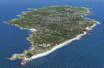
The island of Yeu (LFEY) is located in the west of France, in the south-west of Nantes. Its main runway is located on the wild coast, near the great lighthouse.
It is made up of :
- A new mesh based ASTER compiled in LOD11 and a very local mesh for the airport, compiled in LOD13 to get a good compatibility with the specific payware meshes.
- Photorealistic texture at 0.5 m/pixel based on aerial photography.
- The airfield and runway. The runway is flat, allowing to preserve the AI traffic. The grass strip is modeled with its relief. There is therefore no AI traffic on the grass strip.
- The port of Port-Joinville and several notable buildings made with Gmax (churches, chapel, castle, fort, ruins, beacons, etc)
- Generic or custom objects created with Gmax (boats, buildings).
| Filename: | Yeu_island__LFEY.zip |
| License: | Freeware |
| Added: | 29th December 2012, 04:03:47 |
| Downloads: | 1,721 |
| Author: | marc guitteny |
| Size: | 217.78 MB |
| Category: Flight Simulator X - Scenery | |
| FALE - King Shaka Airport, Durban, South Africa V2 |
|
File Description:
King Shaka International Airport, named after Shaka, leader of the Zulu nation in the early 19th century, also known as La Mercy Airport (after the area in which it is situated) and abbreviated as KSIA, will be the primary airport serving Durban, South Africa. Located at La Mercy, approximately 35 kilometers (22 mi) north of the city centre, it is expected to open on May 1, 2010 (just over a month before the start of the 2010 FIFA World Cup); replacing the existing Durban International Airport. All flights handled by Durban International Airport will terminate on April 30, 2010 and will move to King Shaka International Airport overnight, with KSIA handling its first flight on May 1, 2010.
This updated version caters for AI flight plans and Aircraft.
| Filename: | FALE__King_Shaka_Airport_Durban_South_Africa_V2.zip |
| License: | Freeware |
| Added: | 8th April 2010, 00:07:56 |
| Downloads: | 2,149 |
| Author: | Pierre Cornelissen & Mundus Yssel |
| Size: | 22.17 KB |
| Category: Flight Simulator X - Scenery | |
| FALE King Shaka Airport |
|
File Description:
King Shaka International Airport, named after Shaka, leader of the Zulu nation in the early 19th century, also known as La Mercy Airport (after the area in which it is situated) and abbreviated as KSIA, will be the primary airport serving Durban, South Africa. Located at La Mercy, approximately 35 kilometers (22 mi) north of the city centre, it is expected to open on May 1, 2010 (just over a month before the start of the 2010 FIFA World Cup); replacing the existing Durban International Airport. All flights handled by Durban International Airport will terminate on April 30, 2010 and will move to King Shaka International Airport overnight, with KSIA handling its first flight on May 1, 2010. This updated version caters for AI flight plans and Aircraft. I just added jetways
| Filename: | FALE_King_Shaka_Airport.zip |
| License: | Freeware |
| Added: | 2nd May 2010, 05:36:47 |
| Downloads: | 5,658 |
| Author: | Pierre Cornelissen & Mundus Yssel: Peter Vermeulen added jet ways |
| Size: | 28.58 KB |
| Category: Flight Simulator X - Scenery | |
| LOWL - Linz Airport (aka Blue Danube Airport) - Austria - Update to V1.1 |
|
Images related to this file:
File Description:
In recent months in real some has been changed in Linz Hoersching on Apron. Some standing places have been removed. Many new ones were added. Some were a little altered. Reason enough for an update, in which I have changed a few other things.
---------------
In den letzten Monaten hat es am Flughafen Linz Hoersching in Real einige Aenderungen am Vorfeld gegeben. Manche Standplaetze wurden entfernt. Viele wurden hinzugefuegt. Wieder andere wurden ein wenig abgaendert. Grund genug fuer ein Update, in dem gleich noch einige andere Aenderungen und Neuigkeiten enthalten sind.
---------------
Features: The standing places and lines where the real adapted, New asphalt in higher resolution was applied, Bitumen and cracks in high resolution was implemented, Animated Radar and Towerlight was implemented, and much more.
| Filename: | LOWL__Linz_Airport_aka_Blue_Danube_Airport__Austri.zip |
| License: | Freeware |
| Added: | 8th October 2013, 19:34:59 |
| Downloads: | 6,124 |
| Author: | Oliver Brandl |
| Size: | 34.57 MB |


© 2001-2026 AVSIM Online
All Rights Reserved
Privacy Policy |