
Where Flight Simulation Enthusiasts Gather from Around the World!
AVSIM Library - Search Results

| Category: Flight Simulator X - Scenery | |
| X3LR - RAF Langar - Langar, Nottinghamshire, England |

|
File Description:
RAF Langar (ICAO X3LR) is a former Royal Air Force station located near the village of Langar, Nottinghamshire, England. The airfield is located approximately 6 miles (9.7 km) east-southeast of Radcliffe on Trent and about 100 miles (160 km) north-northwest of London, England.
Opened in 1942 during World War II, it was used by both the Royal Air Force and United States Army Air Forces. During the war it was used primarily as troop carrier transport airfield. After the war it was provided to the Royal Canadian Air Force which used it as an operational base until 1963.
Today the airfield is the location for the British Parachute Schools, who use the original control tower for their headquarters. The former Avro industrial complex is used by private industry.
| Filename: | X3LR__RAF_Langar__Langar_Nottinghamshire_England.zip |
| License: | Freeware |
| Added: | 19th March 2016, 12:18:06 |
| Downloads: | 229 |
| Author: | Terry Boissel |
| Size: | 1.88 MB |
| Category: Flight Simulator X - Scenery | |
| LOWK - Klagenfurt airport - Klagenfurt, Austria |
|
Images related to this file:
File Description:
Klagenfurt Airport (ICAO: LOWK), also known as Kaernten Airport, is the airport of Klagenfurt, the sixth-largest city in Austria.
It is located near the city centre of Klagenfurt and serves some flights to European leisure and metropolitan destinations.
Klagenfurt Airport consists of one small passenger terminal building which features some shops and restaurants as well as a visitors terrace.
The apron provides several stands for mid-sized planes such as the Airbus A320 as well as smaller general aviation aircraft.
As there are no jet bridges, busses are used for boarding.
In this version you have animated workers and by the glock hanger you have a new scenery with a moving limosin and a moving gentlemen.
Manfred Marbler:
Email address in readme.txt
| Filename: | LOWK__Klagenfurt_airport__Klagenfurt_Austria.zip |
| License: | Freeware |
| Added: | 28th August 2015, 02:06:12 |
| Downloads: | 2,059 |
| Author: | Manfred Marbler |
| Size: | 187.34 MB |
| Category: Flight Simulator X - Scenery | |
| Martha's Vineyard Airport (KMVY) |
|
Images related to this file:
File Description:
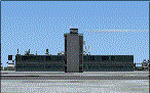
This airport was created using Airports Design 9x. Martha's Vineyard Airport is a airport located in Vineyard Haven, Massachusetts. I replaced all of the stock buildings with more accurate ones. I also put cars in the parking lot and static aircraft on the ramp. There are hangers to the west part of the ramp. I moved the control tower to the correct spot. If you choose to start off at a DOCK gate, you will start off inside the aircraft hanger. Choosing a gate number between 1 and 5 will start you off near the main terminal. Your scenery complexity can not be set to very sparse or nothing will show up. Please read the readme for instructions on how to install. This is for Flight Simulator X only.
| Filename: | Marthas_Vineyard_Airport_KMVY.zip |
| License: | Freeware |
| Added: | 11th December 2011, 06:47:19 |
| Downloads: | 1,788 |
| Author: | Tyler Lawrence |
| Size: | 4.85 MB |
| Category: Flight Simulator X - Scenery | |
| "The door of Paradise" China |
|
Images related to this file:
File Description:
I wanted to create this scenery of China titled "The Door of Paradise" near Zhangjiajie town, Hunan province, and on top of a mountain there is a striking thirty-meter-deep, deep arch rock-shaped cave , Which scales toward the sky. This unique, rocky rock formation seems to date back to the year 263, when - following a catastrophic event - the back of a cave collapsed leaving a hole in the wall and creating this striking panorama that the Chinese call "the symbol closest to God on earth. " I recommend that you leave Zhangjiajie ZGDY airport and reach the Tianmen Mountain coordinates N 29.03.24 E 110.28.58 where you can watch the door l Paradiso.
For more information on the site search on google. In the Package you will also find instructions for installing the scenery.
| Filename: | The_door_of_Paradise_China.zip |
| License: | Freeware |
| Added: | 17th August 2017, 17:19:37 |
| Downloads: | 753 |
| Author: | Pasquale Marrulli |
| Size: | 16.91 MB |
| Category: Flight Simulator X - Scenery | |
| RAF Attlebridge - Norwich, Norfolk, England |
|
File Description:
RAF Attlebridge is a former Royal Air Force station located near Attlebridge and 8 miles (13 km) northwest of Norwich, Norfolk, England. RAF Attlebridge was an early wartime station, laid out for use by No. 2 Group RAF light bombers, and was completed in August 1942. The airfield was used by No. 88 Squadron RAF from August 1941 to September 1942 using Bristol Blenheim IVs and Douglas Bostons.
The Station had runways of 1,220, 1,120 and 1,080 yards length but, when the base was earmarked for USAAF use, these were extended and the airfield was enlarged to meet heavy bomber requirements. The main E-W runway was increased to 2,000 yards and the others to 1,400 yards each. The perimeter track was also extended and the number of hardstands was increased to fifty. In enlarging the airfield, several small, country roads were closed in the parish of Weston Longville, in which the larger part of the airfield was sited.
RAF Attlebridge was assigned to the United States Army Air Forces (USAAF) Eighth Air Force's 2nd Bomb Wing on 30 September 1942. It was given USAAF designation Station 120.
Third party add-on scenery will be required - see readme for details.
| Filename: | RAF_Attlebridge___Norwich_Norfolk_England.zip |
| License: | Freeware |
| Added: | 4th January 2016, 16:32:15 |
| Downloads: | 329 |
| Author: | Terry Boissel |
| Size: | 1.04 MB |
| Category: Flight Simulator X - Scenery | |
| RNAS Twatt (HMS Tern) |
|
File Description:
Opened on the 1 April 1941 RNAS (HMS Tern) was used throughout the second world war by various Sqns of the Royal Navy undergoing training.
The station had 4 concrete runways with various hangers and the usual building associated with a military base. It was also the first unit in the UK to experience a helicopter crash when a Sikorsky helicopter getting ready for take off; hit a parked Blenheim.
The UK and Iceland where involved in what was called the cod wars in the early 1970s, and NATO was concerned that it would have to remove its bases from Iceland should the dispute escalate between the 2 countries and there was talk of Twatt becoming a NATO base. However, this did not happen and the idea was dropped.
There was also talk of the unit becoming a base for helicopters supporting the oil industry, however, as a result of the drop in oil prices during the 80s that idea was also dropped.
Most of the airfield has been returned to farming now with only the unique Control Tower and a handful of other building remaining.
NB: For more detailed history of this unit go to:-
https://canmore.org.uk/site/81752/twatt-airfield
| Filename: | RNAS_Twatt_HMS_Tern.zip |
| License: | Freeware |
| Added: | 30th January 2017, 02:56:37 |
| Downloads: | 143 |
| Author: | Terry Boissel |
| Size: | 18.84 MB |
| Category: Flight Simulator X - Scenery | |
| SBSN - Santarem, Brazil Photo Real |
|
File Description:
The International Airport of Santarem - Maestro Wilson Fonseca ( IATA : STS , ICAO : SBSN ) is the airport serving the city of Santarem and region . Its name is a tribute to the great poet , musician and composer Santareno , Wilson Dias da Fonseca . Currently , it is the fifth busiest airport in the northern region of Brazil . Has great important role in strengthening the bonds of Brazil with the world , due to its geographical location, between Belem and Manaus and is an alternative for international flights . It is located 15 km away from the city center and has easy access by Highway Fernando Guilhon . In its surroundings , a special landscape ornamentation shows markedly the gateway to the region , known as " The Pearl of the Tapajos ." It opened in March 1977 under the administration of the Air Force Command 31 and transferred to the administration Infraero on March 31, 1980.
The airport is currently undergoing reform and the first step is already completed , which is the construction of a new building to house the airport administration . The reform provides for doubling the airport arrivals hall , doubling the departure lounge , increase parking capacity and the overall revitalization of the electrical system and cooling . For all the changes should be needed about £ 2.700.000,00.2
| Filename: | SBSN__Santarem_Brazil__Photo_Real.zip |
| License: | Freeware |
| Added: | 5th February 2014, 09:45:35 |
| Downloads: | 2,637 |
| Author: | Alexandre Lima |
| Size: | 20.16 MB |
| Category: Flight Simulator X - Scenery | |
| "Your Own Sea Port"..Part II of "Your Own" |
|
File Description:
This scenery is Part II of "Your Own" Series. The first one is "Your own AirPort"....
slowly but surely a community is being born!!!!!!...what do you get with YOSP??
--
"YO Airport" has contracted the " Marching Band and Construction Ltd" to construct the " YO-Seaport" near the rich Oil Fields of the coast. MBC Ltd, has thus proceeded full blast on this major important Sea Port which will give traffic to YO Airport and sorroundings.....Now planes will fly on rigid schedules between these two airfields......
later YO-Hill Airfields(Part III) will come along in the mountains in small lakes and Sea Stops...or small seaplane destinations....for more Fun and activities!!!!
What does "Your Own Sea Port" has for you.....?and what can you do there??
1) Two Airfields, one grass for small private planes and one Concrete for Commercial traffic ( new technique so it won´t be "sunk" with whatever mesh you have!!!) ...........+ Floatplane Base!!!
2) Helicopter Pad at the Port Hospital...(lighted)
3) Rescue Sailors at burning ship!!!!---(ship sinking fast!!)...take them to the Port´s Hospital.
4) Check moving traffic with any chopper.( There is a red corvette which must be checked with some women driving too fast!!!)
5) Participate in:
Road Race ( Need a car!!)...Prices galore!!!
Boat Race around Red Bull Pylons (need a Boat!!)...RedBull guys left them here for good!!!
Fly a Race at the same Pylons...(Really Hard!!!!)
6) Fly Tourists to Fishing Lake where Bass Abounds..(Need Floatplane).
8) Fly with your Navy Patrol plane and check on some "Strange Submarine
taking pictures of the port"...if necessary blow it to smitherins!!!!!!!
9) Open a New Airline....YO Air Service Inc...
10) Fly around and take pictures.
11) Take executives to the Oil Facilities in the Interior (EpisodeIII)...
or just fly around with your gal, wife or hummmm, hummmm.............or go fly under its three bridges!!!!!
12) Take passenger from the "Float Plane" Airpark, near the hospital, to lakes and rivers. The Mayor of YOSP will be giving the "city Keys" to all Pilots
who makes four consecutive loops in a helicopter on Sunday at 11:42:45.
| Filename: | Your_Own_Sea_PortPart_II_of_Your_Own.zip |
| License: | Freeware, limited distribution |
| Added: | 28th November 2008, 15:48:14 |
| Downloads: | 1,514 |
| Author: | Gera Godoy Canova |
| Size: | 900.13 KB |
| Category: Flight Simulator X - Scenery | |
| LFMQ - Le Castellet |
|
File Description:
Welcome to Le Castellet Airfield -
This airfield is situated few Nm east of Marseille Provence - LFML, in the south of France. On the 1,000 hectares of plateau he acquired between Marseille and Toulon, Paul Ricard, forever motivated by innovation and development, constructed in 1962 the largest
private airfield in the Provence-Alpes-Côte d’Azur region.
The landing strip at Le Castellet covered a distance of 1,000 metres and allowed for VFR (Visual Flight Rules) operation. Situated on a plateau at the time free of all economic development, it was above all a private airfield. In 1970, the construction
of the Paul Ricard Circuit nearby created an economic dynamic for the first time on Le Castellet plateau. In 1972, Paul Ricard invested in improvements to the runway, lengthening it from 1,000 to 1,750 metres, thus rendering it capable of
receiving business and private airplanes of up to 38 tonnes.
Over twenty years, Le Castellet Airport saw intense periods of activity due to business and private aviation, notably with the arrival of the first F1 French Grand Prix on the Paul Ricard Circuit in 1971, and more recently, with the creation of the Entreprise Zone at Signes, situated only a few kilometres from the airfield. Stop by for an amazing visit at the medieval village as well, situatued on top of a hill.
Nevertheless, from 1972 to 1999, no investment was made at the airfield. In May 1999, the company Excelis S.A. purchased the site (airfield and circuit) and refurbished and modernised the installations.
A truly amazing place to fly to - I have enhanced the entire apron as it is today, all marking correctly set, acces to runway and the Heli area for the "Eggbeater" fan :)
includes the hangar, building and other things around. Hope you'll enjoy your stay at "Le castellet"!
| Filename: | LFMQ__Le_Castellet.zip |
| License: | Freeware |
| Added: | 24th April 2009, 16:28:59 |
| Downloads: | 2,350 |
| Author: | Daniel Louvet |
| Size: | 986.65 KB |
| Category: Flight Simulator X - Scenery | |
| KEKM - Elkhart Municipal Airport - Elkhart, Indiana |
|
Images related to this file:
File Description:
Elkhart Municipal Airport serves Elkhart and Elkhart County and is owned by the City Of Elkhart, Indiana. The airport has more than one runway. The longest is a paved runway extending 6500 feet. The facility is at an elevation of 778 feet at a distance of about 3 miles from Elkhart. For the enjoyment of the FS community, by John B. Loney, Jr.
| Filename: | KEKM__Elkhart_Municipal_Airport__Elkhart_Indiana.zip |
| License: | Freeware, limited distribution |
| Added: | 22nd March 2013, 19:01:03 |
| Downloads: | 571 |
| Author: | John B. Loney, Jr. |
| Size: | 86.56 MB |


© 2001-2026 AVSIM Online
All Rights Reserved
Privacy Policy |