
Where Flight Simulation Enthusiasts Gather from Around the World!
AVSIM Library - Search Results

| Category: Flight Simulator X - Scenery | |
| Mattala Intl. Airport (VCRI), Sri Lanka |

|
File Description:
Sri Lankan Virtual Airlines (ALK-VA) has developed Sri Lanka's main airport VCBI-Bandaranaike Intl. airport, Katunayaka and newest airport VCRI-Mattala Intl. airport, Hambantota scenery for FSX.
All data is accurate as per the currently available airport information.
Scenery files will be updated when new information is received. Please check ALK-VA website for the latest revision.
| Filename: | Mattala_Intl_Airport_VCRI_Sri_Lanka.zip |
| License: | Freeware |
| Added: | 30th October 2013, 17:30:21 |
| Downloads: | 1,582 |
| Author: | Imal Mille |
| Size: | 530.65 KB |
| Category: Flight Simulator X - Scenery | |
| Bangalore, Bengaluru Intl (VOBL), Patch |
|
File Description:
Corrects textures of the jetways. Thanks Sam Coletta for pointing this out.
| Filename: | Bangalore_Bengaluru_Intl_VOBL_Patch.zip |
| License: | Freeware |
| Added: | 7th August 2008, 15:58:12 |
| Downloads: | 3,510 |
| Author: | Sanjay Dutt |
| Size: | 118.78 KB |
| Category: Flight Simulator X - Scenery | |
| LFLJ - Courchevel, France |
|
File Description:
This FSX scenery package contains the LFLJ Courchevel airport in the French Alps. The airport has a very short, upslope runway of only 525 m (1,722 ft). The airport is considered one of the seven most dangerous in the world. It has a difficult approach, a 300 foot upslope runway and is adjacent to the Courchevel ski runs. The Courchevel airport altitude is the highest in Europe, with a mean elevation of 6,520 feet. This airport is intended to be used with FSX and the free addon - TileProxy. TileProxy provides real-time photorealistic satellite imagery in place of the stock auto generated FSX scenery or any other scenery package. The Courchevel airport was originally released as part of an FSX airport scenery package containing 15 airports, located in the French Alps. The link to the original 15 French Alps Airport package is shown below. This file is not required, but allows you to download 15 related French Alps airports. The LFLJ, Courchevel airport in the original 15 airport package was missing a required scenery file which corrects the airport altitude (from 6420 ft. to 6520 ft.) due to the mis-location of the stock FSX airport. This download provides all three of the required .bgl scenery files.
related download:
http://library.avsim.net/search.php?SearchTerm=french+alps+airports&CatID=root&Go=Search
| Filename: | LFLJ__Courchevel_France.zip |
| License: | Freeware |
| Added: | 30th November 2013, 20:20:07 |
| Downloads: | 6,042 |
| Author: | John Greenwood |
| Size: | 655.63 KB |
| Category: Flight Simulator X - Scenery | |
| Alderney Airport (EGJA) |
|
File Description:
Alderney Airport (EGJA) is located on the island of Alderney in the Channel Islands. I have travelled in and out of the island on many occasions and, despite the lack general lack of information on the internet about the airport, this is a pretty accurate representation. Features include accurate control tower, accurate terminal building, grass parking area, static aircraft, ground vehicles, car park, fire-station, surrounding trees, perimeter fencing and more. Many night textures and custom AFCAD file included. The airport is at N49 42 44 and W002 12 88. This scenery is for FSX but should also work under FS2004. It may even work in earlier versions of FS but this is untested.
| Filename: | Alderney_Airport_EGJA.zip |
| License: | Freeware, limited distribution |
| Added: | 29th October 2006, 03:17:06 |
| Downloads: | 8,387 |
| Author: | Tim Clayton |
| Size: | 2.29 MB |
| Category: Flight Simulator X - Scenery | |
| GPS Enabled Acceleration Carrier |
|
File Description:
This carrier is for FSX Acceleration owners and allows the user to start from the deck in FSX, by using the supplied airport code EG51. The carrier is the Acceleration model and includes full use of the cat launch and arrestor cable. Their are two models supplied, a static and a moving version. The static version allows the use of GPS approach from any airport in the world, and start from the deck all day. The moving version allows the same features before 7am GMT and after arrival at the destination port at Lands End (10:15am GMT). The user could use the FSX menu to get on board the deck area of this carrier prior to 7am GMT and then sail with it. The Lands End destination allows full use of GPS facilities whilst the carrier is in that port too, EG53 is the airport code. This is from 10:15 to 14:00 GMT before it starts the return journey.
| Filename: | GPS_Enabled_Acceleration_Carrier.zip |
| License: | Freeware, limited distribution |
| Added: | 23rd February 2008, 14:45:52 |
| Downloads: | 1,818 |
| Author: | Steve Brooks |
| Size: | 103.01 KB |
| Category: Flight Simulator X - Scenery | |
| Cape_Verde_Mesh |
|
File Description:
To improve performance, FSX updated with SP1 loads DEM files in threads and only
the closer terrain (about 10 NM from the point of view) is rendered in high
detail, while at far distances FSX shows up its default low resolution mesh,
if it is not available a multi-resolution one. This terrain mesh file was multilod compiled from 90m SRTM2 source data, reprocessed with 3DEM to remove voids and spikes, providing a 76.4m (LOD9) horizontal resolution topography intended
for use only in FSX updated with SP1.
It covers the Cape Verde, a group of islands in the North Atlantic Ocean, that consist of two small archipelagos, about 400 miles off the western coast of Senegal (Africa), including: Boa Vista, Brava, Maio, Mosteiros, Paul, Praia, Porto Novo, Ribeira Grande, Sal, Santa Catarina, Santa Cruz, Sao Domingos, Sao Filipe, Sao Miguel, Sao Nicolau, Sao Vicente and Tarrafal (Geographic coordinates: 16ºN/24ºW).
Authors:
Hely Heck Junior - Magrao ( [email protected] ) and Jose Lobo (
[email protected] ) TerraBrasilis: www.terra-brasilis.org
| Filename: | Cape_Verde_Mesh.zip |
| License: | Freeware |
| Added: | 21st June 2007, 16:26:23 |
| Downloads: | 4,335 |
| Author: | Hely Heck Jr. and José Lôbo |
| Size: | 1.55 MB |
| Category: Flight Simulator X - Scenery | |
| Coimbatore International Airport - VOCB v2 |
|
File Description:
A complete remake of the Southern Indian Airport of Coimbatore. Older version of this scenery will not be required. Just Download, install and enjoy!
Fully Compatible with FSX, P3D and P3Dv4
| Filename: | Coimbatore_International_Airport__VOCB_v2.zip |
| License: | Freeware, limited distribution |
| Added: | 10th July 2018, 17:39:32 |
| Downloads: | 204 |
| Author: | Rohith Augustine, Jensil Dsouza |
| Size: | 5.6 MB |
| Category: Flight Simulator X - Scenery | |
| EDOV-06 |
|
Images related to this file:
File Description:
FSX scenery--Borstel airport EDOV near
Stendal in Saxony-Anhalt Germany.
Originally a WWII paratroops base, later
base of soviet jetfighters and helicopters,
but now in civilian use. By Thomas Erthner.
| Filename: | EDOV06.zip |
| License: | Check within download |
| Added: | 27th April 2020, 18:05:05 |
| Downloads: | 156 |
| Author: | Thomas Erthner |
| Size: | 2.24 MB |
| Category: Flight Simulator X - Scenery | |
| EDOV-06 |
|
Images related to this file:
File Description:
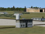
FSX scenery--Borstel airport EDOV near
Stendal in Saxony-Anhalt Germany.
Originally a WWII paratroops base, later
base of soviet jetfighters and helicopters,
but now in civilian use. By Thomas Erthner.
| Filename: | EDOV06.zip |
| License: | Check within download |
| Added: | 28th April 2020, 19:23:40 |
| Downloads: | 78 |
| Author: | Thomas Erthner |
| Size: | 2.24 MB |
| Category: Flight Simulator X - Scenery | |
| Derry Eglinton Airport |
|
File Description:
Derry Eglinton airport.
FSX compatible only
Includes: GA parking, changes to parking beside the terminal, ILS to Runway 08 and fire training area.
Created using ADEX v01.47.07
Created from default scenery.
| Filename: | Derry_Eglinton_Airport.zip |
| License: | Freeware |
| Added: | 9th November 2010, 00:42:33 |
| Downloads: | 1,376 |
| Author: | Padraic O hEithir |
| Size: | 136.08 KB |


© 2001-2026 AVSIM Online
All Rights Reserved
Privacy Policy |