
Where Flight Simulation Enthusiasts Gather from Around the World!
AVSIM Library - Search Results

| Category: Flight Simulator X - Scenery | |
| Chatham Islands for Vector Land Class New Zealand |

|
Images related to this file:
File Description:
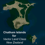
This project is a modified version of the Chatham_Islands.zip project which allows my landclass and airports to work seamlessly with the free Chatham Islands scenery available from Vector Land Class New Zealand. This package allows the user to switch back and forth easily between the different scenery combinations and also provides standalone Chatham and Pitt Island airports which can be used with the Vector Land Class (VLC) scenery on its own. It also allows the user to take advantage of the 15m terrain mesh and added water detail that comes with the VLC scenery. A modified Pitt Island AI runway is also included that is compatible with the 15m mesh. Chatham Islands/Tuuta Airport (NZCI), Napier (NZNR), and the Pitt Island Airstrip (NZPI) are included here. Scenery was created using Airport Design Editor X v1.47.07, SBuilderX 3.13, and the FSX Object Placement Tool. Scenery objects were added and modified from stock FSX scenery to resemble as closely as possible the actual airports.
| Filename: | Chatham_Islands_for_Vector_Land_Class_New_Zealand.zip |
| License: | Freeware |
| Added: | 15th July 2011, 21:54:43 |
| Downloads: | 931 |
| Author: | Carlyle Sharpe |
| Size: | 3.78 MB |
| Category: Flight Simulator X - Scenery | |
| LMML Photoreal - Malta International Airport - Malta, Maltese Islands |
|
File Description:
This is a Photoreal Scenery for Malta's Airport. Note that this is only a Photoreal Scenery and not an AFCAD (airport design file). Tested on FSX and P3D. Might work on FS2004 as well, you might want to give it a try. Read "readme.txt" for more information.
| Filename: | LMML_Photoreal__Malta_International_Airport__Malta.zip |
| License: | Freeware, limited distribution |
| Added: | 23rd August 2017, 01:44:48 |
| Downloads: | 1,087 |
| Author: | Shafat Hasan |
| Size: | 4.35 MB |
| Category: Flight Simulator X - Scenery | |
| Montserrat Island - Leeward Islands, Lesser Antilles, Caribbean Sea |
|
Images related to this file:
File Description:
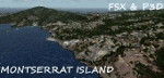
A representation of Montserrat using photo-real scenery along with hand placed autogen.
Montserrat is a British overseas territory located in the Leeward Islands, part of the chain of islands called the Lesser Antilles in the Caribbean Sea. Its capital city of Plymouth was destroyed by an eruption of the previously dormant Soufriere Hills volcano in 1995. Between 1997 and 2005, Montserrat had been accessible only by helicopters or boats.
The airport's name was changed in July 2008 to honour John Osborne, long-standing Chief Minister of Montserrat and the airline FlyMontserrat has its headquarters on the airport property.
For the best results of this scenery, PWSceneries Volume 5 has to be installed. Features included are custom photo scenery covering the entire island, hand placed autogen, detailed 3D Objects and custom buildings. Works in FSX and P3D.
| Filename: | Montserrat_Island__Leeward_Islands_Lesser_Antilles.zip |
| License: | Freeware |
| Added: | 24th September 2015, 10:59:37 |
| Downloads: | 836 |
| Author: | Kenje Thomas |
| Size: | 132.48 MB |
| Category: Flight Simulator X - Scenery | |
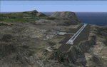
| MWCB - Charles Kirkconnell Intl. - Cayman Brac, Cayman Islands |
|
File Description:
Charles Kirkconnell International Airport, Cayman Brac 2015.
| Filename: | MWCB__Charles_Kirkconnell_Intl__Cayman_Brac_Cayman.zip |
| License: | Freeware |
| Added: | 9th January 2016, 15:02:24 |
| Downloads: | 1,844 |
| Author: | Gerome Bodden |
| Size: | 47.93 MB |
| Category: Flight Simulator X - Scenery | |
| St. Helena, Ascension, and Tristan da Cunha Islands |
|
Images related to this file:
File Description:
This project was begun to add the new airport (FHSH) to St. Helena Island and eventually was expanded to include a complete remake of Ascension Island (FHAW) and Tristan da Cunha (with an optional airport FHTC) and Gough Island with the actual weather station heliport (FHGH). Tested in both the default FSX/Acceleration and with FTX Global/Vector, accurate coastlines, lakes, road data, and SRTMGL1 (30m) mesh, as well as corrected landclass are provided based on the latest available satellite imagery. Flight plans are provided for the proposed commercial service to St. Helena, and some additional GA and military flights to the island are added as well.
The FSX St. Helena (FHSH) airport was created by aligning master plans for the airport with current satellite data and by studying many of the pictures that have been posted as the airport has taken shape. The official opening of the real airport on May 21, 2016, has been pushed back for more field tests due to challenging crosswinds. The Ascension Island (FHAW) airport was updated after I realized that Ascension could receive commercial service as a result of the new St. Helena airport. The entire airfield is redesigned to allow the volcanic terrain to display properly. The airbase, towns, BBC Atlantic relay station, and numerous satellite dishes, radomes, and wind turbines now appear in their real-world locations. Since I was already in the region, I added the Tristan da Cunha Islands (including Inaccessible, Nightingale and Gough Islands) and the Gough Island weather station maintained by the South African National Antarctic Programme. I also added an optional airport (and flight plans) to Tristan da Cunha (FHTC), which can be easily enabled/disabled. The FHTC airport is placed on the only part of the island that appears to be free of people or farmland, and the area is just long enough to accommodate a pared-down version of the St. Helena airport.
Updates were created or rebuilt in a manner which carefully aligns airport data with current satellite imagery. Scenery was created using Airport Design Editor X v1.67.5684, SBuilderX 3.13, and the FSX Object Placement Tool. Scenery objects were added and modified from stock FSX scenery to resemble as closely as possible the actual airports. The animated flag model is by Dietmar Loleit, the FSX apron lights included are from the set created by Jim Dhaenens, and the animated wind turbines and radomes are from the freeware package by Ray Porter.
| Filename: | St_Helena_Ascension_and_Tristan_da_Cunha_Islands.zip |
| License: | Freeware |
| Added: | 1st May 2016, 11:23:05 |
| Downloads: | 6,077 |
| Author: | Carlyle Sharpe |
| Size: | 10.52 MB |
| Category: Flight Simulator X - Scenery | |
| Dodecanese New |
|
Images related to this file:
File Description:
The DodecaneseNew
AS REAL AS IT GETS.
This is photorealistic scenery for the Dodecanese Islands and the
Island of Ikaria WITH NIGHT TEXTURES.
The old Dodecanese zip had some files missing.
Delete the old Dodecanese files and update.
| Filename: | Dodecanese_New.zip |
| License: | Freeware |
| Added: | 9th June 2016, 22:48:41 |
| Downloads: | 998 |
| Author: | Angelo Tassoglou |
| Size: | 134.34 MB |
| Category: Flight Simulator X - Scenery | |
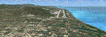
| Whale Island Scenery: "Islands of the Bay of Plenty" |
|
File Description:
This scenery was created from a digital Orthorectified aerial mosaic owned by Environment Bay of Plenty (The Bay of Plenty Regional Council). The imagery has been de-sampled for use in Flight Simulator X and utilizes the default terrain mesh. The textures are intended for summer daylight flying only, although due to the sparse nature of White Islands' Evegetation, the Islands appearance remains relatively consistent throughout the year.
It includes autogen trees, a landable helicopter pad on the top of the Island, Radio masts, and the Department of Conservation (DOC) hut in the south western bay of the island.
| Filename: | Whale_Island_Scenery__Islands_of_the_Bay_of_Plenty.zip |
| License: | Freeware, limited distribution |
| Added: | 9th May 2007, 08:42:59 |
| Downloads: | 1,496 |
| Author: | Tim Barnes |
| Size: | 7.05 MB |
| Category: Flight Simulator X - Scenery | |
| St Vincent the Grenadines and The Grenada |
|
File Description:
Sceneries of St Vincent the Grenadines and The Grenada
You must install the MESHS CARAIBES (LOD 10)
file MESHANTILLES.ZIP put also on this website
(Search keys: Valladier or MESHANTILLES.ZIP )
Redisign of all roads ,coasts and land class of islands
6 airports of St Vincent et les Grenadines
CANOUAN (TVSC) E.T.JOSUA(TVSV) J.F.MITCHELL(TVSB) MUSTIQUE(TVSM) UNION I.Int(TVSU) plus airport Argyle (May be open for 2013...(I name it TVSG)
2 airports Of The Granada
Maurice Bishop (ex Pointe Saline) (TGPY) and Lauriston(TGPZ)
Sceneries of close islands not in FSX
run under FSX SP1 and SP2
| Filename: | St_Vincent_the_Grenadines_and_The_Grenada.zip |
| License: | Freeware |
| Added: | 15th November 2011, 02:35:14 |
| Downloads: | 2,315 |
| Author: | Valladier Jean-Louis |
| Size: | 22.24 MB |
| Category: Flight Simulator X - Scenery | |
| Guernsey X-HD |
|
Images related to this file:
File Description:

Guernsey Airport is located on the island of Guernsey which is on of the few islands that make up the English Channel Islands. With a runway just shy of 1.6 kilometres this airports offers a challenging departure and approach for large aircraft.
Also, the island is small and unguarded from winds gusting through the English Channel so this adds to the challenge.
This scenery is provided with surrounding Photo-scenery for extra realism. it features High definition ground image and detailing, perfectly placed 3d objects overall a very nice bit of eye candy for your FSX world
| Filename: | Guernsey_XHD.zip |
| License: | Freeware, limited distribution |
| Added: | 4th February 2017, 20:01:56 |
| Downloads: | 2,772 |
| Author: | Mark Piccolo - Soarfly Concepts |
| Size: | 67.26 MB |
| Category: Flight Simulator X - Scenery | |
| Gokceada, Imroz (LT86) - Turkey |
|
File Description:
Photoreal scenery of Gokceada Imroz with 2m texture resolution. Gokceada is the far-west point of Turkey in Aegean Sea which makes it a very good VFR base reaching Marmara, Gallipoli, Dardanels, Canakkale, Bosphorous, Istanbul, Trakia and wonderful Greek Islands.
| Filename: | Gokceada_Imroz_LT86__Turkey.zip |
| License: | Freeware, limited distribution |
| Added: | 12th April 2010, 19:23:50 |
| Downloads: | 2,717 |
| Author: | Ahmet Mehmetbeyoglu |
| Size: | 61.65 MB |
© 2001-2026 AVSIM Online
All Rights Reserved
Privacy Policy |