
Where Flight Simulation Enthusiasts Gather from Around the World!
AVSIM Library - Search Results

| Category: Flight Simulator X - Scenery | |
| TLPC George F. L. Charles Airport Castries, Saint Lucia |

|
File Description:
George F. L. Charles Airport (TLPC) is a small airport in Saint Lucia, mostly serving the caribbean Islands. It is the airport that is situated in the north of the island in the capital city of Castries.
It serves quite a few regional airlines mainly operating turbo props like the dash8, ATR and smaller types, but has handled bigger types in the past such as MD82 (BWIA) and B722 (AMERIJET). Since stopped because of noise complaints. (SIGHS)
This is my first attempt at scenery design. I was motivated to build this scenery because I grew up near the airport and always enjoyed flying in there Whether in real or in the sim.
Since FSX, there`s been no scenery built for it and I could not stand the default scenery. So almost two years ago, not knowing a thing about scenery design and where to start, I embarked on this project. It is by no means perfect, but I think it is better than what is on offer. There are no custom ground textures cause I have not worked it out yet, maybe in a later update. The buildings where all made with Google Sketchup8 free version and converted with ModelConverterX and added to FSX with Instant Scenery 2. ENJOY.
| Filename: | TLPC_George_F_L_Charles_Airport_Castries_Saint_Lucia.zip |
| License: | Freeware |
| Added: | 14th April 2013, 13:01:54 |
| Downloads: | 1,696 |
| Author: | Finbar Lesmond |
| Size: | 13.12 MB |
| Category: Flight Simulator X - Scenery | |
| TNCB - Flamingo Airport (Bonaire) |
|
File Description:
Welcome to one of the 3 ABC's beautifull dutch island, Bonaire.
Flamingo Intl. is an international airport located at Kralendijk, Bonaire, Netherlands Antilles. Flamingo Airport serves as a connecting
point for flights of KLM to some destinations in South America. It once served as a hub for BonaireExel, BonaireExpress,CuraçaoExel,
CuraçaoExpress and now serves Dutch Antilles Express as it's secondary hub & also "EZAir" serves Bonaire as its main airline, although
the airline itself is based at Curaçao.
It is the 3rd largest airport in the Netherlands Antilles behind St.Maarten's Princess Juliana International Airport & Curaçao's Hato
International Airport and is the 4th largest between the islands of the Dutch Kingdom behind the already mention St. Maarten,
Curaçao & Aruba's Queen Beatrix International Airport. Arkefly, Continental, Delta & KLM are currently the largest airline operators
that operate flights to Bonaire.
The airport is large enough to accommodate most international widebody airliners such as the Boeing 747, the Boeing 777 and the
Airbus A340, although the largest widebody type to operate to Bonaire today is the MD11. It can also accommodate medium sized
aircraft such as the Boeing 737 and Airbus A310 as well as small aircraft such as the de Havilland Dash 8, ATR 42 and other such
turboprop aircraft.
| Filename: | TNCB__Flamingo_Airport__Bonaire.zip |
| License: | Freeware |
| Added: | 13th April 2009, 08:00:18 |
| Downloads: | 2,343 |
| Author: | Daniel Louvet |
| Size: | 1.01 MB |
| Category: Flight Simulator X - Scenery | |
| KFHR Friday Harbor Photoreal |
|
Images related to this file:
File Description:
This Scenery consists of the FSX default airport of Friday Harbor, set on photorealistic terrain. Although the scenery has been compiled with night masks, night terrain has been excluded to reduce the file size. It has been designed for Megasceneryearth photorealistic scenery of the San Juan Islands but will also work with the default terrain. Seasonal variations are not included. The main scenery file has been subdivided into several smaller files, which can be switched off according to user preference. Full night textures are included with wash lighting in the terminal and carpark areas. All buildings have been custom modelled using real photographs, and include open hangers with interiors.
Next to the fuel station you will find Ernie's Cafe, much loved by resident and visiting pilots. Close to the airport you will find US style houses modelled on real photographs from the San Juan island. Surfaced airport taxiways and aprons have been kept to a minimum to allow the photoreal textures to show through. The scenery also includes sound effects and high definition people, these can be switched off if they place too much strain on your system. Please enjoy, and I hope you like my scenery as much as I enjoyed making it.
| Filename: | KFHR_Friday_Harbor_Photoreal.zip |
| License: | Freeware, limited distribution |
| Added: | 9th January 2012, 00:46:11 |
| Downloads: | 4,073 |
| Author: | George Keogh |
| Size: | 65.88 MB |
| Category: Flight Simulator X - Scenery | |
| Whale Island (Hi Resolution Photo and mesh), New Zealand |
|
Images related to this file:
File Description:
Whale Island (Maori Name: Moutohora) is a small island located off the Bay of Plenty coast of New Zealand's North Island. It is located about 12 kilometers north of the town of Whakatane. A whaling station existed on the island during the 19th century. The 1.43 km island is a remnant of a complex volcano which has eroded, leaving two peaks. This is still an area of volcanic activity and there are hot springs on the island in Sulphur Valley, McEwans Bay, and Sulphur Bay.
This Hi Resolution scenery was created from a 0.25m pixel resolution Ortho-rectified Aerial mosaic owned by Environment Bay of Plenty (The Bay of Plenty Regional Council) and flown in 2007. The imagery has been slightly de-sampled for use in Flight Simulator X and utilizes the a custom hi resolution 5m Mesh derived from photogrammetry data off the photos. The textures are intended for summer daylight flying only, although due to the evergreen nature of New Zealand's native bush, the Islands appearance remains relatively constant throughout the year.
The island contains a small helicopter pad which is used for checking the various radio antennas on the Island. There is also a small Department of Conservation hut near the south western tip of the Island. These objects have been added from the FSX library of objects. Make sure to turn up your graphics sliders to make the most of this data! To find the Island fly north from Whakatane airport.
| Filename: | Whale_Island_Hi_Resolution_Photo_and_mesh_New_Zeal.zip |
| License: | Freeware, limited distribution |
| Added: | 20th January 2010, 10:12:14 |
| Downloads: | 4,650 |
| Author: | Tim Barnes |
| Size: | 9.94 MB |
| Category: Flight Simulator X - Scenery | |
| EICM Galway Airport, Ireland |
|
File Description:
Ireland EICM Galway Airport. Galway airport is a small regional airport situated on the West coast of Ireland. The runway is 1289m(4230ft) in length and is therefore only suitable for GA and small jets. This scenery also includes EICA Connemara and the three airstrips of the Aran Islands, EIIM Inishmore, EIMN Inishmaan, and EIIR Inisheer. EICA Connemara plays host to the shortest scheduled airline service in the world, operated by Aer Arann, and appropriately using BN2 Islanders. In June of 1919, Alcock and Brown crashlanded their converted Vickers Vimy in a Connemara bog, having successfully completed the first non-stop transatlantic flight.
All the terminals and buildings are custom made and static aircraft add a sense of realism. The BGL files have been subdivided so the user can switch various elements of the scenery on or off according to preference. For added realism I have also added some sound effects, animations, people, grass, and rocks. Each airport has a complete set of night textures with wash lighting in the carparks and terminal areas.
The scenery has been primarily designed for VFR photographic scenery using 10m mesh, but will also work with the default terrain, although there are some variations with the default 38m mesh at Inishmore. All the five airports use objects from my Ireland Static object library, 3d aircrew and VFR trees. Full installation instructions are given in the Readme file. I hope you enjoy the scenery as much as I enjoyed making it.
| Filename: | EICM_Galway_Airport_Ireland.zip |
| License: | Freeware |
| Added: | 5th November 2011, 22:04:59 |
| Downloads: | 3,156 |
| Author: | George Keogh |
| Size: | 77.27 MB |
| Category: Flight Simulator X - Scenery | |
| LGSM Samos International Airport, Greece |
|
Images related to this file:
File Description:
LGSM Samos International Airport, Greece.
The island of Samos lies in the Eastern Aegean and is a very popular tourist destination for flights from Berlin, Munich, Gatwick, Oslo, Copenhagen, Rome and many others. It is widely regarded as the most dangerous airport in Greece, mountainous terrain requires a sharp right hand turn onto runway 09 and landings are invariably subject to strong turbulence.
The airport has been designed to sit on the excellent photoreal scenery by Dimitris Ntaskas, which is available here on Avsim and called 'samos_305814.zip'. It also uses many objects from my lgkf_kefallinia.zip scenery also available here at Avsim. The scenery has been designed for and tested with DX9 and FSXA only, if used with the default terrain many objects will be misplaced.
The scenery features a very detailed airport, repositioned according to satellite imagery and is based on real photographs. Full night lighting is included with washed lighting of the apron and carparks. The nearby town of Pythagorio has been modelled and includes some local landmarks. I have included many autogen style buildings based on photographs of Samos and also autogen trees native to the region.
The airport includes many animations, including olive trees, flags, people, windsocks, birds, road traffic and waves. Local Air traffic between the neighbouring islands of Chios, Mykonos, Kos and Rhodes is included, as is a panoramic view from inside the new tower. All the files have been sub-divided and can be switched on or off according to user preference.
Full installation instructions, settings, hints and tips can be found in the readme file. Please enjoy and I hope you like my scenery as much as I enjoyed building it.
| Filename: | LGSM_Samos_International_Airport_Greece.zip |
| License: | Freeware, limited distribution |
| Added: | 27th February 2013, 02:45:01 |
| Downloads: | 23,198 |
| Author: | George Keogh |
| Size: | 47.62 MB |
| Category: Flight Simulator X - Scenery | |
| MYXY - Duncan Town, Ragged Island Chain, Bahamas - Version 2 |
|
File Description:
The Ragged Island Chain consists of a string of small islands in the Bahamas. Only one island, Ragged Island, has a settlement on it which is known as Duncan Town. This FSX scenery improves the airstrip at Duncan Town and creates a new private airstrip on Nurse Cay. The airstrip at MYXY (Duncan Town) has been lengthened by 500 feet and widened by 25 feet. Six parking ramps now exist as well as a fuel pump and helipad. Additional taxiways have been added and lights for the runway, taxiways and apron. A small building has been added to serve as a combined terminal, control tower, and customs office. There is also a hangar to protect your plane from tropical storms. These improvements were necessary to accomodate the increased air traffic due to the new high rise tropical hotel, the Ragged Island Resort. There is also a lighthouse on the island and a cruise ship with helipad just off to the east. A large private yacht just to the north also has a helipad. You can watch dolphins swim at both of those locations - the helipads make great viewing spots. About 20 miles north of Ragged Island is Nurse Cay (MYXN). This is where my private airstrip and villa are located. The airstrip has a 2500 ft concrete runway and a parallel taxiway as well as a helipad. The runway, taxiways, and apron are all lit for night operations. The airstrip was built right on a marsh so wandering off the runway or taxiways could result in getting wet. You will find a variety of birds flying around at various locations throughout this scenery. A flight plan is also included for a dusk flight from Ragged Island (MYXY) to Nurse Cay (MYXN). So come on out to Ragged Island, because it's better in the Bahamas! This is version 2 and supercedes my original file - this version corrects the runway numbers at MYXN.
| Filename: | MYXY__Duncan_Town_Ragged_Island_Chain_Bahamas__Ver.zip |
| License: | Freeware |
| Added: | 24th August 2007, 15:55:49 |
| Downloads: | 2,408 |
| Author: | Mike Lanza |
| Size: | 13.43 KB |
| Category: Flight Simulator X - Scenery | |
| Pagasa Island, Philippines |
|
Images related to this file:
File Description:
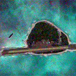
Pagasa Island is a jewel in the South China Sea. It is the one pictured - an emerald splash in an azure sea slashed by a coral runway - whenever new collisions or confrontations are reported in the news for the region. Occupied continuously by the Philippines since 1971, historical use dates back to the Han dynasty, which many believe forms the basis of the Chinese claim to the island. Each country has it's own interpretation of international law and the Filipinos are clearly banking on the precedence of continuous occupation, at no small expense, as Rancudo Field is the farthest airport from Manila within the Philippine sphere of control.
Surprisingly, the geography of the island serves to capture and retain rainwater, although the aquifer is stagnant and the water must be treated for consumption. Sea life remains abundant, poachers take coral heads and sea turtles. There is a solar farm and recently installed solar street lights, fuel for the generators is a precious commodity this far from the mainland.
Sadly, nature may solve the struggle for possession by withdrawing the island from the arena. It is believed that the construction of the runway may have compromised the islands basic integrity, allowing it to crumble into the sea. Whatever the cause, the evidence is clear. Bunkers built during the Japanese occupation in WWII are already slipping beneath the waves and the rate of salt water encroachment has been recorded at close to 6" per day.
There are some things to explore, the grounded BRP Laneo Del Norte to the west; over to the north near the resort grounds are a dugout fishing canoe and some authentic Philippine bangka boats; you may want to load up and head east to do some low warning passes over the Chinese fishing fleet. Standing at the east end of the field, you can just barely spot the China Coast Guard cutter's smoke on the horizon.
The tower is marked by a bright strobe that fires once every five seconds and at night it is bright enough to guide you back to the island from the distance of the fleet. There are no published procedures and the tower is not staffed. Airport ICAO is RPPN.
| Filename: | Pagasa_Island_Philippines.zip |
| License: | Freeware, limited distribution |
| Added: | 10th May 2014, 12:21:19 |
| Downloads: | 1,852 |
| Author: | Rick Keller |
| Size: | 16.17 MB |


© 2001-2026 AVSIM Online
All Rights Reserved
Privacy Policy |