
Where Flight Simulation Enthusiasts Gather from Around the World!
AVSIM Library - Search Results

| Category: Flight Simulator X - Scenery | |
| Warsaw City X DEMO |

|
Images related to this file:
File Description:

WARSAW CITY X DEMO is a sophisticated scenery package, featuring a detailed scenery of Warsaw city in Poland with surrounding airports, fully compatible with FSX, FSX:SE, P3Dv1, P3Dv2.
This product is a fully functional DEMO version of the commercial payware product. It features same layouts as in the full version but with limited 3D objects and low resolution textures. Using this free demo ensures no problems with online (VATSIM, IVAO, multiplayer etc.) flying in case some users use the payware scenery and some don't.
Warsaw is the capital and the largest city of Poland located on the Vistula (Wisla) River. Warsaw City 2015 gives you a possibility to fly over an extremely large area of Warsaw city. We have included a photoreal ground textures of about 5200 square km. The city centre has hundreds of custom buildings modeled, there are all VFR-important landmarks on the whole included area too. We have also created 13 variously detailed airports and heliports for the project: Modlin EPMO, Babice EPBC, Chrcynno/Nasielsk, Sobienie EPSJ, Goraszka EPGO, Konstancin-Jeziorna, Konstancin Heliport, Reczaje (lite), Kroczewo (lite), Trebki Nowe (lite), Wincentow 1 (lite), Wincentow 2 (lite), Zabia Wola (lite).
The product is equipped with an automatic installer, which means that the scenery will be automatically added to the Flight Simulator Scenery Library. Please uninstall all previous versions of similar sceneries you may have installed before. Please make also sure that no duplicated AFCAD files are installed.
Enjoy your virtual flying with Drzewiecki Design!
| Filename: | Warsaw_City_X_DEMO.zip |
| License: | Commercial demo |
| Added: | 5th September 2015, 01:09:15 |
| Downloads: | 3,336 |
| Author: | Drzewiecki Design |
| Size: | 36.95 MB |
| Category: Flight Simulator X - Scenery | |
| Purdown Transmitter |
|
File Description:
Purdown BT Tower was built in 1970 and is located on a hill (Purdown) just north of the city centre of Bristol, in the Lockleaze suburb, UK (National Grid Reference: ST610764) Lat N51 29.05 Lon W2 33.88. It is one of twelve reinforced concrete towers owned by BT in the UK. It is used mainly for point-to-point microwave links and forms part of the British Telecom microwave network. It is one of the few telecommunication towers in the UK built of reinforced concrete.The tower is 58M tall to the top gallery with the lattice structure on the gallery adding an additional 8M
| Filename: | Purdown_Transmitter.zip |
| License: | Freeware, limited distribution |
| Added: | 2nd November 2007, 23:33:30 |
| Downloads: | 611 |
| Author: | Steve Murnan |
| Size: | 253.32 KB |
| Category: Flight Simulator X - Scenery | |
| Robben Island Airstrip (AX78), Table Bay, South Africa |
|
Images related to this file:
File Description:
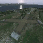
Robben Island is an island in Table Bay, some seven kilometers off the coast
of Cape Town, South Africa. The name is Dutch for "Seal Island". Robben Island
is roughly oval shaped with a disused gravel airstrip. It is of particular note
as it was here that former South African President and Nobel Laureate Nelson
Mandela and former South African President Kgalema Motlanthe, alongside many
other political prisoners were imprisoned. During the Second World War, the
island was fortified and guns were installed as part of the defences for Cape
Town. Please install fsxWorx01, fsxWorx02, and the updates before this
scenery.
| Filename: | Robben_Island_Airstrip_AX78_Table_Bay_South_Africa.zip |
| License: | Freeware, limited distribution |
| Added: | 18th November 2012, 09:56:56 |
| Downloads: | 3,477 |
| Author: | Hannes Steyn, Martin du Preez, Aeroworx |
| Size: | 18.99 MB |
| Category: Flight Simulator X - Scenery | |
| vobl2020 |
|
Images related to this file:
File Description:
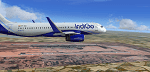
Kempegowda International Airport (IATA: BLR, ICAO: VOBL) is an international airport serving Bengaluru, the capital of the Indian state of Karnataka, in the Southern part of India. Spread over 4,000 acres (1,600 ha), it is located about 30 kilometres (19 mi) north of the city near the suburb of Devanahalli. It is owned and operated by Bengaluru International Airport Limited (BIAL), a public–private consortium.
This scenery is an update to the scenery created by Morten Thomas Van Der Linden. Includes the new south runway 27L/09R and updated taxiways, aprons (T2 aprons), parking stands (upto Stand 112) and radio frequencies. PLEASE FOLLOW INSTRUCTIONS PROVIDED IN THE READ ME TEXT FILE.
| Filename: | vobl2020.zip |
| License: | Freeware |
| Added: | 4th November 2020, 19:53:07 |
| Downloads: | 1,370 |
| Author: | Brandon Rodrigues |
| Size: | 22.27 MB |
| Category: Flight Simulator X - Scenery | |
| Tatoi Airbase (LGTT) |
|
Images related to this file:
File Description:
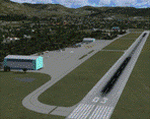
Tatoi AB is located north of Athens and is the home of the Air Training Comand of the Hellenic Air Force as well as all the Academys for basic training of all officer ranks of aircrew and ground crew for the Air Force. The Air force Museum is also based there with a substantial collection of historical static exhibits. Tatoi is also home of three Aeroclubs, the Athens Aeroclub, the Mesogion Aeroclub and Dekeleia Aeroclub as well as the Athens gliding club.
This addon will substantially revamp the scenery for LGTT as well as move the airport to its correct location. All buildings are custom made to represent the actual ones as closely as possible, based on existing photographs as well as my own experiences of being a member of the Athens Aeroclub and currently training there for my PPL.
| Filename: | Tatoi_Airbase_LGTT.zip |
| License: | Freeware |
| Added: | 25th June 2010, 22:10:09 |
| Downloads: | 3,502 |
| Author: | Vassilios Dimoulas |
| Size: | 13.5 MB |
| Category: Flight Simulator X - Scenery | |
| Freeware Project Kobe X (RJBE) Japan, SP1 |
|
File Description:
Freeware project KOBE X SP1. To install just unzip, copy and paste and replace the asked files into your FSX main folder. This file require Freeware Project Kobe X
Problems Solved:
-Flickering objects by adding LOD.
-Tower specular level reduced.
-Flickering Fuel reservoir top.
-Airport fence Z-alpha test causing to see the objects through it.
-Airport Altitude to match the real charts.
-Approachlights pylon missing texture.
-Fuel reservoir building to ground level.
If you have installed the previous version make sure you delete the effects file inside the -RJBE- folder. Everything should be fine now, if not please let me know what other problems you're having with this airport so I can fix it ASAP.
Thanks
Sagga Toure -Devinci-
Devinci Design and Development -3De-
Email: [email protected]
| Filename: | Freeware_Project_Kobe_X_RJBE_Japan_SP1.zip |
| License: | Freeware |
| Added: | 15th June 2011, 18:37:02 |
| Downloads: | 4,352 |
| Author: | Sagga Toure |
| Size: | 2.41 MB |
| Category: Flight Simulator X - Scenery | |
| PTAM - Mokapu - Oahu, Hawaii, USA |
|
File Description:
PTAM is quite a large airport located in beautiful Mokapu, on O'ahu in Hawaii, just over the mountains from Honolulu. It was designed to be a universal testing ground for new aircraft or flight training since the facilities are more than prepared for any scenario. From the varying length runways, full instrument approaches and navigational beacons, to the impressive nearby terrain, PTAM replaces the completely closed and unused airbase XBEL, or Bellows AFB. If you were to visit Bellows AFB in real life today you wouldn't find much except some old runways with plants poking through, some sporadic housing, a tennis court (?!), and a nearby golf course (as per Google Imagery circa late 2011). The flat land that was once used for an airbase combined with beautiful mountains and beaches makes this a prime location for new airport!
| Filename: | PTAM__Mokapu__Oahu_Hawaii_USA.zip |
| License: | Freeware |
| Added: | 14th May 2016, 11:50:13 |
| Downloads: | 755 |
| Author: | Christopher Murphy |
| Size: | 796.93 KB |
| Category: Flight Simulator X - Scenery | |
| EGCC - Manchester Airport - Manchester, UK |
|
Images related to this file:
File Description:
This is a very accurate rendition for Manchester airport and made only for FSX: Terminals 1, 2 and 3 completely rebuilt, airlines assigned to their terminals as per their website including Gate 12 allocated for the A380, PAPI moved to their correct positions for both runways, the mid turning circle for runway 5R/23L is now operational when there is a wind change from the SW and landings are on 23L, although designated up to a 767 max heavies will also use this as well, new control tower, taxiways and taxi signs updated to the latest charts, both fire stations added with the fire service practice ground also included, many other scenery objects also added to further enhance this airport, airport views are from inside the new control tower (when in tower view) please view the readme before installation.
| Filename: | EGCC__Manchester_Airport__Manchester_UK.zip |
| License: | Freeware, limited distribution |
| Added: | 5th December 2014, 13:33:32 |
| Downloads: | 26,625 |
| Author: | Craig Scott |
| Size: | 799.47 KB |
| Category: Flight Simulator X - Scenery | |
| Inter zones Update v1 to v2 |
|
Images related to this file:
File Description:
UPDATE: Interzones (between forest and rock) textures for FSX Update V1 to V2. Changes in this update: spring more darkness, add missing textures, delete bad textures for few airfields. (See screenshots)
| Filename: | Inter_zones_Update_v1_to_v2.zip |
| License: | Freeware |
| Added: | 27th November 2011, 20:14:18 |
| Downloads: | 3,161 |
| Author: | Aime Leclercq |
| Size: | 184.75 MB |
| Category: Flight Simulator X - Scenery | |
| RAF Waterbeach, Cambridgeshire 1943 |
|
File Description:
RAF Waterbeach (ICAO X3WH)is a former Royal Air Force station located in Waterbeach, Cambridgeshire which is 5.5 miles (8.9 km) north of Cambridge. The site was then used by the Royal Engineers, part of the British Army, from 1966, as Waterbeach Barracks until 2013 when the site closed to make way for housing. The site is currently unoccupied, apart from the officers' houses still in use - though Urban & Civic are now looking at temporary uses.
The airfield was built in 1940 on the northern edge of Waterbeach village and operated under the control of RAF Bomber Command. The original control tower and many RAF buildings, including several hangars, are still present
Source: Wikipedia
| Filename: | RAF_Waterbeach_Cambridgeshire__1943.zip |
| License: | Freeware |
| Added: | 11th May 2016, 20:27:00 |
| Downloads: | 143 |
| Author: | Terry Boissel |
| Size: | 1.34 MB |
© 2001-2026 AVSIM Online
All Rights Reserved
Privacy Policy |