
Where Flight Simulation Enthusiasts Gather from Around the World!
AVSIM Library - Search Results

| Category: Flight Simulator X - Scenery | |
| St KILDA upgrade for ORBX SCOTLAND |

|
File Description:
ST KILDA is an archipelago situated 41miles West of the Outer Hebrides.It is a world heritage site.
Its islands with their exceptional cliffs and sea stacks form the most important seabird breeding station in north-west Europe. The evacuation of its native population in 1930 brought to a close an extraordinary story of survival.
This scenery upgrades the ORBX scenery with the addition of -BORERAY Island and its two stacks (highest in the UK), Levenish, many birds, scenery added to HIRTA(the main island) and boat traffic.
Sadly no airfield but as Hirta has a military prescence there is a helicopter pad. This is an ideal place to explore with a floatplane!
| Filename: | St_KILDA_upgrade_for_ORBX_SCOTLAND.zip |
| License: | Freeware |
| Added: | 9th July 2017, 19:11:50 |
| Downloads: | 281 |
| Author: | john watts |
| Size: | 5.41 MB |
| Category: Flight Simulator X - Scenery | |
| RNAS Henstridge (HMS Dipper) |
|
File Description:
Royal Naval Air Station Henstridge or RNAS Henstridge (HMS Dipper) is a former Fleet Air Arm base located 7 miles (11 km) west of Shaftesbury, Dorset (Now Somerset) and 12.4 miles (20.0 km) east of Yeovil, Somerset in South West England.
The main part of the land (355 acres) was purchased in August 1941, after which building of the airfield and the marsh lane accommodation site commenced, it was commissioned on April 1, 1943 as HMS Dipper, principally as number 2 naval fighter school, on the 11th September 1942, another 18 acres was acquired at the adjoining gibbs marsh area for an aircraft repair and maintenance site. The design and lay-out of the airfield was quite unique, having 5 runways, 2 of these being east west lay-out (07-25) both 1000 yards long, the northern runway incorporated a dummy deck landing strip, complete with under-ground arresting gear with four above ground arrestor wires, which was a duplicate of that installed on HMS Implacable for training of aircraft carrier landings, these mainly being carried out with the Seafire, a naval version of the spitfire with folding wings. The site also had its own cinema and stage hall
March 1952 the airfield became inactive and was placed under care and maintenance, during 1953 Air whaling (now Bristow group) used the facilities for repairs to the whaling fleet of helicopters until moving out in June 1958.June 1957 it was finally closed as a naval establishment, from 1958-1960 the entire site was sold off. 27 June 1980 the BBC purchased the whole site and applied for planning permission to erect at the airfield a shortwave radio station consisting of 21 self-supporting towers holding aerial arrays and ancillary buildings on a 300-acre site. The station would transmit overseas radio services to Eastern Europe, the Soviet Union and perhaps South America the application failed and the BBC sold the land during January 1987 The airfield is also the home of the wessex strut, a general aviation club formed in January 1977, which holds an annual fly in and other events their first fly-in was on 17 April 1977 and attracted 107 aircraft. As of today the only usable runway is the north 07-25 runway, extant with the concrete dummy deck, and the underground machinery chamber, it is also the home to a large number of light aviation enthusiasts aircraft as well as the Yakolevs aerobatic display team and the Dorset and Somerset air ambulance
The current airfield is operated by EGHS and is an unlicensed airfield. The only usable runway is 07/25 tarmac/concrete 750 mts long x 6 mtr wide. Henstridge radio can be contacted on 130.250 MHz, it can be found at the south eastern stub of the Yeovilton MATZ
Source:Wikipedia
| Filename: | RNAS_Henstridge_HMS_Dipper.zip |
| License: | Freeware |
| Added: | 9th February 2017, 22:14:54 |
| Downloads: | 164 |
| Author: | Terry Boissel |
| Size: | 4.53 MB |
| Category: Flight Simulator X - Scenery | |
| Istanbul and Marmara Sea Coastlines |
|
File Description:
This scenery corrects the coastlines for the eastern part of the Marmara Sea and the Bosphorus. The default scenery objects, railroads, freeways and bridges have been adjusted accordingly. In addition, the region and landclass files for Istanbul are corrected to give a better representation of this city.
| Filename: | Istanbul_and_Marmara_Sea_Coastlines.zip |
| License: | Freeware |
| Added: | 27th December 2006, 22:34:17 |
| Downloads: | 10,995 |
| Author: | Winfried Orthmann |
| Size: | 374.35 KB |
| Category: Flight Simulator X - Scenery | |
| Sicogon Airport with AirSwift Winter 2018/2019 FlightPlan and AI OSP ATR 72-600 AirSwift repaint textures |
|
Images related to this file:
File Description:

Sicogon Airport ICAO: RPIC with Photoreal Scenery. Comes with my own AirSwift Winter 2018/2019 Flightplan for OSP ATR 42-500 and OSP ATR 72-500/600 and AirSwift textures for OSP ATR 72-500. REQUIRES THE OSP AI MODELS of ATR 42-500 and ATR 72-500 for traffic.
| Filename: | Sicogon_Airport_with_AirSwift_Winter_20182019_Flig.zip |
| License: | Freeware, limited distribution |
| Added: | 3rd March 2019, 22:51:22 |
| Downloads: | 273 |
| Author: | Aeron M. Tumanut |
| Size: | 10.08 MB |
| Category: Flight Simulator X - Scenery | |
| Alderney Airport (EGJA) |
|
File Description:
Alderney Airport (EGJA) is located on the island of Alderney in the Channel Islands. I have travelled in and out of the island on many occasions and, despite the lack general lack of information on the internet about the airport, this is a pretty accurate representation. Features include accurate control tower, accurate terminal building, grass parking area, static aircraft, ground vehicles, car park, fire-station, surrounding trees, perimeter fencing and more. Many night textures and custom AFCAD file included. The airport is at N49 42 44 and W002 12 88. This scenery is for FSX but should also work under FS2004. It may even work in earlier versions of FS but this is untested.
| Filename: | Alderney_Airport_EGJA.zip |
| License: | Freeware, limited distribution |
| Added: | 29th October 2006, 03:17:06 |
| Downloads: | 8,383 |
| Author: | Tim Clayton |
| Size: | 2.29 MB |
| Category: Flight Simulator X - Scenery | |
| RAF Broadwell - Oxfordshire, England |
|
File Description:
RAF Broadwell (ICAO X2BW) is a former Royal Air Force station located 2 miles north of Broadwell and 3 miles southeast of Burford, Oxfordshire, within 2 miles of RAF Brize Norton.
It opened on 15 November 1943 and closed on 31 March 1947, operating under RAF Transport Command. It consisted of 3 concrete runways in triangular configuration.
Broadwell took part in the D-Day assaults with nearby RAF Down Ampney and RAF Blakehill Farm. Broadwell had two such squadrons, No. 512 Squadron RAF and No. 575 Squadron RAF were based here, flying the Douglas Dakota.
In February 1944, No. 512 Squadron was transferred to No. 46 Group at RAF Broadwell, it was a tactical Dakota squadron and started training glider towing and parachute dropping. Its first operation in the new role was a leaflet drop on 5 June 1944 over France, this followed intensive flying in and out of France including dropping parachutists at Arnhem.
On the eve of D-Day No. 575 Squadron dropped 5 Para into the invasion drop zone. On 6 June, it towed 21 Horsa gliders into France. In the next few weeks it started a casualty evacuation service from France back to England. In September 1944, it was involved in operation market garden to Arnhem where it suffered severe casualties.
The airfield continued to be a terminus for long-range transport operations to Europe, the Middle East and India. Source: Wikipedia
| Filename: | RAF_Broadwell__Oxfordshire_England.zip |
| License: | Freeware |
| Added: | 17th April 2016, 19:06:12 |
| Downloads: | 144 |
| Author: | Terry Boissel |
| Size: | 948.66 KB |
| Category: Flight Simulator X - Scenery | |
| Santa Cruz de la Sierra - Bolivia |
|
File Description:
Scenery Photoreal: Santa Cruz de la Sierra, Bolivia
Santa Cruz de la Sierra: (English: Holy Cross of the Mountain Range), commonly known as Santa Cruz, is the
capital of the Santa Cruz department in eastern Bolivia (17 45', South, 63 14', West)at 416 m above sea level.
The city of Santa Cruz is located not far from the easternmost extent of the Andes Mountains and they are
visible from some parts of the city its Situated too on the Pirai River.
The city of Santa Cruz and its metropolitan area are home to over 70% of the population of the department and
it is one of the fastest-growing cities in the world.
Airports: (NOT included in this package, just Scenery Photoreal of the city)
Viru Viru International Airport (IATA: VVI, ICAO: SLVR) in Santa Cruz de la Sierra, Bolivia is Bolivia's largest
international airport. Viru Viru handles domestic, regional, and international flights from Bolivia to
North America, South America and Europe and is the hub for Bolivia's biggest airline Boliviana de Aviacion (BoA).
The airport is able to handle the largest commercial jets.
El Trompillo Airport (IATA: SRZ, ICAO: SLET) is located in the south part of Santa Cruz, Bolivia, about 2 km
(1.25 miles) away from the central plaza. Airport type:(Public / Military).
Compatible with both FSX and P3D.
| Filename: | Santa_Cruz_de_la_Sierra__Bolivia.zip |
| License: | Freeware |
| Added: | 23rd June 2015, 17:09:33 |
| Downloads: | 1,707 |
| Author: | Marcos A. Rivas Torrez |
| Size: | 69.85 MB |
| Category: Flight Simulator X - Scenery | |
| 50 UL airfields which are not included in FSX, located in South-West of Germany, Part 4: |
|
File Description:
50 UL airfields which are not included in FSX, located in South-West of Germany:
Magolsheim, Muensingen-Eisberg, Hayingen, Huelben, Farrenberg, Dettingen, Oppingen-Au, Walxheim-Unterschneidheim, Schwaigern, Neuenstadt am Kocher, Moeckmuehl-Korb, Baumerlenbach, Ottmarsheim-Mundelsheiem, Oberrot-Glashofen, Mittelfischach, Weipertshofen, Hornberg Ostalb, Leuzendorf, Obersoellbach, Hermuthausen, Doerzbach-Hohebach, Gundelsheim, Hagensteiner Hof, Rastatt, Landau-Ebenberg, Bundenthal-Rumbach, Ohlsbach, Hilzingen, Boesingen, Muellheim (Baden), Reiselfingen, Antdorf, Paterzell, Ohlstadt-Poemetsried, Antersberg, Wasentegernbach, Altoetting, Etting, Altomuenster, Eschelbach, Strassham, Aichach, Burgheim, Irsingen-Hesselberg, Peiting, Fuessen, Berg /Ravensburg, Isny-Rotmoos, Kisslegg-Wangen, Riedlingen
| Filename: | 50_UL_airfields_which_are_not_included_in_FSX_loca.zip |
| License: | Freeware |
| Added: | 16th November 2017, 16:53:11 |
| Downloads: | 588 |
| Author: | Juergen Wolf |
| Size: | 32.85 MB |
| Category: Flight Simulator X - Scenery | |
| Plymouth City X |
|
Images related to this file:
File Description:
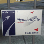
Plymouth City Airport scenery for FSX as of November 2011. The airport was opened in 1925 and closed on 23rd December 2011. This is version 3 of the scenery - any previous versions must be uninstalled first. Scenery includes airport buildings, 3D lighting, photo ground, surrounding traffic, buildings and greenery. Also includes a special scenery level options program to turn certain features on and off and to perform minor updates.
| Filename: | Plymouth_City_X.zip |
| License: | Freeware, limited distribution |
| Added: | 22nd December 2011, 23:32:29 |
| Downloads: | 3,428 |
| Author: | South West Scenery, William Mayne |
| Size: | 32.84 MB |
| Category: Flight Simulator X - Scenery | |
| (CZBM) Roland-Desourdy Airport - Bromont, Quebec, Canada |
|
Images related to this file:
File Description:
This scenery is a rendition of Bromont (CZBM) airport using GMAX.
Previously known as the Aeroport des Cantons de l Est, as of May 2012, this regional airport is now officially renamed Roland-Desourdy Airport.
A 5000' X 100' runway;
Paved parking for aircrafts;
A 190' X 100' hangar;
Runway lighting system;
Visual approach landing system;
Instrument approach system;
100LL and Jet fuel;
Rotating beacon;
Air to ground communications (UNICOM).
| Filename: | CZBM_RolandDesourdy_Airport__Bromont_Quebec_Canada.zip |
| License: | Freeware, limited distribution |
| Added: | 23rd December 2012, 15:57:03 |
| Downloads: | 2,526 |
| Author: | Pierre Gallant |
| Size: | 7.09 MB |
© 2001-2026 AVSIM Online
All Rights Reserved
Privacy Policy |