
Where Flight Simulation Enthusiasts Gather from Around the World!
AVSIM Library - Search Results

| Category: Flight Simulator X - Scenery | |
| MHTG - Toncontin Intl (Beta v0.6) |

|
File Description:
MHTG - Toncontin Intl (BETA v0.6). Featuring one of the most difficult approaches in the world for large jets, Toncontin Intl airport in Honduras is not well-represented in FSX default scenery. I have sought to rectify that situation with this scenery, which features several fully GMAX'ed buildings and extremely accurate positioning of all items. This scenery is more correctly called "incomplete" rather than "beta", but it is complete enough for me to release it in its present form, so that all of you can enjoy the thrill of flying into a more realistic MHTG using the infamous circling approach. I *highly* recommend you have some add-on terrain mesh installed to get the most realism out of the approach.
| Filename: | MHTG__Toncontin_Intl_Beta_v06.zip |
| License: | Freeware, limited distribution |
| Added: | 14th February 2009, 11:59:55 |
| Downloads: | 6,717 |
| Author: | Rhett Browning |
| Size: | 2.58 MB |
| Category: Flight Simulator X - Scenery | |
| EDCB - Ballenstedt Airport - Sachsen-Anhalt, Germany *Version 1* |
|
Images related to this file:
File Description:
The airfield Ballenstedt is located in the eastern foothills of the €œHarz (North German low mountain range) and with twenty thousand aircraft movements per year a relatively highly frequented airport.
The scenery is designed very much in detail. All important objects have been created by me using photos of the original field. Also some clearly visible landmarks are integrated like the large photovoltaic arrangement north of the asphalt runway and the quite large pig farm “Asmusstedt†situated east of the field. An additional important point of reference for glider pilots is the so-called "Gegenstein", a narrow rock on top of the small hill south of the Gliderfield. A retouched photo background, covering all four seasons, completes the scenery.
However, many smaller Objects, like people, cars or static airplanes in this scenery were
taken from three popular freeware libraries for whose use I got the friendly permission of the
authors. If these libraries are not installed , many objects are not visible!
The following libraries are used:
--------------------------------
1. FS-Piloten_Objektlibrary: http://www.fs-piloten.de/thread.php?threadid=1063
2. FSX_FlightPortLib: http://www.flightport.de/libraries/flightport-library/
3. 3d People Library: http://library.avsim.net/download.php?DLID=192454
| Filename: | EDCB__Ballenstedt_Airport__SachsenAnhalt_Germany_V.zip |
| License: | Freeware |
| Added: | 1st May 2016, 21:00:27 |
| Downloads: | 1,366 |
| Author: | Wolfgang Allers |
| Size: | 272.19 MB |
| Category: Flight Simulator X - Scenery | |
| ENRA - Mo I Rana Rossvoll Airport - Nordland, Norway |
|
Images related to this file:
File Description:
The Mo i Rana airport, Rossvoll is a North Norwegian airport in the county of Nordland. It is located about ten kilometers northeast of the city Mo i Rana. Operator of the airport is the Norwegian state-owned company Avinor.
The Mo i Rana Airport is currently served only by the Norwegian regional airline Wideroe. Scheduled flights go to an from Bodo, Bronnoysund, Mosjoen, Rorvik, Sandnessjoen and Trondheim.
The FSX scenery:
The environment of the airport is adapted by new landclasses.
The airport has a photo background in two variants, covering all four seasons of spring, summer, autumn and winter.
The buildings in this scenery come from the fantastic XPlane scenery of Bert alias"almosquito" who kindly gave me the permission to convert them for my FSX scenery.
But there are also some objects taken from two very popular freeware libraries.
If these libraries are not installed, several objects are not visible!
The following libraries are used:
1. FS-Piloten_Objektlibrary:
http://www.fs-piloten.de/thread.php?threadid=1063
2. FSX_FlightPortLib
http://www.flightport.de/libraries/flightport-library/
Basically, libraries should be well integrated into the hierarchy of the Scenery.cfg, even below the Add-On-scenery because the Library objects otherwise may not be found by FSX.
| Filename: | ENRA__Mo_I_Rana_Rossvoll_Airport__Nordland_Norway.zip |
| License: | Freeware |
| Added: | 1st August 2015, 21:40:11 |
| Downloads: | 1,513 |
| Author: | Wolfgang Allers |
| Size: | 9.44 MB |
| Category: Flight Simulator X - Scenery | |
| CYSG - St. Georges Aerodrome - v1.1 |
|
Images related to this file:
File Description:
Saint-Georges Aerodrome, (ICAO: CYSG), is a general aviation aerodrome located 1.5 nautical miles (2.8 km; 1.7 mi) west-southwest of Saint-Georges, Quebec, Canada near the border with Maine. The airport has a long, paved runway, suitable for use by jets. This scenery FSX Airport St-Georges was inspired by the great FS2004 scenery of the late pilot Virtual Hugues Caron img12. It was made very humbly in his memory. This FSX scenery been validated and tested with FSX SP1, SP2 and Acceleration. This is a complete reproduction, more accurate and realistic in Saint-Georges Beauce airport with all the buildings around it. For technical information or assistance contact one of the following email addresses support: [email protected] or [email protected]. Web site : http://imaginairvirtuel.qc.ca
| Filename: | CYSG__St_Georges_Aerodrome___v11.zip |
| License: | Freeware, limited distribution |
| Added: | 26th August 2013, 05:49:28 |
| Downloads: | 761 |
| Author: | Georges Bourgouin |
| Size: | 3.91 MB |
| Category: Flight Simulator X - Scenery | |
| Changi Airport - WSSS - Singapore |
|
Images related to this file:
File Description:
This is a fairly accurate and up-to-date version of Changi Intl Airport, and created only for FSX users, not suitable for P3D: This airport reflects today's situation with its 4 terminals and concourses bought up-to-date, including the Cargo aprons and buildings, all parking spots correctly numbered, airlines assigned to their original terminal where possible, 15 gates/parking spots allocated for the A380, taxiways and taxi signs updated to the latest charts, new control tower, extra fuel trucks and support vehicle paths, drainage channels and the south end reservoir also added, fuel tank farm and many other scenery enhancements and objects included to make this airport more realistic, airport views are from the roof of the control tower.
| Filename: | Changi_Airport__WSSS__Singapore.zip |
| License: | Freeware, limited distribution |
| Added: | 9th March 2021, 05:31:11 |
| Downloads: | 44,689 |
| Author: | JMS Designs |
| Size: | 2.76 MB |
| Category: Flight Simulator X - Scenery | |
| Carnes Farm |
|
Images related to this file:
File Description:
These are the files that I talked about in the Prepar3d forums. I created these objects for Fs9, then upgraded them to the scenery SDK for FSX. They were created 10 years ago in GMAX, and I have used them successfully ever since in Prepared 1.4 as well.
For some reason the individual farmhouse and other objects that I created are not showing up in Prepar3d version 2.0.
That's where you guys come in! These files are free to use in anyway you want as long as proper attribution is given, but, I would like you guys who have both Prepar3d 1.4 and 2.0 to try them out in both and report back to me as to whether you have the same problems that I do. That's your only fee. And I'd like you guys to give it a shot in both, or all four( I am not sure that they will work in FS9 anymore, but try it out. Unfortunately I can't recompile my FSX SDK Files back to FS9 if it doesn't work).
What's included:
1. Photo real scenery of Barbourville, 10 miles to the north west of stinking Creek where we live, and;
2. Photo real scenery of the farm area and stinking Creek, upon which I have placed my GMAX objects;
A. The farm house.Carnes Farm From the Bridge at 500 AGL.jpg
B. The barn, shed and the RV in back of the farmhouse.
C. A two-story long structure the top of which is an apartment but the bottom of which is a re-creation of Mama Carne's store, along with all the real wood floors shelves and original contents.. It is also o n Google earth in 3-D as it is here with further description .
... A little note on Gmax.. Mama Carne's store was one the first structures that I built in Gmax. It was just a box. Later, I added the true architectural features that you see including the steps and rails which took about as long to create as it would have to Saw and fit and hammer the real rails, risers and steps.
D. K-6, my little 2300 foot strip for runways 03 and 21. It has VOR - (117.55), ILS(110.1), and NDB(222).
E. Gerald Bingham's house, 1/4 mile up Warriors Path North from us.( mostly dirt road with gravel topping).
F. Dewitt Baptist Church.
Off property Knox county
G.Escoe's Store and Post Office complete with great prices for gas at the included pumps.
Escoes.jpg
H. Rex allen's killer corner...sheds and farm equipment on the sharpest bend on Stinking Creek...my son went off it with a flat tire, unscathed, but more than several have lost their lives on that curve... there may be several iterations of the sheds...just delete or rename the wrong ones...I was experimenting with ModelConverterX, Arno Gerretsen's wonderful model and object scenery tool.
I. sitting on top of the Barbourville Photo real scenery Barbourville PhotoReal over the shopping center.jpg is the Barbourville P3D Shopping Center2.jpg shopping center all the stores and all the storefronts ... it's on 25 E. as you head into Barbourville.
Recreated, is the entire shopping center with the now outmoded Wal-Mart sign. Probably my magnum opus.
note on the Gmax scenes.
All of the scenery was either directly measured and if not practical for a such a long measuring device, walked off, as in the Stinking Creek Bridge and shopping center. All of the objects were then photographed, in 360° where possible and saved as texture for inclusion in the Gmax model.
Enjoy!
...oh... how do you get there? Wellllll.... situate yourself at Middlesboro (1a6), and tune your Nav radio to K-69's VOR, 117.55, take off and climb to 3500 feet...grinnnnn
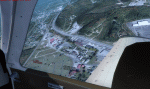
Welcome to Knox County Kentucky!
| Filename: | Carnes_Farm.zip |
| License: | Freeware |
| Added: | 2nd December 2013, 05:34:20 |
| Downloads: | 453 |
| Author: | Chas Honce |
| Size: | 91.13 MB |
| Category: Flight Simulator X - Scenery | |
| NZGA- Galatea Aerodrome (VectorLandClass, New Zealand) |
|
Images related to this file:
File Description:
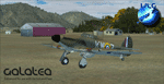
Welcome to Galatea (ICAO: NZGA), a gateway to exploring the Urewera ranges and the east coast of New Zealand. Galatea is a small and basic airstrip with only one old hanger, a public toilet and a small clubhouse on a wide plain surrounded by native bush and pine plantation near Murupara in the Bay of Plenty of New Zealand. It is a grass strip of 1025m length and 60m width and aligned 01/19 with a group rating of 8. No night lighting or fuel is available.
The FSX model includes custom textures and models placed on an aerial image. It makes extensive use of items from the free VLC object libraries which are required to be installed (download from www.vectorlandclass.co.nz downloads menu). This scenery and the VLC libraries have been funded
by sales of VectorLandClass and although you do not need VLC to use it, your purchase helps further development.
To the south west of Murupara township and sawmill is the LakeLand Helicopters base which just fits onto the photo-real coverage. Library objects have been placed here although they may not be accurate as the site was not visited when taking reference photos. This airfield makes a great stop over when flying between Rotorua, Mount Tarawera, Whakatane or Gisborne.
We hope you enjoy exploring the area!
| Filename: | NZGA_Galatea_Aerodrome_VectorLandClass_New_Zealand.zip |
| License: | Freeware, limited distribution |
| Added: | 15th November 2012, 23:35:42 |
| Downloads: | 1,127 |
| Author: | Tim Barnes / VectorLandClass |
| Size: | 45.7 MB |
| Category: Flight Simulator X - Scenery | |
| EDST - Hahnweide Kirchheim - Germany *v1.2* |
|
Images related to this file:
File Description:
The airfield EDST-Hahnweide is located approximately 17 nautical miles southeast of EDDS- Stuttgart. Former it was just a gliderfield but now ist is available also for small motor-aircrafts.
Each two years there are happens the greatest meeting of oldtimer-aircrafts in Europe.
This scenery is designed very much in detail. All important objects have been created by me and Joachim Herwig using actual original photos of the airfield and its surrounding. A retouched photo background, covering all four seasons, completes the scenery.
EDST Hahnweide does not exist in the standard scenery of the FSX. So this scenery is an addon-scenery, which hopefully will fill one of the plenty “white spots†in the World of FSX.
Because this field is some like a “bumpi†medow, the airfield ground is exactly designed like this. Therefore you will not find a plane runway.
Libraries: Many smaller Objects, like people, cars or static airplanes in this scenery were taken from three popular freeware libraries for whose use I got the friendly permission of the authors. If these libraries are not installed , many objects are not visible !
The following libraries are used:
1. FS-Piloten_Objektlibrary -
http://www.fs-piloten.de/thread.php?threadid=1063
2. FSX_FlightPortLib -
http://www.flightport.de/libraries/flightport-library/
3. 3d People Library -
http://library.avsim.net/download.php?DLID=192454
| Filename: | EDST__Hahnweide_Kirchheim___Germany_v12.zip |
| License: | Freeware, limited distribution |
| Added: | 25th October 2016, 21:01:37 |
| Downloads: | 1,481 |
| Author: | Wolfgang Allers, Joachim Herwig |
| Size: | 369.26 MB |
| Category: Flight Simulator X - Scenery | |
| CYYJ (2017) for FS9, FSX and P3D |
|
Images related to this file:
File Description:

CYYJ (2017), Version 7, is a major upgrade to CYYJ (2014). It portrays the Victoria (British Columbia, Canada) International Airport (CYYJ), aviation museum, Pat Bay floatplane base (CAP5) and Coast Guard station, and nearby industrial park as they appeared in early 2017 - as well as a host of static aircraft. It is fully compatible with Victoria+ (both FS2004 And FSX versions), Ultimate Terrain Canada/Alaska for FS2004 and Ultimate Terrain X - Canada for FSX, ORBX's FTX NA Blue and other FS9 road and shoreline upgrades for the area. CYYJ (2017) includes aircraft and traffic files for a realistic AI scenario other than scheduled airline operations. (Use BC Regional AI - also available from this file library - for scheduled traffic).
Version 7 adds all the recent major new construction and apron expansion at CYYJ, and includes a greater level of detail in many areas.
| Filename: | CYYJ_2017__for_FS9_FSX_and_P3D.zip |
| License: | Freeware, limited distribution |
| Added: | 24th May 2017, 18:30:48 |
| Downloads: | 5,991 |
| Author: | Don Grovestine |
| Size: | 118.7 MB |
| Category: Flight Simulator X - Scenery | |
| Istanbul Airport - LTFM - Turkey |
|
Images related to this file:
File Description:
This is a fairly accurate and up-to-date version of the new Istanbul Intl Airport, and created only for FSX users, not suitable for P3D: This airport reflects today's situation with its terminals and concourses including the Cargo aprons and buildings, all parking spots correctly numbered, airlines assigned to their domestic and International terminal gates where possible, Gates D19 and D20 allocated for the A380, taxiways and taxi signs updated to the latest charts, ILS added to runways 16R/34L, 17L/35R and 18/36 including some transitions, control towers, fuel trucks and support vehicle paths added, drainage channels, helipad at the VIP terminal and the state guest house, fuel tank farm and many other scenery enhancements and objects added to make this airport more realistic, airport views are from the roof of control tower 1.
| Filename: | Istanbul_Airport__LTFM__Turkey.zip |
| License: | Freeware, limited distribution |
| Added: | 2nd October 2020, 00:11:54 |
| Downloads: | 44,337 |
| Author: | JMS Designs |
| Size: | 2.02 MB |


© 2001-2026 AVSIM Online
All Rights Reserved
Privacy Policy |