
Where Flight Simulation Enthusiasts Gather from Around the World!
AVSIM Library - Search Results

| Category: Flight Simulator X - Scenery | |
| SBFZ - Fortaleza - Brasil Airport enhancements |

|
File Description:
SBFZ - Fortaleza - BRASIL - Pinto Martins International Airport --> for FS X ONLY!
VERSION 1.0 2007-AGO-12
My first attempt to modify / enhance FS X airports.
Try it out (day and especially at night) and give feedback.
This is a modification of the original FSX airport of Fortaleza (Brazil) SBFZ.
Summary of what has been changed / included:
Modifications on RW 13 / 31
- Runway center light
- Runway edge lights
- illuminated touchdown zones RW 13 / 31
- PAPI for RW 31
- Strobes for approach RW 31
Modification on taxiways
- all taxiways with green centerline lights up to the parking positions
- some additional taxiway indicators
- Gate indicators on APRON to gates 1 - 10 (most with moving jetways - CNTRL + J)
- Gate number at all gates and parking positions on Main Apron
| Filename: | SBFZ__Fortaleza__Brasil_Airport_enhancements.zip |
| License: | Freeware |
| Added: | 12th August 2007, 09:33:23 |
| Downloads: | 8,036 |
| Author: | Peter Koller |
| Size: | 382.19 KB |
| Category: Flight Simulator X - Scenery | |
| FYWH - Hosea Kutako International Airport - Windhoek, Nambia |
|
File Description:
Hosea Kutako International Airport (IATA: WDH, ICAO: FYWH) is the main international airport serving the Namibian capital city of Windhoek. Located 45 km (28 mi) east of the city, it is Namibia's primary airport with international
connections and handled 672,582 passengers in 2007. In 2009, the airport handled around 680,000 passengers, just over 4% down on the previous year when over 710,000 passengers were processed. The airport is named after Namibian hero
Hosea Kutako.
Windhoek Hosea Kutako International Airport underwent a modernizing makeover in 2009. It has one terminal with one departure and one arrival hall.
Airport two runways were corrected also the aprons and buildinds. Airport charts thanks to fly uk virtual airways, www.flyuk.aero/en/index.php?page=airport_opsinfo&id=FYWH.
This work is dedicated to West Wind Airlines.
| Filename: | FYWH__Hosea_Kutako_International_Airport__Windhoek.zip |
| License: | Freeware |
| Added: | 18th June 2013, 04:58:07 |
| Downloads: | 4,284 |
| Author: | Anwar Gonzalez |
| Size: | 586.07 KB |
| Category: Flight Simulator X - Scenery | |
| Boundary Bay Airport, British Columbia (CZBB) |
|
File Description:
The airport was based on a Google Earth photo, and the buildings are not 100% accurate, but are reasonably accurately placed and should give a good feel for the airport.
The airport was based on a Google Earth photo, and the buildings are not 100% accurate, but are reasonably acurately placed and should give a good feel for the airport. Historically this his represents a period at the airport in its GA heyday before Heli One and the new terminal building went up cica 2007-2009, from when McLeod Aviation was still in the big hanger and there were plenty of small flying Schools about, to when the new Alpha Aviation building went up.
There is a fuel truck, a single small gate area for commercial flights (even though there is none in reality) and various static items around the field, including the old white dome hangars down the East end of the field (where I used to keep my plane. Watch out for a surprise if you are taxiing out to 25 or 30!
Enjoy.
| Filename: | Boundary_Bay_Airport_British_Columbia_CZBB.zip |
| License: | Freeware |
| Added: | 6th December 2011, 00:42:16 |
| Downloads: | 582 |
| Author: | Bernie Garrett |
| Size: | 914.75 KB |
| Category: Flight Simulator X - Scenery | |
| KDEN - Denver, Colorado International Airport |
|
Images related to this file:
File Description:
Denver Colorado International Airport For FSX. Several improvements have been made to the default airport, those being:
1. A United Airlines commuter terminal has been added to Concourse B along with custom made jetways complete with the United Airlines logo (these jetways are NOT animated).
2. All jetways and scenery objects will display as long as scenery complexity in FSX is set at normal or higher.
3. The vehicle paths have been redesigned so as not to allow airport vehicles to enter taxiways
4. Optionally, all runways may be opened for AI traffic.
5. The land class has been changed in places so as to prevent autogen objects from displaying on the airport grounds.
6. The tower view has been changed to display from the roof of the control tower.
7. Extra fuel trucks have been added throughout the airport.
8. All gates are accurately portrayed.
9. All taxiways are included and are accurately named, and taxiway signs are accurately placed.
Also, there is an option to place several static United Airlines and Southwest Airlines aircraft in designated spots.
This is an improved version of the airport which I first did in 2007.
Please refer to the README FIRST.txt file for important information
| Filename: | KDEN__Denver_Colorado_International_Airport.zip |
| License: | Freeware, limited distribution |
| Added: | 5th January 2014, 23:51:59 |
| Downloads: | 3,484 |
| Author: | Patrick Finch |
| Size: | 2.57 MB |
| Category: Flight Simulator X - Scenery | |
| Whale Island (Hi Resolution Photo and mesh), New Zealand |
|
Images related to this file:
File Description:
Whale Island (Maori Name: Moutohora) is a small island located off the Bay of Plenty coast of New Zealand's North Island. It is located about 12 kilometers north of the town of Whakatane. A whaling station existed on the island during the 19th century. The 1.43 km island is a remnant of a complex volcano which has eroded, leaving two peaks. This is still an area of volcanic activity and there are hot springs on the island in Sulphur Valley, McEwans Bay, and Sulphur Bay.
This Hi Resolution scenery was created from a 0.25m pixel resolution Ortho-rectified Aerial mosaic owned by Environment Bay of Plenty (The Bay of Plenty Regional Council) and flown in 2007. The imagery has been slightly de-sampled for use in Flight Simulator X and utilizes the a custom hi resolution 5m Mesh derived from photogrammetry data off the photos. The textures are intended for summer daylight flying only, although due to the evergreen nature of New Zealand's native bush, the Islands appearance remains relatively constant throughout the year.
The island contains a small helicopter pad which is used for checking the various radio antennas on the Island. There is also a small Department of Conservation hut near the south western tip of the Island. These objects have been added from the FSX library of objects. Make sure to turn up your graphics sliders to make the most of this data! To find the Island fly north from Whakatane airport.
| Filename: | Whale_Island_Hi_Resolution_Photo_and_mesh_New_Zeal.zip |
| License: | Freeware, limited distribution |
| Added: | 20th January 2010, 10:12:14 |
| Downloads: | 4,650 |
| Author: | Tim Barnes |
| Size: | 9.94 MB |
| Category: Flight Simulator X - Scenery | |
| LJLJ Ljubljana Joze Pucnik Airport |
|
File Description:
Ljubljana Joze Pucnik Airport (IATA: LJU, ICAO: LJLJ) also known by its previous name Brnik Airport, is the international airport of Ljubljana, Slovenia. The airport is located near the village of Brnik, 19 km (12 mi) north of Ljubljana
and 11 km (6.8 mi) south of Kranj on the road between Kranj and Menges. It has a 3,300 m �� 45 m (10,827 ft �� 148 ft) paved runway. Letalisce Brnik was opened on December 24, 1963.
In 2007, the central-right government controversially renamed the airport to Ljubljana Joze Pucnik airport. Joze Pucnik was a Slovene public intellectual, dissident, and politician, leader of the Democratic Opposition of Slovenia (Demos)
between 1989 and 1992.
The airport is home to Adria Airways, the Slovenian flag carrier. There are currently two low-cost carriers serving the airport, EasyJet and Wizz Air. A few other airlines also serve the airport.
On December 8, 2004, the airport received its first annual millionth passenger. Overall, the airport handled 1,369,485 passengers in 2011, down from 1,673,050 passengers in 2008. It is the only airport in Slovenia with scheduled air
traffic.
The airport is served by a motorway exit off the A2 motorway and by bus service connecting it with Ljubljana and Kranj. A rail line to both cities is planned as well.
Airport is equipped with ILS Cat IIIb on runway 30. NDB and VOR approach are also available.
The runway of the Ljubljana Joze Pucnik Airport was closed to air traffic in April 2010. During that time, the entire width of the asphalt surface of the runway was renovated, as well as the asphalt surface on some parts of taxiways.
This file has the right coordenates, apron and characteristics of the airport, airport vehicules and buildings, Airport charts included.
| Filename: | LJLJ_Ljubljana_Joze_Pucnik_Airport.zip |
| License: | Freeware |
| Added: | 22nd November 2012, 16:29:14 |
| Downloads: | 1,511 |
| Author: | Anwar Gonzalez |
| Size: | 1.84 MB |
| Category: Flight Simulator X - Scenery | |
| Mielec EPML 20X |
|
Images related to this file:
File Description:
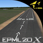
This is new version of EPML airport scenery for FSX. Main features of the scenery are: Airport ground high resolution textures - (four seasons + night textures); Highly detailed 3D objects, all photo textured; Detailed autogen and photorealistic trees. For more details please look at the README file attached to the scenery file.
EPML is home base of PZL-Mielec (Polskie Zaklady Lotnicze - Polish Aviation Works), formerly WSK-Mielec and WSK "PZL-Mielec" is the Polish aerospace manufacturer, based in Mielec. It has been the biggest Polish post-war aerospace manufacturer. In 2007 it was acquired by Sikorsky Aircraft Corporation, retaining the brand. Starting from 1950, the factory developed much and became the biggest Polish aircraft producer. It was a licensed producer of the Soviet jet fighters MiG-15 (produced as Lim-1), MiG-15bis (Lim-2), MiG-17 (Lim-5) and its Polish attack variant, Lim-6. The first Lim-1s were manufactured of Soviet parts in 1952, a full-scale production started in 1953. About 1500 Lims were built by 1964. In 1957-1960 there were also produced 250 Polish-designed piston trainers TS-8 Bies. From 1963 there was produced Polish-designed jet trainer TS-11 Iskra, being a basic trainer in the Polish military aviation. Its successor, designed with a part of PZL-Mielec, the PZL I-22 Iryda, appeared however a failure for different reasons, mostly lack of proper funding, and only a small series was built.
The most numerous plane built in Mielec was the licensed Soviet Antonov An-2 utility biplane, produced from 1960 in different variants. Over 13,000 of these aircraft were manufactured by 1991, mostly on the Soviet order, but also used in Poland and exported to other countries. From 1984 PZL-Mielec manufactured Soviet STOL transport planes Antonov An-28, as its only producer in the world. The plane was subsequently developed in Mielec and in a modernized variant PZL M-28 Skytruck/Bryza is offered for the Polish Army, Polish Navy and services abroad, with some success.
| Filename: | Mielec_EPML_20X.zip |
| License: | Freeware |
| Added: | 15th May 2010, 08:52:09 |
| Downloads: | 3,680 |
| Author: | Marcin Bobro, Kuba Paczek |
| Size: | 91.27 MB |
| Category: Flight Simulator X - Scenery | |
| LYPG Podgorica Airport, Montenegro |
|
File Description:
Podgorica Airport (IATA: TGD, ICAO: LYPG) is an international airport located 11 km (6.8 mi) south of Podgorica, Montenegro. It is the main hub for Montenegro Airlines.
It is one of two public airports in Montenegro, the other being Tivat Airport. Both are operated by the state-owned company Airports of Montenegro. The airport is sometimes called Golubovci Airport by the locals, as the town of
Golubovci is in close proximity. Airports Council International awarded Podgorica the best airport under 1 million passengers in 2007.
The IATA code of the airport is still TGD because Podgorica was named Titograd (after Josip Broz Tito) from 1946 to 1992, during which time the airport opened.
The airport handles domestic flights within Montenegro as well as international flights. As Montenegro's two main airports are merely 80 km apart, there are no regular passenger domestic flights. Domestic flights have been reduced to
charter flights and general aviation, and all scheduled traffic is international.
There are daily scheduled flights to various European destinations. During the summer season, there are many charter flights and air connections to various major cities in the world. The flight to Belgrade airport has traditionally
accounted for majority of the traffic at the airport, but the percentage is decreasing.
VIP and taxi airlines Vektra Aviation, Di Air and OKI Air are based at the airport. Serbian VIP airlines Air Pink and Prince Aviation also use the airport.
Podgorica Airport served 538,477 passengers in 2008. However, due to global economic downturn, passenger numbers declined to 450,504 in 2009. In 2010, strong growth was recorded, so numbers passed the 600,000 mark.
Thanks to Serbia And Montenegro Virtual Area Control Center for the airport charts.
This file has the right coordinates, with the apron and characteristics of the airport, airport vehicles and buildings, also it is set to the correct altitude of 126 feet or 38 meters.
| Filename: | LYPG_Podgorica_Airport_Montenegro.zip |
| License: | Freeware |
| Added: | 29th October 2012, 21:41:37 |
| Downloads: | 4,669 |
| Author: | Anwar Gonzalez |
| Size: | 10.52 MB |
| Category: Flight Simulator X - Scenery | |
| YFRV Oombugurri Community, Western Australia (Town closed 2011) |
|
File Description:
YFRV Oombugurri Community, Western Australia, formerly Forrest River Mission. Features extensive flattening of Forrest River which runs uphill. Take a flight there before installing the scenery.
Oombulgurri, was an Aboriginal community in the eastern Kimberley, 45 kilometres southeast of Wyndham.
The Anglican Forrest River Mission for Aborigines was founded in 1896���¢������97 by Harold Hale (Later Bishop of Prth) but was abandoned after a few months. A permanent mission, known as the Forrest River Mission, was established on the site in 1913 by the bishop of the north west, the Rt. Rev. Gerard Trower. In December 1913, Anglican priest Ernest Gribble took charge, three years after he was forced to resign as superintendent at Yarrabah. Gribble remained as superintendent until the early 1930s.
In 1926 the mission was plagued by an influenza epidemic and impacted by the Forrest River massacre where police killed a number of Aboriginal people. This event remains controversial.
The mission was closed in 1969, after the 1967 Aboriginal referendum.
In 1973, fifty Aboriginal people decided to resettle their abandoned tribal land and rename it Oombulgurri. Within a year, the population had grown to 200. Infrastructure and welfare programs were set up in the 1970s and 1980s to provide the residents with basic amenities and to allow the town to become self-sufficient.
In 2007 a Coronial Inquiry began into Aboriginal deaths in the Kimberley, including five in Oombulgurri. It revealed high levels of alcohol abuse, suicide and child neglect in Oombulgurri. Some time after the inquest, alcohol was banned there and the population began to move away to areas where alcohol was available.
It had a population of 107 as of the 2006 census. In 2011, the government of Western Australia encouraged residents of Oombulgurri to move elsewhere as it considered the community "unviable". The last residents from Oombulgurri were relocated to Wyndham just before Christmas 2011. REQUIRES Blencowe_LibraryKit.zip
REQUIRES blencowe_librarykit_309494.zip (Available HERE)
| Filename: | YFRV_Oombugurri_Community_Western_Australia_Town_c.zip |
| License: | Freeware |
| Added: | 28th February 2013, 02:37:06 |
| Downloads: | 229 |
| Author: | Alan Blencowe |
| Size: | 2.97 MB |


© 2001-2026 AVSIM Online
All Rights Reserved
Privacy Policy |