
Where Flight Simulation Enthusiasts Gather from Around the World!
AVSIM Library - Search Results

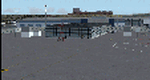
| Category: Flight Simulator X - Scenery | |
| China International Airports: ZBYN Taiyuan Wusu |

|
Images related to this file:
File Description:

Scenery of Taiyuan Wusu Airport in Shanxi Province of the PR China as it is in 2021. Airport layout corresponds with satellite images and actual charts, buildings made with GMAX
| Filename: | China_International_Airports_ZBYN_Taiyuan_Wusu.zip |
| License: | Freeware, limited distribution |
| Added: | 9th October 2021, 20:53:14 |
| Downloads: | 441 |
| Author: | Winfried Orthmann |
| Size: | 65.49 MB |
| Category: Flight Simulator X - Scenery | |
| Minneapolis St Paul International (KMSP) 2018 |
|
File Description:
In 2015 I posted 2 versions of KMSP with and without the ability to use AI aircraft. Since then, significant changes have occurred at MSP, mainly in the construction of three hotels, attached office block occupied by Cray Computers and road layout allowing for the construction of the InterContinental Hotel and another car park. Mall of America in the 2015 version was the original Microsoft Model, which turned out to be way too high. I have therefore also remodeled that.
| Filename: | Minneapolis_St_Paul_International_KMSP_2018.zip |
| License: | Freeware |
| Added: | 18th August 2018, 02:56:56 |
| Downloads: | 1,495 |
| Author: | Martin Connor |
| Size: | 31.74 MB |
| Category: Flight Simulator X - Scenery | |
| Greater Kankakee KIKK |
|
Images related to this file:
File Description:
FSX Scenery - Greater Kankakee Airport (IATA: IKK, ICAO: KIKK, FAA LID: IKK) is a public airport located three miles (5 km) south of the central business district of Kankakee, in Kankakee County, Illinois, United States. The airport was opened in 1962 and continues to operate as a general aviation facility serving the Kankakee area and South Chicago. It is 60 miles (97 km) south of Chicago and 75 miles (121 km) north of Champaign, Illinois. It is the largest Airport between the Chicago Midway Airport and the Champaign Airport. Greater Kankakee is a general aviation airport, consisting of mostly private aircraft with a mix of corporate and business aircraft usage. Created by John B Loney Jr.
| Filename: | Greater_Kankakee_KIKK.zip |
| License: | Freeware, limited distribution |
| Added: | 20th March 2012, 01:36:22 |
| Downloads: | 646 |
| Author: | John B. Loney, Jr. |
| Size: | 4.09 MB |
| Category: Flight Simulator X - Scenery | |
| Yuba Co-Oroville Muni |
|
File Description:
FSX Scenery - Yuba County Airport (IATA: MYV, ICAO: KMYV) is a public airport located three miles (4.8 km) southeast of Marysville, serving Yuba County, California, USA. The airport has two runways and is mostly used for general aviation. Oroville Municipal Airport (IATA: OVE, ICAO: KOVE) is a public airport located 3 miles (5 km) southwest of the city of Oroville in Butte County, California, USA. Oroville Municipal Airport covers 920 acres and has two runways. This airport is about 23nm NW of Yuba Co. An 18 hole golf course is located right next to the facility for you "Fly-in Golfers". EZ Scenry libraries require, some are included. By John B. Loney, Jr. and Robert Lacy.
| Filename: | Yuba_CoOroville_Muni.zip |
| License: | Freeware, limited distribution |
| Added: | 11th May 2010, 21:36:46 |
| Downloads: | 1,305 |
| Author: | John B. Loney, Jr. |
| Size: | 9.77 MB |
| Category: Flight Simulator X - Scenery | |
| Grati Pacitan Airport (WARD) |
|
Images related to this file:
File Description:
Grati Airport (WARD), formally known as R.E.B.O Tjokroadiredjo Airport is an Indonesian Navy Base Located in Pasuruan District, East Java, 34 miles South East of Surabaya. Grati was opened in October 10 2016. This airport serves VFR flight only.
| Filename: | Grati_Pacitan_Airport_WARD.zip |
| License: | Freeware |
| Added: | 20th March 2021, 16:26:51 |
| Downloads: | 55 |
| Author: | Sangwang Amarapati |
| Size: | 587.27 KB |
| Category: Flight Simulator X - Scenery | |
| KPNE Northeast Philadelphia Airport |
|
Images related to this file:
File Description:

KPNE Northeast Philadelphia Airport. Detailed general aviation airport with all new hand placed buildings using Google earth. Some buildings were left out to keep this highly detailed airport frame rate friendly. This scenery works well with general aviation AI.
| Filename: | KPNE_Northeast_Philadelphia_Airport.zip |
| License: | Freeware |
| Added: | 30th November 2010, 06:20:58 |
| Downloads: | 919 |
| Author: | Rob Touchtone |
| Size: | 199.36 KB |
| Category: Flight Simulator X - Scenery | |
| EDUT Templin Groß Dölln |
|
File Description:
The Airport "Templin" first were used by the German "Luftwaffe". After the WW2 the Russian Airforce become home there. This Airport was the biggest Airport in the GDR. I have resized the Runway to orginal 3500 x 60 meters.
| Filename: | EDUT_Templin_Gro_Dlln.zip |
| License: | Freeware |
| Added: | 17th April 2009, 09:38:39 |
| Downloads: | 480 |
| Author: | Guido Weiß |
| Size: | 285.93 KB |
| Category: Flight Simulator X - Scenery | |
| LIEE 2013 for FSX\P3D |
|
Images related to this file:
File Description:
Airport LIEE 2013 for FSX\P3D. Liee is the most important Sardinia's airport for number of passengers. The island is in the Mediterranean sea, in Italy. The low cost traffic encourages European Tourists to come on the island. This is LIEE 2013 airport. It is update to August 2013 and reproduce near 100% the real airport. This file includes also Cagliari with its monuments and interesting zones. Traffic and animation are enclosed on this airport.
Enjoy and have fun.
| Filename: | LIEE_2013_for_FSXP3D.zip |
| License: | Freeware |
| Added: | 9th September 2013, 17:07:41 |
| Downloads: | 4,856 |
| Author: | Andrea Deplano |
| Size: | 42.97 MB |
| Category: Flight Simulator X - Scenery | |
| Rio Vista Municipal Airport 2015 |
|
Images related to this file:
File Description:
FSX Scenery-Rio Vista Municipal Airport (FAA LID: O88) is a public airport located three miles (4.8 km) northwest of Rio Vista, serving Solano County, California, USA. This general aviation airport covers 273 acres (110 ha) and has two runways and one helipad. The airport is the current base of operations for the Travis AFB Aero Club. It opened in 1993, replacing the original Rio Vista Airport which closed in 1995. By John B. Loney, Jr.
| Filename: | Rio_Vista_Municipal_Airport_2015.zip |
| License: | Freeware, limited distribution |
| Added: | 18th May 2015, 12:53:28 |
| Downloads: | 238 |
| Author: | John B. Loney, Jr. |
| Size: | 6.43 MB |
| Category: Flight Simulator X - Scenery | |
| SKSA |
|
File Description:
Los Colonizadores Airport (IATA: RVE, ICAO: SKSA) is an airport in Saravena, Colombia.It is served by SATENA from Bogota y Bucaramanga.
| Filename: | SKSA.zip |
| License: | Freeware |
| Added: | 27th February 2011, 04:25:54 |
| Downloads: | 979 |
| Author: | Anwar Gonzalez |
| Size: | 6.88 KB |
© 2001-2026 AVSIM Online
All Rights Reserved
Privacy Policy |