
Where Flight Simulation Enthusiasts Gather from Around the World!
AVSIM Library - Search Results

| Category: Flight Simulator X - Scenery | |
| Misrata Intl. Airport HLMS FSX |

|
File Description:
This Addon for FSX, Currently the most realistic and best addon for Misrata airport.
Changes:
- APT position aligned.
- Correct Taxiway designators.
- Corrected stands and thier positions.
- Corredted VOR position
- Apron Lights.
and more...
-Info. : Misrata Airport (IATA: MRA, ICAO: HLMS) is an international airport serving Misrata, a Mediterranean coastal city in the Misrata District of Libya. It also acts as an air base and training center for the Libyan Air Force.
for contact: [email protected]
| Filename: | Misrata_Intl_Airport___HLMS_FSX.zip |
| License: | Freeware |
| Added: | 17th February 2019, 18:56:27 |
| Downloads: | 559 |
| Author: | Hamza Aswaid |
| Size: | 54.59 MB |
| Category: Flight Simulator X - Scenery | |
| Benina International Airport HLLB 2010 V.1 FS2004/FSX-sp2 |
|
File Description:
Benina International Scenery. located in the town of Benina, 19 km east of Benghazi, from which it takes its name. The airport is operated by the Civil Aviation and Meteorology Bureau of Libya and is the second largest in the country after Tripoli International Airport. Benina International is also the secondary hub of both Buraq Air and flag carrier, Libyan Airlines. During World War II, the airport was used by the United States Army Air Force Ninth Air Force during the Eastern Desert Campaign. Known as Soluch Airfield, it was used by the 376th Bombardment Group, which flew B-24 Liberator heavy bombers from the airfield between 22 February & 6 April 1943. Once the combat units moved west, it was used as a logistics hub by Air Transport Command. It functioned as a stopover en-route to Payne Field near Cairo or to Mellaha Field near Tripoli on the North African Cairo-Dakar transport route for cargo, transiting aircraft and personnel.
| Filename: | Benina_International_Airport_HLLB_2010_V1_FS2004FS.zip |
| License: | Freeware |
| Added: | 28th November 2010, 19:49:42 |
| Downloads: | 4,293 |
| Author: | Emad Qtiefan |
| Size: | 10.79 MB |
| Category: Flight Simulator X - Scenery | |
| Frankfurt Main Airport with new 25L/R ILS approaches (v2.1) |
|
Images related to this file:
File Description:
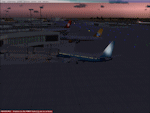
This scenery is a minor update to v2.0 of the FSX Frankfurt/Main airport package and was designed using ADE v1.40.
This change updates the 25L ILS frequency from 110.70MHz to 111.15MHz at EDDF as per change at the real EDDF on 28Oct2009. All other features remain unchanged.
Features include additional jetways, vehicle roadways around Terminal 2, up-to-date airline mapping to gates and additional taxiway and CAT II/III signs.
** Gates have been resized and added as per current layout
** Additional fuel trucks & support vehicle roads built around the airport
** 3 helipad start locations added
** B Gates now contain double jetways
** The control tower view has been moved to the south side and aprons have been remodelled
** 25L and 25R ILS Rwy frequencies now updated.
| Filename: | Frankfurt_Main_Airport_with_new_25LR_ILS_approache.zip |
| License: | Freeware |
| Added: | 15th November 2009, 12:20:37 |
| Downloads: | 2,776 |
| Author: | Mark Aldridge |
| Size: | 3.06 MB |
| Category: Flight Simulator X - Scenery | |
| CYYB - North Bay |
|
File Description:
Welcome to Jack Garland Airport also Known as North Bay!
Just minutes from the downtown core, the municipally-owned North Bay Jack Garland Airport is served by several air carriers and charter operators with daily flights to Toronto and Ottawa. This provides national and international connector service for North Bay and other Northern Ontario communities.
The North Bay Airport is certified by Transport Canada for day and night, IFR, and VFR operations. The main 10,000 foot runway is serviced by a parallel taxiway for efficient airport operations.
| Filename: | CYYB__North_Bay.zip |
| License: | Freeware |
| Added: | 26th March 2009, 08:30:43 |
| Downloads: | 1,593 |
| Author: | Daniel Louvet |
| Size: | 403.25 KB |
| Category: Flight Simulator X - Scenery | |
| FSIA - Seychelles Intl Airport - Seychelles |
|
File Description:
FSIA - GPS-accurate update to the default airport.
Seychelles International airport, a tropical earthly paradise located in the Indian Ocean, east of Madagascar, with beautiful scenery and an amazing approach.
The airport has been edited using ADEX, with the runway re-positioned on top of a google map to allow pilots to accurately execute the amazing RNAV RNP approach into runway 13.
The water class is also reworked since the default island is completely wrong.
You will certainly love your landings at this airport!
| Filename: | FSIA__Seychelles_Intl_Airport__Seychelles.zip |
| License: | Freeware, limited distribution |
| Added: | 10th November 2016, 18:12:19 |
| Downloads: | 2,032 |
| Author: | Ahmed Abdessalam |
| Size: | 8.26 KB |
| Category: Flight Simulator X - Scenery | |
| FSX Scenery Only KHRL Valley International Airport, Harlingen, Texas |
|
Images related to this file:
File Description:
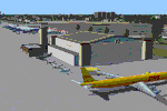
FSX Scenery Only KHRL Valley International Airport, Harlingen, Texas
Custom built terminal, hangars, buildings for a very nice South Texas airport. Transparency and interiors for night views.
A traffic file for generic and common use GA aircraft provided to add some spice. Photo credits for construction
to Robby Huffman and John Simmons. ADEX work by Al Von Pingle.
By Dan French.
| Filename: | FSX_Scenery_Only__KHRL_Valley_International_Airpor.zip |
| License: | Freeware, limited distribution |
| Added: | 10th October 2022, 14:02:34 |
| Downloads: | 202 |
| Author: | Dan French |
| Size: | 16.35 MB |
| Category: Flight Simulator X - Scenery | |
| Istanbul ATATURK Airport (LTBA) |
|
Images related to this file:
File Description:

The biggest and the busiest Turkish Airport. Meticulously detailed and realistically
depicted FSX scenery for Istanbul Ataturk International Airport.
Created with 3ds max from scratch, the scenery includes accurate buildings, hangars, parking bays, safe docking, night texturing and illumination effects. The scenery contains variety of static aircraft and boats, animations and photo real terrain texture. This a complete scenery.
| Filename: | Istanbul_ATATURK_Airport_LTBA.zip |
| License: | Freeware |
| Added: | 23rd January 2010, 10:01:24 |
| Downloads: | 28,294 |
| Author: | Serdar Nuzhet |
| Size: | 51.06 MB |
| Category: Flight Simulator X - Scenery | |
| Virac Airport RPUV with Photoreal Scenery |
|
Images related to this file:
File Description:
This is my reworked version of RPUV Airport. Now with Photorealistic Scenery, latest colors and updated terminal.
Virac Airport (IATA: VRC, ICAO: RPUV) is the only airport serving the island province of Catanduanes in the Philippines. It is located in the capital, Virac. The airport is classified as a Class 1 principal (major domestic) airport by the Civil Aviation Authority of the Philippines, a body of the Department of Transportation and Communications that is responsible for the operations of not only this airport but also of all other airports in the Philippines except the major international airports.
On October 27, 2013, Cebu Pacific launched the first ever Airbus flight in Virac.
| Filename: | Virac_Airport_RPUV_with_Photoreal_Scenery.zip |
| License: | Freeware |
| Added: | 26th November 2018, 16:20:24 |
| Downloads: | 828 |
| Author: | Aeron M. Tumanut |
| Size: | 35.35 MB |
| Category: Flight Simulator X - Scenery | |
| Thanlwin Bridge Mawlamyine VYMM (Moulmein-Martaban) V2.0 |
|
File Description:
The Thanlwin Bridge of Mawlamyine, linking Mawlamyine, the capital of Mon State, and Mottama side, is the longest and largest of its kind in Myanmar (Burma). It is 11575 feet long and has a 28-foot-wide two-lane motorway with the length of two miles, a 14-foot-wide railroad with the length of four miles, and two six-foot-wide walkways on it. The opening ceremony was on February 5, 2005 (Saturday) at 8 am on Mawlamyine bank. This scenery was produced based on pictures of satellites. Many Thanks go to the teams of FSX Planner, SceneGenX, Open Ports Scanner, AFXBgDownloader, FSUIPC and Google Earth. This scenery is only for FSX, for FS2004 please download bridgevymmfs9.zip
| Filename: | Thanlwin_Bridge_Mawlamyine_VYMM_MoulmeinMartaban_V.zip |
| License: | Freeware, limited distribution |
| Added: | 8th January 2008, 23:44:34 |
| Downloads: | 533 |
| Author: | HOUSE-RP, Robby Pauletto |
| Size: | 16.72 KB |
| Category: Flight Simulator X - Scenery | |
| KJYO - Leesburg Executive Airport - Virginia, USA |
|
Images related to this file:
File Description:

East Coast Simulations presents scenery for Leesburg Executive Airport (KJYO/JYO) for FSX/P3D! Leesburg Executive Airport at Godfrey Field (IATA: JYO, ICAO: KJYO, FAA LID: JYO) is a town-owned public-use airport located three nautical miles south of the central business district of Leesburg, a town in Loudoun County, Virginia, United States. It is a busy general aviation airport in the Washington, D.C. area, and a reliever for nearby Washington Dulles International Airport. This scenery includes all custom buildings and terminals with a season changing photoreal background. There are many custom ground polygons, and even 3-D PAPI lights are modeled.
| Filename: | KJYO__Leesburg_Executive_Airport__Virginia_USA.zip |
| License: | Freeware |
| Added: | 19th August 2015, 20:58:47 |
| Downloads: | 1,014 |
| Author: | Wesley Chin |
| Size: | 74.66 MB |
© 2001-2026 AVSIM Online
All Rights Reserved
Privacy Policy |