
Where Flight Simulation Enthusiasts Gather from Around the World!
AVSIM Library - Search Results

| Category: Flight Simulator X - Scenery | |
| Mesh South America / MeSA A02 |

|
File Description:
FSX Mesh South America Project:
This terrain mesh file is a part of a whole project covering all the Continent of South America and some islands, divided in tiles identified in a map by its column (letters) and rows (numbers).
Those files were multi-LOD compiled from 90m SRTM2 source data, reprocessed with 3DEM to remove voids and spikes, providing a 76.4m (LOD9) horizontal resolution topography intended for use only in FSX updated with SP1.
Although not well documented, to improve performance, the updated FSX loads DEM files in threads and only the closer terrain (about 5 NM from the point of view) is rendered in high detail, while at far distances FSX shows up its default low resolution mesh, when there is not a third part terrain mesh compiled in all others intermediate level of details (multi-LOD).
THIS FILE:
FSX_MeSA_A02
Column A x Row 02
This file covers the area inside the boundaries:
N = 11º 15' N; S = 5º 37,5' N;
W = 90º 0' W; E = 82º 30' W;
AUTHORS:
Hely Heck Junior - Magrao ( [email protected] )
and Jose Lobo ( [email protected] )
TerraBrasilis: www.terra-brasilis.org
| Filename: | Mesh_South_America__MeSA_A02.zip |
| License: | Freeware |
| Added: | 11th June 2007, 00:02:15 |
| Downloads: | 1,592 |
| Author: | Hely Heck Jr. and José Lôbo |
| Size: | 10.95 MB |
| Category: Flight Simulator X - Scenery | |
| Mesh South America / MeSA E03 |
|
File Description:
FSX Mesh South America Project:
This terrain mesh file is a part of a whole project covering all the Continent
of South America and some islands, divided in tiles identified in a map by its
column (letters) and rows (numbers).
Those files were multi-LOD compiled from 90m SRTM2 source data, reprocessed
with 3DEM to remove voids and spikes, providing a 76.4m (LOD9) horizontal
resolution topography intended for use only in FSX updated with SP1.
Although not well documented, to improve performance, the updated FSX loads DEM
files in threads and only the closer terrain (about 5-10 NM from the point of view)
is rendered in high detail, while at far distances FSX shows up its default low
resolution mesh, when there is not a third part terrain mesh compiled in all
others intermediate level of details (multi-LOD).
THIS FILE:
FSX_MeSA_E03 (Column E x Row 03)
covers the area inside the boundaries:
N = 5º 37,5' N; S = 0º 0' S;
W = 60º 0' W; E = 52º 30' W;
| Filename: | Mesh_South_America__MeSA_E03.zip |
| License: | Freeware |
| Added: | 13th June 2007, 21:41:26 |
| Downloads: | 1,255 |
| Author: | Hely Heck Jr. and José Lôbo |
| Size: | 83.82 MB |
| Category: Flight Simulator X - Scenery | |
| KFFZ - Falcon Field - Mesa, Arizona |
|
Images related to this file:
File Description:
Once again I have finally had enough of a bad airfield that I am very familiar with! FSX default KFFZ is "BAD" so here you go!, a much improved Airfield!. Falcon started out as a WW2 British training field and some day I will make a version of it, till then here is my rendition of KFFZ as of 2013, corrected apron's and taxiways to be current, added taxi sighs (so you know what taxiway your on, and lots more!, Hope you like it?, ENJOY!..
| Filename: | KFFZ__Falcon_Field__Mesa_Arizona.zip |
| License: | Freeware |
| Added: | 9th April 2013, 06:50:51 |
| Downloads: | 1,776 |
| Author: | Darrell Meadr |
| Size: | 28.47 MB |
| Category: Flight Simulator X - Scenery | |
| KKIC - Mesa Del Rey Airport - California, USA |
|
Images related to this file:
File Description:
FS2004/FSX Scenery - Mesa Del Rey Airport (IATA: KIC, ICAO: KKIC, FAA LID: KIC) is a city owned, public use airport located one nautical mile (2 km) northeast of the central business district of King City, in Monterey County, California, United States. It is included in the National Plan of Integrated Airport Systems for 2011–2015, which categorized it as a general aviation facility. This was a quickie design to test how things worked under Windows 10. Nothing fancy, but enjoyable. For your flightsimming pleasure by John B. Loney, Jr.
| Filename: | KKIC__Mesa_Del_Rey_Airport__California_USA.zip |
| License: | Freeware, limited distribution |
| Added: | 20th July 2016, 09:05:10 |
| Downloads: | 417 |
| Author: | John B. Loney, Jr. |
| Size: | 23.97 MB |
| Category: Flight Simulator X - Scenery | |
| KSEZ Sedona, Arizona, USA |
|
Images related to this file:
File Description:
KSEZ Sedona Airfield for FSX.
Designed to fit the footprint of the free Blue Sky Scenery Project created by Gottfried Razek.
Custom made models of the hangar area, restaurant, arrivals/departure block, fuel store and nearby hotel buildings together with "AGN" tree and shrub pack covering the area of Airport Mesa.
| Filename: | KSEZ_Sedona_Arizona_USA.zip |
| License: | Freeware, limited distribution |
| Added: | 10th January 2013, 21:53:51 |
| Downloads: | 1,763 |
| Author: | Anthony R Meredith |
| Size: | 1.51 MB |
| Category: Flight Simulator X - Scenery | |
| East Mesa and Phoenix Sky Harbor Airport Updates |
|
File Description:
KSDL:
Added ILS and Terminal with Jetways and Corrected Gate Numbers
KFFZ:
Added ILS and a small gate (NO JETWAY)
KCHD:
Added ILS
KPHX:
ADDED ILS TO 25R (DO NOT INSTALL UNLESS WANTED)
There are 4 airport updates in this package. I added ILS to all the regional and municipal airports in MESA, AZ that don't have ILS (most CAT III).
| Filename: | East_Mesa_and_Phoenix_Sky_Harbor_Airport_Updates.zip |
| License: | Freeware |
| Added: | 2nd December 2013, 05:30:00 |
| Downloads: | 359 |
| Author: | Alex Kulak |
| Size: | 73.12 KB |
| Category: Flight Simulator X - Scenery | |
| Nellis Air Force Base - KLSV |
|
File Description:
This file contains several BGL's which enhance the default
FSX Nellis Air Force Base (KLSV ). I have added some
ramp parking for miltary aircraft. Additionally, I have added several
scenery objects to enhance the visual experience.
The other change I made was to eliminate the "mesa effect" caused by
the stock FSX airport as it sits above/below the surrounding
terrain using "sloped flattens" to blend the airport level
terrain into the surrounding terrain.
I am using the "FSX Usa 10 M terrains Project - West Coast Version 1.1"
mesh but the default FSX mesh should blend O.K.
| Filename: | Nellis_Air_Force_Base__KLSV.zip |
| License: | Freeware |
| Added: | 21st December 2007, 04:37:40 |
| Downloads: | 3,343 |
| Author: | Paul Strogen |
| Size: | 855.47 KB |
| Category: Flight Simulator X - Scenery | |
| Tonopah Test Range - TNX |
|
File Description:
This file contains several BGL's which enhance the default FSX Tonopah Test Range (TNX).
Parking, scenery objects, and roads are added to the bland stock airport.
The "mesa" created by the stock airport backgound flatten is blended into the
surrounding terrain using "sloped flattens". The surrounding "city" was removed
and a better landclass substituted.
This scenery is not intended to re-create a perfect match to the real world but
to enhance the visual experience of flying into and out of the airport.
The files were tested with FSX-Acceleration\SP2 on WinXP Pro, DX9.
I used 10M mesh from the "FSX Usa 10 M terrains Project" when blending
| Filename: | Tonopah_Test_Range__TNX.zip |
| License: | Freeware |
| Added: | 21st December 2007, 04:35:03 |
| Downloads: | 1,236 |
| Author: | Paul Strogen |
| Size: | 843.73 KB |
| Category: Flight Simulator X - Scenery | |
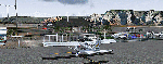
| Aerodromo de Tela - MHTE |
|
Images related to this file:
File Description:

Tela Airport (Spanish: Aeropuerto de Tela) (IATA: TEA, ICAO: MHTE) is an airport serving Tela, a town in the Atlántida Department on the northern coast of Honduras. In 2009, plans were laid to lengthen the runway from 1,346 metres (4,416 ft) to 1,600 metres (5,200 ft) and possibly to construct a new terminal building. There are hills southeast of the runway. Northeast approach and departure are over the water. The La Mesa VOR-DME (Ident: LMS) is located 31.0 nautical miles (57.4 km) southwest of the airport. The Bonito VOR-DME (Ident: BTO)is located 35.4 nautical miles (65.6 km) east of the airport.
| Filename: | Aerodromo_de_Tela__MHTE.zip |
| License: | Freeware |
| Added: | 25th January 2021, 02:29:26 |
| Downloads: | 207 |
| Author: | Luis Flores |
| Size: | 87.71 MB |
| Category: Flight Simulator X - Scenery | |
| Tonopah - KTPH |
|
File Description:
This file contains several BGL's which enhance the default FSX Tonopah, Nevada airport (KTPH).
Additional parking, scenery objects, and roads are added to the bland stock airport.
The "mesa" created by the stock airport backgound flatten is blended into the
surrounding terrain using "sloped flattens".
This scenery is not intended to re-create a perfect match to the real world but
to enhance the visual experience of flying into and out of the airport.
The files were tested with FSX-Acceleration\SP2 on WinXP Pro, DX9.
I used 10M mesh from the "FSX Usa 10 M terrains Project" when blending
the altitude data but the files should provide good results with the default FSX terrain.
| Filename: | Tonopah__KTPH.zip |
| License: | Freeware |
| Added: | 21st December 2007, 04:29:50 |
| Downloads: | 1,171 |
| Author: | Paul Strogen |
| Size: | 812.46 KB |
© 2001-2026 AVSIM Online
All Rights Reserved
Privacy Policy |