
Where Flight Simulation Enthusiasts Gather from Around the World!
AVSIM Library - Search Results

| Category: Flight Simulator X - Scenery | |
| USA East 10 metre mesh, Batch 1, Part 1 / N. Dakota, Minnesota |

|
File Description:
USA EAST USGS 10 metre mesh terrain - FSX only.
This constitutes 10 metre terrain mesh for a section of the USA, The whole USA East mesh files will abutt the US West Coast 10m mesh already available elsewhere, that was made by: Raimondo Taburet. Make sure you have your scenery terrain settings at about 5 metres in the FSX display dialogue for the mesh to show properly!
| Filename: | usx1-1.zip |
| License: | Freeware |
| Added: | 27th March 2009, 10:46:09 |
| Downloads: | 1,200 |
| Author: | Wayne Evans |
| Size: | 69.21 MB |
| Category: Flight Simulator X - Scenery | |
| USA East 10 metre mesh, Batch 1, Part 2 / N. Dakota, Minnesota |
|
File Description:
USA EAST USGS 10 metre mesh terrain - FSX only.
This constitutes 10 metre terrain mesh for a section of the USA, The whole USA East mesh files will abutt the US West Coast 10m mesh already available elsewhere, that was made by: Raimondo Taburet. Make sure you have your scenery terrain settings at about 5 metres in the FSX display dialogue for the mesh to show properly!
| Filename: | usx1-2.zip |
| License: | Freeware |
| Added: | 27th March 2009, 14:21:50 |
| Downloads: | 961 |
| Author: | Wayne Evans |
| Size: | 45.96 MB |
| Category: Flight Simulator X - Scenery | |
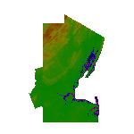
| Taiwan LOD11 / 19m Terrain Mesh |
|
Images related to this file:
File Description:
LOD11/19m Terrain Mesh covering Taiwan.
| Filename: | Taiwan_LOD11__19m_Terrain_Mesh.zip |
| License: | Freeware |
| Added: | 19th January 2016, 18:15:53 |
| Downloads: | 1,132 |
| Author: | Justin Tyme / TOPOSIM |
| Size: | 26.79 MB |
| Category: Flight Simulator X - Scenery | |
| Iceland 76m Terrain Mesh |
|
File Description:
This 76m terrain mesh covers the whole of Iceland and is derived from recently released source data produced by, and used with the permission of, Jonathan de Ferranti. It has been tested in FSX only but should work fine in FS2004. Improvements are most noticeable in the rolling interior of the country where the default FSX terrain resolution is relatively low.
| Filename: | icemesh76m.zip |
| License: | Freeware |
| Added: | 16th October 2007, 14:45:53 |
| Downloads: | 2,353 |
| Author: | Michael Johnson / Jonathan de Ferranti |
| Size: | 13.08 MB |
| Category: Flight Simulator X - Scenery | |
| Greece Mesh Terrain, v1 |
|
Images related to this file:
File Description:
Detailed FSX mesh terrain of Greece and surrounding territories (West Turkey, South Bulgaria, FYRoM, Albania) based on SRTM Data (3 arcsec, 90m) and sampled to LOD9 resolution (76m). For more information visit www.avsim.com/greece/scenery.
| Filename: | hspfsxmesh1.zip |
| License: | Freeware, limited distribution |
| Added: | 9th June 2010, 14:46:18 |
| Downloads: | 30,421 |
| Author: | Hellas Scenery Team (HST) |
| Size: | 76.59 MB |
| Category: Flight Simulator X - Scenery | |
| USA East 10 metre mesh, Batch 4, Part 3 of 9 |
|
File Description:
USA EAST USGS 10 metre mesh terrain - FSX only, includes: IA, MN, WI, IL, IN, MI, OH, PA, NY, VT, NH, ME, MA, CT, RI. Part 3 of 9!
This constitutes 10 metre terrain mesh for a section of the USA, The whole USA East mesh files will abutt the US West Coast 10m mesh already available elsewhere, that was made by: Raimondo Taburet. Make sure you have your scenery terrain settings at about 5 metres in the FSX display dialogue for the mesh to show properly!
| Filename: | usx4-3.zip |
| License: | Freeware |
| Added: | 11th May 2009, 10:11:50 |
| Downloads: | 1,061 |
| Author: | Wayne Evans |
| Size: | 29.56 MB |
| Category: Flight Simulator X - Scenery | |
| USA East 10 metre mesh, Batch 4, Part 5 of 9 |
|
File Description:
USA EAST USGS 10 metre mesh terrain - FSX only, includes: IA, MN, WI, IL, IN, MI, OH, PA, NY, VT, NH, ME, MA, CT, RI. Part 5 of 9!
This constitutes 10 metre terrain mesh for a section of the USA, The whole USA East mesh files will abutt the US West Coast 10m mesh already available elsewhere, that was made by: Raimondo Taburet. Make sure you have your scenery terrain settings at about 5 metres in the FSX display dialogue for the mesh to show properly!
| Filename: | usx4-5.zip |
| License: | Freeware |
| Added: | 11th May 2009, 10:14:06 |
| Downloads: | 610 |
| Author: | Wayne Evans |
| Size: | 33.54 MB |
| Category: Flight Simulator X - Scenery | |
| USA East 10 metre mesh, Batch 4, Part 9 of 9 |
|
File Description:
USA EAST USGS 10 metre mesh terrain - FSX only, includes: IA, MN, WI, IL, IN, MI, OH, PA, NY, VT, NH, ME, MA, CT, RI. Part 9 of 9!
This constitutes 10 metre terrain mesh for a section of the USA, The whole USA East mesh files will abutt the US West Coast 10m mesh already available elsewhere, that was made by: Raimondo Taburet. Make sure you have your scenery terrain settings at about 5 metres in the FSX display dialogue for the mesh to show properly!
| Filename: | usx4-9.zip |
| License: | Freeware |
| Added: | 11th May 2009, 10:18:22 |
| Downloads: | 1,018 |
| Author: | Wayne Evans |
| Size: | 29.02 MB |
| Category: Flight Simulator X - Scenery | |
| Extreme Southwestgreenland |
|
File Description:
Everybody who flies in Greenland knows, how incorrect the default scenery is.
This is a new terrain mesh scenery which covers Westgreenland - from Lat N 65 to N 62.
As SRTM data do not cover above N 60 - no Greenland mesh scenery has been produced. Like Extreme Westgreenland this is the one of the most detailed Greenland terrain mesh released up to release date of this scenery.
This great package covers more than 60.000 sq. km. area. This includes:
- LOD11 Mesh (terrain/elevation)
- Redesigned coastline
- Redesign lakes
| Filename: | eswg.zip |
| License: | Freeware, limited distribution |
| Added: | 26th November 2007, 04:29:14 |
| Downloads: | 4,058 |
| Author: | Ulrik Motzfeldt |
| Size: | 62.32 MB |
| Category: Flight Simulator X - Scenery | |
| Northeast New Jersey 5 Meter Mesh Terrain |
|
Images related to this file:
File Description:
High Resolution Northeast New Jersey 5 Meter Mesh Terrain by Wally-Bob represents a significant improvement over FSX default 38 meter mesh terrain. The results are also dramatic compared to 10 meter compressed payware mesh as lossless compression compilation (read no data loss) is used. Lossless compiling produces renderings that have the Crispness of the Real World Terrain. Fly the Hudson River and view the Palisades as they are in real life, see the screen shots enclosed. High Quality 5 meter mesh terrain is a must have for mountainous areas especially where photo scenery is also used to render the virtual world. Manual includes FSX configuration and scenery installation tips. USGS LiDAR 1/9 Arc-Second source data.
| Filename: | nenj_mesh_5m_v1_w-b.zip |
| License: | Freeware, limited distribution |
| Added: | 26th February 2011, 21:35:52 |
| Downloads: | 1,096 |
| Author: | Walter Roberts |
| Size: | 135.89 MB |
© 2001-2025 AVSIM Online
All Rights Reserved