
Where Flight Simulation Enthusiasts Gather from Around the World!
AVSIM Library - Search Results

| Category: Flight Simulator X - Scenery | |
| Whale Island Scenery: "Islands of the Bay of Plenty" |

|
File Description:
This scenery was created from a digital Orthorectified aerial mosaic owned by Environment Bay of Plenty (The Bay of Plenty Regional Council). The imagery has been de-sampled for use in Flight Simulator X and utilizes the default terrain mesh. The textures are intended for summer daylight flying only, although due to the sparse nature of White Islands' Evegetation, the Islands appearance remains relatively consistent throughout the year.
It includes autogen trees, a landable helicopter pad on the top of the Island, Radio masts, and the Department of Conservation (DOC) hut in the south western bay of the island.
| Filename: | Whale_Island_Scenery__Islands_of_the_Bay_of_Plenty.zip |
| License: | Freeware, limited distribution |
| Added: | 9th May 2007, 08:42:59 |
| Downloads: | 1,496 |
| Author: | Tim Barnes |
| Size: | 7.05 MB |
| Category: Flight Simulator X - Scenery | |
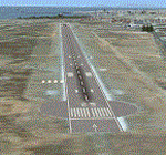
| FALL - Lydenburg Airfield, South Africa |
|
Images related to this file:
File Description:

Gmax representation of Lydenburg Airfield (FALL), Lydenburg, Mpumalanga, South Africa with photo real textures and seasonal ground textures. Lydenburg Town is to the East of the airfield and the township of Mashishing directly to the North of the airfield which you pass over on final approach to runway 22. Extra "hand-placed" autogen buildings were also added to make this approach a bit more "realistic". Lydenburg airfield is a small airfield with two grass runways and only 6 hangars. The airfield is shared with the model-aircraft pilots who has their own area and two smaller runways.
| Filename: | FALL__Lydenburg_Airfield_South_Africa.zip |
| License: | Freeware |
| Added: | 28th May 2014, 05:45:49 |
| Downloads: | 1,347 |
| Author: | Kobus van Wyk, Aeroworx |
| Size: | 25.22 MB |
| Category: Flight Simulator X - Scenery | |
| Mallam Aminu Kano Airport DNKN for FSX | Not tested with P3D |
|
Images related to this file:
File Description:
MALLAM AMINU KANO INTERNATIONAL AIRPORT
---------------------------------------
Mallam Aminu Kano International Airport (IATA: KAN, ICAO: DNKN) is an airport serving Kano, the capital city of Kano State of Nigeria. It was a Royal Air Force station before the country became independent. It is the main airport serving northern Nigeria and was named after politician Aminu Kano.
FEATURES
--------
*Photoreal Airport background with Night map,
*Improved Military wing,
*Corrected Parking's,
*Added Landclass,
*Autogen Buildings for Airport surrounding,
*Improved RWY and TWY marks,
*Bay Numbers
*Ramp lights, Taxi edge lights,
*FPS friendly,
*Custom 3D Building for the main terminal,
*More Airports Building,
| Filename: | Mallam_Aminu_Kano_Airport_DNKN_for_FSX__Not_tested.zip |
| License: | Freeware |
| Added: | 20th May 2018, 16:59:40 |
| Downloads: | 1,187 |
| Author: | Raheem Adeleke |
| Size: | 47.07 MB |
| Category: Flight Simulator X - Scenery | |
| Tokol (LHTL) enhanced scenery and ADE file |
|
File Description:
Tokol (LHTL) is a former military airfield just south of Budapest Ferihegy.
This scenery replaces the default LHTL with an enhanced and "reactivated"
version of the military airbase. Parking for military aircraft is provided
on the ramps and in numerous hardened shelters. Parking is also provided
for general aviation aircraft. This design was accomplished using ADE,
SBuilderX, FSXPlanner and Whisplacer. Custom hardened shelters created
by Juri Masnik. Default FSX library objects, autogen and RWY12
objects were used for this creation, This scenery is for FSX only and
was tested in FSX-Acceleration\SP2 on WinXP Pro.
| Filename: | Tokol_LHTL_enhanced_scenery_and_ADE_file.zip |
| License: | Freeware |
| Added: | 3rd February 2008, 13:51:21 |
| Downloads: | 1,842 |
| Author: | Paul Strogen |
| Size: | 1.97 MB |
| Category: Flight Simulator X - Scenery | |
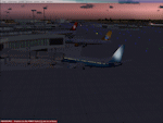
| Thraki |
|
Images related to this file:
File Description:
AS REAL AS IT GETS.
This is a detailed photorealistic scenery of southern Thraki.
Default FSX airports of Alexandroupoli (LGAL) and Komotini (Z11W) were completely redone, positioned to their exact location, and many buildings and objects were added in the airport compounds.
New aprons, taxi signs and plenty of aircraft parking.
New models for Komotini airport terminal building (not original), building signs, barracks and military vehicles all with night textures.
The scenery contains plenty of autogen objects, buildings, vegetation and road traffic near the airports.
I have also included 2 aircraft traffic files and 1 helicopter traffic file.
| Filename: | Thraki.zip |
| License: | Freeware |
| Added: | 26th September 2011, 14:41:10 |
| Downloads: | 1,921 |
| Author: | Angelo Tassoglou |
| Size: | 231.55 MB |
| Category: Flight Simulator X - Scenery | |
| The Real VCBI X |
|
Images related to this file:
File Description:

This is the complete & high detailed scenery of Bandaranaike International Airport
for Microsoft Flight Simulator X. If you are a Sri Lankan flightsimmer or like to fly
around Sri Lanka in Flight Simulator X, then this is a must for you!.
Features -: High quality Satellite terrain.
G-Max�������® designed terminal and other buildings.
Accurate building and apron placement.
Extremely high detailed terminal and surroundings.
Re-Adjusted glide scope and localizer to match actual situation.
Road traffic animations and other effects.
High detailed Autogen data.
| Filename: | The_Real_VCBI__X.zip |
| License: | Freeware, limited distribution |
| Added: | 4th October 2011, 08:00:05 |
| Downloads: | 8,602 |
| Author: | Gayan Liyanaarachchi |
| Size: | 22.65 MB |
| Category: Flight Simulator X - Scenery | |
| Jastarnia Scenery (EPJA) |
|
File Description:
Sim Hangar team presents Jastarnia scenery. Jastarnia (EPJA) is small, private aerodrome located at Hel Penisula in Poland. Its operated mostly in Summer and offers sightseeing tours around Puck Bay and Hel area. The scenery was built using SbuilderX, Whisplacer 0.9, ADE and Autogen Annotator. Every 3D object comes from FSX object library. The scenery contains seasonal and night textures plus additional, fictional water runway. Its compatible with Vector Europe and UTX: Europe. If you don't have any of those great add-ons, I have included some small scenery which will improve Polish coastlines in your FSX. Blue Skies!
| Filename: | Jastarnia_Scenery_EPJA.zip |
| License: | Freeware, limited distribution |
| Added: | 19th May 2008, 23:12:02 |
| Downloads: | 4,960 |
| Author: | Lukasz Kubacki |
| Size: | 25.57 MB |
| Category: Flight Simulator X - Scenery | |
| Frankfurt Main Airport with new 25L/R ILS approaches (v2.1) |
|
Images related to this file:
File Description:
This scenery is a minor update to v2.0 of the FSX Frankfurt/Main airport package and was designed using ADE v1.40.
This change updates the 25L ILS frequency from 110.70MHz to 111.15MHz at EDDF as per change at the real EDDF on 28Oct2009. All other features remain unchanged.
Features include additional jetways, vehicle roadways around Terminal 2, up-to-date airline mapping to gates and additional taxiway and CAT II/III signs.
** Gates have been resized and added as per current layout
** Additional fuel trucks & support vehicle roads built around the airport
** 3 helipad start locations added
** B Gates now contain double jetways
** The control tower view has been moved to the south side and aprons have been remodelled
** 25L and 25R ILS Rwy frequencies now updated.
| Filename: | Frankfurt_Main_Airport_with_new_25LR_ILS_approache.zip |
| License: | Freeware |
| Added: | 15th November 2009, 12:20:37 |
| Downloads: | 2,776 |
| Author: | Mark Aldridge |
| Size: | 3.06 MB |
| Category: Flight Simulator X - AFCAD Files | |
| CZBB Boundary Bay Airport, BC, Canada |
|
File Description:
This is a complete redo of the default FSX CZBB Boundary Bay Airport, BC using ADE v1.37, Google Earth satellite image and the latest airport chart effective as of 31 July 2008. The airport center and boundary repositioned. Control tower moved and replaced. Runway 07/25 extended to 5606 ft from 3540 ft and new taxiway E added. VASI Added to Runway 07/25. Taxiway signs added and/or corrected. Airport aprons resized and added where necessary. Taxiways and roads added. Static airport library objects and vegetation added for an improved look. XWind runways activated. Airport views are from the roof of the control tower when in tower view. A fuel truck has been added - Shift-F will bring this truck to your aircraft for refueling and will automatically refuel AI aircraft after landing and before take off. Airport chart and history included.
| Filename: | CZBB_Boundary_Bay_Airport_BC_Canada.zip |
| License: | Freeware |
| Added: | 5th November 2009, 02:16:37 |
| Downloads: | 448 |
| Author: | Robert Catherall |
| Size: | 381.61 KB |
| Category: Flight Simulator X - AFCAD Files | |
| CZBB Boundary Bay Airport, BC |
|
File Description:
This is a complete redo of the default FSX CZBB Boundary Airport, BC using ADE v1.37, Google Earth satellite image and the latest airport chart effective as of 31 July 2008. The airport center and boundary repositioned. Control tower moved and replaced. Runway 07/25 extended to 5606 ft from 3540 ft and new taxiway E added. VASI Added to Runway 07/25. Taxiway signs added and/or corrected. Airport aprons resized and added where necessary. Taxiways and roads added. Static airport library objects and vegetation added for an improved look. XWind runways activated. Airport views are from the roof of the control tower when in tower view. A fuel truck has been added - Shift-F will bring this truck to your aircraft for refueling and will automatically refuel AI aircraft after landing and before take off. Airport chart and history included.
| Filename: | CZBB_Boundary_Bay_Airport_BC.zip |
| License: | Freeware |
| Added: | 26th March 2009, 08:31:55 |
| Downloads: | 491 |
| Author: | Robert Catherall |
| Size: | 137.2 KB |
© 2001-2026 AVSIM Online
All Rights Reserved
Privacy Policy |