
Where Flight Simulation Enthusiasts Gather from Around the World!
AVSIM Library - Search Results

| Category: Flight Simulator X - AFCAD Files | |
| Lhasa Gonggar (ZULS) Update 1.2 - Tibet, China |

|
Images related to this file:
File Description:
This update to the ZULS airport I created using the freeware Airport Design Editor X (v1.47.07), it includes:
-an extended vehicle taxi network that surrounds the perimeter of the airport
-extended jetways, resized parkings radius and taxipaths
-additional and touch up on some airport objects' appearance and/or position, including a rotating tower beacon at night
with FSX object libraries. Some objects (lightposts and car parking lots) from the Acceleration pack are added for more realism, but may not be visible for the FSX RTM users.
This scenery is designed based on photos taken from Google Maps and other sites about the Lhasa Gonggar Airport.
| Filename: | Lhasa_Gonggar_ZULS_Update_12__Tibet_China.zip |
| License: | Freeware |
| Added: | 5th August 2010, 20:44:02 |
| Downloads: | 944 |
| Author: | Harry Sung |
| Size: | 424.7 KB |
| Category: Flight Simulator X - Scenery | |
| SKMD - Enrique Olaya Herrera Airport |
|
File Description:
Enrique Olaya Herrera Airport (Spanish: Aeropuerto Enrique Olaya Herrera) (IATA: EOH, ICAO: SKMD) is an airport located in MedellÃ�ÂÂn, Antioquia, Colombia is an airport located in Colombia's south-west of the city of MedellÃ�ÂÂn, which serves regional and domestic flights in that country. Additionally, more is the airport hangars and general aviation in Colombia. Due to the large number of general aviation and charter flights, regional and national, the Olaya Herrera is the second busiest airport in Colombia.
This file has the right coordinates, with the apron and characteristics of the airport. The runway and runways were resized, the gates placed on correct location.
| Filename: | SKMD__Enrique_Olaya_Herrera_Airport.zip |
| License: | Freeware |
| Added: | 17th February 2011, 02:09:59 |
| Downloads: | 571 |
| Author: | Anwar Gonzalez |
| Size: | 27.22 KB |
| Category: Flight Simulator X - Scenery | |
| New Orleans LA Louis Armstrong Intl. Airport |
|
File Description:
New Orleans LA Louis Armstrong Intl. Airport for FSX. Here are the enhancements which have been made: 1.) Gate numbers have been changed to accurately reflect the real life ones. 2.) The gates have been assigned to specific airlines using Afcad2. 3.) Sixteen jetways have been added. 4.) The crosswind runways are now active, thanks to Ray Smith for his help in getting this working. 5.) The vehicle paths have been rebuilt, essentially eliminating the problem of airport vehicles using the taxiways, which can cause traffic delays. 6.) Some ramp areas have been resized. Note that this file is for FSX only. It will not work properly in FS9.
| Filename: | New_Orleans_LA_Louis_Armstrong_Intl_Airport.zip |
| License: | Freeware, limited distribution |
| Added: | 8th April 2007, 20:17:16 |
| Downloads: | 2,764 |
| Author: | Patrick Finch |
| Size: | 202.43 KB |
| Category: Flight Simulator X - Scenery | |
| Chitral Airport - OPCH |
|
File Description:
Chitral Airport (IATA: CJL, ICAO: OPCH) is a small domestic airport situated 2 NM (3.7 km) north of the city centre of Chitral, in Khyber-Pakhtunkhwa province of Pakistan. It is a VFR airport which only operates in daylight and has domestic flights to and from Peshawar and Islamabad.
* 3D modeled terminal building and other small objects
* Accurate mesh around the Airport
* Custom ground textures for realism
* Photoreal textures for the Chitral city
* Autogen
Developed By Genysis Sim
| Filename: | Chitral_Airport__OPCH.zip |
| License: | Freeware |
| Added: | 27th December 2016, 00:46:11 |
| Downloads: | 1,099 |
| Author: | Haris Malick and Irfan Kaleem |
| Size: | 35.5 MB |
| Category: Flight Simulator X - Scenery | |
| Waterford City, Ireland - Photorealistic |
|
Images related to this file:
File Description:
Waterford City Photorealistic. This scenery consists of high resolution photographic scenery of Waterford City and is designed to complement my EIWF Waterford Airport Scenery. Autogen trees and buildings have been added with some custom landmarks. The scenery was designed to be used with vfr photographic scenery and uses masks to blend with the surrounding terrain. The bgls have been compiled with night masks but night lighting has been excluded to reduce the file size. Please enjoy.
| Filename: | Waterford_City_Ireland__Photorealistic.zip |
| License: | Freeware |
| Added: | 15th November 2011, 02:37:23 |
| Downloads: | 1,880 |
| Author: | George Keogh |
| Size: | 90.54 MB |
| Category: Flight Simulator X - Scenery | |
| Limnos - Greece |
|
Images related to this file:
File Description:
Limnos-Skyros Dn
AS REAL AS IT GETS.
This is a highly detailed photorealistic scenery of the islands of Limnos, Samothraki,
Agios Efstratios and Skyros WITH NIGHT TEXTURES.
Default FSX airports of the islands (LGLM and LGSY) were redone, (runways added)
positioned to their exact location and some buildings and trees were added in the airport vicinities
Aprons added, parking spots, air and vehicle traffic.
The scenery also includes autogen objects, vegetation and road trafic near the airports.
| Filename: | Limnos__Greece.zip |
| License: | Freeware |
| Added: | 24th November 2016, 17:36:47 |
| Downloads: | 808 |
| Author: | Angelo Tassoglou |
| Size: | 51.28 MB |
| Category: Flight Simulator X - AFCAD Files | |
| Rafic Hariri International Airport (BEY/OLBA), Beirut, Lebanon |
|
File Description:
Airport layout file (AFCAD) for the default Rafic Hariri International Airport (BEY/OLBA), Beirut, Lebanon. This is a minor update to the default OLBA airport in FSX. Cargo parking has been added and the position of certain gates and jetways has been corrected. An exclusion rectangle should prevent autogen to pop up between the northwest runways, both of which have been closed to landings as in real life. Minimal gate assignments. Tested with World of AI and custom AI only.
| Filename: | Rafic_Hariri_International_Airport_BEYOLBA_Beirut_.zip |
| License: | Freeware |
| Added: | 5th April 2009, 01:32:32 |
| Downloads: | 804 |
| Author: | Marten Weber |
| Size: | 148.43 KB |
| Category: Flight Simulator X - Scenery Design | |
| Terrain Design |
|
Images related to this file:
File Description:
Terrain Design for Flight Simulator X
This simple illustrated document explains the basic concepts in Flight Simulator X terrain, and how to change them using SBuilder for FS X. Make new water bodies, roads, vehicle traffic, airport flattens, remove autogen, add more detail - anybody can do it easily and quickly.
My most sincere apologies - I am unable, for lack of free time, to offer support of any kind. For questions or problems, please post in the Avsim scenery design forum.
| Filename: | Terrain_Design.zip |
| License: | Freeware |
| Added: | 14th December 2009, 13:29:15 |
| Downloads: | 18,390 |
| Author: | Luis Feliz-Tirado |
| Size: | 3.9 MB |
| Category: Flight Simulator X - Scenery | |
| TGPY |
|
File Description:
Maurice Bishop International Airport (IATA: GND, ICAO: TGPY), formerly known as Point Salines International Airport, is located in the parish of St. George's. The town of St. George's is about 5 miles (8.0 km) north of the airport and is the capital of the island nation of Grenada. The airport is located on Point Salines, the most southwestern point of the island. It is the most important airport in terms of infrastructure in the northern part of the country and the first in terms of cargo movements.
This file has the right coordenates, with the apron and characteristics of the airport. The runways were resized the gates placed on correct location and number.
| Filename: | TGPY.zip |
| License: | Freeware |
| Added: | 30th April 2011, 00:18:46 |
| Downloads: | 1,954 |
| Author: | Anwar Gonzalez |
| Size: | 7.85 KB |
| Category: Flight Simulator X - Scenery | |
| Frankfurt Main Airport with new 25R ILS approach (v2.0) |
|
Images related to this file:
File Description:
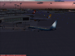
This scenery is an update to v1.0 of the FSX Frankfurt/Main airport package and was designed using ADE v1.40.
This update now features additional jetways, vehicle roadways around Terminal 2, up-to-date airline mapping to gates and additional taxiway and CAT II/III signs. ** Gates have been resized and added as per current layout ** Additional fuel trucks & support vehicle roads built around the airport ** 3 helipad start locations added ** B Gates now contain double jetways ** The control tower view has been moved to the south side and aprons have been remodelled ** In addition the ILS for Rwy25R has been updated to reflect the new frequency change from 109.50 to 111.55Mhz as of June 2009.
| Filename: | Frankfurt_Main_Airport_with_new_25R_ILS_approach_v.zip |
| License: | Freeware |
| Added: | 4th November 2009, 19:49:58 |
| Downloads: | 1,370 |
| Author: | Mark Aldridge |
| Size: | 3.06 MB |


© 2001-2026 AVSIM Online
All Rights Reserved
Privacy Policy |